Mattatuck E2E FKT
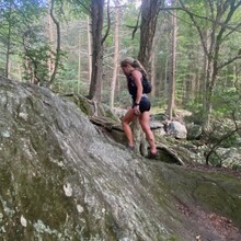
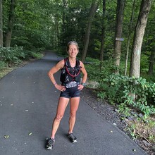
Overgrown trail, prickers, heat, bugs, dead watch, dead phone, bears, and poor markings; these are a few of the things that I encountered on my Mattatuck Trail adventure. I have wanted to do this trail, which is 2 parts with a road run between, for a while now. Logistically, for me, it made more sense to go north to south since the southern most trailhead is near my parents house. I started off with the intent of being unsupported but as the day unfolded I ended up needing assistance from my husband whose initial plan was only to meet me at the finish. The attempt turned into a supported run due to all the challenges listed above. Besides quite a few pricker patches covering the trail and crossing paths with a bear, everything was going quite smoothly. I wore my 2L UltrAspire Zygos with an additional flask filled with UnTapped Maple Aid in the front, two Untapped Maple sleeves, 1 packet of gummies and a bag of trail mix. Along the road section I stopped in the town of Bantam on the side of the road to change my socks that were wet from all the dewy vegetation covering the trail. I ran out or water about 20 miles in but promptly found a reservoir to refill and treat. A few miles later I had noticed the map on my watch failing to indicate mileage remaining, and then around 33 miles (according to my track) my watch died. It didn’t mean game over, since I was following blue blazes but I eventually hit a dirt road and the blazes were practically non-existent. I went back and forth for 30+ minutes looking at my phone map and comparing it with google maps which drained my battery down to 11%. I eventually hit a high frustration level where I called Scott (my husband) and told him I was lost. I needed help, especially since my phone was dying. He tried to understand and look at my InReach tracker on his end but that didn’t seem to be updating. I finally decided that the blue blazes with the red dot on them had to be the trail (not sure why some of them had these dots) as it really threw me off! I was thirsty, hot, and hungry but Scott urged me on. Besides, the road I was on was inaccessible so I’d have to walk out anyways. This part of the trail was overgrown at first and barely traveled; and the later half was ravaged by ATVs as was a few earlier sections. I texted Scott when I popped out on South Eagle Street. After a few road turns I went uphill to Buttermilk Falls where Scott was waiting for me. He gave me lemonade and asked what else I needed, but I just wanted to keep moving after trying to cool off in the falls. I filled up on water at the falls thinking I was only 2 miles from the finish. Back in the woods I realized my phone was dead. When I came back out onto road Scott gave me his watch to use the map. I looked at the face and saw I still had 3.5 miles to the end. I was crushed but also knew than I wanted to get it done before dark. With a map on my wrist, as well as much better blazes, I knew the rest of the trail would be much easier to navigate. I finished in Peterson Park as darkness was starting to take over. I handed the Garmin InReach over to Scott to stop the track and he said that it was not tracking. Ugh! So I asked him to please take a photo so at least we have a time stamp! My electronics failed me miserably on this day. I have the GPS track of the 1st 33 miles and then a Strava track of another 15. I believe I am only missing the last ~1.5 miles of track. From Wolcott Road to the finish in Peterson Park I wore my husband’s watch and can share that gpx file if needed. Otherwise, I have time and location stamped photos of the last approximately 5 miles. We also have videos if needed. I couldn't figure out where to attached them.
I started at 7:26am and got to the end at 8:28pm.
I feel a bit embarrassed by this time knowing that it can and should be run 2+ hours faster but I also feel it's good to tell an almost failed attempt and to keep the FKT adventure spirit going!
Oh, and I bought a new watch with solar charging the next day.

