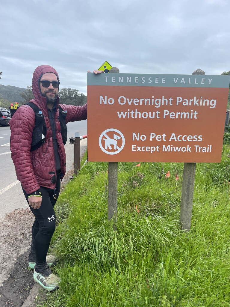
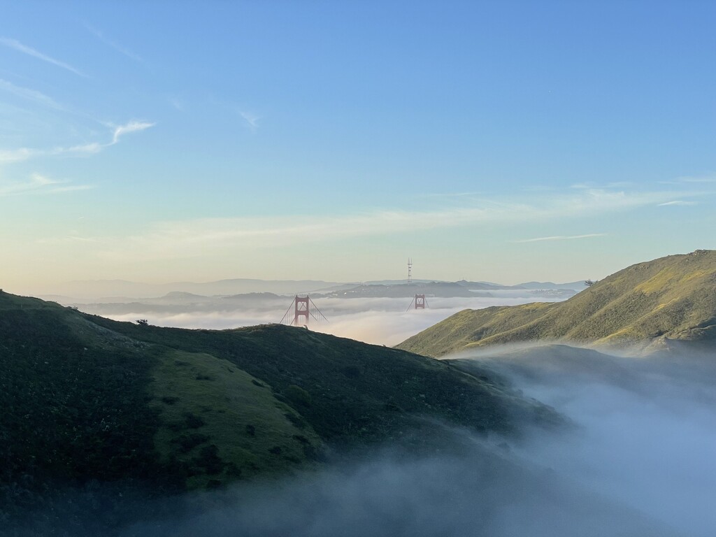
The Marin County 100 Miler, a self-supported adventure on a clockwise loop in the Northern San Francisco Bay Area. My Garmin clocked the route in at 106.8 miles with 24,560 feet of gain. I missed a few turns, had to go down to the beach to use the restroom at Stinson, searched for and recovered 7 cache bags and went off course for a bit at the 100K mark so it’s probably around 104 miles minus those additions. The weather was perfect, with a nice fog with no wind in the morning and then sunny with temps in the low 60’s later in the afternoon. This route was challenging and took a lot longer than I wanted it to. There are a lot of ups and downs on the route with punchy climbs, steep descents and enough varying technical terrain to keep you honest and break rhythm. I felt amazing until mile 22 (Steep Ravine) where my IT band began to bother me. My running was hampered significantly by IT band issues during the effort, which slowed me down and made it hard to move through technical and/or steep terrain quickly and efficiently or to find a rhythm. However, the positive was that I was able to climb pain free and I ate well the whole time, getting in about 400 calories per hour. Plus, all my cache bags and water drops were present and accounted for, so no complaints there. I had my lows for sure and was in a severe Iow when I got off course climbing out of Pacheco Creek at mile 65. I was kind of losing it and ended up on a very hairy trail on the wrong side of the creek that collapsed under foot. A little epinephrine woke me up and got me back on course and out of there. After that, both nasty descents on Big Rock; the Whopper and Exposed Misery at 30%, were brutal on the IT band and I hobbled down them. Not much later, the sunrise rejuvenated me, and I moved ok through the Tam Watershed and felt strong summiting Mt. Tam. The Tam section involves running below and past the east peak fire lookout, wrapping around on the mountain on Eldridge Grade then descending on Wheeler and then summiting on Temelpa. It was certainly an attention getter at mile 93. I was definitely in zombie mode for the last stretch and probably looked like a madman barreling through Muir Woods, talking to myself with a bunch of gear hanging off me and a coke in hand. It was pretty cool though, to hit the 100-mile mark exactly as I entered Cathedral Grove, it was serene. I missed my arbitrary time goal of 24 hours by a long shot but I’m happy that I completed the route successfully. It’s such an inspiring, beautiful route that is packed with iconic, amazing views and diverse terrain. This was such a worthwhile project and I now feel a greater connection and respect for Marin County. I hope some others will want to run the route and I offer my help to anyone who wants any information. This route is very crew and cache drop friendly. I utilized 7 camouflage canvas cache bags full of nutrition which I duct taped to tree limbs in hidden areas of forest along the route. I utilized 8 public water fountains, filtered water from three creeks, tapped two natural springs, and placed two water drops along the route.
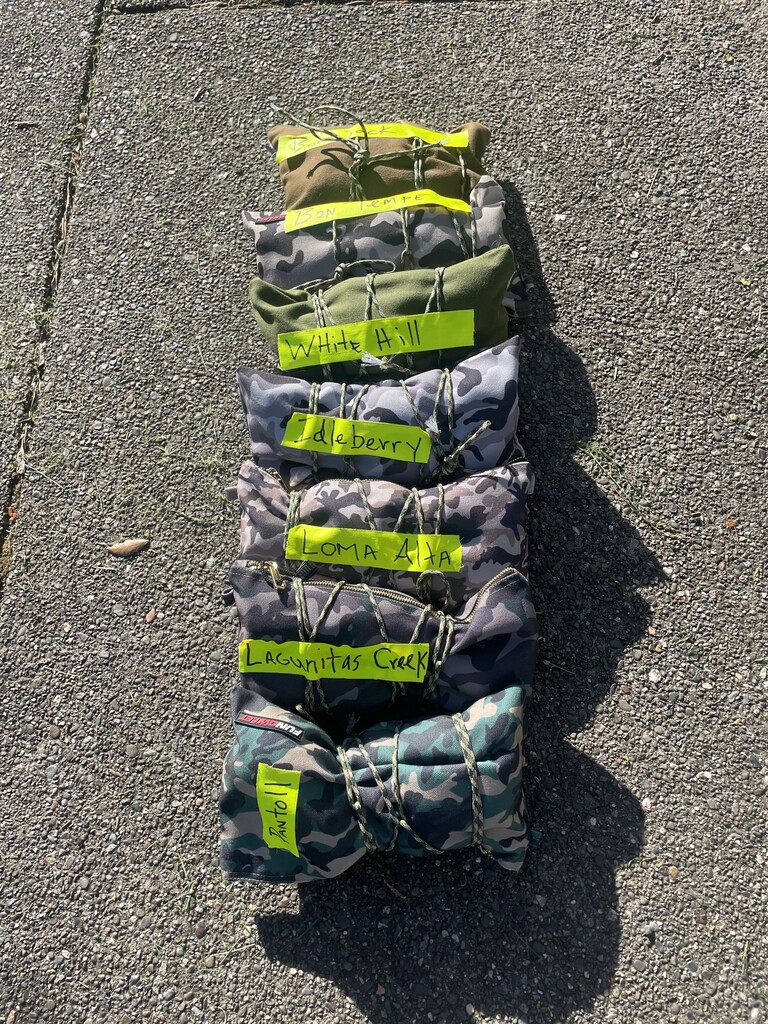
Hidden cache locations:
Pantoll Ranger Station (mile 20)
Lagunitas Creek (mile 36)
Loma Alta Open Space Preserve (mile 52)
Lucas Valley Memorial Park (mile 66)
White Hill School (mile 72)
Bon Tempe Meadow (mile 80)
Bootjack Campground (mile 95)
Water source locations:
Rodeo Beach-fountain (mile 8)
Lone Tree Spring-fountain (mile 19)
Stinson Beach-fountain (mile 23)
Bolinas Ridge South Trailhead-water drop (mile 28)
Lagunitas Creek- filtered (mile 36)
Big Carson Creek-filtered (mile 41)
Loma Alta Open Space Preserve-water drop (mile 52)
Big Rock Ridge-spring (mile 56)
Pacheco Creek-filtered (mile 64)
Lucas Valley Memorial Park- fountain (mile 66)
White Hill School-fountain (mile 72)
Bon Tempe Meadow- fountain (mile 80)
Broko Spring (mile 84)
Mount Tamalpais East Peak- fountain (mile 93)
Bootjack Campground-fountain (mile 95)