Between July 21 and August 7, 2020, I climbed all the Wyoming 13ers in supported fashion, for a total time of 16 days 17 hours 42 minutes (measured from summit of first peak to summit of last peak). I had just finished setting the self-supported FKT for the Colorado Hundred highest peaks (100+peaks, 685 miles, 295kft elevation gain in ~33 days), and took one full rest day to drive to Pinedale Wyoming and start on the Wyoming 13ers. The next morning Matt Lemke and I started hiking in to the Winds.
Over the next two weeks we climbed the 30 peaks in the core Wind River range as one continuous trip starting and ending at Elkhart Park with one rest day due to an all-day rain event. We used horse packers to bring in 3-weeks of food the first 15 miles to Island Lake, but otherwise carried all our own gear for the remainder of the trip. We soloed all peaks except Speahead, Wilson, and Koven, for which we used ropes and belayed each other. The horsepackers and the belayed climbing are what made this effort a supported FKT. We ended up not needing the full 3 weeks of food, so got to eat double rations on many days.
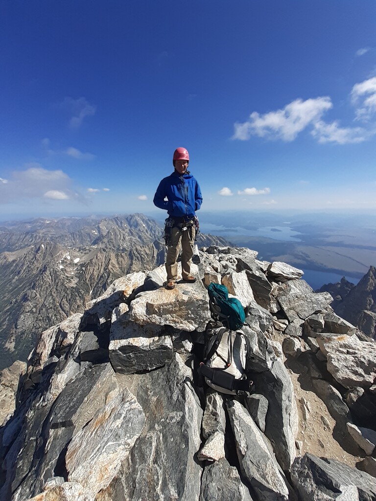
After hiking out of the Winds in the evening of August 3 I continued the next morning and following three days to climb the remaining five 13ers. I climbed Wind River, Black Tooth, Cloud, and Francs solo, and then climbed Grand Teton with Andrew Gwozdz for my final peak.
Note: For Pedestal Peak my GPS measured a prominence of 266ft, which is well less than the required 300ft of prominence for list inclusion. Thus I recommend this soft-ranked peak not be included with the generally-accepted list of 35 Wyoming 13ers, the list used by the first completers.
I've included the original gpx files from each day of the effort. These generally include the route from camp to summit, but not the long hike in or hikes between camps since I wanted to save battery. I've also included a link to my full trip report and my instagram page, which I updated in real time during the effort (I got service on many peaks, surprisingly). I additionally sent an inreach message from each summit to my mapshare page, and I've included the link to the mapshare page and the exported gpx file (WY13ers.gpx) from the gps points recorded on the summits by the inreach.