
Journal below .. additional answering the specific questions for this section:
What did you do, and how did it go?
>Thru-hike of the OHT west to east/north. Awesome trip. Only downside was ticks (zillions) and spring growth on trail sections that hadn't been cleaned recently,
Did anyone hike with you for any distance? Did you resupply with food and, if so, how? Where did you get water?
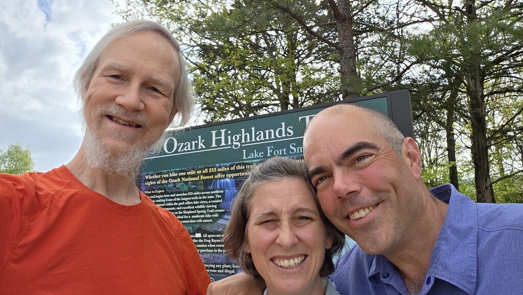
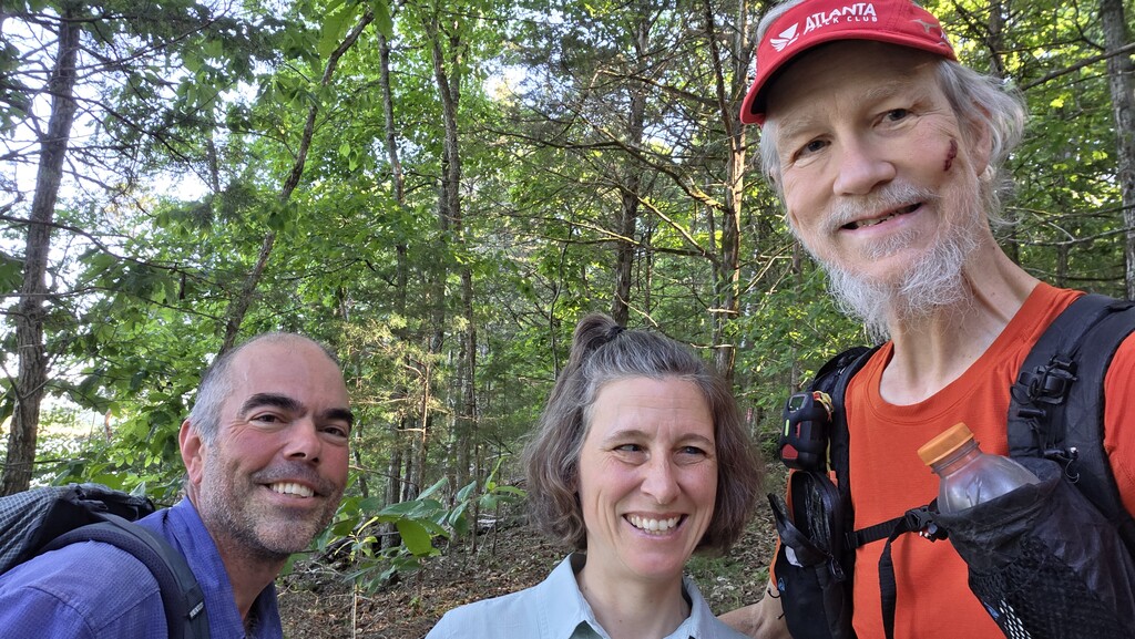
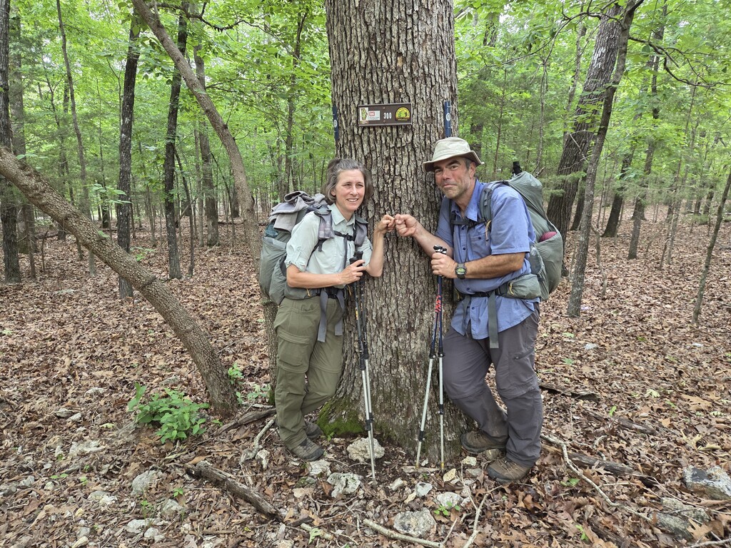
> Just the three of us listed and pictured above hiked - all other contact was centered on trailheads or other road/town to trail connections. Josh and Elizabeth are longtime OHT members and trail maintainers for a section and live relatively near the trail, so we had some good connections nearby.
> We had mutual friends from the OHT area who met us at a few of the remote trailheads and put us up for the night to shower/resupply/rest/fellowship. One was near the trail and we walked out/back for a visit. The OTHA (trail association) was having their annual Rendezvous meeting and fellowship at Tyler Bend State Park, about a mile from the OHT. We hiked out to the park, visited, ate, showered, and resupplied. They took us back to the trail and we resumed walking exactly where we'd left the trail. In the town of Norfork, we stayed in a nice 3BR cabin and ate town food and resupplied from mailed packages. Finally, an OHTA maintainer friend met us at the parking lot 3.2 miles from the end of the trail - we hiked out and they put us up for the night and then drove us back to our car parked at the Lake Fort Smith Visitor Center where the trail starts and where we'd parked back on April 10th.
> We mostly got water from streams that were near or crossed the trail. It had rained a lot before we started the trail and off/on during the hike. (March-June is the OHT "wet" season.) For dry campsites, we carried water in from a previous stream crossing. We also picked up water at our off-trail resupply stops, and at state and Corp of Engineers (CoE) campgrounds and occasional facilities provided for general day user.
> You didn't ask but ... Verification URL List (above) index:
1) I tracked the trek using my Garmin Messenger+ and shared the trek through the Garmin share.garmin.com portal (URL in the list above.)
2) PDF "as hiked" daily statistics and endpoints 29 line summary for 29 day hike.
3) PDF "pretty printed" version of the journal (dup pasted below)
4) GPX OHT_Walk_With_Waypoints_RC7.gpx - this is the same backbone GPS data as from the raw tracks captured by Garmin but it is prettied up with side trails (e.g., to Tyler Bend State Park Group Campground) broken into separate tracks and with waypoints added based on pictures, campsite plans, books/maps, and other sources. ** Note that both the linked .gpx files have one track per day of hiking. I turned on tracking every morning when we started hiking and off every evening when we arrived at the next stop. Garmin collects each day as a separate track and exports them all in one .gpx file with the multiple tracks - each representing one day.
5) JPG/et al - Google Photos album with pictures from the trek (I also added a few photos directly in the section requesting that.)
> The below section is my (Daddy Long Legs / Ferrell) personal trail journal. I attempted to write something every night - sometimes that was hard after long days! I published it on Facebook for my friends/family, but those posts were frequently a week or more apart - there's not much cell coverage on most of this trail.
==============================
Ozark Highland Trail Journal (Cleaned & Formatted)
#1 | Fri, 2026-04-10 | From Lake Fort Smith V/C to C/S Hurricane Creek (west) | 10.0 mi | 6:00 | 1.7 MPH | Full Pack
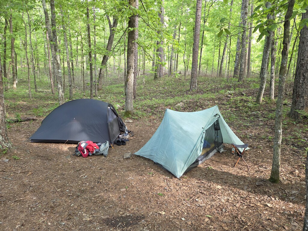
First days are always challenging; today did not disappoint. Leaving the house this morning, everything common to city life was thrown into the top of the pack. At camp tonight, it all had to be sorted out and put where it belongs. I'm particularly not good at that. Three hours since arrival at camp, I'm in my tent hiding from light rain, and still sorting. Dinner worked well, but for some reason, no decaf was packed. Just realized, probably no real coffee for the morning either (for the next six days until resupply). Cold turkey caffeine withdrawal ahead. Oh well, better to look at the positives: a marvelous first hiking day—two stream fords done, great company to walk with (Elizabeth and Josh), beautiful flowers, a nice, well-graded trail, and we made good time and got a nice little campsite. All setup is done and dinner was eaten before the rain, which seems lighter than expected. Thunder has moved out, so maybe it will be a nice night after all! Decided to use a bear bag rather than a bear can—while I'm in AR, do as the AR folks do. Bad start: my first rope throw went low, wound around a small branch, and then looped again around the branch. When I pulled to get it free, the carabiner clicked around the branch and it was stuck solid. Walked around to find a 15-foot dead tree branch on the ground and managed to hoist it and pull the trailing line free, where I could pull down hard on the stuck rope. When I did, the small branch broke clean off and I had my line back. Josh showed up about this time—they were wondering if I'd fallen in the river or got eaten by a bear. With him watching, the next throw landed perfectly, and my food is now safely hung PCT-style, 12 feet above the ground and 12 feet below the branch. They tell me there are no bears around here, but then the story about the two hikers attacked separately by two different bears last year comes along for the ride. Good to have it perfectly hung!
#2 | Sat, 2026-04-11 | From C/S Hurricane Creek (west) to C/S @23.5 | 13.5 mi (+ 1.0 mi off-trail) | 9:00 | 1.6 MPH | Full Pack
Tough day—found I had no coffee in my food kit, then encountered two 1,000-foot ascent plus descent mountains, plus rocky, steep terrain. The lunch break at White Rock Mountain Recreation Area made up for it (a lunch pavilion with a view, garbage cans, a privy, a camp store, potable water, and coffee—perfect except for climbing more and a half-mile extra walk!). The birds, flowers, and scenic overlook were all great. The heat and humidity were stifling. We have a nice camp tonight by a noisy stream—very nice. Late to camp, now late to bed. That's it for today.
#3 | Sun, 2026-04-12 | From C/S @23.5 to cabin near MP 31 | 7.5 mi | 4:00 | 1.9 MPH | Full Pack
Rain wasn't expected but became a reality about 5:00 AM. It was off and on, light and drizzly for most of the day, but not bad. Only one ford today—shallow and ready, but not a dry-foot crossing. There was more of the up-and-down that is characteristic of this area. It was a really good hiking day. We are staying at a backcountry friend's cabin, and he fixed us an awesome dinner; plus, we got showers and laundry done as well as picking up our resupply packages. It has been a busy but fun afternoon here with lots of great conversations. Just realized that I took only two pictures all day long. Guess the rain had me focused on walking and not taking pictures, so trust me, it was another beautiful day.
#4 | Mon, 2026-04-13 | From cabin near MP 31 to Herrods Creek C/S 46.2 | 15.2 mi | 9:15 | 1.6 MPH | Full Pack
A full breakfast with sausage, eggs, toast, etc., at the cabin this morning started the day off right. The first 10 miles to the Hare Mountain summit were mostly uphill and usually steep. There were great views from the summit, where we decided not to camp but to move on another 5+ miles to a small campsite near the confluence of several streams. The last five miles went pretty quickly, but we were really exhausted by the time we got here about 4:00 PM. We worked through all our camp chores, which were a bit more than usual because of this being the first day after a resupply. It's now 7:15 PM and I'm the last one up, and not for long. Doing the long day today reduces the next three days to about 12.5 miles per day, which will be nice compared to the two 15+ mile days we had planned. In addition to nice views from the highlands, we found a large box turtle, a nice little froggy, and lots of pretty flowers. Another great day on the trail. Good night, all.
#5 | Tue, 2026-04-14 | From Herrods Creek C/S to Samuel's Lookout C/S 59 | 12.8 mi | 8:00 | 1.6 MPH | Full Pack
A shorter day than yesterday but with more up and down, resulting in the same net speed of 1.6 MPH. Today's lottery was whether the stream at the top of the final climb near the campsite was running. It was—which avoided the ugly consequence of having to go back down the mountain to spend the night near a known water source. This would be much harder later in the season or in drier weather. Every day has been near 100% overcast all day and night, but with relatively little rain. It's in the mid-70s but very humid. I'm listening to an owl nearby, watching the gray skies in all directions, and waiting for my wet socks and other clothes to dry. We've had many fords or rock hops, and our shoes and socks are damp to wet. Saw the first close-up of the native Arkansas azaleas today—beautiful (see pictures). Met three box turtles on the trail today. They are protected, so it was great to see so many out and about.
Started the day with a crazy, panicked deer. I think it didn't know we were close until I was almost on top of it. It was nested down in a clump of trees, and as it tried to escape, it kept running into trees, crashing back, and trying again. There was a tremendous clatter and clamor for about 10–15 seconds before it figured out an escape route and shot out the back of the trees headed for the horizon. It took us those same panicked seconds to figure out what was creating the commotion since we couldn't see it, but something big was definitely going on! We're at one of the nicest campsites we've had (less poison ivy and open/level). Josh continues to find little seed ticks and others climbing up his legs despite the permethrin fumigation. I found my first one this afternoon attached just below the knee. It hadn't been there for long, and I evicted it with tweezers (it was too small and soft to get off with my nice little tick puller). It didn't match any of the tick illustrations in my first-aid kit—small and black with a tiny row of some sort of decoration around the back of the body. Lost it trying to get it off the tweezers and into my sample bag, so I won't ever know what it was unless someone can ID it from that description! That's enough for tonight—probably too much. Good night!
#6 | Wed, 2026-04-15 | From Samuel's Lookout C/S 59 to Lewis Prong 72 | 13.0 mi | 6:30 | 2.0 MPH | Full Pack
A late start to the day, but we made up for it and even finished a bit ahead of schedule. Rain off and on, mostly off; temperatures were around 70°F and humid—becoming the usual. It was a really scenic day, beginning with our discovery of the actual Lookout the campsite was named for—new even to my local hosts. We hit a couple of other overlooks and saw lots of waterfalls and flowers, plus the usual box turtle and frogs. Had a leisurely dinner and everyone is turning in early. Tomorrow is a big day with several serious water crossings (we're camped by the river and it doesn't look bad; hopefully, there will be no deluge overnight). We wind up with local friends tomorrow night and then have a zero day to recover from the first 85 miles over 7 days. Oh—and ticks are everywhere. We're all pulling them off with multiple finds daily. Other than that, it's an awesome trip!
#7 | Thu, 2026-04-16 | From Lewis Prong 72 to Ozone T/H | 13.7 mi | 8:30 | 1.6 MPH | Full Pack
Rained and thunderstormed overnight. Soaked up a bit of water in the tent (I was in the flow line down the hill), but all gear was safe and dry. We were concerned the rivers and streams we had to ford might be flooded, but all were fine by the time we got to them. We forded five streams. We moved much faster than it appears; a lot of time was spent changing shoes and socks, working to keep our feet healthy. We got to the trailhead and were picked up by Bill just before more rain moved in. Donna fixed us an awesome dinner of baked sweet potatoes, creamed corn, green beans, pulled pork, tomatoes, baked beans with ham, bread, and soda—AWESOME. Stayed up too late tonight, but it was great conversation, and it feels wonderful to have clean clothes and be clean ourselves—such fun. We're taking a zero tomorrow and will be back on the trail on Saturday.
#8 | Fri, 2026-04-17 | From Ozone | Bill & Donna | ZERO
#9 | Sat, 2026-04-18 | From Ozone T/H 84.7 to Cedar Creek & Tentsite 96.7 | 12.0 mi | 5:45 | 2.1 MPH | Full Pack
Great breakfast with Bill and Donna Hignite and on the trail slightly early (7:45 AM). It was cool, even cold, this morning (50°F and breezy). I wore more than shorts and a t-shirt for the first time while hiking here—it's usually been warm and muggy. Today was perfect: sunny, cool, and delightful. We met 10 other backpackers on the trail today—way more than the total from the first hundred miles before today. One hiker called High Point (because he has hiked the highest point in all 50 states) was a lot of fun to talk to while we hiked together. We were at our planned camp by 1:30 PM. There are no other good camps for another 6 miles, so we just chose a wonderful campsite near the stream and waterfall and called it a day. A lovely day of conversation, relaxation, and unrushed enjoyment made for a perfect day. The cool weather is supposed to last another two days, and then it's supposed to be sunny and clear for about a week. That will make for an awesome week on the trail if Mother Nature doesn't change her plans.
#10 | Sun, 2026-04-19 | From Cedar Creek & Tentsite 96.7 to Hurricane Creek Camp 110 | 13.3 mi | 8:00 | 1.7 MPH | Full Pack
The temperature was 36°F at sunrise—the coldest night so far. Today brought drier air and felt cooler even when the temps got up into the mid-70s. Today's big challenge was fording Hurricane Creek, the largest creek we have had to ford so far. Fortunately, it's been long enough since the rains that the creek was only knee-deep. We have to ford it again tomorrow morning, but no rain is expected, it's further upstream, and no problems are anticipated. This was potentially one of the biggest challenges of the hike, but it looks like we will be moving forward as planned. Poison ivy continues to be a big challenge; so far, Josh is the only one who has had a problem, and it wasn't a big exposure. The celebration of the day is that we are at mile 110 of the 224-mile trek—well past the one-third mark!
#11 | Mon, 2026-04-20 | From Hurricane Creek Camp 110 to OHT C/S 119.5 | 9.5 mi | 6:00 | 1.6 MPH | Full Pack
More perfect weather. It's been blue skies, a light breeze, highs in the low 70s, and lows in the low 40s. The tree canopy is leafing out; I'm lying here looking at the bright sun glowing through the green leaves against the blue sky—a beautiful afternoon. We got in early today due to the short mileage and are enjoying relaxing for a couple of hours before we prepare dinner and head for bed. Not many critters today except for big snails, and no other hikers; this section has been mostly wilderness and fairly wild trail. The campsite is a little rough with lots of rocks scattered around, poison ivy, and lots of other green things beginning to sprout up around the site. It is supposed to be for three tents, but we just managed to squeeze in our two. Still, there's a marvelous, noisy brook next door and we're going to eat dinner down there in a few minutes. Bear bag lines are hung and ready. The OHT has almost no facilities such as bear poles/boxes, privies, or shelters, but we're still enjoying our time on the wild side!
#12 | Tue, 2026-04-21 | From OHT C/S 119.5 to Fairview T/H 123.8 | 4.3 mi | 2:20 | 1.8 MPH | Full Pack
Up and on the trail at the usual time even though it was a short hike today—it's resupply day, and inspecting and repacking things takes time. We got near the trailhead and Wade C. met us with clippers in hand, out cleaning up the trail while waiting for us to appear! We had ham and salami sandwiches with chips and trimmings for lunch after showers were done and laundry was started. It has been a quiet afternoon. For dinner, Josh sautéed a huge Chicken of the Woods mushroom that Wade harvested nearby. We're snacking on that while he and Wade fix spaghetti with more of the sautéed mushrooms, a salad, and brisket for dinner, with brownies still to come! Packed salami, cheese, spinach, and peanut butter with orange marmalade sandwiches for lunch tomorrow. We'll have a hot breakfast before we head back to the trail tomorrow. Food, food, food—what a day!
#13 | Wed, 2026-04-22 | From Fairview T/H 123.8 to Falling Water C/S 138.5 | 14.7 mi | 7:30 | 2.0 MPH | Full Pack
Up at 6:00 AM to pack and eat the wonderful breakfast that Wade fixed us: coffee, scrambled eggs with ham, brisket, cheese, toast with apple butter or orange marmalade, apples, and Cuties. After cleanup and pack out, he took us up to the trailhead and we said goodbye. Today was the longest day we've done in some time, almost 15 miles, but the trail was nice, the grades were pretty easy, and it really went quite quickly. Two more long days plus one medium day will get us to Rendezvous, the OHTA annual gathering. There will be more great food and a chance to meet a lot of the folks involved with creating and maintaining this trail we're hiking. Our campsite tonight is fabulous. It's located down the side of Falling Water Creek, a colorful and noisy stream flowing through the gorge below our campsite. I enjoyed just sitting with my legs dangling in the rushing water for about 15 minutes to revive after the long hike today.
We saw three more box turtles today—well, maybe three and a half; two of them were working to make baby turtles. More pretty flowers, some old CCC ruins, and a picture of the huge Chicken of the Woods mushroom we had for dinner last evening. Oh wow, it's 8:00 PM already—past hiker midnight. Good night, all.
Editor's Note: The painted box turtles encountered on this trek are Ornate box turtles (Terrapene ornata), while the plainer varieties are Three-toed box turtles (Terrapene carolina triunguis). Both are land-dwelling species distinct from aquatic terrapins or true tortoises.
#14 | Thu, 2026-04-23 | From Falling Water C/S 138.5 to C/S(2) 152.9 | 14.4 mi | 8:00 | 1.8 MPH | Full Pack
We're all feeling the impact of two long, hard days (29.1 miles, lots of elevation change, rough trail). I fell and bruised my right knee, as well as taking away a good-sized chunk of skin. Hopefully, we all feel better in the morning—another 14+ awaits but with a bit kinder terrain, it appears. We're in a pretty minimal campsite but near a wonderful water source. Soaked our feet for a long time—awesome. Today's wildlife included a copperhead snake, a black snake, two box turtles, and a lifetime supply of ticks and poison ivy. We're pulling 6, 8, or 10 ticks apiece—some dead from the permethrin, some walking around stupefied by the permethrin, some running for a lunch site, and a couple attached and stubborn. We're doing thorough tick checks several times per day so even the ones that attach don't get to stay long enough to cause trouble. We've got a permethrin resupply in our next supply box. All in all, we are doing well and are almost halfway done (we cross that line tomorrow!).
#15 | Fri, 2026-04-24 | From C/S(2) 152.9 to Ben Branch 167.2 | 14.3 mi | 7:45 | 1.8 MPH | Full Pack
The fun started at 5:30 AM with a boom of thunder, followed shortly by a steady rain that lasted until about 9:30 AM. The forest dripped for a good while and the creeks turned brown and deeper. We had to cross Richland Creek for the third or fourth time, this time at the far downstream end within sight of the Buffalo River. About 2:00 PM we crossed that stream—brown and faster/higher than previous crossings, but we made it safely. That was the highlight of the day; everything else was secondary! We slogged through a wet, slippery trail, made worse by recent horse traffic, for the rest of the day, finally arriving at Ben Branch. The campsites here were covered by spring vegetation, including legions of poison ivy. We scraped them clear with our shoes and then washed up thoroughly to ensure we didn't get a breakout of poison ivy sores. Hope we got that right! Another wave of rain threatened at 5:00 PM but never hit us. It's now 8:00 PM—hiker midnight. That's all for tonight.
#16 | Sat, 2026-04-25 | From Ben Branch 167.2 to Tyler Bend State Park 176.9 | 10.6 mi | 5:15 | 2.0 MPH | Full Pack
*** Passed 1/2 point (162.5 miles) today! ***
Started raining at 5:30 AM but stopped shortly afterward. The day improved from there. It was a smooth hike to the state park with some great views above the Buffalo River. Got to the campground where the OHT Rendezvous meeting and dinner were happening. Washed clothes in the shower and hung them out to dry on an improvised clothesline. Working hard to pack 7 days of food, fuel, etc., to head back into the woods in the morning. More posts when I get a signal again.
#17 | Sun, 2026-04-26 | From Tyler Bend State Park 176.9 to MP 184 CS (2) | 7.1 mi | 4:30 | 1.6 MPH | Full Pack
Slept in until 7:00 AM! Packed up slowly while talking with OHTA friends. Gordon Brown fixed us breakfast with eggs, cheese, and his famous sourdough bread, plus "adulterated" coffee (with cream and sugar). Phil Brown (OHTA president) drove us back to the trail, saving us the 1.5-mile walk. Yvonne Liske (and Steve) took our bounce box to bring to us at the end of the trip, saving us from having to carry our cold-weather gear and other extras through the tough upcoming sections. It was a nice short day (7.1 miles) but we were carrying 7 days' worth of supplies (heavy), so we were a bit slower. Arrived at the river crossing at the end of the day (mid-thigh deep) and waded across. No water or camping is documented for another 5+ miles, so we worked hard to find/create a nice two-tent campsite among the grasses, briars, and ticks. It was a mostly sunny day, warm but pleasant under the tree canopy. Thunderstorms are predicted for the morning, so we're prepped for rain, but it's hard to imagine that on this ideal evening.
#18 | Mon, 2026-04-27 | From MP 184 CS (2) to MP 197.7 CS(3) | 13.7 mi | 8:15 | 1.7 MPH | Full Pack
Hot—85°F. Last night, there were fireflies in the meadow all night. We saw a total of 15 box turtles (including 6 today), 2 snakes (a speckled king snake and a garter snake), and a wild hog with a piglet right in the middle. Sighted many snails, birds, and a wild turkey in flight above us.
Got water 0.4 miles from the campsite. Camped at an abandoned but documented site that needs clearing. My feet slid on a slick rock and I landed hard on my right side. Broke the lower pack stay, the right strap lifter is torn, and the right strap attachment to the pack is broken. It is all temporarily fixed with duct tape, safety pins, and zip ties. Ivy is going to try to ship new parts to me tomorrow, destined for our next stop in 5 more days. Late to bed; tomorrow we enter the bushwhacking section. Up early.
#19 | Tue, 2026-04-28 | From MP 197.7 CS(3) to Ingram Creek 210.4 | 12.7 mi | 9:30 | 1.3 MPH | Full Pack
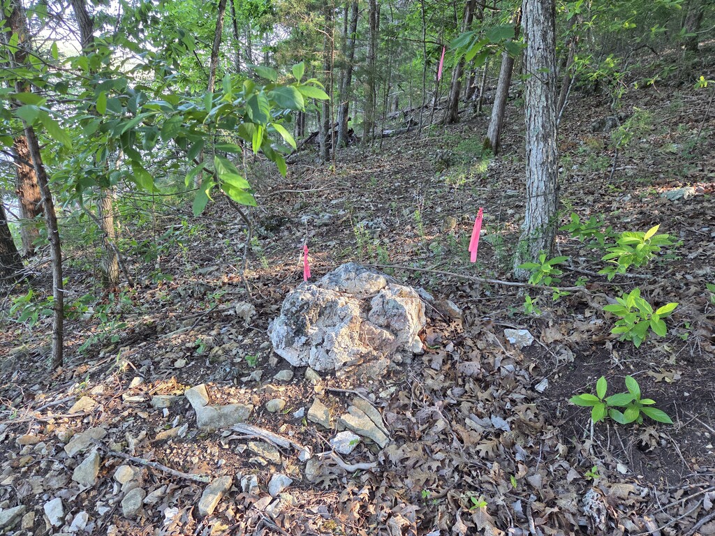
Includes 4.5 miles of unmarked wilderness bushwhacking
Spotted 4 more box turtles! It was a VERY tough last 4.5 miles in the wilderness. Camped in another mess of wild weeds, cane, and stinging nettle. The guide called it a "good campsite"—it's pretty good, maybe great in the winter, but definitely not in late spring!
#20 | Wed, 2026-04-29 | From Ingram Creek 210.4 to Big Creek 220.2 | 9.6 mi | 9:30 | 1.0 MPH | Full Pack
ALL unmarked wilderness bushwhacking
Almost finished the wilderness section today, with just a mile or two left for tomorrow. This is a very tough section, averaging one mile per hour—very similar to the speed on the toughest AT sections in Maine, but tougher. There are no trails, just a map and a compass app on the phone. The trails indicated on the map are largely hints or suggestions, not well tied to reality. No box turtles or much of any other wildlife sighted today—just birds and two timid frogs. We were the wildlife, crawling through the woods.
Another gear disaster for me today: broke a nearly new hiking pole. Patched it successfully with duct tape, but then the duct tape came loose and the broken piece was lost. Josh has loaned me one of his poles to help keep my knees functioning in this terrain. There's a gear shop in a small town two days ahead; looks like they will be selling a set of hiking poles! Completed our last major ford of a stream today: Big Creek. It probably should be called a river, but what's in a name? We're over two-thirds done with this trek at this point. What a grand adventure we're having on the Ozark Highland Trail system.
#21 | Thu, 2026-04-30 | From Big Creek 220.2 to Cole Fork 236 | 15.8 mi | 9:00 | 1.8 MPH | Full Pack
Back on regular trail, moving much faster and easier, with more miles covered. Created a campsite creekside among the thorns and flowers; nothing preexisting was found along the dense spring growth.
#22 | Fri, 2026-05-01 | From Cole Fork 236 to Matney Camp T/H | 15.3 mi | 8:00 | 1.9 MPH | Full Pack
Nice day, lots of old roads to walk and reasonable elevation changes. We missed a turn and had to backtrack, but it was less than a 1/2-mile bonus walk. We rearranged our schedule to spend an extra night in town. Ricky moved us to an Airbnb we could have for two nights, and his helper, Casey, shuttled us from the trailhead to town. Had a nice dinner and live music at Norfork Brewing Company. Laundry and showers greatly improved our presentability for the town visit! Weather continues cool and clear.
#23 | Sat, 2026-05-02 | From Matney Camp T/H to Norfork B&B (2nd night) 256 | 5.0 mi | 2:00 | 2.5 MPH | Slack Pack
Casey picked us up and took us back to yesterday's pickup point so we could do the road walk into town as a slack pack. It was a very pleasant walk, even though half of it was on a paved, high-speed road. Had lunch at the small-town café—just a burger, but it was tasty and the staff were friendly. We were going to have breakfast there tomorrow but found out at lunch that they are closed on Sunday, so it's back to the Mexican restaurant again tomorrow. Casey's daughter works there and waited on us at dinner this evening! The food, salsa, and guac were great. Got showers and completed a final load of laundry. We head back into the woods tomorrow for one night, and then it's back to town. We're moving into a much more populated area, so we get another trail environment to manage. Great stay here in Norfork (north fork of the White River—not Norfolk, despite what half the maps say!).
#24 | Sun, 2026-05-03 | From Norfork B&B 256 to campsite near MP 267.8 | 12.0 mi | 6:30 | 1.8 MPH | Full Pack
Wildlife observed today:
- 1 Ornate box turtle (painted)
- 1 Three-toed box turtle (plain green variety)
- 1 Spotted king snake
- 1 Black snake
- 1 Large armadillo
- 1 Whippoorwill (very loud, right over the tent)
- 1 Honey bee hive (probable, according to Josh)
- 3 Unrestrained dogs (1 friendly, 1 anxious, 1 unhappy; no injuries)
- 2 Canada geese and 1 gosling
Great breakfast at Lazy Burrito, lunch at Whispering Woods Grill, and dinner in camp. Went through the remains of a large tornado from some years ago; the trail is still not fully restored, plus miles of other trail carnage. Camped at a dry camp—the first open, flat space in miles. Bushwhacked down to the lake 0.4 miles before and hauled water up with us. The last four miles of the day were hard, but overall another great day closer to finishing this epic adventure!
#25 | Mon, 2026-05-04 | From campsite near MP 267.8 to Fish & Fiddle Family Resort 275.8 | 8.0 mi | 4:45 | 1.7 MPH | Full Pack
Wildlife observed today:
- 8 Ornate box turtles, including another mating couple (bringing the trip total to 30 box turtles). Elizabeth was handing me #30, the smallest we've seen, and it reached forward and locked onto my hand with its beak. There I was, in the middle of the woods, with a box turtle hanging from my hand. How do you convince an upset turtle to let go rather than eat your hand? All three (four) of us were making quite a scene, and the turtle finally decided to let go and retreated into its shell. We put it back and hiked on. No blood was spilled on either side, and we'll be more careful with future photo sessions!
- 1 Snake (a tiny ring-neck—very cute).
Ticks—yeah, thousands more of them, especially attracted to Josh, though we all find our share. Permethrin helps; we find many dead in our sock fabric. Josh manages quite a collection in the zipper fold of his convertible pants—they want in but can't operate a zipper. We cleaned everything, including ourselves, when we arrived at the resort today. After showers, we took our hiking clothes to the washer and dryer. After a good wash and dry run, Josh pulled out the dryer screen and dumped a bunch of fried ticks in the trash. Ewww.
Oh—and yesterday—we were passed overhead by a flight of five A-10 Warthogs making quite a noise over Norfork Lake. Pretty cool. We've got dinner fixings delivered by Walmart (this is Arkansas...). We've also got two OHTA friends (Yvonne & Steve) coming by for a shared dinner on the grill. This is really a nice resort—they don't formally open until Sunday but were happy to let us walk in today.
#26 | Tue, 2026-05-05 | From Fish & Fiddle Family Resort 275.8 to lakeside C/S at 287.1 | 11.3 mi | 9:30 | 1.2 MPH | Full Pack
The day started wet and stormy overnight but cleared a bit by the time we started hiking. Off and on drizzle all day long; heavier rain started about an hour before we made camp. It slacked off enough that we were able to get camp pitched in relative dryness. Socks, shoes, and most everything is wet, except our spare clothes and sleeping gear which are dry in the tents. The day included about 6 miles of bushwhacking, and that was tough and very, very slow. We've got about 15 miles to do tomorrow, which is a lot, but only about four of that are bushwhacking.
Today was a banner day for box turtle sightings. We spotted 17 box turtles along the trail today, bringing our total for the trip to 47. Springtime is clearly their season, and they really didn't mind the cool, rainy weather today. We had a cute dog that unfortunately followed us all afternoon. We had no food or supplies for the dog and were feeling very bad about it hanging around wet and lost. The story has a great ending, however. We had been winding our way around this large bay off of Lake Norfork during the time the dog had been following us. We finally made camp late in the day and had to chase the dog back because it was determined to get into tents and food and those sorts of things. A bit after that, Josh was down at the shore and heard a boy calling for a lost dog on the other side of the lake. On a hunch, he called across the lake to the boy to see if it might be his dog. Sure enough, the boy thought it was his dog and tried to call it across the lake, which didn't convince the dog to try to swim over. After some considerable time, we heard a truck up the shore from us and an adult calling that dog by name (Sam), and then everything was quiet. The dog had followed us exactly all the way around this bay, and we had camped exactly across from the dog's home. What are the odds? In any event, all is well—a slight bit of a miracle of dog rescue.
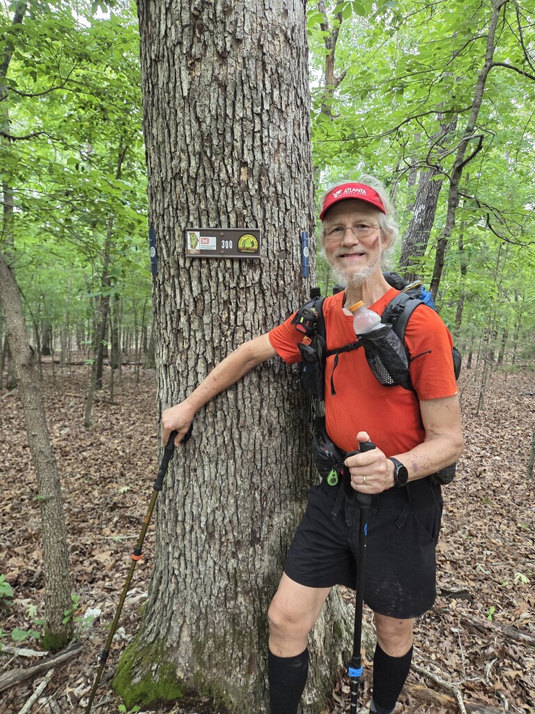
#27 | Wed, 2026-05-06 | From lakeside C/S at 287.1 to Robinson Point Campground Site #1 300.1 | 13.0 mi | 9:30 | 1.4 MPH | Full Pack
** 300 miles done, 25 miles to go!! **
No dogs and only two box turtles today; however, we had a full day. The first five miles were a continuation of the previous day's bushwhacking section. Very slow and painfully difficult, but we got it done about lunchtime. After that, we were back on a real trail for the first time in days. It wasn't easy—lots of up and down—but so much easier than bushwhacking. We got to the campground about 5:30 PM and checked in with no problem. Our campsite was the closest one to the entrance (so a short walk) and right across the street from the restroom/shower facility and nearby trash collection. Nearly perfect except it started to rain just as dinner was getting ready. We scurried around getting under cover, and about the time we finished doing so, the rain stopped. It's been off and on since then, but it didn't stop us from getting hot showers and finishing the rest of our evening routine. It's hiker midnight in about 9 minutes, so signing off for the night.
#28 | Thu, 2026-05-07 | From Robinson Point Campground 300.1 to Three Oaks Resort 310.4 | 10.3 mi | 5:30 | 1.9 MPH | Full Pack
Starting to whittle down the remaining 25 miles. Easy trail, clear, and minimal elevation change, plus picnic tables about every mile for breaks. Very different from earlier days. Cool, dry air—what more could we ask? Two box turtles were seen, for a total of 51 for the trip. Found and removed two ticks for me at the end of the day. Staying at a backcountry resort (aka a cabin), and we got a free ride into town for a Rapps Barren dinner and Walmart. Laundry and showers for the win! The resort is at the top of a major hill and has a rail sled down/up the mountain. Not the Mount Washington Cog Railway, but still very neat. The resort just sold today—our money went to the new owner after we checked in with the old owner. Hope the new place stays as cool as it is now. Oh, and there's a cartography mistake so that there are two mileposts numbered 309 on today's hike, each a mile apart. If you are counting my miles, give me some slack on this; it's an ongoing debate as to whether to make the trail mileage correct or to stick with the incorrect map mileage. So, for now, there's a 309A and a 309B, whatever that means! (Besides an extra mile for us.)
#29 | Fri, 2026-05-08 | From Three Oaks Resort 310.4 to Barren Creek C/S 321.8 | 11.4 mi | 7:20 | 1.6 MPH | Full Pack
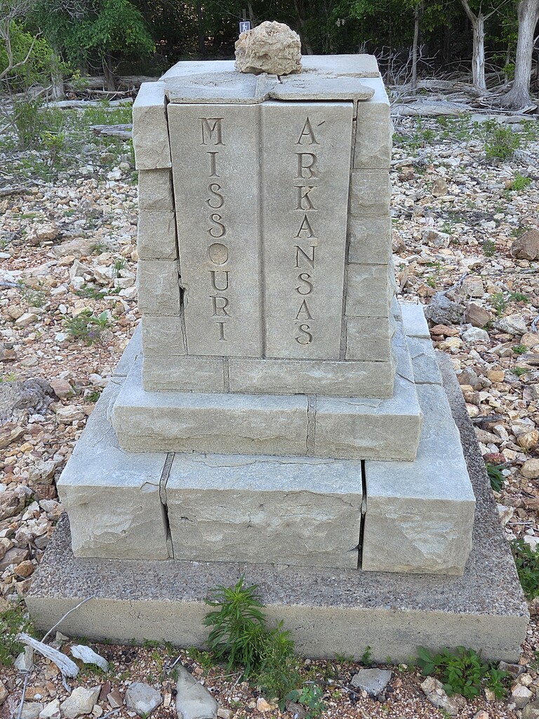
Our last full day and night on the OHT. Tomorrow we hike three miles to the Missouri border and back to Barren Creek, where a friend is coming to pick us up and take us to their home for the night. Hard to believe this adventure is coming to an end, but we've got two more planned this summer: the Olympic Coast hike and the Wonderland Trail. They are not as long as last year's AT thru-hikes, but it will be a quite fabulous summer of hiking together.
Meanwhile, today's hike continued working our way east along Norfork Lake. We saw six more box turtles, including two busy making more box turtles (we didn't disturb that pair). We also saw a large, healthy black snake and a cute little rough green snake, plus a frog (there are many more frogs in the surrounding woods' chorus, but they didn't come visit us!). We passed a few old mines, likely for zinc. The trail spends a couple of miles running along a high bluff above the lake. At one point, there is essentially a bench rock in the back of an opening in the bluff; you can sit on the bench in the shade from the rock above and enjoy the cool air from the rocks all around, taking in the tremendous view out across the lake. We spent a good bit of time at that place.
#30 | Sat, 2026-05-09 | From Barren Creek C/S 321.8 to Eastern terminus & back | 6.2 mi | 4:00 | 1.6 MPH | Slack Pack
We're done! A complete west-to-east traverse of the whole Ozark Highlands Trail. 325 miles for the record. Four more box turtles today for a trip record of 61. More ticks—not counting those. Picked up from the Barren Creek trailhead parking and now we're headed for showers, laundry, food, etc. We'll stay here with friends for the night and head to Siloam Springs tomorrow. For now, enjoying the warm, happy feeling that we made it! Dream accomplished.