Ozark Highlands Trail (OHT) Full Thru-Hike Guide
Important Note on Route Evolution & FKT Status
To FKT Editors and Future Thru-Hikers: The current route data listed across many historical tracking platforms (including fastestknowntime.com) frequently reflects the old, original baseline of 164 miles (terminating at Woolum). Later iterations stopped at Dillard's Ferry (208 miles) or the White River road walk (251 miles).
The OHT is now a completely different animal. Thanks to massive, ongoing development by the Ozark Highlands Trail Association (OHTA), the continuous, modern thru-hike now spans approximately 325 miles all the way to the Missouri state line. There is no longer any operational reason to terminate a thru-hike at the historical 164-mile mark. This guide—and its accompanying GPX data—documents the full, modern, continuous 325-mile footprint.
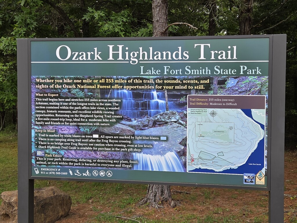
The Ozark Highlands Trail (OHT) is one of the premier long-distance hiking trails in the United States. Located in the middle-South, it is well-known for its prime winter hiking opportunities when many other national scenic trails are impassable. Fall through spring are the peak seasons for this corridor. Featured in National Geographic, The Guardian, and Backpacker Magazine, the OHT offers roughly 325 miles of backpacking across the most rugged, beautiful, and scenic terrain in the region.
Major Segments (West to East)
-
Boston Mountains (164 miles): The historical western footprint. The terminus begins at Lake Fort Smith State Park and ends at the mouth of Richland Creek near the Woolum ford.
-
Buffalo River (43 miles): The OHT coexists with the Buffalo River Trail from Richland Creek downstream to AR-14 / Dillard’s Ferry.
-
Lower Buffalo Wilderness (LBW) Bushwhack: This sits between AR-14 and the Spring Creek Trailhead in the Sylamore area. FarOut includes a GPS track of a suggested route with a critical preamble: "The next 14.5 miles are a bushwhack, without trail tread or blazes. Maps, a GPS device, and the ability to use them consistently are needed. See OHTA for various options and help."
-
Sylamore (32 miles): Runs from the Spring Creek Trailhead heading east, then turns north to the Matney Knob Trailhead on AR-341.
-
Lake Norfork Sections, Gaps, and Bushwhacks:
-
The Matney Knob Road Walk (8-Mile Gap): Located between the Matney Knob Trailhead and Norfork Dam. Much of this is private property, so the trail utilizes an established road walk to connect the trailheads. It is highly doable, and both FarOut and Google Maps do a fine job navigating this road link.
-
Tracy Arm Section: A beautifully maintained, permanent singletrack section running north from the Norfork Dam for about 13 miles to CR 1028 (Fish and Fiddle Road).
-
The 17.4-Mile Shoreline Bushwhack Connector: Running from Fish and Fiddle Road to CR 396 / Panther Creek. Do not confuse this with a simple road-walk gap; this is a true, continuous shoreline bushwhack similar in physical difficulty to the LBW. FarOut notes: "Warning: the next 18 miles are under construction... The wide red line shown here in the app does not necessarily depict reality." On the ground, you are strictly tracking the U.S. Army Corps of Engineers (CoE) property line to stay on public land. Follow the pink surveyor's tape where present, and rely on the white CoE boundary trees and posts to navigate the raw, unmaintained side-slopes.
-
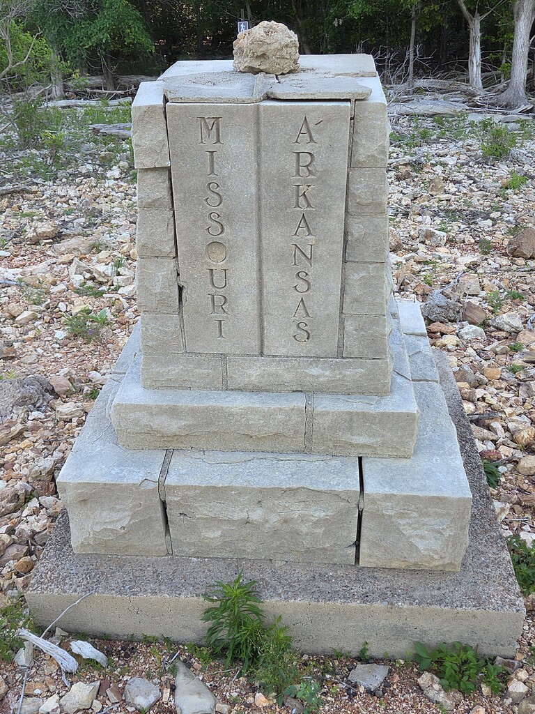
David’s Trail: Once you clear the shoreline bushwhack, you step directly onto the completed, blue-blazed singletrack of David’s Trail, running north for about 17 miles from Robinson Point to the Red Bank Recreation Area. From Red Bank to the Missouri/Arkansas state line, the trail is fully built and blazed normally.
Water & Safety
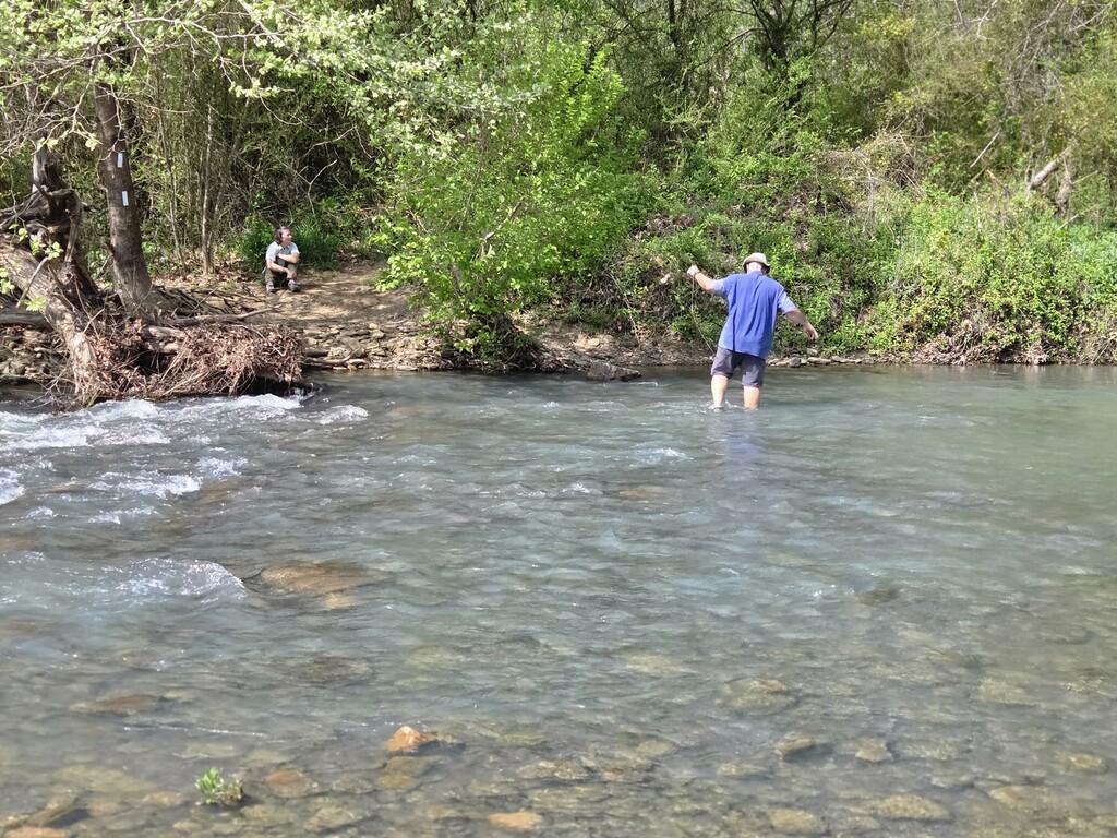
Water is frequently found and crossed in the wetter seasons, though sources can become scarce from late spring until sometime in the fall.
Critical Safety Note: There are many wide, generally shallow streams that can change overnight into dangerous, impassable fords. This is especially an issue during the peak "wet" season from March through June. Always utilize a high-water route where available, or be prepared to backtrack. To borrow the driving maxim: "Turn around, don't drown." Know your skill level and proper fording techniques before entering the backcountry.
Essential Navigational Aids & Logistics
-
The Ozark Highlands Trail Association: The definitive hub for updates, trail status, and section information can be found at [ozarkhighlandstrail.com/trail](https://ozarkhighlandstrail.com/trail).
-
FarOut Guides (faroutguides.com): An official partner with the OHTA. FarOut is actively building out a deep, detailed track map and hosts active hiker comment logs with current waypoint data. This app was an essential navigational aid on our recent thru-hike, particularly through the unblazed LBW bushwhack and the upper lakeside section of Norfork.
-
Tim Ernst's Ozark Highlands Trail Guide (7th Edition, 2021): The essential paper guidebook. Ernst mentions plans for an 8th edition. While recent trail maintenance and Norfork developments have introduced minor errors into the older mileage charts—and it doesn't yet cover much ground north of the Sylamore section—my copy is dog-eared and well-worn. It remains a classic for understanding the historical context and planning daily logistics.
-
Duane Woltjen's Hikers Guide to the OHT in the LBW (2nd Edition, 2006): While dated, this remains a highly useful resource for understanding what to expect mentally and physically in the Lower Buffalo Wilderness.
-
Paper Maps: I typically hike using only digital apps, but the OHT is a different beast. We carried and heavily used the waterproof, tear-resistant three-map set produced by Underwood Graphics (underwoodgraphics.com). Maps 1 and 2 cover the East and West sections of the southern trail; Map 3 covers the North section. For the bushwhack portions, having these alongside FarOut or a custom Gaia GPS track is indispensable. More information is always better out there.
-
Other Web Resources: Helpful third-party information and journals can be found at Compulsive Hiker (compulsivehiker.com), and a reliable public GPX file for the Boston Mountains section is accessible via caltopo.com.
Electronics & Cell Service
Cell service is relatively rare, though you can occasionally snag a strong signal near high ridges or the few major road crossings. More often, you will be squeezing text messages in and out with 1–2 bars of transient service.
If you use Gaia GPS, their map layers include a Verizon Coverage Overlay. I found this layer remarkably reliable for predicting exactly where on a ridge I could expect enough signal to send a text. For safety, peace of mind, and keeping family updated on stream levels and bushwhacks, carrying a satellite communicator (like a Garmin Messenger or inReach) is highly recommended.
Time, Pace, and Distance Realities
-
Total Time: 29 days total to complete the continuous thru-hike.
-
Pacing Strategy: This included two planned "Nero" (near-zero) days of 4.3 and 4.7 miles (on Days 13 and 24) and one full "Zero" day on Day 9.
-
Daily Mileage: Our maximum daily output consisted of several 14-to-15+ mile days. Expect a full 15-mile day on this terrain to take a bit over 9 hours of moving time.
-
Terrain Speeds: On established singletrack, we averaged over 2 mph. However, in the unmaintained bushwhack sections, our pace routinely bogged down to 1.0 to 1.3 mph.
For personal context: I typically average about 1.8 mph on the southern Appalachian Trail, and about 1.0 mph through the rugged rock of New Hampshire and Maine. Expect the OHT's wilder sections to mimic that slow, technical Northeast pace.