I had the idea to attempt this record about 14 hours before I started. I was 20 miles north of the Georgia border on the AT, descending from the Albert Mountain fire tower at sunset. Over the last ~two and a half months and 2,100 miles from Mount Katahdin in Maine, I had started listening to podcasts during some of my many hours of hiking under the stars. The FKT Podcast was my favorite. What if I could be a part of this community too, and try setting a record on the final leg of my journey?
I was in the middle of another challenge I set for myself: to hike the last 200 miles in 100 hours, from the highest point on the trail at Clingmans Dome to the southern terminus on Springer Mountain with ~50,000 feet of gain. I paused and checked to see if I had cell service; I did. I looked up the page for the Georgia AT section on fastestknowntime.com and saw that there was no female benchmark yet in the unsupported/self-supported categories. Therefore, I believe the precedent may be Heather Anderson’s AT thru-hike that established the overall FKT in 2015. Based on her book Mud, Rocks, Blazes, she completed Georgia in about 35 hours. Next I looked up the rules for setting a record and realized that I would need to track my attempt. I have the Strava app on my phone but had never tried recording something for so long. I carried a 10,000mAh power bank which I had partly charged the evening before at the Nantahala Outdoor Center; I figured it would probably be enough to power the Strava tracker and my headlamp for the rest of the trip, so I would give it a shot.
I woke up at 7am on November 20, at Bly Gap. The first daylight filtered between black trunks and mist droplets were landing on my face with the rest of me in my sleeping bag. I took some extra time getting myself set for my final state on the AT: pack up and stretch, go dig a cathole, stake out my water sources for the last 78 miles. I checked my food bag and was disappointed by what I found there. I had exactly 2 packets of ramen, 1 honey stinger waffle, some instant coffee, and 2 bottles of 5-hour energy that I picked up on a whim in Gatlinburg and were still rattling around. I had eaten some peanut butter and 2 granola bars for dinner when I reached Bly Gap six hours before, and could have sworn I still had a few bars left. It was what it was; I would pass through Mountain Crossings Store at Neels Gap in the middle of the night.
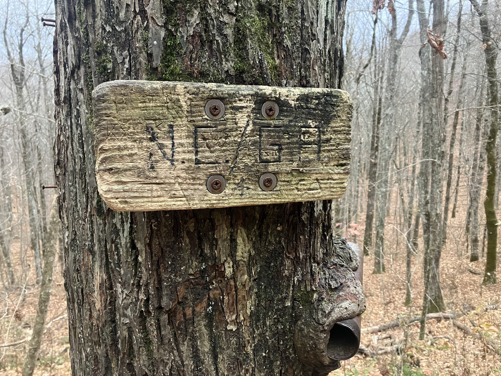
Just before 8am, I tagged the small wooden ‘NC/GA’ sign nailed to a tree trunk. I started the GPS tracker on my phone and took off through the woods.
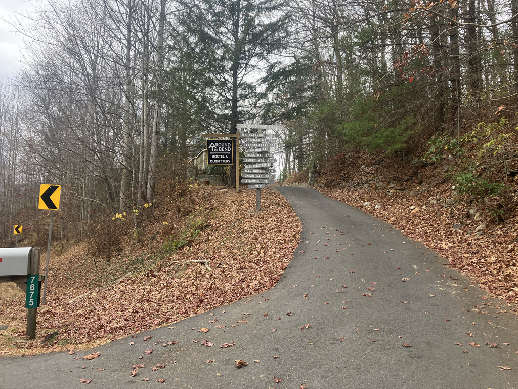
At 10am the food thing was still bothering me. I knew hiking through the night with not much fuel would be a double mental mountain. I checked the FarOut app for any other options for acquiring some more. Less than two miles ahead, I would cross Highway 76 with Around the Bend Hostel & Outfitters only 0.6 miles from Dicks Creek Gap. It was closed for the winter but with a note that you could call to see if someone was around. I did, and 45 minutes later, I was on the porch with former thru-hiker Nimrod. In the outfitter shed I picked one of just about every snack there. While Nimrod rang through my purchases, I sat on a stool in the warm kitchen with a mug of hot coffee. It was good just to chat for a few minutes with another long-distance hiker. For weeks I had rarely had any conversations past the ritualized ‘Hello, happy trails’ of passing by other people on the trail corridor. Because I walked to and from Around the Bend and bought food, I am submitting a self-supported rather than an unsupported record attempt.
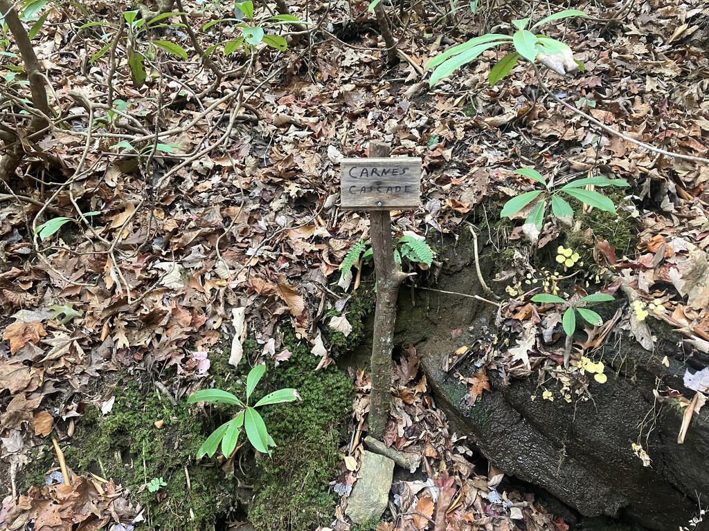
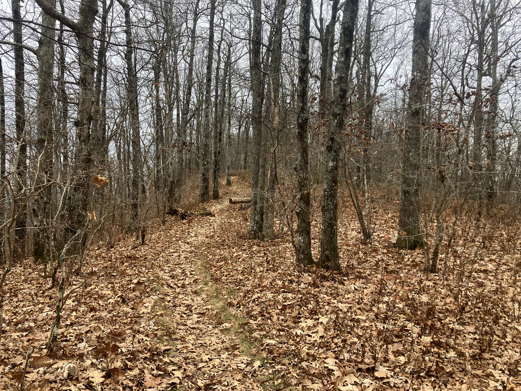
The rest of the day passed by pretty quickly. A half of one of my snacks every 45 minutes powered me through the miles as I hiked up hills and jogged the downhills under a gray sky. One of my favorite parts of hiking the AT is noticing the signs of care taken by people who have gone before me, tending spots that are overlooked by widely distributed maps and apps. When I filled my bottle at a stream that feeds into Dicks Creek, a little bench greeted me and a wooden post adorned with Sharpie let me know that my water source was ‘Carnes Cascade’. What the southern tip of the AT lacks in sweeping majestic views, it trades for charm and rhododendron tunnels, and a relatively smooth tread–far more inviting to fly along than the boulder pits of Maine.
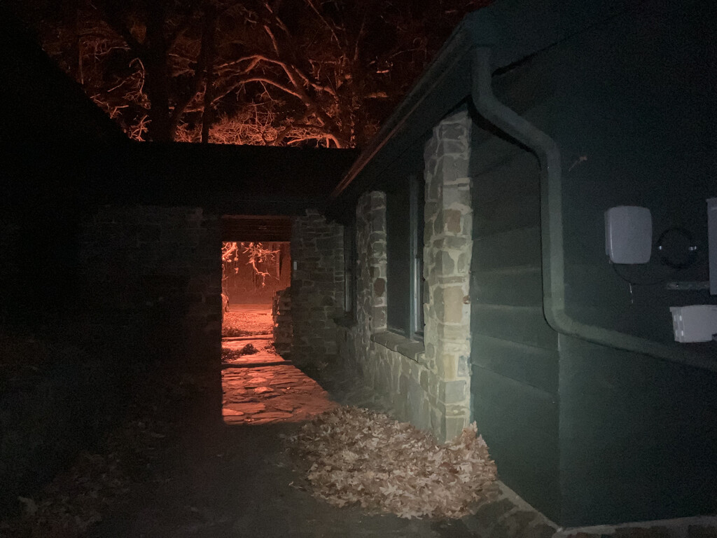
Nightfall was rapidly approaching when I paused to collect water at the spring for Blue Mountain Shelter, exactly 50 miles from the terminus. The excitement of my last night on trail was tempered by knowing I would spend the next 13 hours without sunlight. I often relish being a wild creature of the night when I hike by moonlight or headlamp, but the transition into darkness is hard. Strangely though, despite the accumulated mileage and low sleep of the last few days, I felt stronger and more eager than many previous nights when I had looked to spend just a few hours walking before laying down under the stars. Miles flew by. Just past midnight, I reached Mountain Crossings and plopped my stuff down at a picnic table. I plugged my headlamp into my battery bank, knowing from experience that a full charge only lasts 8 to 10 hours and I would need more than that to get through the night. I searched the well-lit building complex fruitlessly for a tap or water source for about 20 minutes (I know there is one, just couldn’t find it). Then I donned my headlamp again and marched onward and upward into the darkness. I paused briefly at the top of Blood Mountain to admire the view of city lights below while eating a Reese’s peanut butter cup. As the early morning hours progressed, I waded through heaps of leaves that filled the trail tread and swallowed my legs to my knees, swept there by the increasingly violent wind. Around 3am, clouds rolled in and enveloped me. My pace sometimes slowed to a crawl as I navigated downed branches, hunted the trail beneath the leaf piles, and played blind man’s buff at every trail intersection and parking lot with visibility of only a few feet.
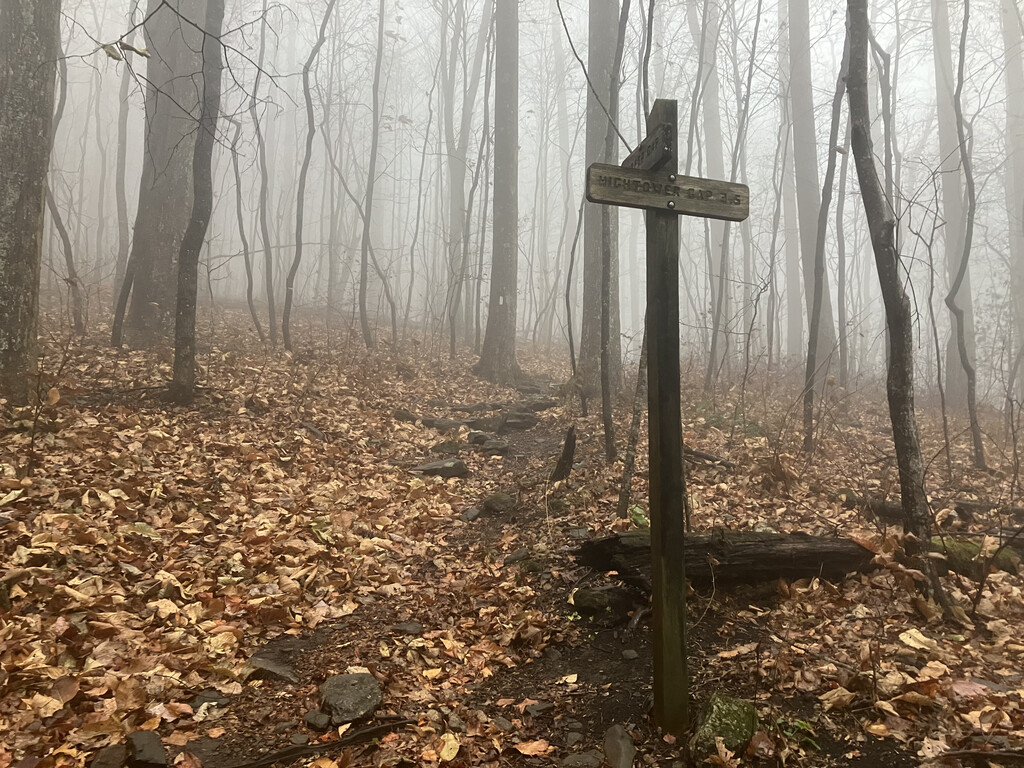
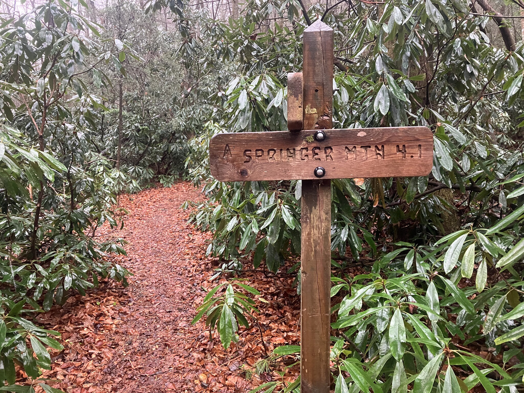
I welcomed daylight and the chance to see more than one or two steps ahead, finally clicking off my dying headlamp at 7am. Suddenly too sleepy to keep going, I took a nine-minute dirt nap propped against a tree on trail; in the cold and wet of a weekday November morning I wasn’t too worried about another hiker walking up on me. I woke up refreshed and ready to tackle the last fifteen miles. Then a half marathon. Then ten miles. Rain made slippery work of some steep ups and downs between Cooper Gap and Hightower Gap, but I continued to move efficiently, fueled by the nearly 2,200 miles walking through these mountains that came before. The smooth, wide path beside Long Creek that turned upwards into the final gentle ascent to Springer Mountain felt like something out of a dream. As I strode alone past innumerable campsites, I imagined the trail in March, filled with thousands of eager hikers beginning their northward journey.
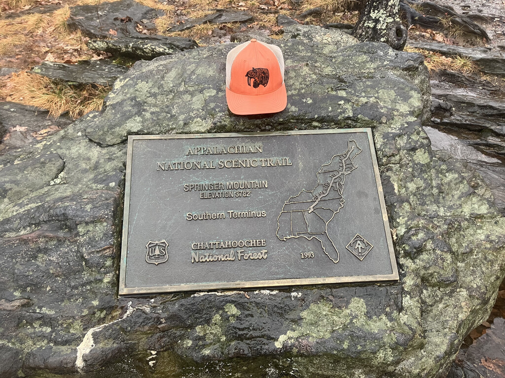
I reached USFS 42 just before noon, crossed the dirt parking lot in the pouring rain, and began the final mile up the mountain. I ran. At the summit I tagged a lichen-splotched boulder with both hands. The plaque set into it read: ‘Appalachian National Scenic Trail, Springer Mountain Elevation 3782’, Southern Terminus’. It had been 78 days since I stepped away from the summit of Katahdin, 96 hours since I stood atop Clingman’s Dome…and 28 hours, 10 minutes since I left the North Carolina state border.