


I was inspired to run/hike the Bradford Millennium Way as a local project after listening to the Fastest Known Podcast, I knew the start and finish areas reasonably well but the rest of it was unknown and would also be the furthest I'd gone in one effort before. On Thursday I had the idea to attempt it and estimated I could do it in 11-15 hours; it was early September so I wanted to do it as soon as possible to maximise my daylight hours. The weather forecast was good for Saturday and as I only live one hundred metres off route there weren't any logistics to organise, so I went for it.
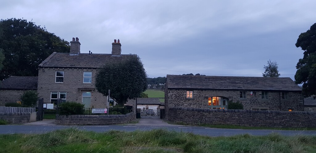
The normal start is at Bracken Hall Countryside Centre but I live closer to the bottom of Shipley Glen so I decided to start at the information board on Higher Coach Road. I left the house at 5:45 am, at the start I took a photo of the board, got the GPS on my watch running and set off into the darkness at 5:50 am, With owls calling all around me I headed up the river, the trees sheltering me from the drizzly rain. Wanting to save my headtorch for a possible late finish I carried on through Hirst Wood in the dark nervously jogging the lighter sections but mainly walking for fear of tripping on a root, by the time I'd got onto the playing fields heading towards Bradford and Bingley Canoe Club it was light enough to see and I could start to run a bit more. Once past Cottingley Bridge I was into new territory, navigating the stiles, walls, gates and packhorse bridge on my from Beckfoot up to the golf course was quite fiddly holding two walking poles and a map and was a sign of things to come for the earlier stages of the attempt. As I left the shelter of Ruin Bank Wood I got my first long view ahead filled with gloomy grey cloud, I stopped to put on my waterproof and wondered if I was in for a long day of rain. After 1:13 I was approaching Harden but came across a closed footpath, there was no diversion notice and the guidebook wasn't detailed enough to show an alternative, so I hopped over the gate and continued, it turned out the bridge was down but there was a farm track adjacent so I used that instead although someone was clearly not happy about people doing this judging by the amount of barbed wire about the place. Running up through Goit Stock Wood I came across the waterfalls below Hallas Bridge, dropping about four metres down to a flat plunge pool at the bottom. Climbing up a grassy field underneath Hewenden Viaduct I was treated to a great view over Hewenden Reservoir. At 1:54 I reached Holling Park House crossing behind a grand old stable block I cut up the valley to the rear and saw a fox run across the paddock ahead of me. I passed quickly through Denholme with a brief stop to take a photo of the view back to the viaduct, the heather on the sides of the track was a sign that I was gaining some height and getting closer to the moors. Up until now the trail had been mainly rural footpaths with many stiles and gates but here it begins to open out a bit and gave me an opportunity to gain some time back. I had been running flat sections and walking the ascents and descents in an attempt to save my knees for the later sections, descending down on soft moorland towards Leeming Reservoir gave me an opportunity to take on some more food, I'd been aiming for 300 calories an hour, so far made up of flapjack, I arrived at Leeming Reservoir at 2:45 and used the flat section to get Strava going on my phone before my watch battery died (Incidentally this is why there are two GPS tracks, I haven't been able to add them together correctly, I've cropped the first as close to the second as I can but there is still a slight overlap hence the slight time discrepancy, I hope no one minds that but I figure as this time is easily beatable by hours rather than minutes it wouldn't matter too much). After a bit of trouble finding the right route out of Oxenhope I was back up onto the moors, the route so far had mainly felt as though I was connecting a string of local dog walks together with short paths and lots of stiles but once I headed up towards Penistone Hill I had a long stretch of easily runnable paths right up to the Bronte Bridge which I reached at 3:55. After 4:28 I passed a field of Herdwick sheep, no doubt familiar to any lakeland runners, and reached Oldfield School, a traditional stone primary school in a tiny village. I followed a narrow path full of nettles before climbing up past Harehills House and onto a long flat section of moor where I had my longest stretch of running so far. The damp grass and boggy patches soon soaked my feet but the enjoyment of running in the big open space soon surpassed any worries about that. I reached Keighley Moor reservoir twenty six minutes later and began to descend the long tarmac path down towards Morkin Bridge, I got more food in here but my knees were beginning to ache a little and some rough mental calculations brought the realisation that I wasn't making good time. I pushed on hoping that the long moor section that I knew lead to the finish would give me chance to claw some time back. At five hours and fifteen minutes I passed Slitheroford Farm crossed a paddock and headed up a steep field that I couldn't see the other side of, I reached one corner that looked a possible route but didn't seem right so I headed on up the boundary, I cut the corner to the middle of the next fenceline but couldn't find the stile, crossing ankle deep in mud and cow muck to the next corner where my hunt for the path was still in vain I was starting to get really frustrated, reading and rereading the directions I couldn't make sense of them. Eventually I headed back to the corner I'd cut out earlier and found the elusive stile, whereupon all the directions suddenly made sense and I was left frustrated at the time I'd lost and my inability to compute the simple instructions. I passed the Turkey Inn at Laycock at 5:46, and began the steep tarmac climb out of the village. A nice section of running over farmland followed before joining the road for about a mile descending and taking on more food, a peanut butter and jam sandwich this time, a short climb and then I was back onto trails before reaching the busy road at Eastburn at 6:45. Five miles of flat farmland running broken up with stiles followed and gave me the chance to feel I was making good progress again. More farmland running and then a long slightly downhill stretch on a wide grassy bridleway approaching Addingham was enough to get my positivity back, but reaching the allotments in Addingham at 9:30 with thirteen miles still to go had me doubting that once again. From Addingham there were roughly two miles of fairly steep climbing, but it was on grassy paths with amazing surroundings so it was easy to enjoy the experience. Turning round at the Cairn on top of Windgate Nick made the preceding ten hours and fourteen minutes worthwhile, the best view of the route so far overlooks Addingham, Ilkley and the surrounding Yorkshire Tea box style countryside. The route takes a sharp left turn here and runs along the top of the ridge looking into the valley for a couple of miles of running on sandy trails, shotguns were firing of to the right while the grouse were all around me calling in their strange gurgly, squeaky dog toy like way. At 11:06 I reached White Wells, back on familiar territory from last years Dales Way hike; I was hoping to use the tap to fill my bladder but it was out of action due to Covid restrictions so I pushed on without, I was very thirsty and had at least eight miles to go so drank from Backstone Beck hoping I was high enough up and far enough out of lambing season to catch anything too nasty. I reached the famous Cow and Calf Rocks at 11:34 but the way markers were no longer obvious and I couldn't make sense of the directions again, this and the confusing number of paths around this tourist hotspot meant I wasn't confident I was on the right path as I set off. I struck off the track to get higher up as the directions talked of the ridge and I knew the normal route was to the west, still no sign of way markers I continued on and then further west to the trail I knew, convinced I was too far east, I came across a marker pointing to the west; thinking that was where I should have joined this track I carried on. No more way markers appeared though so I had to resort to GPS, I found that I had been too far west most of the time until the last marker post where I should have turned west but instead had carried on and was now south of the trail, I hit the road to the east of the route and got back on track just before Weecher reservoir at thirteen hours exactly, not knowing where I was meant to be and trying to decipher the navigation when I had hoped to be running easy flat trails over the moor had eaten into my time so I had to mentally readjust and aim to finish under fourteen hours. On familiar territory now I headed for home, passing Bracken Hall Centre at 13:40 walking all the time, I hobbled down the final steep rocky path in the dark and finished at the information board at 7:40pm, exactly 13:50 after setting off.
I felt frustrated at the time I lost through navigation, at least ninety minutes and probably more like two hours, I carried more food than I needed and didn't manage to get enough water, but this was outweighed by the sense of achievement I had from travelling further than I ever have before and the sense of freedom and confidence that goes with that. I'm already thinking of going again, knowing the route will help, ditching the hiking poles might help speed up all those gates and stiles but the main thing would be the confidence that the distance isn't the obstacle now and I could push harder knowing I'm capable of that. For me under eleven hours would be a good goal, but for a real runner who knows the route I'm sure they could aim for a few hours under that, I hope to see someone achieve that and see how fast it can be done.