


What a fun time! My approach to completing the trail was to prepare as if I was going to be doing it unsupported. I created multiple checkpoints where I would be able to resupply myself but became lucky with having a few friends help me during the day making it supported. From a long ultramarathon perspective, it's an easy trail since most of it is flat or pavement with a mix of technical hiking but the elevation gain is not bad. This time can be easily worked on. But there are a few things to consider:
1. The Patriots Path has "Closed, end of Trail" signs in two locations. The trail just ends because it cuts through a rail yard and power lines that are not passable. So alternative routes need to be found.
2. There is one section that the Patriots Path has you go through a literal Pond. Not a flooded trail but the trail just ends, and you have to go through a swamp. I saw the other end of the trail but the pond was hip-deep so I picked an alternative.
3. The GPX file needs some work. There are multiple sections where it's wrong and I probably had to add about 10 miles to do the correct sections.
I decided to go from PA to NJ as the route since I live in Jersey City. The one benefit of going the opposite way would be to knock out all of the pavement in the very beginning. But both ways would end very flat.
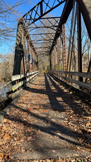
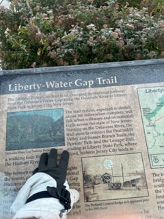
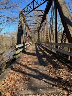
You can break the Liberty Water Gap Trail into four sections if you go my route: Rail to Trail, Patriots Path, Lenape Trail, and City
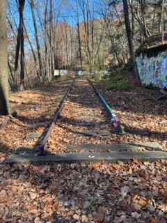
Rail to Trail: This was the first 30ish miles of the trail. It is very straightforward and flat. All gravel is packed and well-marked. This section would eventually end once you make it to Newton. my one goal was to just pace properly and not go out too hard. It was probably the most social part of the trail because a lot of people were walking their dogs. My Spot device started tracking a bit late here, but you can call my mom. She dropped me off at the start haha.
Patriots Path: The Patriots Path will be all you do from Newton to Morristown. The Patriot's path is decently well-marked but this was also mostly during the night for me. There are multiple "Open Park Preserves" where there is no specific trail, just markers on trees. It's very easy to make a wrong turn. My headlamp was not working so I had to navigate by phone and moonlight. fun times. You also need to be careful once you reach Lewis Morris Park. This was the hour 23-24 mark for me so I needed to sleep. I realized I made a wrong turn because the Patriots Path has two trails with no warning. There is a Patriots Blue Path and a Patriots Red Path, and you can accidentally take the wrong one and be a few miles off track. And the Liberty Trail constantly switches between using both.
Lenape Trail: Once you leave the Patriots Path, you'll be on the Lenape Trail. You will start with bush-whacking through power lines but then be on a mix of pavement and NJ trails. The Lenape Trail is well-marked. It started to get dark when I was on the Lenape Trail but a friend gave me a hand-held amazing flashlight. You will take this to Newark.
City: This is when you leave Brookdale Park in Newark and go into the streets of Newark to make it to Jersey City. I reached Newark at about 1 am. I did take some alternative paths to stay on the main streets and well-lit streets to avoid any bad situations but had no issues. But I would suggest doing this during the day or having someone with you. Besides some sleeping homeless, I had no issues. Luckily, I knew how to navigate the bridges to get into Jersey City but it can be confusing. Just keep on following the crosswalks and you will make it. Once in Jersey City, don't celebrate, you still have 8-9 miles until you finish.
Editor: The tracking was not optimal with few waypoints and the start missing. However, it was possible to reconstruct the start from pictures w coordinate data and timestamps. Also, based on the description it is possible to follow the progress and assess the route. There has been extensive correspondence to verify the run. The effort is flagged for the limited tracking.