Splits:
Nannie (old fire lookout) 1:07
Nannie (northern high point 1:14
Peak 7478 3:18
Ives 4:02
Old Snowy 5:07
Peak 7210 5:50
Hawkeye Point 7:58
True Summit of Goat Ridge 9:08
Berry Patch TH 9:44
Finish 11:32:46
This FKT attempt was a bit of a last minute decision. I’d been planning an adventure in the Wallowas, but wet and potentially stormy weather scuppered that. The weather further west looked better, and I’ve been meaning to check out the Goat Rocks for years. A quick browse through the FKT site brought me to this peak tour which looked like the perfect way to experience as much of the wilderness area as possible and climb some fun peaks.
I drove up Friday night, getting to the trailhead and sleeping in my car before a 4:45 wakeup call. I decided to start and end from Walput Lake rather than Berry Patch mainly due to weather. There was a chance of rain starting around noon, and a slight chance of thunderstorms starting around 3. I wanted to frontload the higher portions of the loop in case weather did indeed roll in to give myself the biggest margin of safety. For the same reason, I decided to start before dawn and do the initial climb by headlamp.
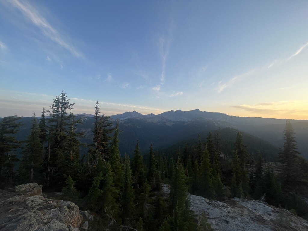
I don’t think I’d recommend a 2200 foot climb as the ideal warmup, and my body took a while to settle in. Nonetheless I moved efficiently, and as I reached treeline looked over my shoulder to see Adams looming in the distance, lit up by the pre-dawn alpenglow. This would be the first of many times I’d get goosebumps from the sheer beauty around me.
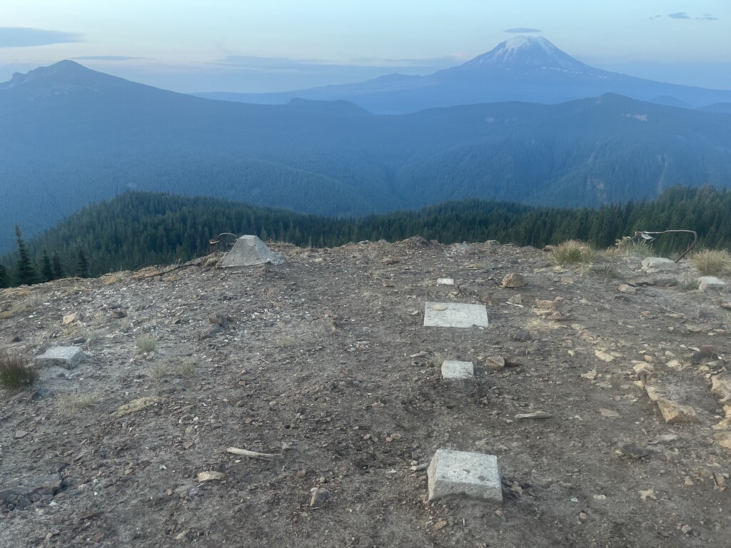
I hit the spur trail to the top of Nannie, going first to the site of the old fire lookout and then the other direction to the end of the trail on the north prominence. I’m not sure where the true summit is up there so wanted to be safe by hitting both.
On my way to Cispus Pass, I began experiencing some foot pain, mostly in my right foot. I was wearing a brand new pair of shoes (possibly not the best idea), and eventually decided to stop, take off the shoe, and see if I could fix the issue. A little foot massage and creative lace tying later, and it was solved forever! That proved to be a good reminder of how important solving small problems early can be, a reminder I did a solid job of respecting throughout the rest of the day.
The climb from the PCT up the Cispus River Drainage was fairly pleasant, I was able to settle into a nice rhythm and quite quickly found myself at the saddle just to the east of my second summit of the day, Peak 7478. A quick scree scramble later and I was on top looking at the intimidating summit pyramid of Ives. From a distance it looks like vertical rock! Thankfully, during my research I’d encountered a trip report from someone who had the same perspective and said that as he got closer there was a relatively tame way up. With that reassurance and the confidence that I could always backtrack down to the PCT if necessary, I continued along the ridge.
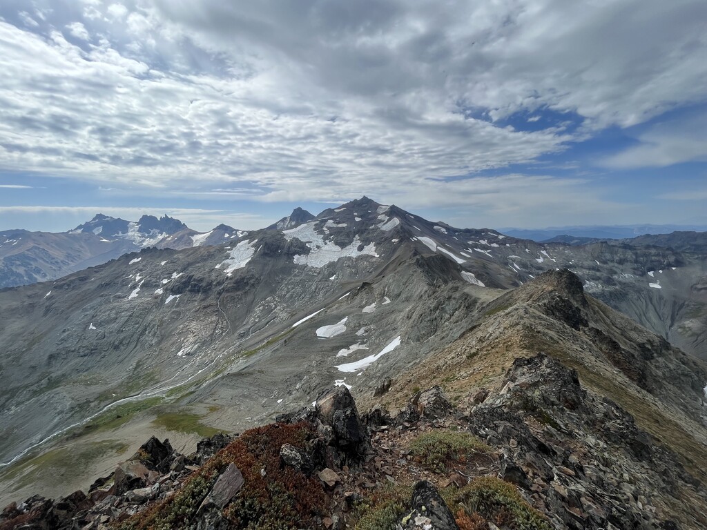
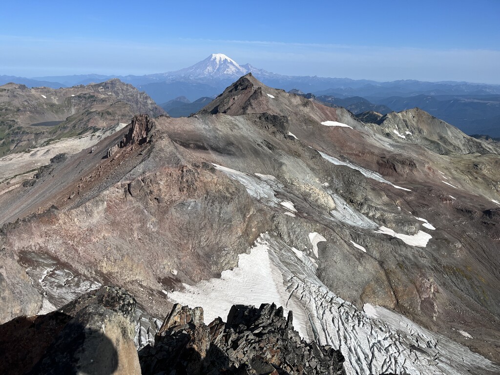
The mysterious internet stranger was right, and although there were a few class 3 moves to get up Ives I never found myself uncomfortable or without a clear safe option for continuing upwards. The summit of Ives is epic. It’s a small flat area with the world dropping away in all directions. Getting down was challenging, as I needed to plot a safe path down from the pinnacle and below some more gendarmes. Here I dropped too far down the ridge and found myself trying to cut crosswise on a very steep scree slope, with every step sending rocks tumbling below me. It wasn’t fun. Eventually I corrected and regained the ridge. There were some more class 3 moves along here, as the best route wound sometimes on the southwest side and sometimes on the northeast. There is a bit of a use trail here, and the occasional cairn but I often found myself needing to take a moment to critically think about the safest way through. Finally I reached the top of Old Snowy very ready to be back on trails for a bit.
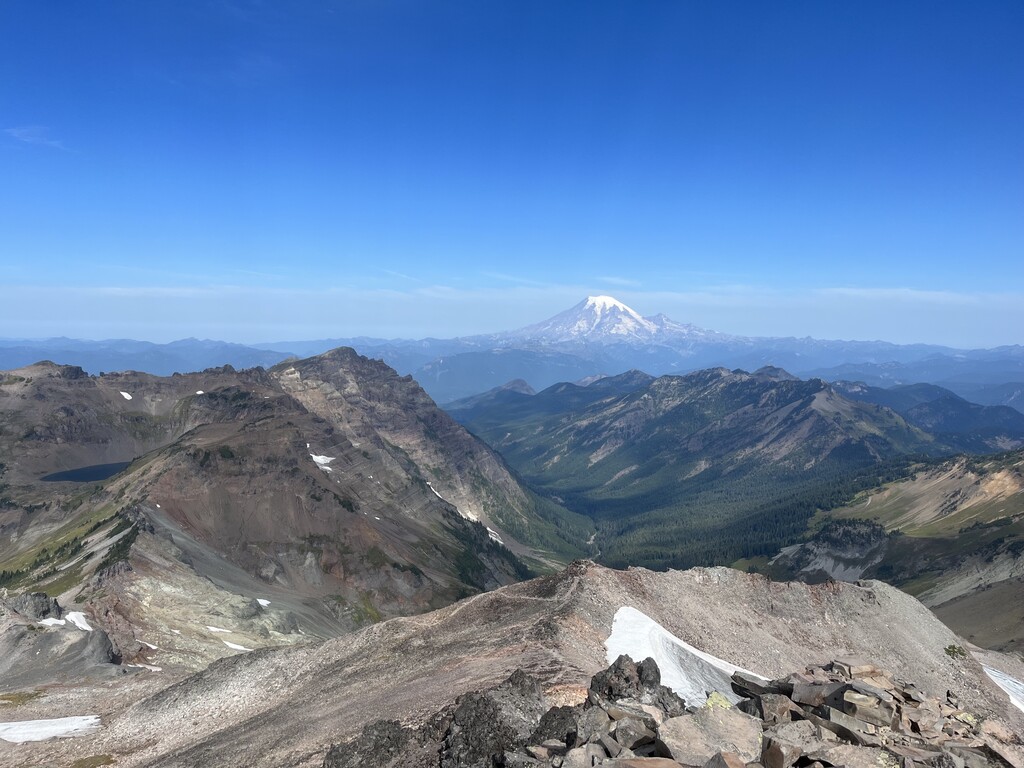
The section of PCT north from where the Old Snowy trail connects might be the coolest trail I’ve ever been on. It follows the crest of a sharp ridgeline providing incredible views of the peaks and valleys of the wilderness area. It’s also brutally technical and the slopes falling away to either side require caution while running downhill. I was well aware of the elevated consequences were I to trip, and proceeded more slowly than I often do down technical descents.
The PCT high point (peak 7210) was sketchy. To get up it, I stayed on the PCT further north than the peak itself, to come up the northern ridgeline. That was steep but fine. I thought I saw a more direct line down from the south ridge. I made it but good lord that was not fun. I highly recommend going back down the north side. The PCT at this point is cutting crosswise across the steep slopes and any fall would have taken me quite far down into the valley. And a fall felt very possible. This was the least safe I felt all day, but moved slowly and carefully and was able to successfully rejoin the trail.
I hit my biggest low of the day as I left the PCT to head to Goat Lake at the base of Hawkeye point. In hindsight I was dehydrated and getting a bit behind on calories, and it led me to make poor navigation decisions. I got a bit off trail and ended up heading straight down a scree slope paralleling but definitely not following the trail. This ended up being a kindness though, as I stumbled on a little glacial melt stream and was able to filter water and take a bit of a break to reset. I didn’t properly find the trail again for another frustrating eternity, but I could see it in the distance heading up towards the lake so I kept moving in the right direction and trusted that I’d get there eventually.
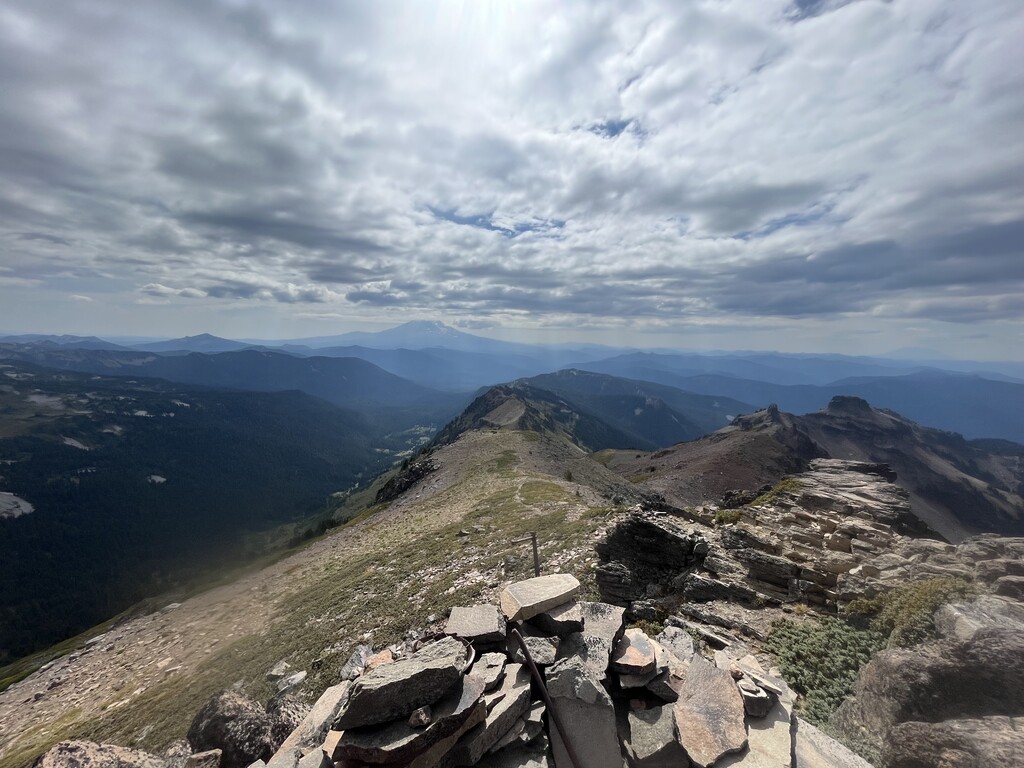
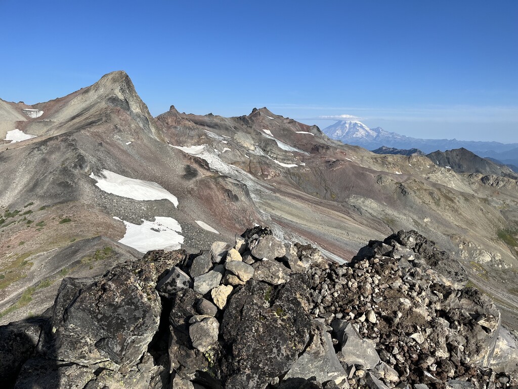
I started coming back to life up to Hawkeye, with more food in my belly and water in my system. I’d also taken my first caffeine of the day. You could see the Snowy/Ives ridgeline for much of the climb, and I spent some time marveling at how far I’d come. The top of Hawkeye was a quick stop, as I was ready to begin moving towards my car. I was also ready to start actually running again, and the Goat Ridge trail proved a pleasant change from the steep technical terrain I’d spent most of the day on. Just one more peak to go!
This is an epic loop. Richard Kresser is a genius for putting it together. But I was cursing his name as I reached the end of the trail at the Goat Ridge Lookout, as it was clear from both my eyes and my GPS that the “true” high point would require a bushwacky descent to a saddle and one more off-trail climb. But I was far too close to quit at this point, tapped the final high point, and descended to the trailhead.
Navigation from Berry Patch to Walput wasn’t trivial, as the trail is overgrown and there are a number of points where it intersects with and/or briefly follows other forest roads (some maintained some 4-wheeler tracks), but I was back in a good headspace and moving efficiently.
One note here: There are two points at which following the maintained forest roads rather than the trail could save meaningful time/effort/distance/vert. The first mile post-Berry Patch, and the last 1.5 miles to Walput. I ended up on the road briefly leaving Berry Patch before correcting my mistake and heading back on the trail. I feel like following the trails wherever possible best fits the spirit of this FKT and so I did so, but if the main goal is to link up the 6 peaks as efficiently as possible, a bit of road running would speed things up.
All in all, I don’t have the words to properly sum up this day, or this loop. It was beautiful beyond superlatives and tested me mentally and physically. I’m excited to come back and spend more time amongst these peaks!