


PDF Version - https://drive.google.com/file/d/1xfzmHP2-FdDhCBUPR9WJzziMfqUR0hst/view?usp=sharing
The Why
After the World Orienteering Championships, which were held in Denmark during July 2022, I felt I needed an adventure and something out of the ordinary, both physically and mentally. The timing fell nicely to do something before the Charleville Half Marathon and cross-country season. My parents were going to Bantry on the weekend of the 2nd – 4th of September and when I did some map nerding and googling it didn’t take too long until I came across the Sheep’s Head Way. It looked a serious challenge, being ~30km further than I had ever covered on foot before, so I was hopeful it would scratch my adventure itch!
The Route
On “The Sheep’s Head Way” website the route is measured as 93km (~58miles). The start point is at the map board outside the gate to Bantry House and the route goes along trails and open mountain, through forestry and fields and along the general highways and byways around Kilcrohane, Ahakista and Durrus before finishing back where it started. I spent some time reading the website information, looking at the Ordnance Survey Ireland (OSi) maps for each section, watching YouTube videos, reading the reports from Remi Delille (supported FKT holder) and Conor O’Neill (unsupported FKT holder). On paper it looked quite a daunting undertaking and I was very aware there was a reasonable chance of not finishing it.
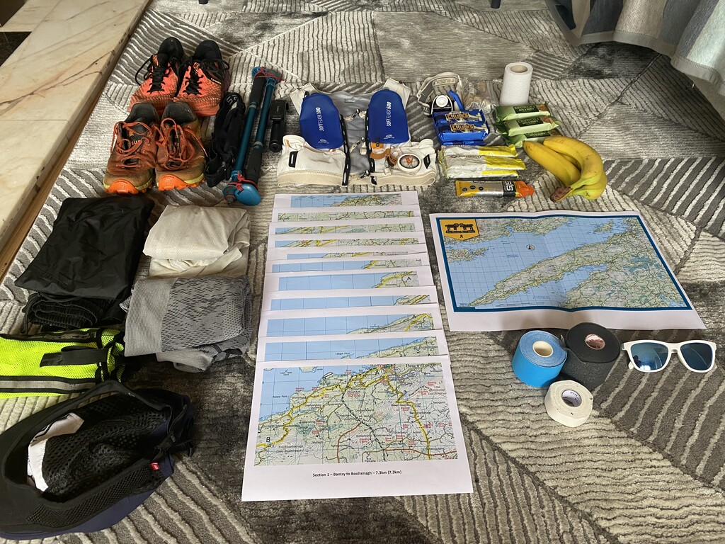
The Gear
Since this was a supported attempt (Mum and Dad gave up one of their holiday days to hoof it around the Sheep’s Head looking after me) I was able to travel relatively light, about 3kg. We planned to meet for 3 stops on the route – the car park by the lighthouse, Kilcrohane and then in Durrus – where I could pick up calories, get fresh bottles and have a chat for few minutes with someone other than myself. I ran in Icebug trail shoes for the majority of the route but switched to Asics for the final road section and I used a 5L Evadict backpack from Decathlon with 2 * 500ml soft flasks along with Quechua collapsible hiking poles. Fuel included – 1.5L of tailwind, oat bars, rice-crispy squares, kinder bars, fruit, Jaffa cakes, a Solero, 2 fizzy drinks, 2L of water.
The Day
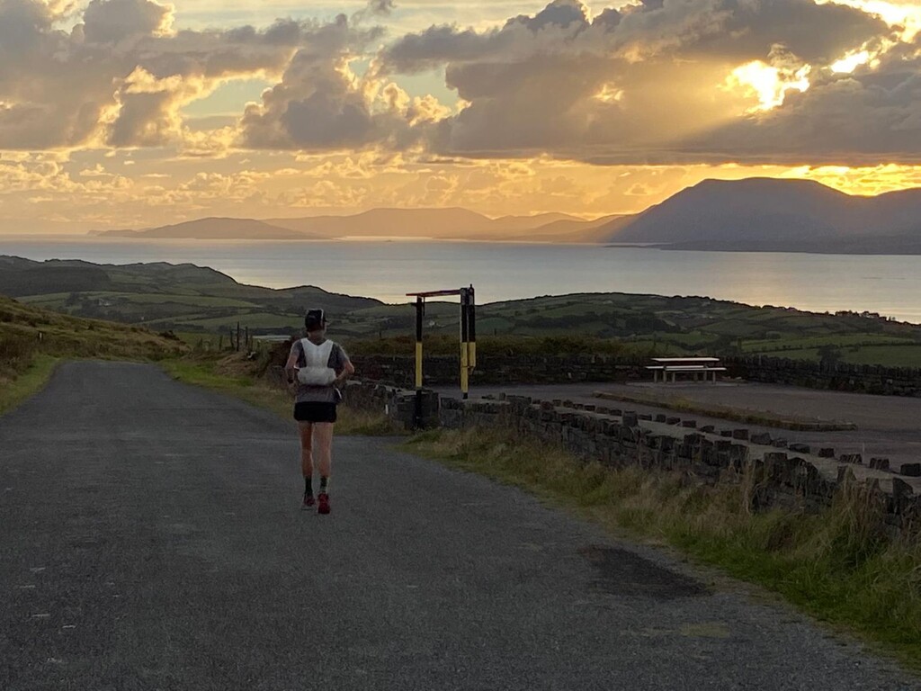
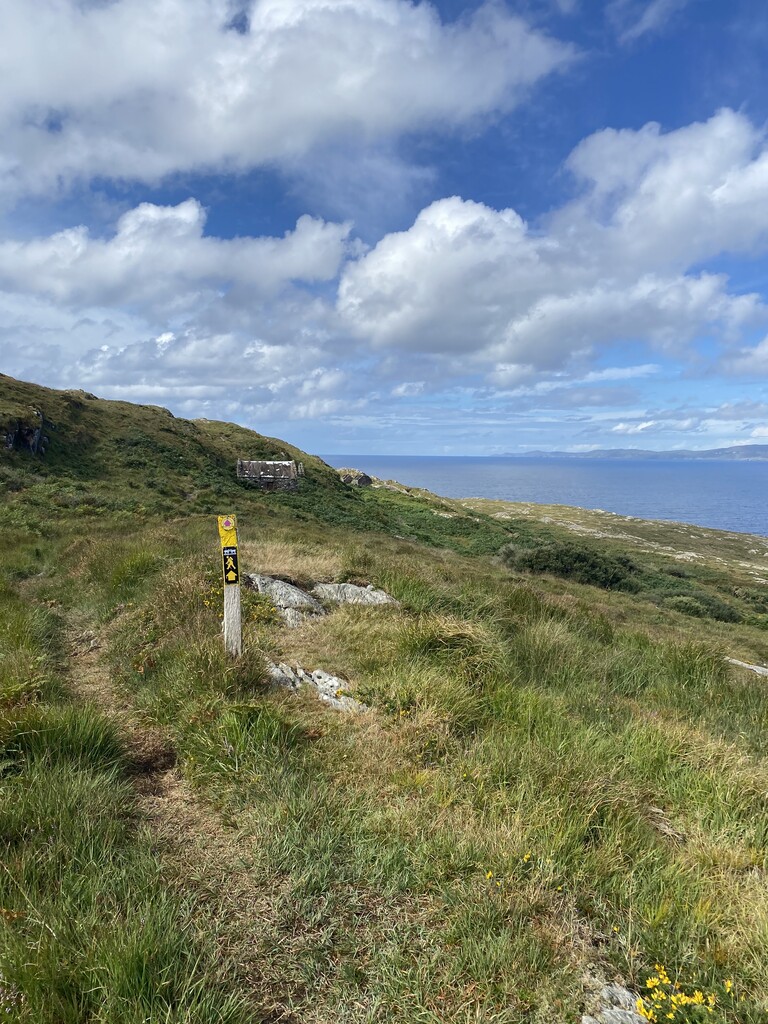
Having travelled down the evening before from Dublin (via Killarney on the train) I spent the night in the caravan with my parents in Eagle Point and then Dad dropped me to the start point on Saturday morning. We took a few “before” photos with nervous smiles. I started the watch, touched the sign and at 08:30 away I went. The gate to Bantry House was locked so it was the alternate start up along the road and in behind “the Pond” to pick the yellow man back up. The first section to Booltenagh was mainly on roads and was mostly uneventful but I did get my feet wet crossing the early fields which I was hoping to avoid for as long as possible.
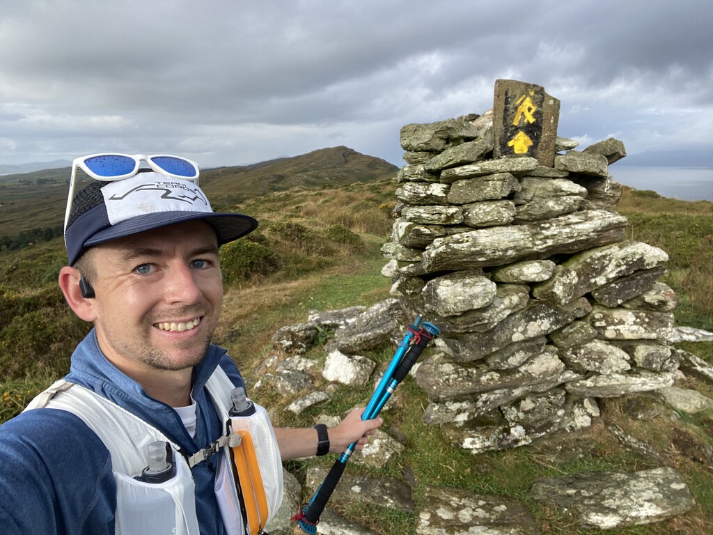
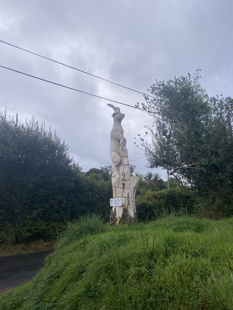
Section 2 was out onto the hills and along the ridge line passing above “the big gap” and the around Lough na Fuilla (The lake of blood). The lake gets its name after a hot summer during which it was empty and the animals had no water to drink. They went mad with thirst and killed each other filling the hollow where the lake sits with blood. The rest of the ridge was good running but the descent towards Glanlough was quite rough a slippery on the bare rock section. I took this extra carefully after reading Conor’s report where he took a heavy tumble early on in his attempt. On the road run down around Glanlough I passed a wooden carving of a goat which I decided to call “Wood-ie Goat-tree”……It’s a good joke and you know it!
I had actually run a part of the 3rd section of the route before, I can’t remember the year, with Rob McEvoy. From the road to where it flattened off was ~250m of vertical gain so I took the time to take on some food and have a bit of a munch. Along the top, as with basically all of this route, the views were stunning looking out over Bantry Bay on one side and Dunmanus Bay on the other (in between the heavy rain showers). This part of the Sheep's Head way passed over the CorkO maps of Maulnaskehy & Gouldane and the along the north side of the Derrycluvane and Seefin map’s used in Shamrock O-Ringen’s in years gone by. Again the descent from Gortnakilly to the switch back trail was not great underfoot and lots of undergrowth meant I spent most of it not able to see where my feet were landing.
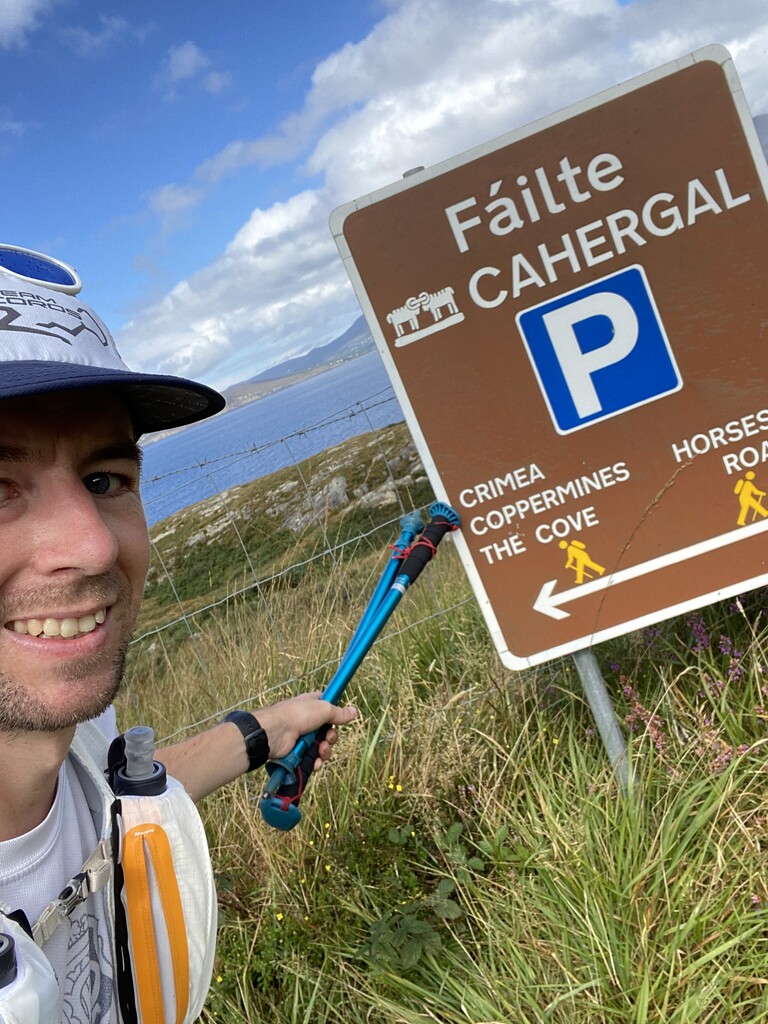
Finally on the way from Seefin to Cahergal I met my first people of the day (since Bantry) in the form of a group of walkers. This section was the shortest on the route and was good running on wide trail and then tarmac surface.
Out towards the tip of the peninsula was stunningly beautiful but also a bit sketchy in places underfoot so finding and keeping a rhythm was difficult. After leaving the road you soon come across “The Crimea” which is an old deserted hamlet and not long after that there is the remanence of the copper mining along with a long row of ruined terraced buildings. After cresting the ridge and chatting to a few sheep I trotted downhill to “The Cove” which is where J.G Farrell, the author of “The Empire Trilogy” died in 1979. From here to the lighthouse was tough going but I knew I was meeting my support crew (Mum & Dad) in the carpark for my first break.
At the carpark I stopped for between 10-15mins, had a chat with the gang, took on some food, refilled my bottles, changed my t-shirt and we made a plan to meet in Kilcrohane in around 90 – 100 minutes time. Despite this only being ~40k into the run it felt mentally like the halfway point had been passed as I was now heading back Bantry bound. I got rolling again up the hill above Doo Lough (insert Shrek reference) and passed both the signal tower and trig point before a nice relatively straight run to Letter West.
It was in section 7 I made my first, and only, navigation error of the day. I scuttled down the road to Ballinatra but missed a marker and saw some wooden stakes in the field with yellow painted tops so started following them. After a few minutes confused and a quick look at the OSi 1:50000 map I spotted the error after matching up the 2 lone buildings on the map with those on the ground. It was about a 6-7 minute error. The Way then bounced along between the coastline and the main road until I came into Kilcrohane.
The “Post Office/Shop/Bit of everything” had only opened just before I arrived so I was able to grab a can of Coke and a Solero to have on the wall. This was a ~19 minute stop all in and we were going to meet again in ~ 2hrs in Durrus. Just as I was ready to head out Mary C walked into the village, you can’t do anything without meeting people you’d know!
The route goes down to Farranamanagh Lough where you run along the back of the beach and over a small picturesque stone bridge before looping back over the road. After passing the “Well of the Poets” came a long straight section along the south side of Rosskerrig Mountain which is where I ran my first Shamrock O-Ringen back in June 2007......as an under 14! After a search for the results online afterwards we found I was 5th on that day, +7:27 behind the winner. I climbed up past the stone circle and after scaring a lady out picking blackberries who didn’t hear me coming it was on to the next map extract, a long 12km section to Durrus.
I have a vague recollection of running the first part of this with Rob a few years back when we started in Ahakista. The first half was on some rough ground before hitting the road and some agricultural lands again. One of the trails, north of Rossmore, did not seem well used as I bashed my way through the ferns and brambles. Coming into the outskirts of the thriving metropolis that is Durrus the yellow man took me through the grounds of the Church where I had to hop the wall out because of a locked gate. With “Four Mile Water” on my right someone came past in a car beeping the horn and cheering at me.....I spotted the O-kite on the rear view mirror and clicked it was the Perkins when I saw Steve hanging out the window cheering! Rolling in to Durrus there was a real feeling of “no matter how much you’re under pressure you can’t pull the plug now” with just over 13 miles left to go but in all honesty I was feeling pretty ok all considered.
I took a 15 minute break here again with the gang, refuelled, perked up, got some Club Lemon in to me, other carbonated soft drinks are available, and focused on getting the 2nd last section, which had the high point of the route, chalked down and out of the way. Mum & Dad said they would pop up on the road crossings on this section to keep me going.
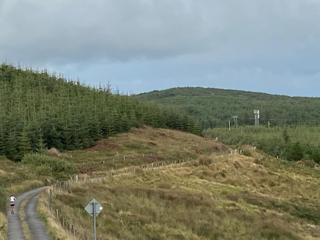
As I trundled out the road I came across a new sign for a change to the Sheep’s Head Way route that brought me through field’s, including a loop I had to take to avoid livestock, and some not so great forest trails before re-joining the original route. The long climb up Derrylahard was a bit of a slog but I took on some more food, got some Miami Sound machine on the earphones (yes, I’m that cool......) and trucked on through. Dad met me on the descent and again at the cross roads by Barnageehy.
After a quick ~4 minute break to chug some more Club Lemon I changed from my Icebug trail shoes to an Asics road shoe for comfort on the tarmac back to Bantry. Maybe I should’ve gone for the Vaporfly 4%’s!?
The boreen descent at the start of this section really started to blow my quads out and on top of that I had issues with dogs that were not happy with me being there. I got past the first 2 relatively ok but Dad had to come and help me with another one a bit further down. Got rolling up the final long climb to the view point with the masts on the hilltop. Since the gate to Bantry House was shut on the way out I was mentally prepared for an extra bit tagged on the end too via the hotel at the N71. I felt quite strong in the last 5km, averaging <5min/k (although it must be said there was a chunk of downhill).
Along the road I had started on just under 12 hours ago but this time with the water on my left and all the way to touch that sign and stop the watch. What a day, what an experience!
The Aftermath
I spent the evening, or what was left of it, chatting with my parents and having dinner before calling it a night. Sleeping was difficult and I had plenty of aches and pains all over. The next morning I went for a short recovery shuffle with Dad before getting my legs into the sea at the camp site and now as I write this on the Monday I’m just in from a 20k recovery jog where my body doesn't feel terrible other than my quads are very tender. A few days of easy jogging and I should be right as rain.
The Thanks
Thanks to Mum & Dad for crewing for me today and giving up a day of their holiday and thanks to everyone for the messages before, during and after the run.
The “What next?”
The focus for the next few days is on recovery so I’m ready to hit the last few sessions before racing the Charleville Half Marathon at the end of this month. After that some cross-country and orienteering but maybe someday in the future I’ll make the jump 2 peninsulas over and take on the big challenge that was also on this weekend, the Kerry Way Ultra!