A really wonderful tour of the Northern Sangres as a loop, and a great alt. to needing to set up a car shuttle on top of Hayden Pass.
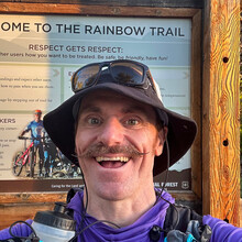
I set off around 2:00am southeast from the Rainbow Trail Trailhead outside of Salida, CO, having hiked up from town the night before. There's a bus line (Bustang Denver-Gunnison) that runs fairly close by, making this a convenient place to visit for car-free folks like me. The Rainbow trail is fairly easy going in the early morning. The creeks were flowing! No one else seen.
Reached The campsite off of Hayden Pass Road at ~ 10:00am, and got ready for the road climb up to Hayden Pass proper. I knew the road would be hot and exposed, with little flowing water at the top, so I cameled up, plugged in some tunes and humped up the surprisingly steep incline! Still not a soul in sight.
At Hayden Pass proper, I took a snooze, knowing that resting on the ridge would be a little difficult (wind! cold!). Weather looked a little iffy - VERY windy, and rain threatening, but having done the traverse from this pass to Methodist Mountain now four times previous, the risk seemed worthwhile to me, as I now have unlocked so many little secrets.
The traverse went smooth enough -- it's amazing how many peaks and points there are such a short distance. I called it quits around 1:00am for the day -- 23 hours of movin'! -- finding a flat, former elk bed-down area in amongst some dwarf trees right at treeline. Very windy, so happy to have found some marginal shelter to bivy.
Work up after a few hour snooze to frozen water bottles and continued on, happy to summit the last point above treeline -- Simmons Peak -- and make my way to Methodist. The area between Simmons and Methodist has experienced quite the wildfire, so all the blowdown from Jason's original report of his point to point FKT are gone, and in its place are wildflowers, shoots of aspen stands, raspberry patches and skittish herds of elk. Really beautiful, otherworldly.
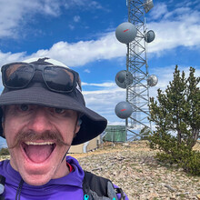
The Communication Towers and Methodist Mountain were summited with little fanfare, then I took on the long trudge down -- town looks so far away! And to think, you're only at 12,000'!
Happy to have a good amount of water still in reservese, as the massive elevation loss is accompanied with a massive temperature increase -- around 60 degrees F once I passed the trailhead and hit town for the requisite recovery burrito.
Made it to the trailhead again around noon. Happy with the effort, but boy is there still time left on the table to go faster. Going the opposite direction would be far easier, as you can stumble up Rainbow Trail at night without fear of being stuck in a raging tempest, 13,000' up.
An incredible loop! With two very different flavors put smack together. The terrain never gets harder than class 2+. Highly recommended. In total, I saw not one other person the entire time, having finally bumped into two families back at the Rainbow Trail Trailhead, who were out for a mountain bike ride.


