


<English follows Japanese >
今回FKTに挑戦したのは滋賀1周トレイルという滋賀県の県境をぐるっと取り巻く山々を一周するもので、大津港をスタートし総距離438km 累積標高28,300mに及ぶコースを6日間12時間10分で完走しました。
コース概要は以下のような感じです。
----------------------------------------------------------------------------------------------------------------------------------------------------------------------------------------------------------------------------
滋賀一周トレイル(通称Shiga1(Shiga-Ichi))は、日本最大の湖、琵琶湖を擁する滋賀県を一周する、総延長438km、累積標高28,300m(反時計回りの場合)の日本最長級のトレイルである。
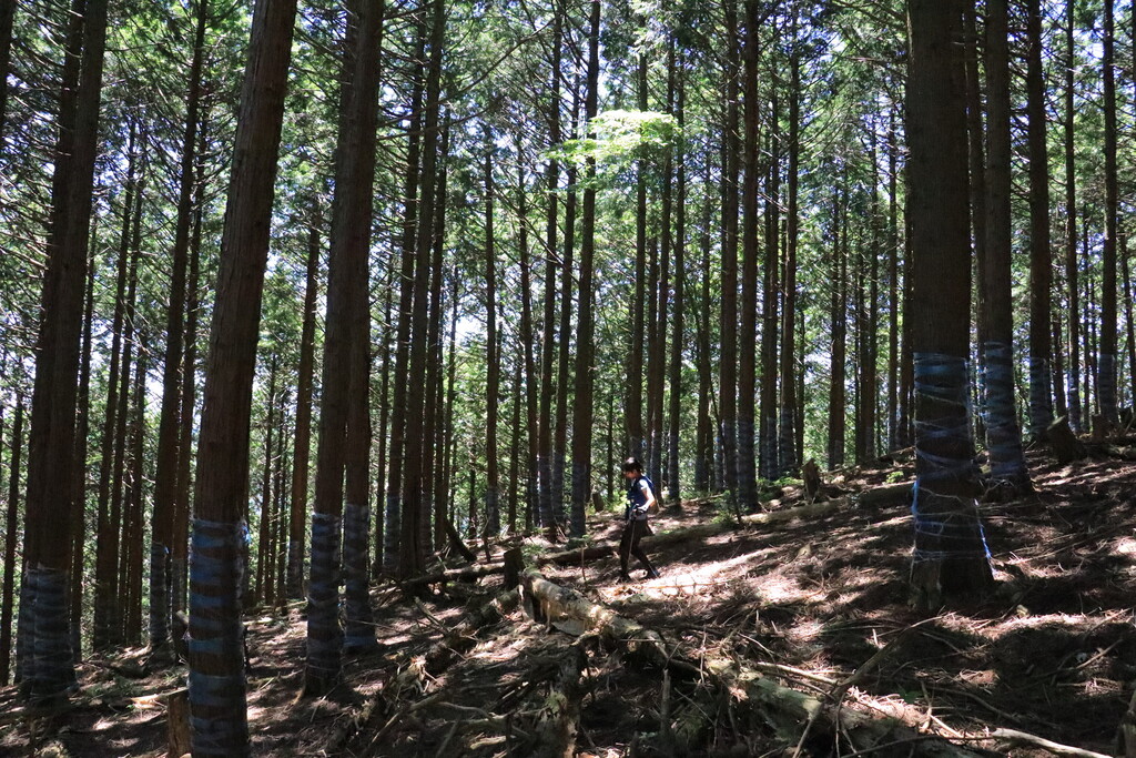
2019年、有志のメンバーが数十kmに及ぶ未開拓ルートの整備を行い、滋賀一周トレイルが開通した。 全体の9割以上がトレイルまたはダートの林道となっており、未舗装率が高いのが特徴である。
ルート内には、関西や中部圏をはじめとする各地から登山者を集める魅力的な山脈やトレイルが含まれている。(以下、大津から時計回りに紹介)
- 比叡山: 高野山と並び、古くより信仰対象の山とされ、頂上一体には延暦寺の施設が点在する。比叡山山内で行われる天台宗の回峰行の一つ、「千日回峰行」は1000年以上の歴史があり、毎日数十kmの山道を巡拝する行を7年間に渡って続けるという過酷な修行は、日本のトレイルランの元祖とも言える。
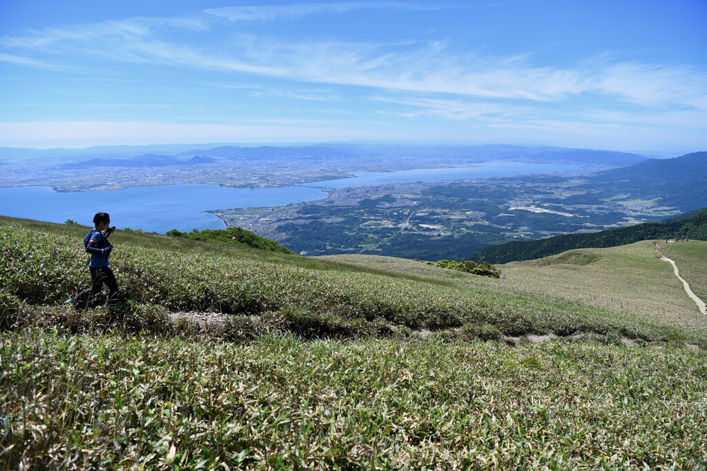
- 比良山地:琵琶湖西岸に連なる山地。最高峰は武奈ヶ岳(1,214m)。大部分が琵琶湖国定公園に属し、古くから近江八景の一つ「比良の暮雪」で知られる景勝地。京阪神からの交通の便もよく、登山やスキーに多くの人が訪れる。南比良の打見山頂付近には、びわ湖バレイスキー場があり、冬だけでなく夏場も景色を求める観光客で溢れる。南部の蓬莱山、ホッケ山、権現山に渡る区間では琵琶湖を見下ろす尾根に笹野原が広がり、比良山を代表する絶景区間となっている。
- 高島トレイル:高島市を囲む中央分水嶺を結んだ約80kmに及ぶトレイル。琵琶湖と日本海の両方が見渡せ、トレイル周辺には美しいブナの林が点在する。
- 余呉トレイル:滋賀県最北部、本有数の豪雪地帯である余呉町に広がるトレイル。いくつものルートがあるが、滋賀一周トレイルは、中央分水嶺区間を主に通る。
- 奥伊吹トレイル:滋賀一周トレイルによって整備され、2019年に開通した区間。滋賀県標高第2の高峰、金糞岳(1317m)や、第3位のブンゲン(別名射能山、1259m)などを結び、伊吹北尾根縦走路から滋賀県最高峰の伊吹山へとつながる。全区間が標高1000m前後あり、冬場は深い雪が積もり、夏場はブナの森に涼しい風が抜ける。
- 伊吹山:滋賀県最高峰の山(1377m)。日本百名山。古くから霊峰とされ、『古事記』、『日本書紀』においてはヤマトタケルが東征の帰途に伊吹山の神を倒そうとして返り討ちにあったとする神話が残されている。中京圏や京阪神から年間約30,000人の登山者が訪れる。薬草の宝庫としても知られている。
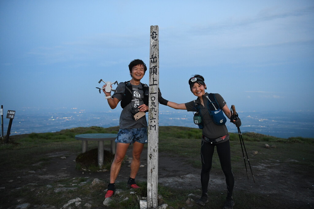
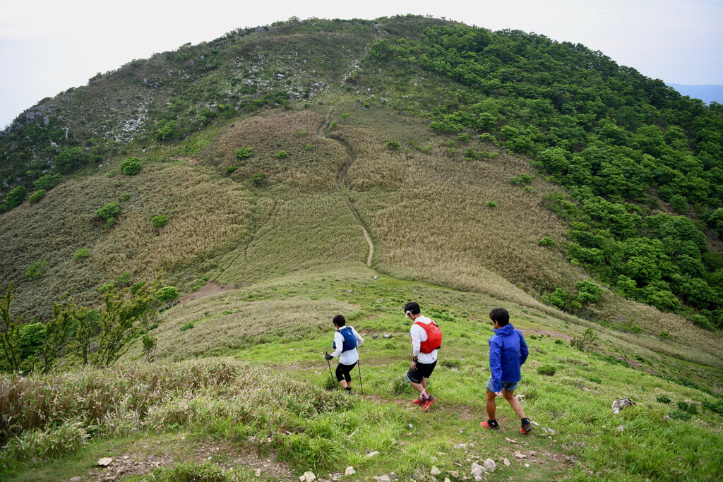
- 鈴鹿山脈:岐阜県及び三重県と滋賀県との県境沿いに位置する山脈。北端の霊仙山から、南端の油日岳まで、総延長100kmのロングトレイルがつながり、伊勢湾や知多半島などを見下ろすことができる。北部の霊仙山(1083m)、御池岳(1247m)、藤原岳(1144m)は石灰岩質の山で、山頂付近にはカルスト地形が見られる。一方、中央部の竜ヶ岳(1099)南面から鎌ヶ岳(1161m)にかけては花崗岩質で鋭い山容となっている。三重県側は比較的険しく、滋賀県側はなだらかな山が広がっている。御在所岳(1212m)にはロープウェイがあり、多くの観光客が訪れる。藤原岳から入道ヶ岳にかけての7座は「鈴鹿セブンマウンテン」と呼ばれている。鈴鹿峠以南は標高が低く登山者は少ないが、急な岩場などがあり気を抜くことができない。
滋賀一周トレイルは、これらのトレイルをつなげながら、滋賀県を一周するトレイルである。そのため、多くの登山者が歩いている分かりやすいトレイル区間もあれば、地図がないと進めない不明瞭な区間も含まれている。
全体を通じて、標高は1000m前後とそれほど高くないが、このトレイルをすべて踏破するには、一定以上の登山技術と体力が必要となる。
また、古くから人が往来した東海道や中山道、北国街道と交差し、旅人や商人が歩いてきた道や、信仰のために歩かれた道、戦のために築かれた山城跡など、歴史を残す場所も多い。美しい景色と同時に、日本の歴史と人々の暮らしを感じることができる。
-----------------------------------------------------------------------------------------------------------------------------------------------------------------------------------------------------------------------------
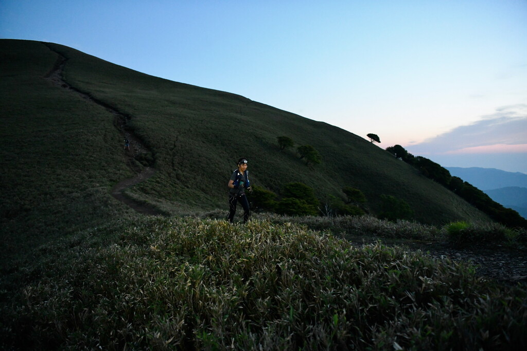
今回は6月1日スタートでしたが、苦戦したのは暑さと、既に木や草が茂る時期であったこともあり、場所によって試走の時には感じなかったルートファインディングの難しさでした。
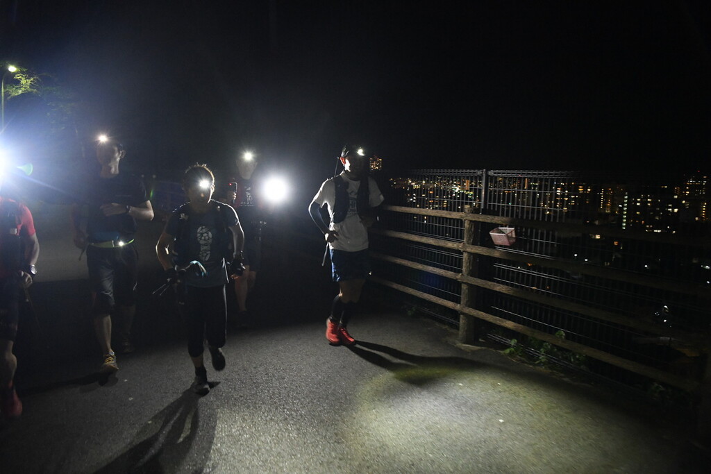
特に夜間2か所ほどで大きくロストしてしまいました。そして夜間はヘッドライトの光に向かって虫がぶつかってくるというのが結構不快でした。お勧めの時期は5月です。
お天気には恵まれすぎて、1週間の間1度も雨が降ることがなく、逆に真夏日を記録した日が何日かあり、それはそれで厳しい気候となりました。
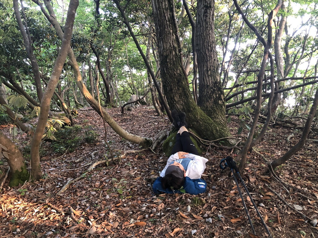
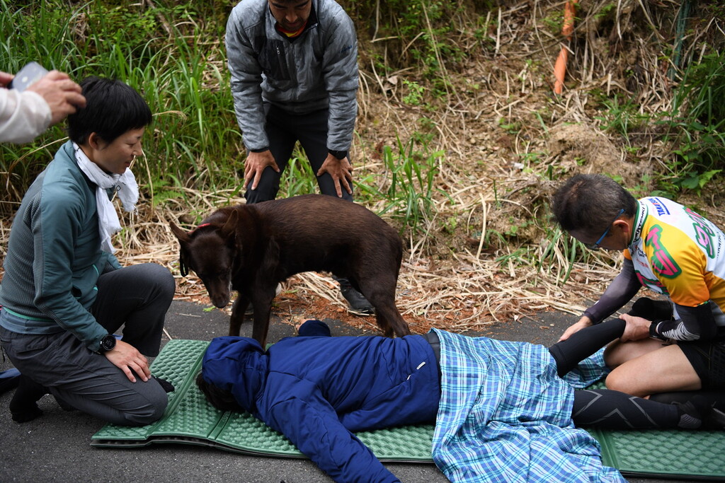
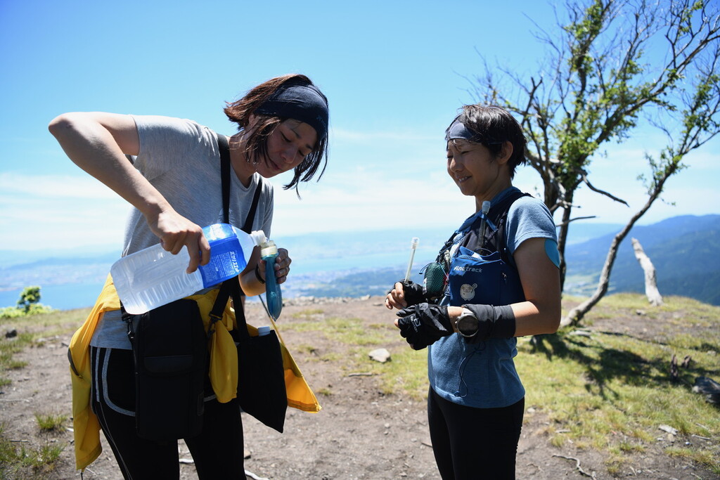
前半は順調でしたが、途中から貧血症状が激しく、何度か倒れてしまいました。足や体のむくみもひどかったです。早い段階で暑さにより食欲が激減し、予定していたものが食べられなくなったり、熱中症の症状が出たりで、体を冷やしたり、急遽サポートに予定していなかった食料を調達してもらったり、暑い時間はペースを落として進むなどの配慮が必要でした。それでも後半は胃腸の調子も戻り、暑さも少しマシになってか、自分が慣れたのか、しっかり食べられるようになりました。
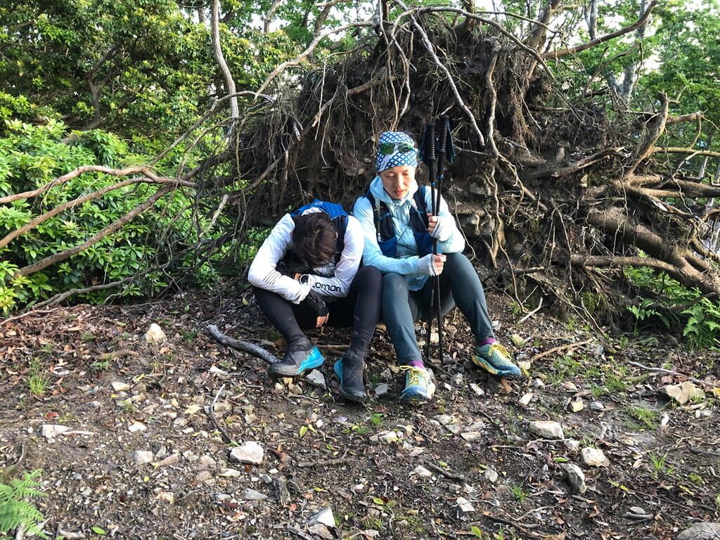
しかし、今回トータルで6時間半ほどしか睡眠時間がなかったため、後半は暑さよりも睡魔との戦いになりました。
最終日の朝が一番辛く、足裏の痛みもひどく、下りが一番つらかったです。眠気もひどく、いつでもどこでも眠れる状態で、ペースもものすごく落ち、周囲は予定していた日曜日中のゴールは難しいだろうと予想していました。
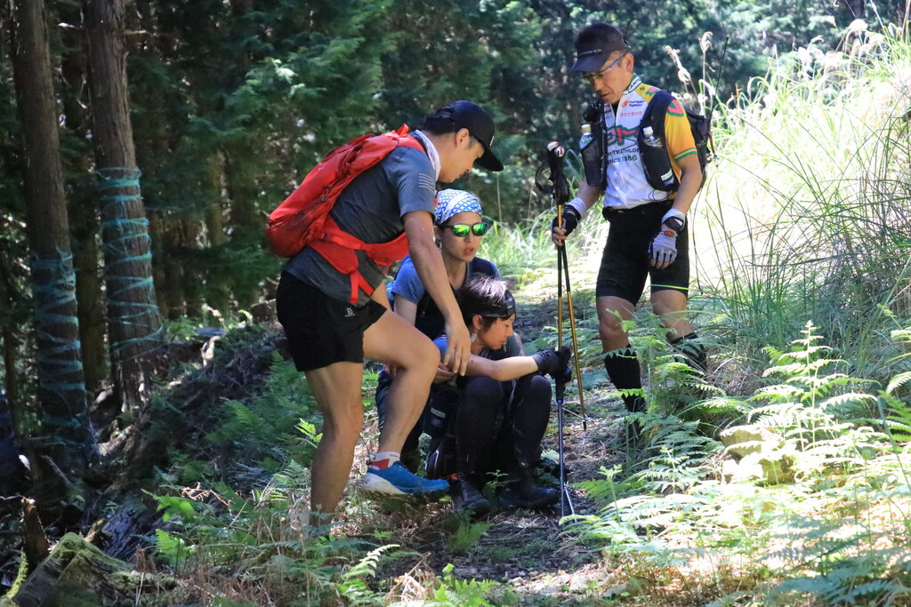
しかし私の精神力は低下するどころか、逆境にあらがうようにより強くなり、絶対に日曜日中にフィニッシュするだけでなく、可能なら6日と12時間以内に完走するという気持ちを持っていました。ゴールから40キロほど手前の還来神社でサポートを受け出発したのが7日の14時頃でした。6日と12時間でゴールするには7日の21時までにゴールする必要があり、この区間を7時間で走る必要があります。この区間だけを試走で走った際にも7時間ほどかかっており、既に400キロ近い距離を走ってきた体で、それがどれだけ難しいことかはわかっていましたが、出来ないという気持ちは不思議とありませんでした。
ペーサーを務めてくれた仲間の、この時間でゴールすることは難しいけど不可能ではないと思わせてくれるポジティブな励ましで洗脳され、その力強い走りにけん引されるように、ひたすら背中を追い、走り続けました。
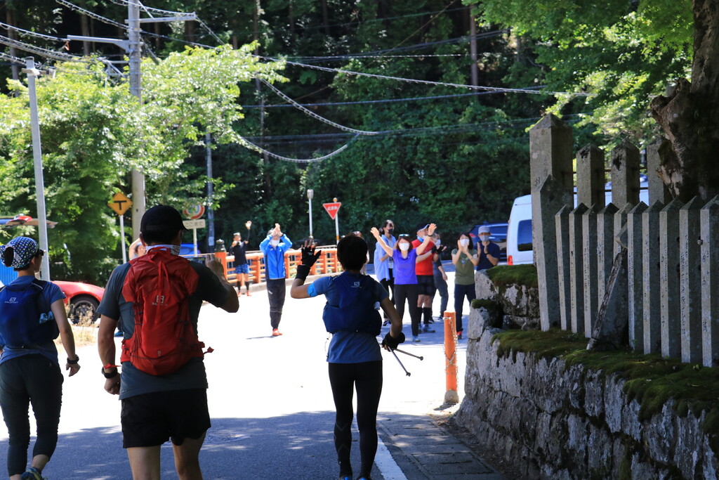
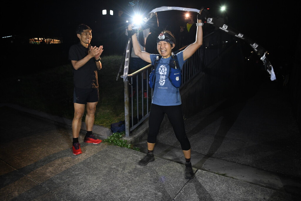
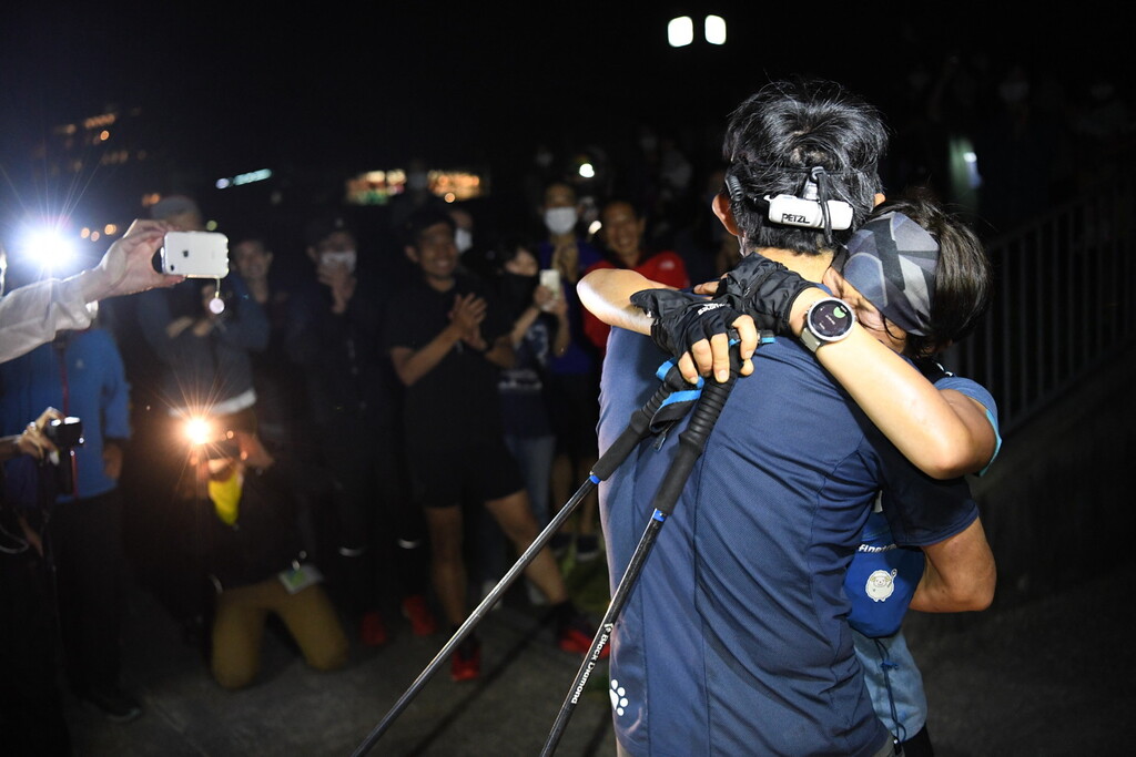
そしてついに、約1週間ぶりにスタートした大津港に帰ってくることが出来ました。
多くの仲間や、IBUKI LIVEを見ながら応援してくれていた人たちがゴールに集まっていてくれて感動のゴールでした。今まで経験したどのレースのゴールよりも感動して体が震えました。
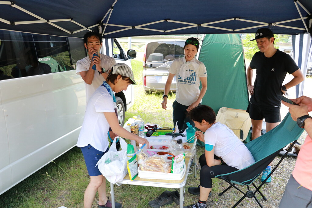
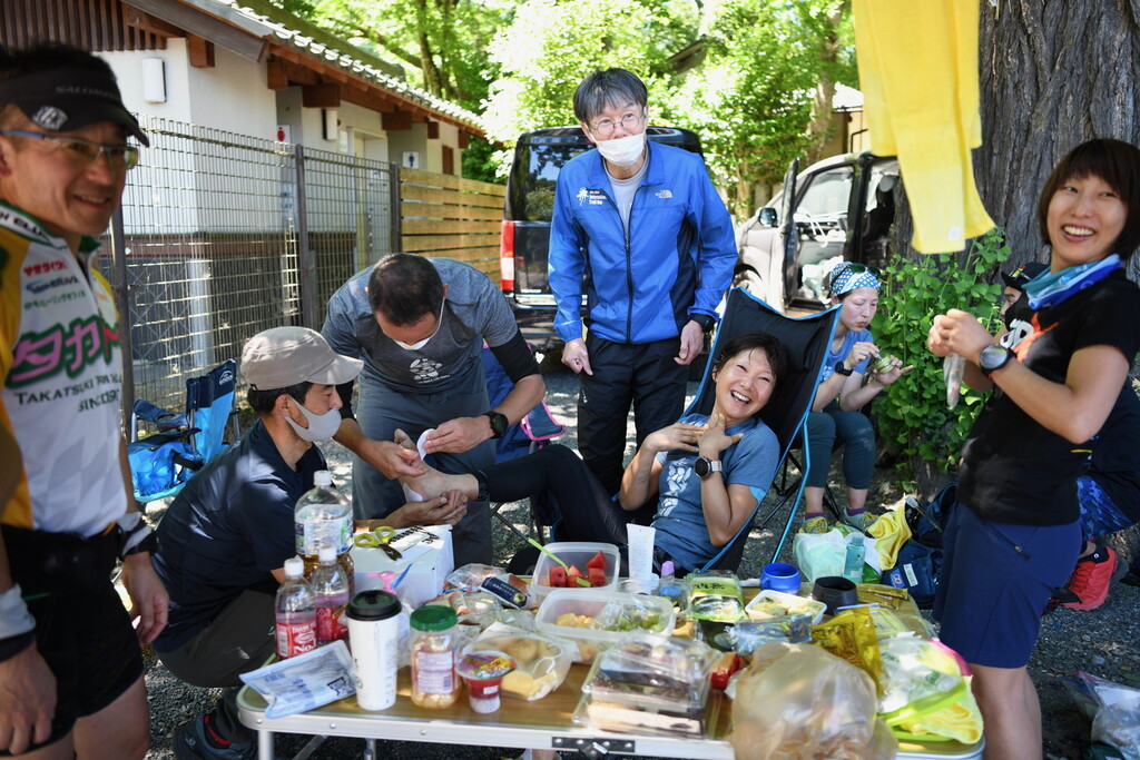
今回の滋賀1周トレイルは、途中に山小屋もなく、水場も限られており、食料を調達できる店もありません。そのためサポートはキャンピングカーを用意して、そちらで寝泊まりしながら、私もその車の中で時々仮眠しました。シャワーはポータブルシャワーを用意して、私は2度シャワーを浴びました。サポートはそこでシャワーしたり、時間があるときは近隣の温泉に行ったそうです。サポートは少し車を走らせれば、街にコインランドリーやスーパーやコンビニがあるので、期間中の食料の調達や洗濯は特に困らなかったようです。
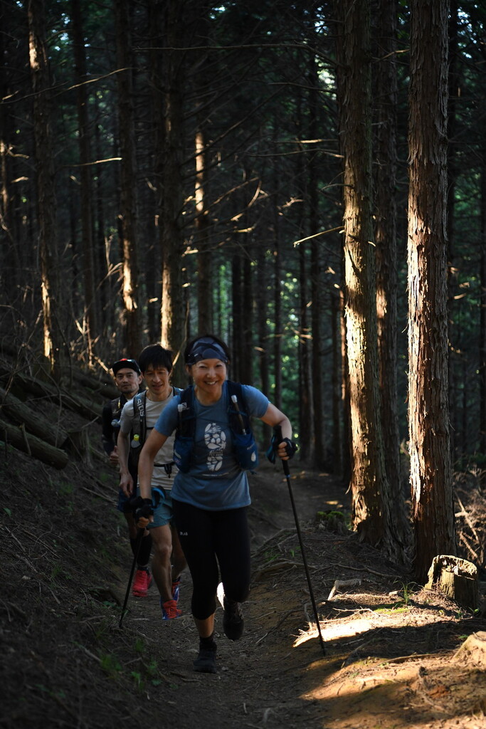
また、このコースは熊が出る山域が多く、熊鈴必携で、夜間は小さいBluetoothスピーカーから音楽を流しながら動物たちに自分たちの存在をアピールしながら進みました。
ルートが不明瞭な個所もあり、夜間は特に注意が必要で、危険回避と事故防止、緊急時の対策として全区間にペーサーを配置し、ペーサーとサポートカーでデジタル簡易無線を使用し、携帯の電波が入らない場所でも通信ができるようにしました。それに加えて、GPS端末をもって走り、絶えず現在地がWEB上で確認できるIBUKI LIVEのサービスを利用し、安全対策を万全にしました。
ペーサーはいましたが、自分の必要な装備や食料などは自分で背負って走りました。
気軽に山小屋などを使いながら一人で挑戦できるコースではないため、少し大掛かりになりますが、十分準備をしたうえで、こういう距離に自信のある方には挑戦していただきたい素晴らしいコースです。
最後になりましたが、今回のFKTチャレンジを可能にしてくれた、家族や友人、私の活動をクラウドファンディングで支えてくださっているみなさん、スポンサーしてくださっている企業や病院の方々に心からお礼を申し上げます。特に今回7日間にわたって動画配信をし続けてくれ、応援企画もやって全面的にバックアップしてくれたメインスポンサーのサロモンと、安全管理とみんなが見て楽しめるエンターテイメントとしてのFKTを可能にしてくれたIBUKI LIVEを用意してくださった(株)ONDには感謝の言葉がみつかりません。応援してくださった皆さんも含めて、本当にありがとうございました!
English Version
I run the Shiga Round Trail which is the trail surrounding whole Shiga prefecture in Japan. Started from Otsu marina on June 1 2020 and took me 6 days 12 hours 10 minutes for 438 km D+ 28,300m.
About the Shiga Round Trail, please refer to the route description.
The thing made this challenge hard was hot weather sometimes temperature went above 33 ℃ in town. The mountains are not that high and some places are very exposed without high trees because I had to do it in June for the sake of Covid-19 restriction.
Trees and grasses were overgrown and made some trails difficult to find, especially at night.
I lost my way in two different places at night and wasted about 1h30m.
What also irritated me was so many bugs including mosquitoes coming at my head light during night.
The best recommended season is May. It would be too cold before May and too hot after.
Whether was rather too perfect. It didn’t rain at all during whole one week, so it was very hot during day.
It started very well, maybe I was feeling too well and arrived at 70 km point earlier than I expected, but I kept planed pace after that until I got lost first time at 150 km point.
However, my period started unexpectedly early and probably because of that and lack of sleep caused serious anemia symptoms. I fainted three times soddenly and had dropsical swelling.
In early stage, hot weather caused trouble to my stomach and I lost appetite especially towards sweet foods. Watermelons and salty noodle and rice balls helped me to keep going.
I needed to cool down my body with an ice pack on my neck or spraying water. I also had to slow down during day to prevent heat stroke.
Towards the end, I got used to the heat or just temperature went a bit milder, I started to feel better and ate a lot.
However, I started to suffer from sleepiness instead because I only slept 6h30m in total during whole duration.
In the morning of the last day, I was having the hardest time with so much pain in my sole of foot and pain increased on downhill. Sleepiness was unbearable and I could sleep anywhere if I stopped even when I was standing. My pace became very slow and everyone thought I wouldn’t be able to finish within 7 days.
My body was exhausted but my spirit was still very strong and got even stronger as if it’s fighting against all the tough situations. I told myself I can finish within 7 days and I can even try to finish within 6 days and 12 hours.
When I left the Modoroki shrine at 14:00 on June 7, remaining distance was about 40km and only 7 hours left to complete within 6 days 12 hours. I run this section only when I was fresh previously and took me 7 hours so I knew how hard it is with tired legs after running about 400km, but I was still positive and didn’t think that’s impossible.
My pacer and friends who run the last section together kept telling me positive things, but in realistic way like I have to push very hard to make it happen but it’s very possible and I’m running fast enough. I was kind of hypnotized by them and I kept following after their back no matter how hard they run. I was talking to them but I was hearing my voice very funny from somewhere else and I was looking at myself from above. I didn’t quite know where I was running, so I kept asking where I was and how many kilometers to go. It was very weird experience. I think I fell into a trance or something like that and I could run like when I’m fresh.
I couldn’t quite make 6 days 12 hours but when I reached the finishing line, many friends and those people following me on IBUKI LIVE were there to watch my finish.
I was very moved, more than any other races I had ever experienced.
There are no mountain huts, few water resupply points and almost no places along the trail to buy food or other supplies, so I had to have supporting crews with a camping car which allows us to sleep in. I sometimes slept in the car and most of times in the mountains. We also carried a portable shower and I took shower twice on the way. Supporting crews and pacers used this portable shower or when they have time, they used nearby Onsen (hot springs).
There are coin laundry and supermarkets in nearby town if you drive a bit, so supporting crews could buy food and do washing too.
Last of all, I want to thank you to all who supported me and gave me cheers on the way or through SNS. I couldn't do it without them.
Special thanks to Salomon Outdoor Japan for delivering update movies on SNS and IBUKI LIVE for making it possible to conduct the challenge safely and entertain audience.
Some places on Shiga Round Trail has bears. They are not dangerous if you don’t bump into them. I carried a bear bell and at night played music from a small bluetooth speaker to let them know our existence.
Some trails are not easy to find especially at night, so I was always running with my friends taking turns. My pacer and my husband who was supporting me with a camping car carried transceivers in case of accidents or any special situations because many areas are out of mobile phone range.
I also carried a GPS transmitter to let people know where I was real-time on IBUKI LIVE for the sake of safety.
I was always running with my friends, but I made sure to carry all my gears, food and water by myself.
It’s not an easy challenge which requires a lot of planning and preparations, but worth trying and I recommend to tough people who loves this kind of long trail with much elevations.