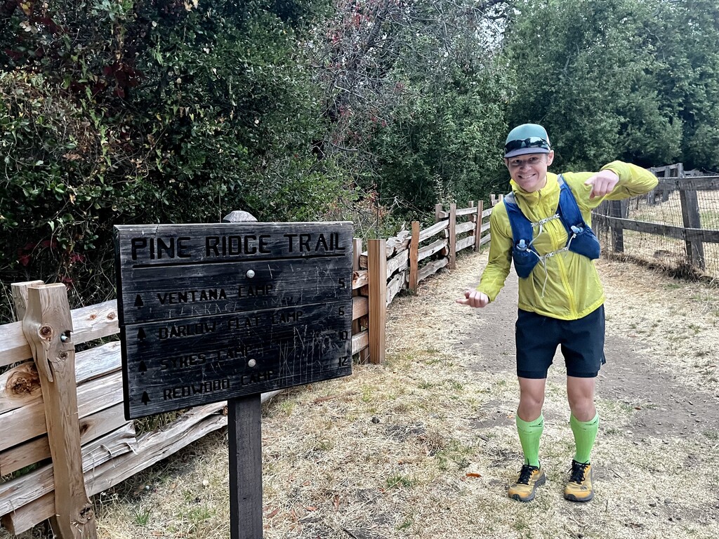

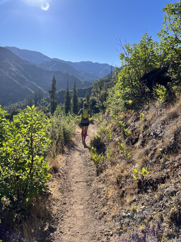
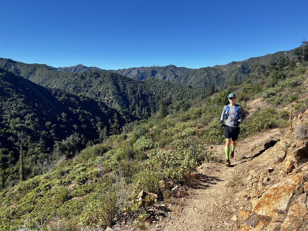
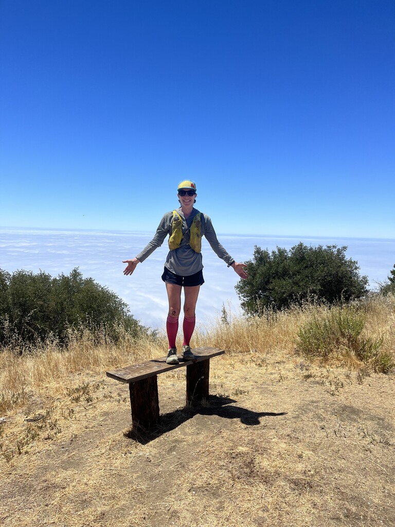


What a fun day! We were out in Big Sur (from Idaho) for my brother's wedding and wanted to get some fun running in, so we ran the Big Sur Loop on Sunday, July 24th. Ben and I ran as a mixed gender, self-supported team--we carried all our fuel and gear and just filtered water at the ample crossings. This is a fantastic route that, although it has some hefty vert for the distance, is actually really runnable if you're up to it and we hope some speedy folks will take the opportunity to lower the times set so far. For us this was certainly a good challenge and some decent time on feet, but not so much a speed record attempt (especially for Ben), but more a way for us to see a new-to-us area for the first time. We started just after 6am on the Pine Ridge trail from the parking lot at Pfeiffer Big Sur State Park. We had downloaded Ashly Winchester's gpx file (thanks, Ashly!) and used that and Gaia to help us stay on track. There were a few reroutes posted, including going through a campground just after the start, but it looked like that's what Ashly had done as well, so we followed the trail as currently posted and are guessing this at least the semi-permanent route at this point. Within a few minutes of starting, I took a huge digger going downhill and ran the rest of the day banged up with bloody knees and hands, but our fortune improved from there! The trail is easy to follow with good signage at junctions and water is plentiful the entire way for filling bottles and staying cool. We each had two full soft-flasks to start and just filtered the rest along the way. At about mile 28, we enjoyed a nice soak before completing the lollipop portion of the route to finish out the day. Getting to run up and then back down through the marine layer is one of the coolest parts of this loop and running in this area. It was nice and cool (high 50s) when we started, but got warm out there--probably 80ish once we got up higher and stayed pretty warm the rest of the day--the most exposed parts are up high and unlike where we live in Idaho, it gets hotter as you go up into the mountains, not cooler. We had read a lot about the poison oak in the area and were nervous about getting totally covered by it. We wore tall compression socks, long sleeves, and gloves for some of the day and then used Tecnu scrub after run and seem to be fine (not sure how sensitive we are). There is a ton out there, and though the trail is very well maintained the entire way, it's narrow at times and impossible avoid brushing up against it. Pics below, but of course we totally forgot to take one together. We loved this loop and highly recommend it for an FKT attempt, or just a fun day out, or both!
Note: distance is probably closer to 33.75/34 miles and 86/8700 ft of climbing based on comparing our own watches and the other runners on the route vs what is posted on the FKT page. It's about 7700ft to the high point, but don't worry, you get another 1k more after that!