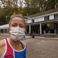
Overcast but a bit humid day. I've run some of the yellow trail between Ridge Ave and Valley Green, but not familiar with much past that. Started watch right in front of Valley Green sign and ran to sign to finish, but GPS track "finished" before then. First 5 miles were most confusing, added some distance by accidentally running some side trails that actually exited the park. Got stung in the back a bit before 10mi, and I was already salty about missing so many turns. Yellow trail was a bit easier to follow along the west side, but the route to the 100 steps wasn't clear. My goal was originally sub 4:00 and I thought I was gonna sneak in under that but ran out of gas in the final 1.5miles. Took 8oz soft flask and most of one GU; definitely could have benefited from more water since I was sweating more than anticipated with the humidity. Tough route but some some really beautiful sections of trail, esp up by Andorra. Shout out to Sarah, who was the first girl to attempt this without knowing the route well. This would be hard to complete without a gps track, or intimate knowledge of the park, and even the gps route in my watch lacked the specificity to follow many of the parallel trails and tight turns. Moving time on Strava was 3:48! Yikes. That was a lot of stopping for directions (and the wasp...).
Athletes
Route variation
Standard Loop
Multi-sport
No
Gender category
Female
Style
Unsupported
Start date
Finish date
Total time
4h
4m
43s
Verification
GPS track(s)
5664205631.fit196.32 KB
Report

