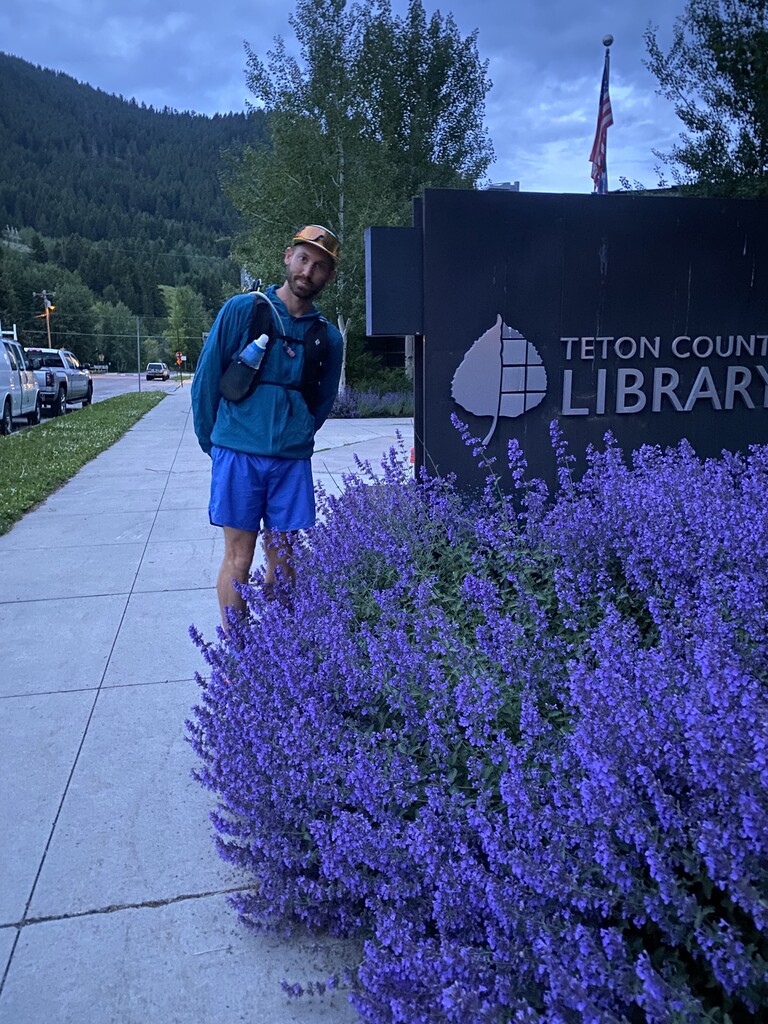

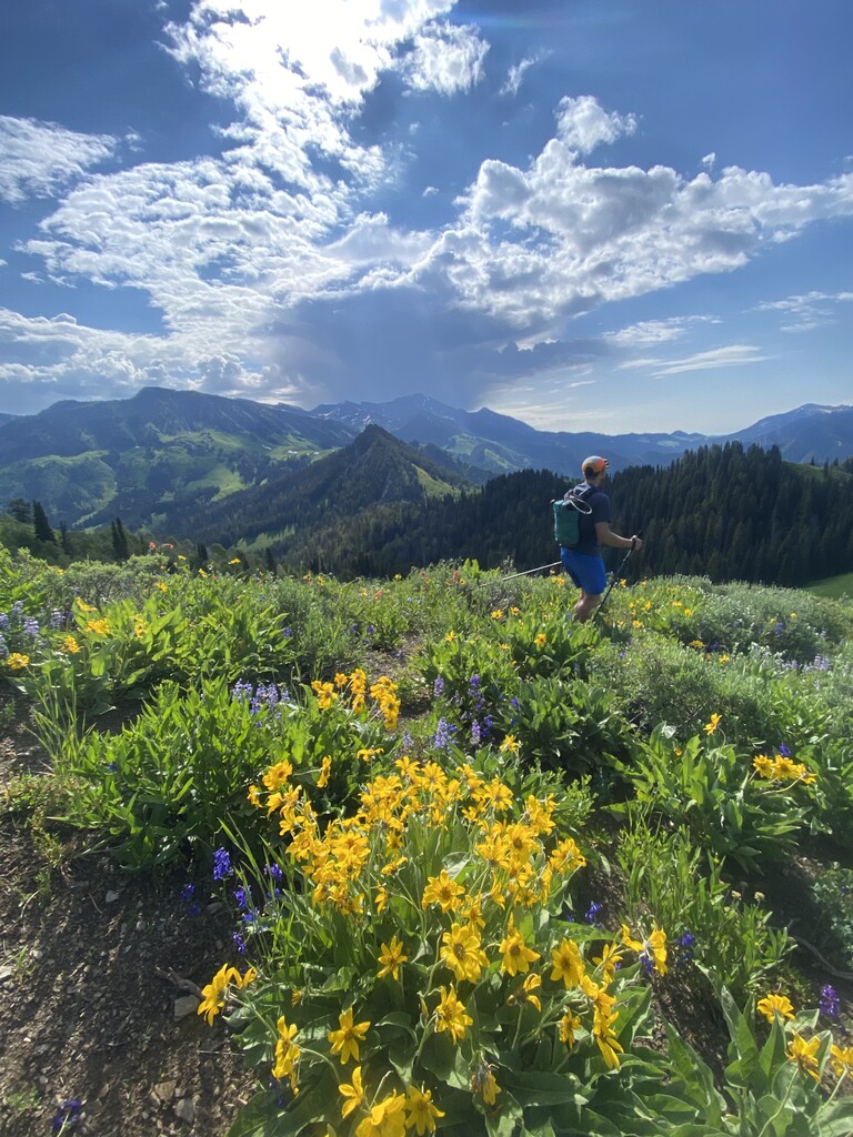
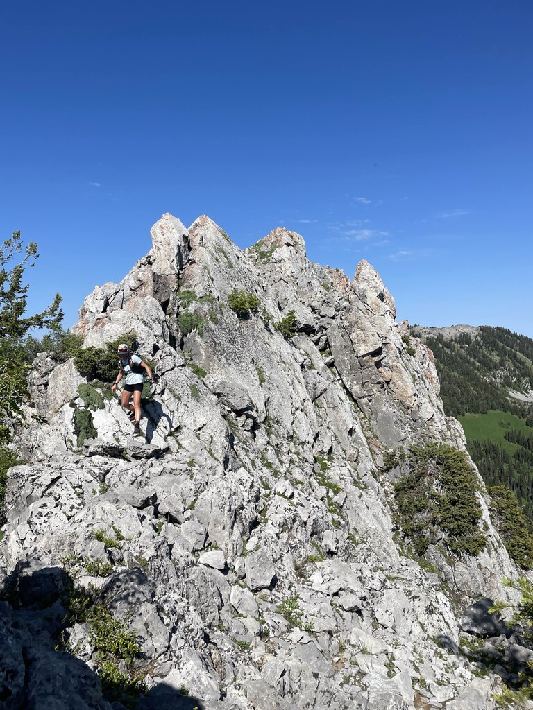
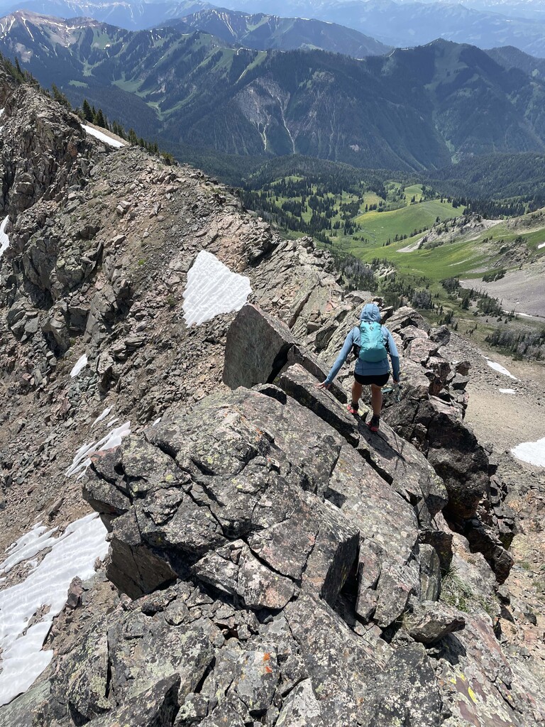
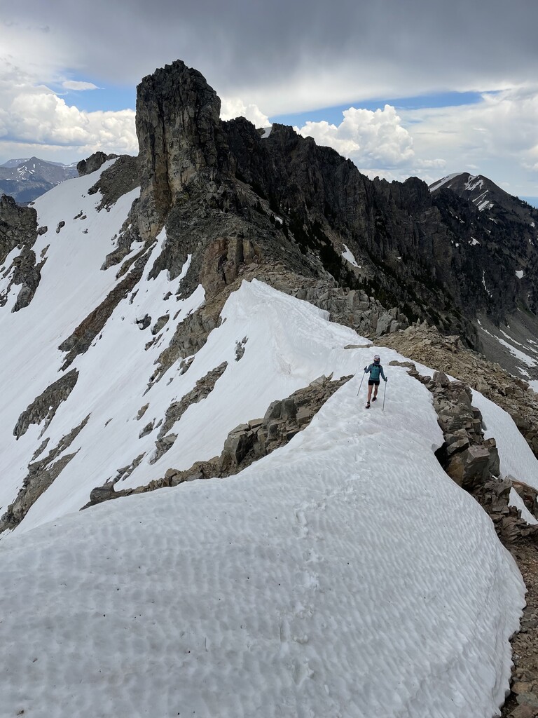
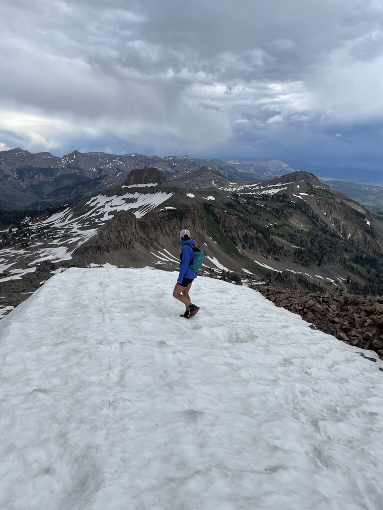
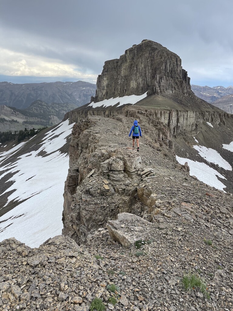
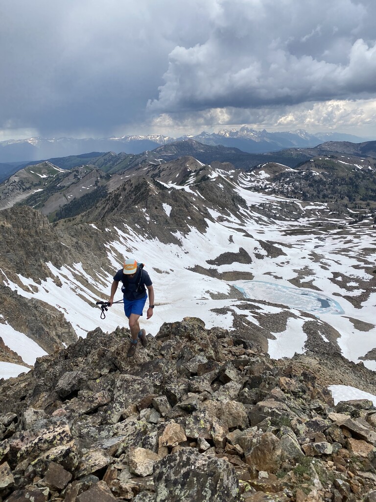
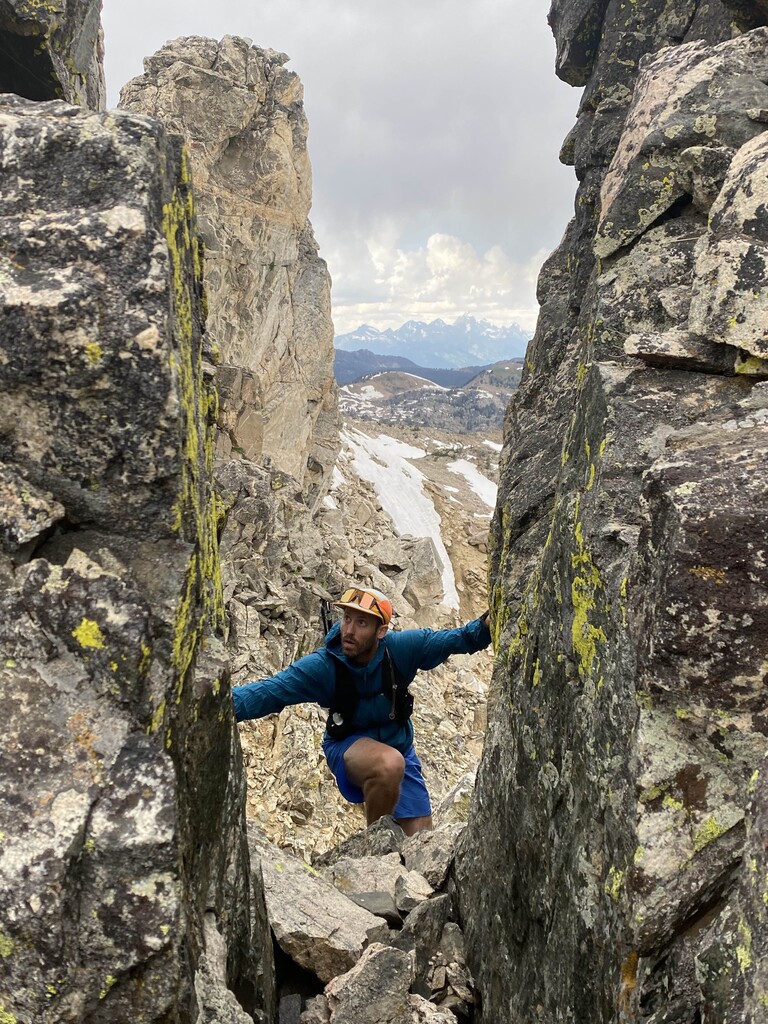
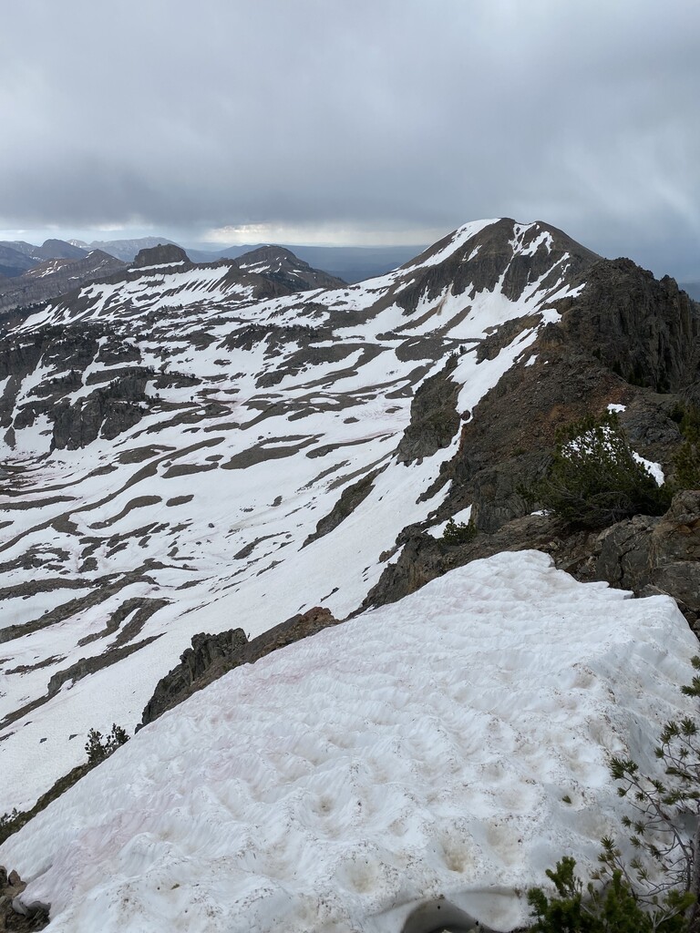
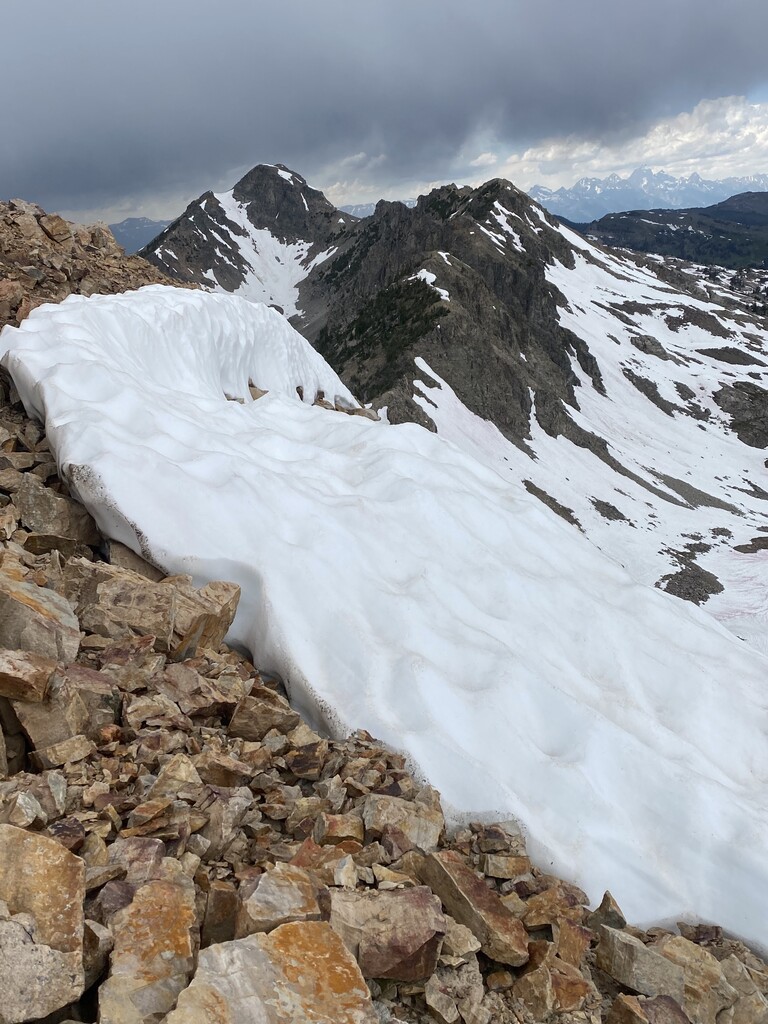
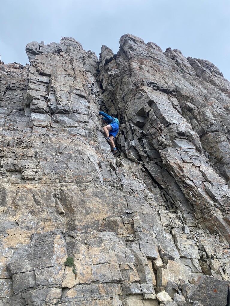
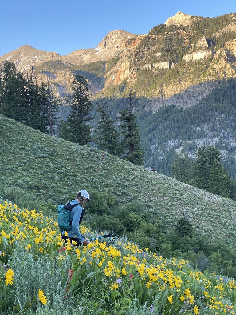
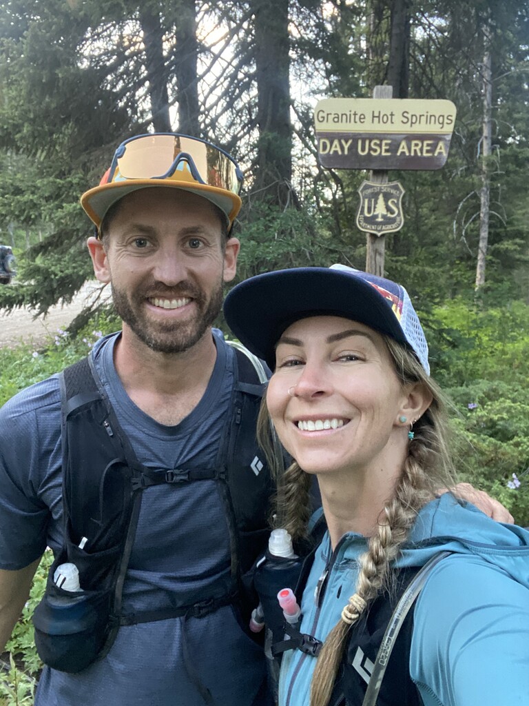
Really beautiful day on this route, although the weather made it quite adventurous. Both Brian Ralph and I had separately been wanting to do this linkup from town for a number of years. We got beta from friends who had traversed the alpine portion of the route and we decided to link it to Josie's Ridge/ Snowking/ southern half of the Cache Dash Traverse in a single push. We started at Teton County Library in Jackson at 5:30am on July 8th, ascending the ridge via Josie's Ridge Trail. We traversed Snow King to Skyline Trail (which is closed until July 1 for elk calving) to Snow Queen. There are a few hunter/game/pack trails in sections along the ridge but for the most part the route is off trail after Skyline. From Snow Queen you stay on the rugged ridge line eastward and climb the backside (southside) of Cache Peak to begin the more alpine portion of the linkup. We had cloud cover up until Cache Peak when the thunderstorms began to form. There was a 20% chance of storms that day so we weren't entirely surprised although the weather grew increasingly intense until late afternoon. At one point I experienced static around my upper body and we briefly ducked below some rocks. The alpine section between Cache Peak and Peak 10623 is stunning. We hit a few sections of low 5th class climbing but for the most part the ridge is 3rd and 4th class. We hit all the high points except the very top of Pinnacle Peak which requires a rope or a very scary solo to summit. There was enough snow up high to refill water at various melt pools. Along the way we saw bear, elk, deer, and cat tracks. We traversed the ridge until right before Peak 10623 where we began making our way down into Granite Creek area. The bushwhacking down was a lot more intense and much further than we had thought- took nearly 2.5 hrs to get down from the ridge to the Granite Creek road. We also had to crawl through a significant amount of waist high stinging nettles. We came off the ridge at what seemed to be the most logical furthest east access point to the linkup. The last peak above Granite has a lot of cliffs both along the ridge and right above the Granite Creek TH area so dropping down right before made the most sense. Brian and I made it back to the car we had shuttled the night before at 8:40pm- and just in time as I had accidentally parked in the Granite Hot Springs lot that closes at night.
**If anyone knows of a name (official or otherwise) for the alpine portion of the traverse, I would love to know it and add it to the description. I've been unofficially calling it the southern Gros Ventre Traverse. Brian and I have been calling the full linkup the Little Belly Linkup as it's the shorter of the two ridge lines in the Gros Ventre (Big Belly) Range.