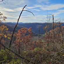
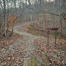
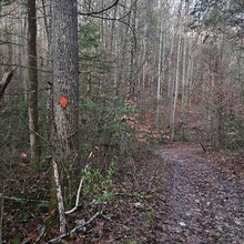
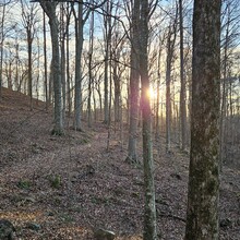
I started the route from a side forest road 1710 at it's southern touchpoint with the trail. Morning of in the dark I drove out in my trusty Honda Accord. Turns out the precipitaiton from the last week made a bigger impact that I had planned so I had to park about a quarter mile from the trail crossing (first and last lap on the watch with times removed from total elapsed time from the Garmin data). It also meant getting ankle deep in mud before getting to the start line. The NFS map (pic attached) has the route in 22 sectors. Starting at sector 6 and heading south. After speaking with the NFS local rangers a few weeks back they had asked that I snap pictures and upload them to Avenza of trail issues, downed trees, etc. so they can focus there 2 man crew to the areas needing attention. I chose where to start based on known water availability at (now) mile 32 and 52 (approx) from the 2 larger creek crossings. I thought there was a 3rd about 6 miles from my finish - I later learned that to be false. I passed a few deer hunters on ATVs Sunday but not too much traffic on the multipurpose trails on this portion. Thankfully a smooth start, stopped for water and my classic 25 cent ramen back country cuisine at the Bear Creek Trailhead just before 5p with sunset looming. After dinner set out for another 8 miles to hit just over 40mi on the day and stopping to sling up my hammock just off the trail along sector 14. Now the NFS map has the route listed as 65mi, the Garmin mapping has ~70mi. However the Garmin map I downloaded to my watch also included the old sector 7, now closed and rerouted and a couple other small changes and reroutes due to storms since Covid. So my sincere hope was that the mileage was more along the 65 mark. I did have a couple issues in sector 8-10 with road crossings and lack of clear directions on which way to go up or down the road to find the trail again so I know I spend an extra half mile there, plus the bonus meters in camp, water, bathroom breaks, etc. I rounded that to a bonus full mile. However, I thought for Monday I would be facing 28 miles with 31 being the max. Doing the math and trying to get back to the car before being dark'ed on was the goal as rain was supposed to roll in around sunset. Up before dawn and moving yet again I knew I had dirt and some paved road for the first couple miles in the morning which would make for an easier start before the worst segment hit. Section 16-22. I had pre run this segment both directions and knew that, now heading North, to start it what I was up against. Straight uphill for the first mile with about a half of it wild, untamed, and overgrown with no real trail marked in years and dozens of trees in the way from storm damage. Tired and sore feet with a queezy stomach were not what I had planned for this segment of vertical bushwacking. My average moving pace began to plummet from the strong 3.5mph down to 3.2 pretty quick this morning. A few up stop and think moments taken on tree stumps until I finally got moving well enough. Tough morning all in all. Finally after mile 46 I got some fuel in and started to perk back up and made my way out of section 22 to the ranger station/main trailhead and my brunch stop. I was already an hour behind goal but at this point I just needed to finish. I had gotten cell service enough to finally check the weather and it looked like the rain was holding off until 8p so that was nice. Some more ramen in and a few gulps of water and off I went. Thinking that in 9.3 miles I had another water stop, I would finish off my camelback in about 2-3hours and get what I needed at that crossing to get me home but I wanted to save the weight as I new there was a brutal vertical segment awaiting me on sector 1. I get started and am pleased to find 1.5mi of nice graveled out dirt road and think to myself the ranger must not be too familiar with the far reaches of this place because this trail is so tame. Why the warning? I found out. 650 vertical feet in under a half mile of crumbling rock with slick mud between. By now I had developed decent blisters in the center of my forefoot and each rocky sector was rather unpleasant. I longed for pine needles under foot. Thankfully somewhere around segment 2 there was a nice quarter mile of surprise pines and lovely carpeted trail. Shortly before this I had also noticed that my total vertical gain was over 10k, yet the entire loop on various maps was 8400-9400, but I still had another 10mi or so to go. They, whoever they are, sit on a throne of lies, right next to the forest service cartographer. The vert I can handle but it became painfully clear in section 4 that the 68 mile idea was long gone, and I would be lucky to finish under 71 miles total. I make the descent into the Sugar Creek Trailhead and I ran out of water 2 miles back; but no sugar creek crossing, I don't even hear a creek. I think to myself I should only have 6mi left according to the map so nothing else to do now but keep moving forward. Between sector 4 and 6 the map has a lot of errors with their estimated distances. Things listed in the tenth of miles are off by 2 full miles. Nothing else to do but trudge on, the nutrition I have left I don't want without water to chase, so I parcel out what I have and can stomach and make it stretch. Some skittles and one gel. The Stroopwaffles are staying in the back now. I message the mrs. one last update at mile 67, "not sure if it'll be 71 or 73ish total but getting close." I check the TOD again. After needing to stop and take a nap on a felled tree back in sector 2 when my eyelids weren't staying open and the total mileage grow longer and longer I could see sunset approaching much faster than my car. I begin to rally the energy I have an jog a couple downhills. Mile 65 is when it started to be more than just the blisters but I could feel the breakdown in my arches and calves now. The now 12000 feet of vert gain and drop was hitting heavy. The unstable rocks and rugged mountain trails were winning. As dusk began to glow I surged again, vowing to not take out my lights. 1 min to sunset and I see the sign listing forest road 1710 1.5 miles away. Do I still have another 1.5mi?!? I think to myself, I can see where I started on my watch mapping and it doesn't look that bad. Doesn't matter just go! With the last fading light I see the gap in the trail. It wasn't that far, I realize their distance was to where the road devolved from a country road to the forest road past the last house. Thank the Lord, I should only have a quarter mile or so back to the car. Now to get through the mires again. Last time I got muddy but kept my feet almost entirely dry. Now in my rush and refusing to take out my lights, I am not so lucky. Fully immersing both feet in thick pasty mud moments from my car. I look ahead to where I think my car should be and I don't see it. I start to worry that it got towed or stolen (the latter much more likely). I recheck my watch and see that it's one more turn in the road to go, all good. I make it back and head home. Up the road a half mile a local stops by on his 4wheeler with his children in tow and ask how far I went. They saw my car and my note in the dash. The little boy says "wow, did you see my Christmas tree" and points of the hill to their charming decorations. No celebration, no finish line after party, just a kid living his best life showing off his decorations with dad. Taking on challenges, tough hikes, or even big races are so unique. Personally for me this is a massive accomplishment that I have been thinking about for over a year. Could I have done it faster, sure. Is it that impressive in the world of distance, no. But I spent two days in my own head, pushing, growing, and experiencing something that no one else has lived or experienced. Try as we might, we will never truly walk in anyone else's shoes, and your experience is just that. It is YOUR experience, and it only happens once. And I'm glad to have been there to have it.
In all, I took photos of 15 different downed trees on the trail and notes around a few other crossings and issues. There were many more but there was a period where stopping to get out my phone was more trouble than I could muster. I do plan on coming back out once every week or 2 and using this as my distance training grounds to help the rangers with trail reports and want to increase the use of these trails from mostly motorized traffic to recruiting/developing other trial runners/hikers in the area. My hope is that this is a respectable enough but beatable enough record that it will bring about some competition and get others out here to see what they can do.


