Harrimeter Report Part 1: Start to AS3
“I'm pumped for tomorrow's Hot Mess Harrimeter adventure. See you at the start. 2-3 inches of snow last Saturday. 80s this Saturday. Go home, Mother Nature. You're drunk.”
That was my final post on a group text the night before taking on the 44-mile run around the perimeter of Harriman State Park in New York.
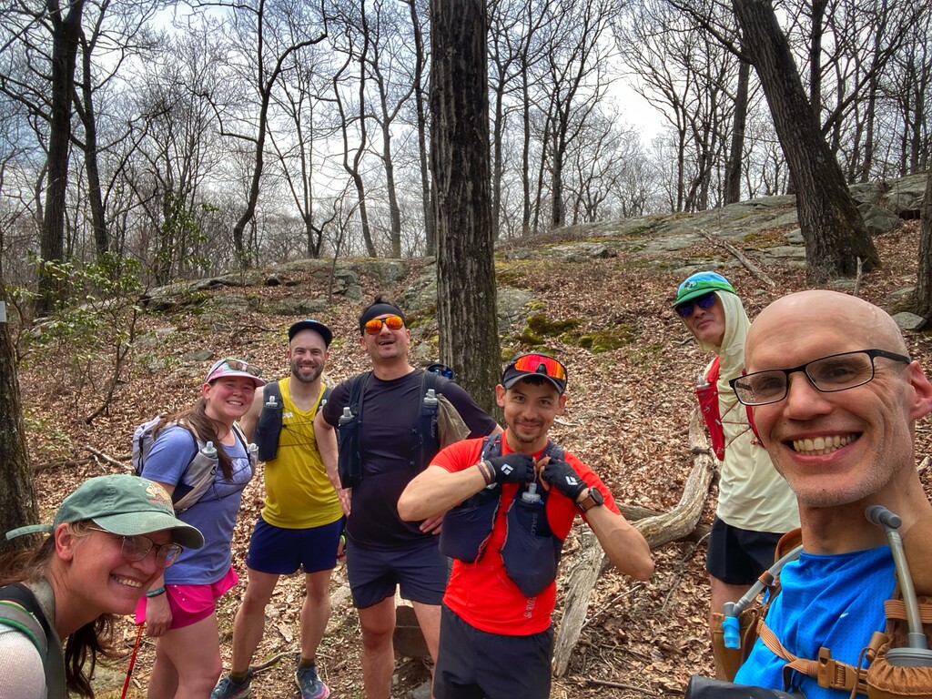
The next morning, we started the Harrimeter run around 5:10 a.m. I was joined by Jason Braun, Sam Lebowitz, Brian Mott, Chad Smith, Wayne Bianchetta. Everyone was in great spirits, and we made good time through the Long Mountain section, moving efficiently along the Long Path. The early miles were smooth and uneventful — a strong start for the long day ahead. The weather was perfect: cool and breezy.
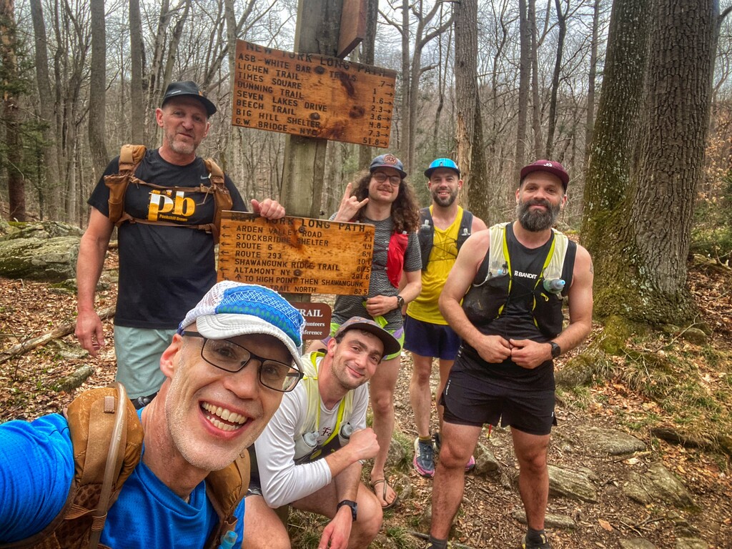
When we reached Aid Station 1 at Arden Valley Road, it was a huge lift to see Nick Speranza, Mike Racioppo, and Tricia Racioppo waiting for us with water, snacks, and tons of encouragement. We shared a few laughs, everyone still riding high, and after refueling, we pushed onward into some of the rougher sections of the Long Path.
Despite the increasingly rugged terrain, we continued making excellent time. Turning onto the Appalachian Trail brought a fresh set of climbs. We tackled the popular Lemon Squeezer with enthusiasm (although not so gracefully in my case) and pressed forward. The Appalachian Trail treated us to a steep descent to the Elk Pen area with some flats to run on. But then we began the scenic but strenuous climb through the Valley of the Boulders — a stunning section, but one heck of a climb.
Our reward came soon after: the flat and deliciously runnable Island Pond Road, which gave everyone a much-needed chance to shake out their legs. At Aid Station 2 on Kanawauke Road, we met Kat Spector and were joined by Brian Kingsbury and Christian Manna. After a quick rest, some refueling, and a group picture, we were back on our way.
The next segment kicked off with a few more climbs, but once they were behind us, we enjoyed some of the most runnable terrain on the entire Harrimeter Route: the Yellow Triangle trail and the end of the Ramapo-Dunderberg trail. This section let us stretch our legs before heading into the next big grind: the climb to Dater Mountain.
As we neared the viewpoint on Dater Mountain, we got word from Kat Spector, who had hiked back on the route from Aid Station 3 to be on the lookout for a mama bear and her cub roaming the mountain. We would have to be cautious on our descent. Luckily, we didn’t encounter the bears.
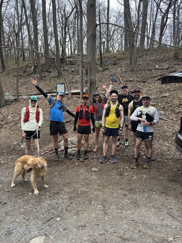
We met Kat at the Dater Mountain viewpoint, carefully made our way down, and regrouped at Aid Station 3. Here we had a major transition: Chad Smith, Brian Mott, and Sam Lebowitz finished their runs. Dave Morganite joined Christian Mena, Wayne Bianchetta, Brian Kingsbury, and me for the second half of the course.
Up to this point, the weather had been perfect — cool, overcast, and breezy. But as we left Aid Station 3, we could sense that things were about to change. More on that later...
Harrimeter Report Part 2: AS3 to AS4
Leaving Aid Station 3, our group — Christian Mena, Brian Kingsbury, Wayne Bianchetta, Dave Morganite, and myself — headed out on a short road section to cross Seven Lakes Drive and rejoin the trail. Spirits were still high, but the day was warming up fast.
As we worked our way along the Pine Meadow Trail paralleling Seven Lakes Drive, the rising temperature became impossible to ignore, particularly when we started the climb up the Seven Hills Trail. This climb started to take its toll, and by the time we began the steep scramble up toward Ramapo Torne, I was feeling overheated. The heat was hitting hard, and it was concerning given that we were only around 25 miles into the run.
From Ramapo Torne, the trail dropped briefly before climbing again — this time up the Russian Bear, a steep and punishing ascent. At the top, I was toast. But we persisted, carefully negotiating the rest of the Hillburn-Torne-Sebago Trail before making a right onto the Raccoon Brook Hills Trail. Thankfully, this stretch was flatter and more forgiving, giving everyone a chance to recover a bit.
Turning right onto the White Kakiat Trail, we settled into a manageable rhythm. We reached a stream crossing — and it couldn’t have come at a better time. We took the opportunity to cool off, soaking hats, splashing ourselves down, and, in Wayne's case, fully dunking into the refreshing water. It was an absolute lifesaver. However, as I was leaning down to soak my hat, my phone slipped out of my hydration vest into the stream. It disappeared under the water for a few seconds, as I stared incredulously. Luckily, I fished it out quickly. Thanks to Dave’s quick thinking and a towel he had stashed away, we dried it off — and miraculously, it still worked.
Somehow, I found a second wind. As we closed in on Aid Station 4, I managed to keep a decent clip — hiking the climbs and running the flats where possible. I was getting low on water, but the sight of Kat Spector and Jen Bernard waiting for us at the intersection of the Suffern-Bear Mountain and Kakiat Trails lifted everyone's spirits. They had hiked in supplies 1.4 miles from the Kakiat park lot – not just water but some other goodies. Amazing!
I had told Wayne, maybe half a mile before reaching the aid station, that what I wanted more than anything was an ice-cold seltzer. And wouldn't you know it — when we arrived, Kat had packed the remaining seltzers I had given her, and they were perfectly chilled. Honestly, it was probably the best thing I’ve tasted in a long time.
Harrimeter Report Part 3: AS4 to AS5
We left Aid Station 4 in high spirits, recharged from the cold seltzer and the warm encouragement from Kat and Jen. But almost immediately, we were reminded that the Suffern-Bear Mountain Trail is a force to be reckoned with. It’s an unrelenting stretch — technical, rocky, steep — and offers almost no opportunity to settle into a rhythm or string together a consistent run.
The one short section where we did find smoother footing and started to get a bit of a run going was the place we accidentally got slightly off-trail for a few hundred feet. Reluctantly we turned back and rejoined the SBM.
The technical terrain of the SBM began to take a real toll. Our pace slowed dramatically, and we found ourselves stopping at every water crossing to soak hats, splash down arms and necks, and try to keep cool. The views from this stretch of the Suffern-Bear Mountain Trail were undeniably beautiful — wide open vistas and rugged scenery — but exhaustion was creeping in hard.
Frequent stops became necessary, both to catch our breath and to mentally gear up for the next set of climbs. At one point, as we neared one of the shelters, I found myself slightly ahead of the group and laid down on a rock to rest. I could have easily slept for an hour there.
By the time we made it down to Brian's car, which was staged on Kanawauke Road as Aid Station 5, we were all running critically low on water and energy. The sight of the car — and more importantly, the promise of cold seltzer and snacks — was an absolute relief. We took our time here, rehydrating, eating, and regrouping.
As we sat there, storm clouds gathered in the sky. The storm passed without hitting us luckily (or unluckily), but it foreshadowed the struggle to come. Waiting for us were the punishing climb of Pingyp Mountain — one of the toughest climbs on the entire Perimeter route and one that I personally dreaded.
Harrimeter Report Part 4: AS 5 to the Finish
We left Aid Station 5 feeling a bit refreshed after restocking, but the climb on SBM to the large boulder called the “Irish Potato” quickly reminded us that the hardest work was still ahead. That boulder carries personal weight for me — during the North Face Endurance Challenge 50 miler, it marked the moment I realized a DNF was inevitable. But this time, I passed it knowing I would finish this adventure — a quiet victory.
This section of the SBM slowly wore us down with its leaf-strewn, drawn-out technical descents. The thought of ascending Pingyp Mountain loomed large. After a short road stretch, we carefully crossed the Palisades Parkway just before sunset, then began the grueling climb.
Midway up, I felt cramps threatening — particularly in the lower inner thigh, the notoriously hard-to-stretch "ultra muscle." Near the summit, I had a close call when a branch knocked my glasses off. I watched helplessly as they bounced down the slope toward the edge of a cliff but thankfully stopped just short of falling over the edge. I lay flat, stretched out, and carefully retrieved them — one of the more nerve-wracking moments of the day.
We finally topped out on Pingyp, but it drained just about everything I had. My stomach was trashed. I had both a sloshy, full feeling and persistent heartburn. I started speed walking, not because my legs were fatigued, but to limit the impact on my stomach. We rolled into Aid Station 6 at Queensboro Road, as the last light of the day faded.
With headlamps on, we began the last leg of the Harrimeter heading toward Timp Pass and the West Mountain shelter. The steep climb from a stream to the Red Cross Trail triggered some bad leg cramping. After a few hundred feet of limping, I was able to move again. The Timp Pass ascent, which I typically think of as three sequential climbs, went surprisingly well. I managed to power hike then at a steady pace.
Reaching the pass was a boost, but we still had to scale the steep, rocky Blue Trail to the West Mountain Shelter…in the dark. We took it slow, and when we finally reached the top, we sat for a few minutes to catch our breath before heading down.
The trail on West Mtn ridgeline started smooth, but the lower Blue Trail — steep and technical — tested us again. It was particularly challenging in the dark, especially when my headlamp battery died. Luckily, I had a backup! My legs were cooked, but somehow, I managed to stay upright. Finally, we hit the short trail leading back to the Anthony Wayne parking lot.
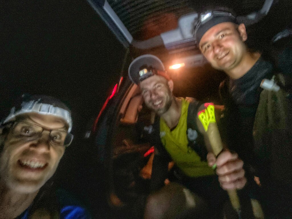
Somewhere in that final half mile, knowing the end was in sight, I found one last reserve of energy. Dave, Wayne, and I broke into a run and crossed the parking lot together.
We had finished the Harrimeter.