
A trial run on September 23 provided me with splits to work with and a few minor navigation adjustments to make to lines of ascent and descent. Two weeks later I returned hungry to nail it, and at 9:04AM on the dot started up from Clear Creek TH under unseasonably warm conditions.
Crossing Clear Creek after 35 and a half minutes gave confirmation that the legs were on a good day. Taking my poles out, I transitioned from running to hiking up increasingly sandy and steep terrain. At 10,100' and 61 minutes elasped (10:05AM) I took a short break to down a gel before continuing, roughly 4 minutes under on my split from September. The "trail" braids several times and I stayed left on these - more direct but with poorer footing than the switch-backing braids to the right. It's a proper scree slog up there.
At 13,100' and 121 minutes elasped (11:03AM) I took a second break, pounded another gel and threw on my jacket on account of the wind. I was 7 minutes under on my previous split but was starting to feel the altitude and the effort. Above the rock band I emerged first onto the lower summit plateau and then a few minutes later onto the upper, larger plateau. It smelled significantly less like sulfur than two weeks ago - funny, the fumaroles must not be acting up as much today, I thought as I beelined it across the final talus field to the base of the summit plug. I scrambled up on reasonably solid rock, past the summit register and to the true high point before hitting split on my watch at 11:29:20AM.
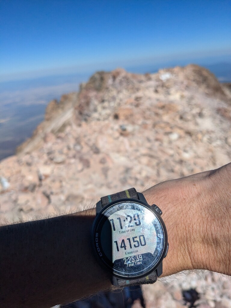
The 2:25:20 elasped ascent (2:20:52 moving) was 8 minutes faster than my trial run, but feeling dizzy, I was in no mood to revel so I quickly snapped a picture of my watch and down climbed the plug. Headed back across the talus and plateaus then found a little chute of fine scree to descend thru the rock band section which felt pretty time efficient. Paused briefly to talk with a pair of hikers just above 13k' before resuming the descent. Took a little spill at 12,700' as the terrain transitioned from chunky rock to more consistent scree, but was quickly up and moving again with minimal damage.
Had a blast bombing it all the way back down to Clear Creek, arriving at 12:25PM / 3hr 21min elasped. Stopped for about 2 minutes to dump scree out of my shoes and stash my poles back into my pack before taking off for the final 3-ish miles of conventional trail running. My head felt better now that I was down from the higher altitude, but my legs were really toasted for the last 15 minutes or so. Reached the trailhead at 12:47PM, 3:43:56 elasped, recording a 1:18 elasped descent (1:14:02 moving).
Based on my September trial run (2:33 ascent / 4:18 round-trip) I thought a sub 2:30 ascent / sub 4hr round trip would be possible, so I was stoked to have exceeded my expectations on the day. What started as a personal challenge to see how quickly I could get up and down this queen of Cascade volcanoes, turned into an FKT submission when my friend encouraged me to put it out there: "The community would def enjoy knowing the Shasta Clear Creek FKT. It's not just some random route. That's a proper mountain and the only runable/ safe way to do it in runable conditions." So here we are; if you come to explore Shasta after the season is over for the traditional Avalanche Gulch route, try this route instead, especially if you like scree!
Note- this route, and other routes on Shasta, ought to be considered an open route. As mentioned, the "trail", while distinct lower down, braids so many times on the upper mountain that the subtle variations are essentially endless. A route? Yes. Worn in foot paths from use? Yes. But a true trail? No. Per the Mt Shasta Avalanche Center website (a great USFS resource for conditions updates and climbing advisories), "There is no trail to the top of Mount Shasta," underlined and in italics.