

Be in this Moment
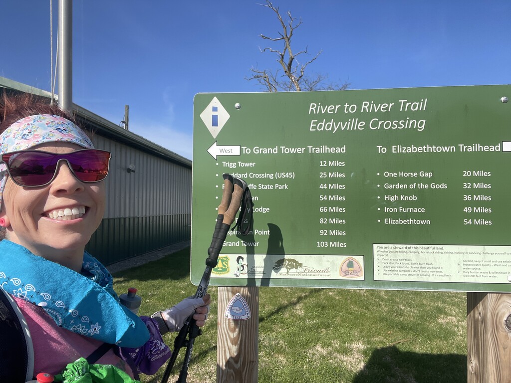
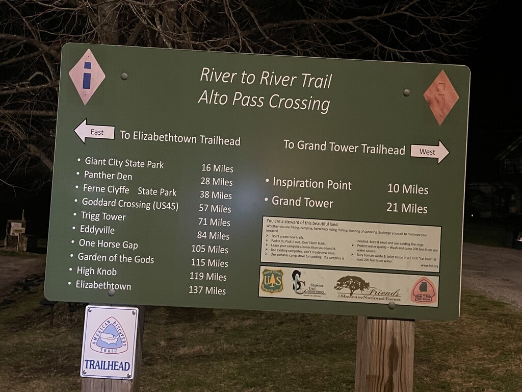
The River to River Trail is a 160-mile trail that winds its way from the Ohio River to the Mississippi River, traversing the entirety of southern Illinois. John O’Dell, the Father of the River to River trail passed away on November 8, 2021, and although I never met him, I thought of him often and thanked him for creating such a wondrous journey. The route has roughly 113 miles of trail and 44 miles of road (dirt, gravel, asphalt), and showcases four different wilderness areas. I completed the Supported Fastest Known Time (FKT) in April 2021 in 2 days, 17 hours, and 35 minutes (65 hours & 35 minutes). In general accordance with my desire to pursue the next most difficult thing, I began a Self-supported FKT attempt on March 26, 2022. I wanted to see if I could complete the trail by myself, without any assistance. This is the story of that attempt.
Based on FKT guidelines, I would need to finish the trail faster than Kevin Gottlieb’s unsupported FKT of 3 days, 16 hours, and 42 minutes (88 Hours & 42 minutes) for my self-supported FKT to count. I had an A goal – beat my supported time, B goal – come in under 3 days, and C goal – finish under Kevin’s time. I suppose the D goal would be to finish, however long it took.
I cached seven buckets of supplies along the trail. I would attempt to only use supplies from those drops, declining any help offered by passersby, and avoiding asking for assistance from anyone. I wanted to rely on myself, and only myself to complete the 160 miles.
This journey began months ahead of dipping my toe in the Ohio River. I practiced several of the navigationally challenging sections of trail over the winter. I carried a heavy pack on long runs. I added consistent strength training to my workout schedule. I planned and purchased supplies. Thankfully, I work at a run specialty store (@RuntoSucceedSports), where I was able to get my shoes, socks, sunglasses, compression, and most of my hydration and nutrition. I made list after list after list of what I needed to carry with me at all times versus what would be in each drop location. I began caching supplies a week before go time. Sunday, I dropped off three supply buckets (Godwin Trail East, Godwin Trail West, and Giant City). Wednesday night, I put caches at Taylor Ridge Road and Garden of the Gods, and Thursday night, I hid one at Hilltop Campground near Goreville. I tried to balance going deep enough into the woods such that no one would find my caches while at the same time not making it too difficult for me to retrieve them while covering 160 miles. At most drops, I dug a small depression in which I placed the bucket, covered the bucket in camo burlap, and threw leaves and sticks on top of that. I was extremely nervous about my drops being out there so far ahead of time. If someone took one, it would seriously jeopardize my chances of finishing. I taped a note to each bucket “Hi! I’m thru-hiking the R2R trail starting March 26th, 2022. This bucket is one of my lifelines. If you find it, please leave it, or it may put me in serious danger. I will pick this drop up after I have completed the trail. Thank you, and happy trails! ~Lindsey.” I tried to have faith in humanity, but I was worried.
On the way to the start in Elizabethtown on Saturday morning, I left my Honda Element (her name is LeeLoo) near Circle B at the Lusk Creek Trailhead (50.3 miles in). This was a very last-minute decision. As the forecasted low for the night kept dropping, my Coach, Mike West, suggested that I “drop” the entire car. I re-read the rules, and since I was the one doing the drop, it was allowed. I looked at it as similar to leaving a tent as a cache – it was a sleep system I left for myself. At least I wasn’t staying in a hotel (allowed under the self-supported rules). It was going to be 30°F at night, and that is the absolute minimum for my gear. Sleeping in my sleeping bag in my car would provide added protection from the cold. I definitely felt a bit like it detracted from some of the badassery, but I needed to get a good few hours of sleep that first night, for sure. If not, everything could fall apart quickly. With cache #7 in place, I got a ride to the start. I was so nervous. I was excited too, but mostly nervous. This was going to be so hard. I predicted a 50:50 chance of success:failure.
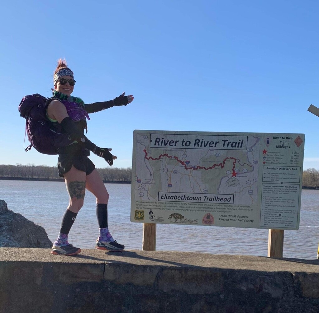
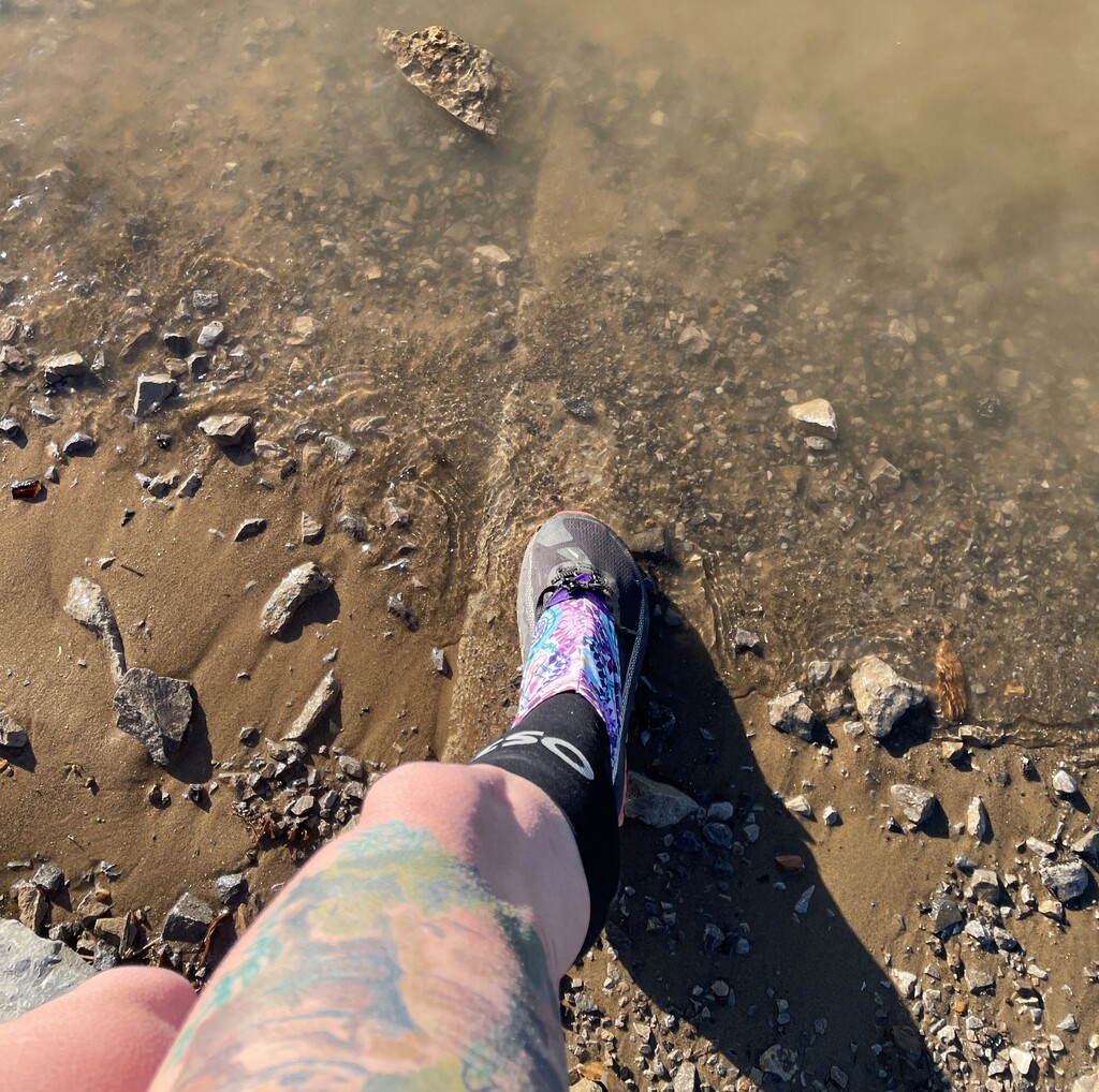
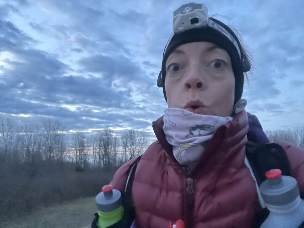
The sky was clear and the wind was whipping in Elizabethtown. It was a gorgeous morning. I touched the Elizabethtown R2R Trailhead sign and headed down to the Ohio. I started my watch (and Strava on my phone as a backup for GPS data if my watch failed). Small waves lapped at my shoe as I dipped it in the river: 8:24am. I turned around, took a deep breath, and began my journey toward the Mississippi. I started running. I immediately felt the weight of my pack (Osprey Tempest 30L), about 14 pounds. It felt too heavy. How was I going to go 160 miles with this thing on my back? I started repeating “The first mile is a liar.” I had practiced this, surely it would feel better as I warmed up. I thought about what a beautiful morning it was. As the pavement turned to gravel, I met some cows and said good morning. I bet some of them were the cows I talked to at the start of my journey last year. As the gravel turned to trail, I met the first gnarly climb. It was more washed out than last year, and it was a doozy. I power-hiked up the hill. My plan was to run the flats and downhills and power-hike the uphills. I reached the top out of breath, the pack making it hard to inflate my lungs. This was going to be hard. What was I thinking? My sleep system was in a bucket in Leeloo at mile 50.3, so I had no choice but to make it that far on Day 1.
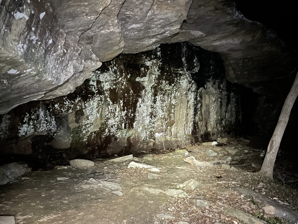
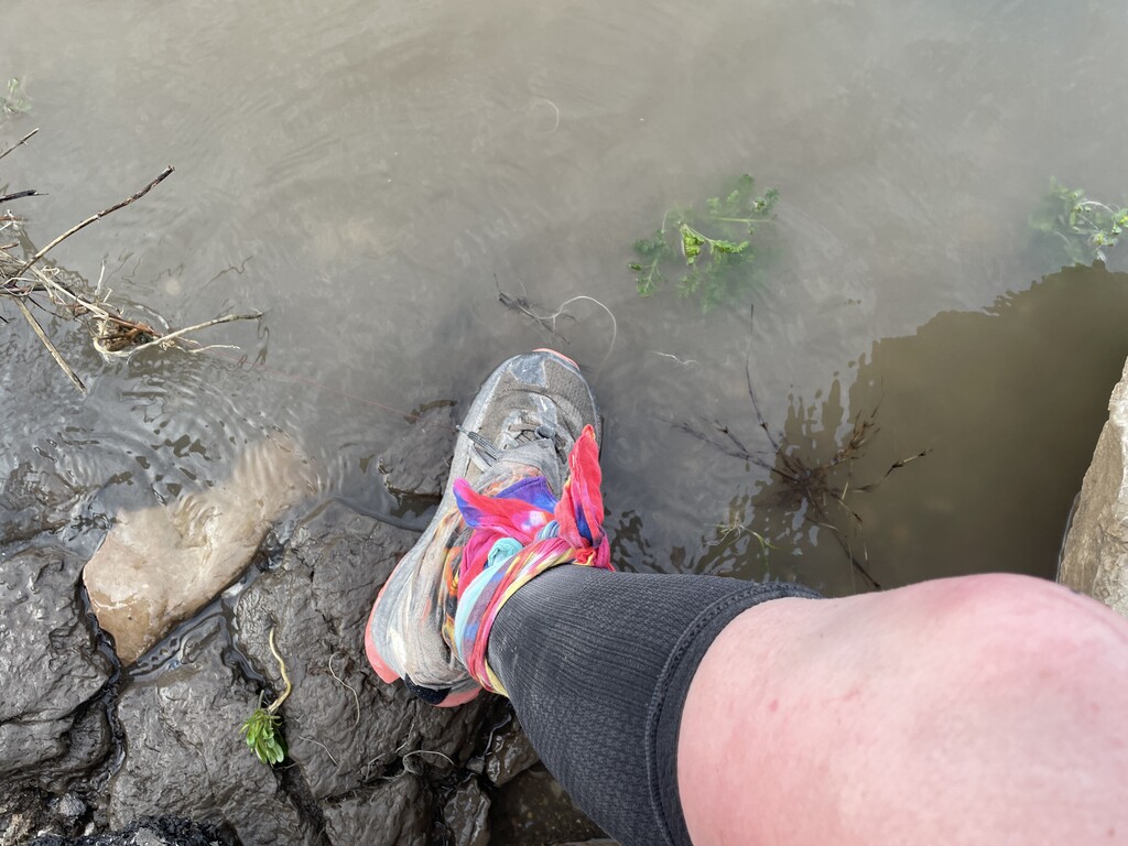
I passed by the cypress-filled Whoopie Cat Lake, and took a few extra steps to go out to Lake Tecumseh dam. I saw an upside-down R2R sign. That’s kinda how I was feeling, a bit like things weren’t going the right direction. Then, I started seeing wildflowers - tons of Virginia Blue Bells and Spring Beauties! I smiled and started feeling better. I saw frog eggs and tadpoles swimming in the sunny puddles along the trail. I noticed a person on trail up ahead. I stopped running and slowed to a power hike. We chatted for a minute, then he suddenly said – “Hey! Aren’t you the girl that ran it last year? I saw your videos.” I said yes, and he responded “You’re more of a man than I am!” I laughed and wished him a safe and fun-filled journey. I resumed my slow run. I crossed Hog Thief Creek, and got my feet wet for the first time. I stopped, took off my pack, and filtered a liter of water. It seemed to take so long, but the water was clear, and it tasted great. A bit farther, I noticed some brick structures along the trail, and then saw a marker for a closed mine shaft that said it was filled in 1990 – I was going through the area of the abandoned Lee Mine, an area I’d seen on the map but never noticed while running until now! I investigated some of the brick structures. What a pleasant surprise. At mile 14.4, crossing Karber’s Ridge Road, I saw a R2R trail sign that had a quote from John O’Dell: “For those who will be seeing Southern Illinois for the first time, there are many surprises. Beautiful scenic overlooks, complex and vast wilderness opportunities, space, landmark historical settings, a homeland to the rest of the state, all add up to a special quality and could be summarized by saying this is a unique and special place.” Although I was not seeing Southern Illinois for the first time, there had already been surprises.
Approaching High Knob Horseback Camp, the trail was in pretty good condition - much better than last year. I hoped it would continue. I saw an old cabin between mile 17 and 18, took my pack off, and sat down on one of its foundation stones. I wasn’t eating and drinking enough. Filtering water takes a long time, and I was rationing so I didn’t have to do it as often. This was a terrible move. I talked to myself out loud in a scolding voice – “Filter water, drink water, no matter how long it takes. Hydrate; don’t diedrate.” I wasn’t eating enough because I didn’t have enough food readily accessible, and I didn’t want to take my pack off frequently. I made some adjustments – I moved my water filter (Katadyn BeFree) from the expandable pocket on the back of the pack to the overhead pocket I could unzip and access without taking my pack off. I moved as much food as I could from the inside of the pack to the zippered waist pockets. Now, I could filter water and eat for several hours without having to take the pack off. Hopefully that would help my nutrition and hydration situation. I was thirsty; my mouth felt dry. I was hungry; my stomach was vocalizing its discontent. I needed to do better.
Passing through High Knob, I saw some beautiful horses. They navigate the trail so confidently. I wished I had four legs at times! I wanted to get some water at the High Knob Camp Store, but I couldn’t and stay true to my version of self-supported. I was hoping to come across a flowing creek soon. I saw another hiker up ahead sitting on a rock. I stopped to chat, and found out he was ending his thru-hike already due to a broken water filter. I wasn’t carrying a spare, so I was no help. He said he was surprised at how much the trail was torn up by horses. I didn’t tell him that this was the best condition in which I’d ever seen it. There were some large mud holes, and of course hoof prints sometimes, but there weren’t vast expanses of poop porridge like last April. Most of the trails are closed to horses from November 30th to April 1st, so I was coming in right under the wire for good trail conditions.
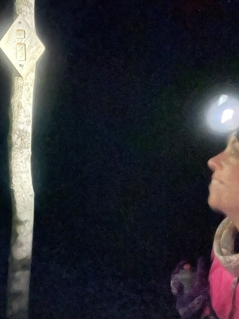
I enjoyed the rock formations and wild flowers coming through Garden of the Gods. I made it to the Backpackers parking lot at mile 21.6. I was managing an average of about a 17:00min/mile. I was pleased with this. There are some amazing overlooks, and I walked out and stood on them, appreciating the beautiful sunshine blanketing the vast expanse of wilderness. I paused and watched the pine trees perched precariously on the overlook as they danced in the wind.
It was almost 4:00pm, and I met some hikers that had already set up camp for the night. It hit me hard that I hadn’t even reached my first drop for the day, and they were already done. I exited Garden of the Gods wilderness and came out on the road. I was at my first drop! I hoped it was still there after three days of waiting for me. I walked over to it, and it looked undisturbed! I moved the branches off and lifted the camo burlap. It was there! I sat down on the road, got my knife out, and tried to open the thoroughly gorilla-taped box. The knife broke. My only knife. I grabbed the corner of the tape and pulled, and thankfully it came off easily. I cracked open an Ale-8 and took a big swig – perfection. I changed out my bandanas, restocked my Dan’s bars, grabbed a back-up headlamp, and chose to leave my gimball behind. It weighed over a pound, and I wasn’t using it much. I added an oatmeal mixture (quick cook oats, cacao nibs, coconut milk powder, peanut butter powder, and flax seeds) to my cold soak container, added water, and put it in my pack. I refilled my flasks with water, added tailwind powder, and I was off - down the road and into Herod. I ran/hiked the road for a few miles, and headed back into the forest to head to One Horse Gap. I had forgotten how truly wonderful this place is in the spring (before April 1st): runnable trail, lovely bluffs, amazing overlooks, and beautiful creeks! I made a mental note to come run this section more next winter & spring. It may well be my favorite section of the entire trail (mile 29.7 to 37.3). I saw a cluster of Dutchman’s Breeches growing on a boulder. They are one of my favorite wild flowers, and I was happy to get to see so many on my journey. The sun was going down as I walked out onto Rocky Top. You can see forever from this overlook! I got to One Horse Gap, and even though the trail doesn’t go through the gap, I hiked up and back down it. It is such a neat passage, but it doesn’t seem wide enough for even one horse in some parts! At the bottom of a descent after One Horse Gap, I approached a R2R sign with a figurine sitting on top of it – a unicorn with a purple mane! No way! I smiled ear to ear. The sun was setting, I still had to run a half-marathon to make it to my stopping point at mile 50.3, but I was pumped. I had seen a unicorn in the forest! I made it to the large Benham Hill parking lot, and sat down on the gravel. It was getting cold fast. I put on a jacket, an extra headband, and ate as much oatmeal as quickly as I could. It was delicious and very filling! I ate half and saved the other half for farther down the trail. I put on my headlamp and UltrAspire waist light, and headed off into the darkness. After some fire road and gravel road, I entered the Lusk Creek Wilderness. On most of the trail, markers are white diamonds with a blue “i”. In wilderness areas, the markers are diamonds carved from cedar with an incised “i”. They are difficult to see during the day, and I would be trying to navigate through the wilderness at night. I was definitely nervous, but I had done it several times during the day. I was hopeful that practice would pay off. As I was filtering water in Little Lusk Creek, my headlamp caught some movement in the water, and I began to notice the tiny creatures inhabiting the creek. I saw a crayfish, salamander, and so many fish! It was cold, and they were moving slowly. I understood – it was cold and I was moving slowly too! I made it to Owl Bluff at mile 47.4, one of my favorite overlooks, which is high above Lusk Creek. I went out on the bluff, turned off my headlamp, and looked at the stars. They were brilliant. I could hear Lusk Creek below. I thought about Wim Hoff’s advice “Be in this moment.” I breathed the chilly air in deeply, held it, and calmly exhaled into the night. I had this. Most moments today had been enjoyable. I felt grateful I could even attempt this journey.
The descent down to Lusk Creek was difficult and slow-going, but when I reached the creek, I stood in the cold water, letting it work its anti-inflammatory magic on my tired legs. After a few minutes, I climbed out of the creek and began the ascent to Lusk Creek Trailhead. I was cold, but not overly so. I was less than two miles from LeeLoo. My headlamp caught what I thought were the eyes of a forest creature, and I turned and pointed my waist light in the same direction. Ope! It was a reflector on a tent. I hoped I hadn’t woken up the hiker – it was late, 11:45pm. I made it to LeeLoo at the Lusk Creek Trailhead and eagerly climbed in. I activated some hand warmers, body warmers, and plugged my phone, watch, and head/waist lamps into a power bank in my bucket. I was too tired to wait for my mashed potato dinner to cold soak, so I ate the rest of my oatmeal with a few pieces of bacon. I drank some Tailwind Rebuild in a half a liter of water, and hoped that was enough calories. I was so dang tired. I changed into pants and a sweatshirt, wiped off my face and body with a wet wipe, brushed my hair with my hands, put Voltaren and cbd cream on my unhappy shins, and crawled into my sleeping bag. Warm and fed, I started going through my pack to see what weight I could drop. A friend had messaged and recommended I drop as much weight as I could – if I hadn’t used it the first day, I probably wouldn’t. I looked at the forecast, no significant chance of rain. I dropped my rain jacket; I still had an emergency poncho if it did rain. I went through every pocket. I left behind Benadryl (I hadn’t seen any stinging insects today), half of the ibuprofen, salt tabs, and Tylenol, my cold soak container (I would just cold soak in a zip lock bag and hope for the best), one extra shoe string (I still had one), and my warm Land Between the Lakes beanie (I would definitely regret this one!). I used my broken knife to hack off an extra two panels from my sleeping pad – it was down to about 4 feet long, long enough for my head, torso, and most of my legs. I even went down from 6 wet wipes to 2 in my poop kit. I laughed at myself, but also hoped it would help. Knowing I would be adding my sleeping bag (Western Mountaineering 30°F down) and pad (Ozark Trail open cell foam) to the pack, I was hoping I had parted with enough things that the pack would not be heavier the next morning. Satisfied with my sorting job, I laid down to rest. My legs were stinging through their entire thickness. My shoulders were giant balls of anger. Sleep did not come easy. I was having trouble turning my brain off too. I finally fell asleep about 2:30am. Day 1: 50.9 miles – 45.6 trail, 5.3 road.
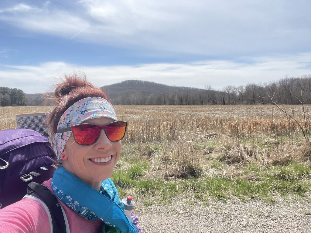
I slept well from about 2:30 to 7:30. I laid in my sleeping bag for another 20 minutes contemplating my life decisions – lol! I got dressed for the day (short sleeve shirt, arm warmers, shorts, compression socks, headband, Altra Olympus, gaiters, Goodrs) drank some coffee rebuild + instant coffee, and ate some bacon. I stuffed my sleeping bag into my pack, and attached my egg-shell foam sleeping pad to the side. I stepped out of the car, and was greeted with sunshine. It didn’t feel too chilly, and I resumed my westward journey. I felt a dull ache in my left shin, but everything else felt good. The pack felt heavy, but manageable. I headed into Eddyville, reluctantly bypassing Shotgun Eddy’s. Man, I would have loved some brekky! I left the blacktop and followed the R2R into the forest once more – into the Double Branch Hole Ecological Area. As surprised as I was yesterday about the good condition of the trail, I was about the poor condition of this section. Some of the horse hoof prints were so deep it looked like post-hole digging! There were a good number of sloppy areas, and it was slow going. There were some pretty bluffs, boulders, and creeks, so I focused on those. I continued to admire the many Spring Beautys along the trail. I started the section of the R2R that overlaps with the race course for the Shawnee Hills 100. I knew this area so well. I came out on a gravel road and stared at Millstone Bluff as it towered over the flat field below. I ran along Millstone Lake Dam, looking for the eagles that frequent the area, but saw none today. I climbed up to Tin Whistle where the trail goes under the train tracks, but there was no train coming. Another passage through the whistle and no train, hopefully someday! I crossed over Trigg Tower road, and saw several horses and riders. A lady shouted – “You go girl!”
I was not moving fast. I had covered about 66 miles total. At least I had less than 100 to go? I was excited if my watch clocked a sub-20:00min/mile. The trail was not in great shape, and little of this section was runnable for me with an extra 12-14 pounds on my back. My left shin was waxing and waning with sending sharp pain signals to my brain. My right shin was doing okay. I was thankful that I wasn’t experiencing any lower back pain like I had in a 100-miler last year, or the pain of a broken pelvis like I had during a 100 in 2020. My shoulders had accepted their fate as the load bearers, and my trapezius muscles had formed into crunchy, hard, buttress balls beneath my pack straps.
About 2:00pm I entered an area of newly burned forest. It still smelled strongly of smoke. I had been lucky so far with controlled burns. The Forest Service doesn’t announce controlled burns for sure until the day of, since they are so weather-dependent. I was hoping I wouldn’t have to decide whether or not to run through fire on this journey. I’d barely missed this one! I cruised over some soft pine needle-covered trails, and then struggled through some rocky, muddy areas. I kept my eyes on the ground, trying for #nowhammies. I was on a trail, but didn’t recognize the area, and didn’t see any markers. I pulled out Avenza. DANGIT! I had followed the wrong trail during my downward focus. I backtracked ¼ mile, and saw a tree over the area I was supposed to have turned. DANGIT! I climbed over the tree and resumed the correct path. I climbed up a power line corridor and came out on gravel road at the Boot Ranch, a farm with boots overturned atop the fence posts and an interesting collection of vintage farm equipment. It’s a really neat place. Mile 72.9! My drop was at mile 76.8 – I was getting close! I ran/walked some road, and entered the trail again. I crossed beautiful Max Creek. I tried to run a technical section. I wanted to get to my drop! I toed a root, tucked, and rolled. WHAMMY! Thankfully, I landed mostly on my sleeping pad attached to the side of my bag. I laid on the ground for a second, hoping that when I got up nothing was hurt or bleeding. I felt like a turtle laying there on my backpack looking up at the sky, and even more like one when I had to roll around to get momentum to get up. I checked myself over, all systems go! 76 miles, one soft whammy – not bad!
I came out of the trail and started walking down the gravely Taylor Ridge Road. I veered into the woods and found my drop bucket. I chugged an Ale-8, and saw a Snickers! Heck yes! I’d forgotten I’d put that in there. I inhaled it, and got ready for the night. It was already getting cold. I put on a lightweight jacket, wrapped a few bandanas around my neck, put on gloves, my headlamp, and waist light. I poured some water in the plastic bag containing my oatmeal mixture. I was hoping the Great Value baggie would keep my cold-soaked meal contained. Just in case, I got an extra baggy out of my drop bucket and double-wrapped the meal. I refilled my supply of Dan’s Bars and other sustenance, and headed off toward the sunset. It was another lovely one! I enjoyed running toward it, rays of orange, yellow, and blue were my company on that road. I came to US45 – 6:40pm, mile 78.3. I ran as much of US45 as I could – I was so close to the halfway point! A van passed me and started braking, then turned around and parked in a driveway in my path. I got out my pepper spray. A woman rolled down her window and asked if I had a place to stay for the night, that it was going to get cold. What a wonderful human! I quickly explained to her what I was doing, and that my place to stay for the night would be on trail, moving forward, until I reached mile 104.9. She wished me luck, and I thanked her for being so thoughtful. There is so much good in this world.
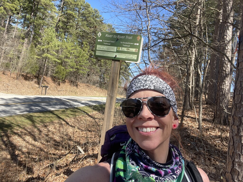
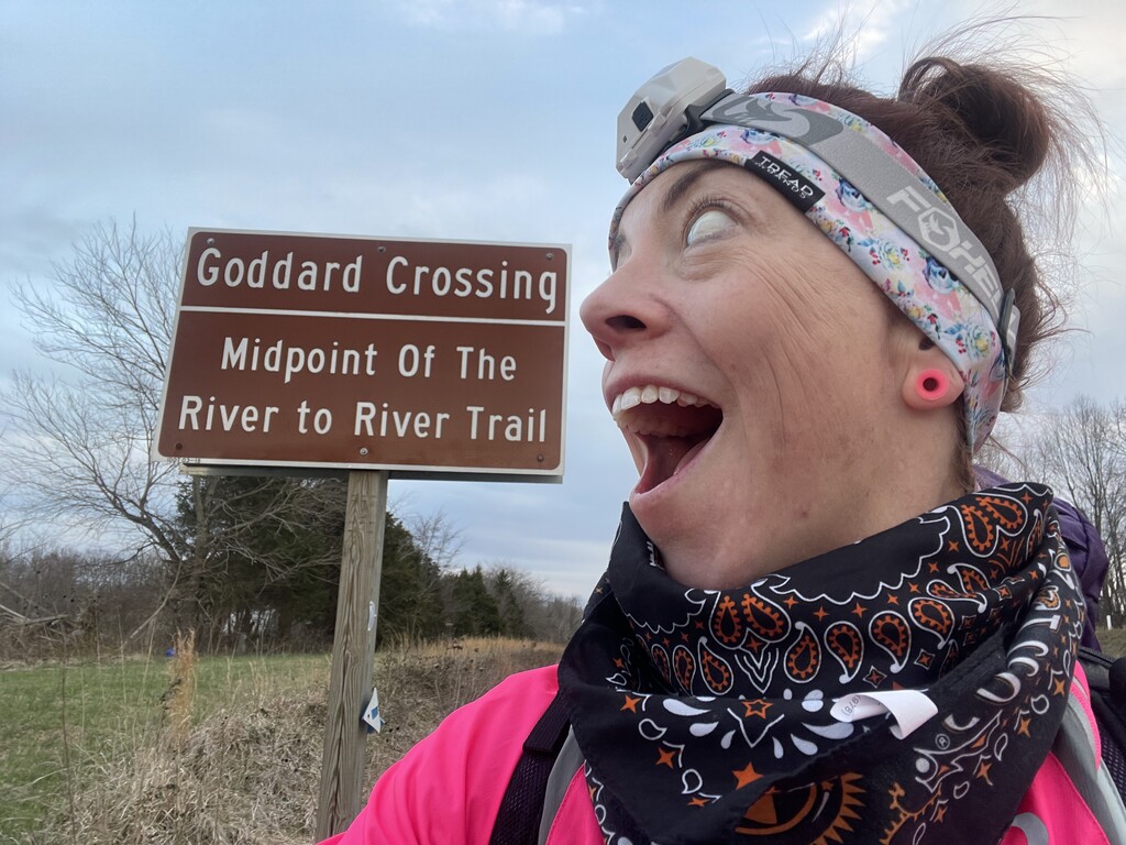
I saw the sign for the halfway point at Goddard Crossing – the great divide! 6:54pm – mile 79.5. I was ecstatic that I was halfway done. I entered the forest again as the sun set, and did a bit of math. I had almost a marathon to go before I could sleep. It was going to be a long, cold march through Dutchman Lake, a long road section, and then Ferne Clyffe. I started to get overwhelmed, and resumed focus on the mile I was on. Be in this moment. I crossed over Tunnel Hill trail – fitting that my next big goal will involve that trail! I ran some power line corridor, and headed back into the woods. I stopped to pee. When I pee, I don’t pull down my shorts and squat. I ain’t got time for that. I pull my shorts to the side, spread my legs, and let it flow. There are two layers to pull to the side – the built-in underwear and the shorts themselves. Despite successfully completing this maneuver hundreds of times, in my tiredness, I only pulled over one layer. Well, piss. I realized very quickly that the built-in panties were not out of the way! I had partially peed my pants. I grabbed an extra bandana from my pack and made a bandana diaper of sorts. Hopefully the shorts would dry quickly.
As I closed in on Dutchman Lake, a maze of gargantuan pine trees blocked my path. There was so much blow down, and it seemed fresh – the downed pines still sporting their evergreen foliage. It was exhausting crawling over, under, and around these trees. I finally got through the worst of it, and was on a runnable trail again. I noticed a set of vehicle lights paralleling my location on a road to my left. There was over half a football field between us, but it was unsettling that the vehicle was creeping along the road, matching my progress. Perhaps they were wondering why there was a light in the forest so late? I looked for trail markers, what if I’m off trail and on private property? I didn’t see any for a minute, so I got out my phone to check Avenza. DANGIT! I was off trail. I turned around and high-tailed it back to the point of my mistake. I looked for any other trail. I searched so long. I couldn’t find it. With so many trees down, my limited night visibility, and my tired brain and body, I worked my way back and forth, trying to find anything that looked like a trail. I turned my headlamp and waist light to their highest settings – battery conservation be damned! I couldn’t find it. It was too cold to move this slowly. I decided to keep my phone on Avenza, and keep my blue dot on the red line for the R2R trail. I hiked, crawling under and over downed trees, bushwhacking through thorns. Sometimes I saw maybe a hint of a trail, but I was never sure. I was moving so slowly, and I was so cold. I started to worry. I wasn’t thinking I hope I don’t need to quit, I was thinking “I hope I don’t have to quit.” There’s a difference, with the latter being one of force. You are forced to quit because not quitting is too dangerous. I thought about Harvey Lewis and Courtenay Dauwalter searching for a book in the woods at the Barkley Marathons, not even a trail to follow. I had lost my trail to follow. At first, I stayed close enough to where I had come from to retrace my steps if necessary. But then I had wandered far and not found any sign of a trail. “I hope I don’t have to quit,” I thought. I was damp from sweat from the heat of the day (and partially peeing my pants), and that didn’t help. I was too cold. I thought about what I would do if I didn’t find the trail soon and had to camp overnight. My footprint, bivy, and tarp were in my next drop, but I had my sleeping bag with me. My plan was to get in my sleeping bag, wrap the bag in my emergency blanket, and pull my emergency poncho over that combination. The low was going to be 30. It wouldn’t be comfortable, but it would keep me safe until the sun came up. I kept bushwhacking. Avenza said I was getting close to where the trail exited the forest. My worry began to ease. I kept hiking. Suddenly, there was pavement in my dome of light. I knew exactly where I was, as I saw the sign for “Dutchman Lake”. Shew. Thankful. I took a deep breath, and slowly exhaled, watching the transient cloud I’d created disappear into the night. The truck that had paralleled me was nowhere in sight, and I took off across the lake’s levee. I moved quickly to try to warm up.
After a bit of trail, I had a 5-mile road hike. I tried to run some. On US37, I heard several coyotes calling ahead of me. It sounded like they were laughing at my life choices! I didn’t blame them – my shins were killing me! I made a left turn and the sounds of the coyotes faded. I left the road to begin my run/hike/hobble through Ferne Clyffe. I have done so many miles in these woods it felt like home. I was glad to turn my brain off for a little bit; I knew this trail well and didn’t have to keep my eyes peeled for trail markers. Natural Arch towered over me. Even at night it was impressive! I was moving so slowly – mile 95.6. I was on part of The Last Boyscout course (albeit going through it backwards), and to try to pump myself up to get up some steep, slippery rocks, I said out loud “You’re the damn Last Boyscout. Get yo ass up these rocks.”. I got myself through Ferne and came out on the road in Goreville. I limped down a steep downhill – downhills felt like my shins were tearing apart. A set of eyes fixated on me from the side of the road ahead. As I got closer, I expected them to move, but they didn’t. My tired eyes couldn’t make out what kind of animal it was, but it was holding its ground. I got out my pepper spray. I thought – it’s probably a rabbit, and you’re getting out your dang pepper spray for a dang rabbit! Sure enough, when I was about 5 feet from it, it finally darted away. I chuckled to myself.
After 2.3 miles of road, I entered my last trail section for the day – the Happy Hollow Road Trailhead heading to Borks Falls. Another steep downhill. Ouch! My husband watches a YouTuber who uses “Bob Saget,” as his substitute for profanity and I screamed “Bob Saget!” into the quiet woods. The lone Spring Peeper calling in the cold stopped in response to my yell. After about a mile of hiking, I heard a four-wheeler in the distance. It sounded like it was coming closer. Maybe raccoon hunters? It was 2:00am on Monday morning. Who is the heck is out riding a four-wheeler? I moved with a bit more vigor, but about five minutes later, the sound of its engine started getting farther away rather than closer. I could hear Borks Falls roaring, but couldn’t see it through the darkness. I came out on a gravel road and was greeted by a car sitting atop the falls with its bright lights pointed right at me. I couldn’t see a darn thing. I tried to navigate a section of road that had been overrun by the creek draining to Borks Falls. It was slippery and I couldn’t make out the best path. I waved my arms in front of my eyes, and the vehicle turned its lights from bright to dim. That helped. I pulled out my pepper spray as I walked by the car, but the guy sitting in it was probably wondering what in the heck I was doing hiking at 2:00am as much as I was wondering why he was sitting in the middle of nowhere by himself. People are strange when you’re a stranger.
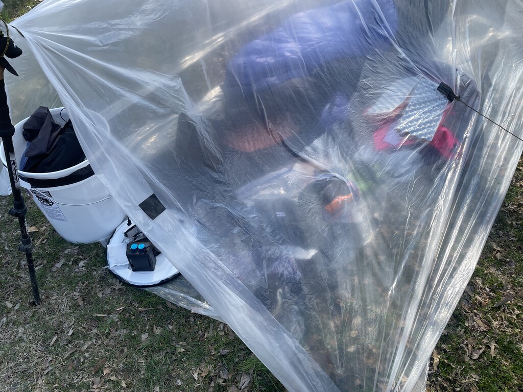
I had about two miles to go before I could stop for the night. The road coming up out of Borks Falls seemed incredibly steep and like it lasted forever. I was hoping I would feel excited about being close, but I was so tired and my shins hurt so badly that I wasn’t feeling much positive. I dug my poles (Foxelli carbon fiber trekking poles) into the gravel and pulled myself up the hill with my arms. Gravel changed to asphalt and Hilltop Campground came into view. I managed a little smile. I had made it to another drop! I found my bucket, and immediately activated three body warmers and stuck them to the back of my neck, lower back, and one would go on my feet when I got in my bag. There was a warning that said not to stick them directly to skin, but I wanted no barrier between my bod and the warmth they would produce, any possible 1st degree burns be damned! It was 30 degrees. I laid plastic drop cloth down for my footprint, staked out my bivy (Bristlecone Bivy 5’6’’), laid my foam pad down, put my sleeping bag inside, and quickly assembled a plastic A-frame to help block the wind. I laid tomorrow’s clothes under my sleeping bag. I figured any additional barrier between myself and the ground would help. I peeled off my stinky clothes, wiped off with wet wipes, and put on some PJs and my down jacket. I wrapped as many bandanas around my head as I could for warmth (no, not the pee bandana). I ate the rest of my oatmeal from earlier and drank some Tailwind Rebuild while I was adding some Leukotape to the already substantial collection of it around my ankles, and up and around my shins. I slathered my shins with Voltaren and cbd cream. I took two ibuprofen and one Tylenol. I was too tired to wait for my dinner of mashed potatoes and camp beans to soak - again. I got all settled and tried to fall asleep at almost 5am. Day 2: 54 miles – 37.9 trail, 16.1 road.
I laid down from about 5am to 1030am. My sleep system wasn’t warm enough. I was uncomfortably cold, but managed maybe 3 hours of sleep. At least I was off my feet and giving my body a break. By the time I crawled out of my sleeping bag, the sun was shining and it was warming up, but I still felt cold. I quickly packed up, ate some bacon, and drank Tailwind Rebuild with instant coffee. I had an extra pair of shoes in this bucket if I needed them, but my Altra Olympuses had treated me well, and I was having no foot pain. I made the decision to stick with them for the entire 160 miles. I left behind my footprint, bivy, sleeping pad, and plastic cover, which meant I really wouldn’t be able to sleep again. I kept my sleeping bag in case of emergency, but I planned to keep moving until I touched my toe in the Mississippi. I looked at my Zox strap, the same one I wore for the last FKT, “Happy To Be Here.” Despite the shin pain, tiredness, and cold, I was happy to be here. Another beautiful day pushing my limits! I was wearing a unicorn headband – I needed all the magic I could get!
I left out of Hilltop held together with hope and Leukotape. I had a long road hike to get to the Wayside Lane trailhead to enter Panther’s Den. I thought I saw smoke in the distance and asked a friend to call the NFS to see if there were any burns today. As I waited for the answer, I thought about what I would do if I came upon a controlled burn on the last day. Would I walk through fire? Nah, I would def take a long nap! The response – no controlled burns this afternoon (and no nap!).
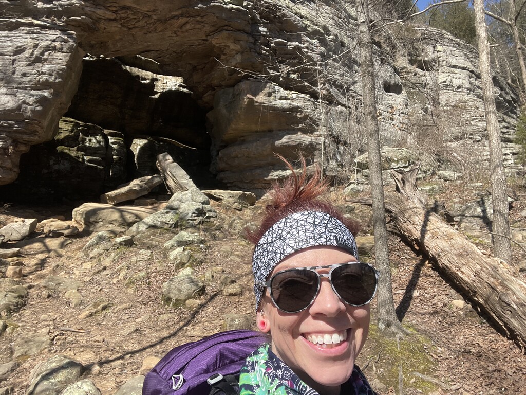
Panther’s Den is always beautiful. I stopped to admire the wildflowers and rock formations. For a bit, my shins stopped hurting. I was hoping this would last for at least the first marathon of the day. I saw two trees that looked like they were locked in the world’s longest kiss. I stopped and made kissy sounds at them. I was in high spirits. It was a gorgeous day and my legs felt okay! I filtered water at a creek feeding Devil’s Kitchen Lake. This was the clearest of any water than I drank – yum! I crossed into Crab Orchard NWR – mile 113.5. I’d run/hiked this area so many times with Moxie and Hubs, I wished they were here. I pictured Moxie’s little floof butt and butt wiggles, and laughed out loud. I saw the old, overturned truck from the days when this used to be a road, and climbed up the steep, rocky slope. There were moments I thought I was going to fall backwards and end up at the bottom overturned like the truck, but #nowhammies. I crossed over Rocky Comfort and thought about the upcoming R2R relay. Lawd I hope my leggies are ready to run fast by then! SIU had posted signs about trapping in the area, and I laughed at ornaments and feathers hanging from the trees. I even stopped to play with one, channeling my inner feline. The trail between Antioch Lane and Giant City is super gnarly. Most of it feels like you’re hiking in a giant, rutted out wash, with the added bonus of many a downed tree you get to climb over or crawl under. I mentally prepared myself. I saw the footprints of a hiker that had come through when it was much muddier, and I was in awe of how deep they had sunk into the mud. At least it wasn’t that muddy today!
I saw a trail marker with a red dot on it next to the R2R blaze, and I knew I was on the section that overlaps with the Red Cedar Trail. Hello Red Cedar, my old friend! Having broken my hand in five places on that trail in 2019 (big whammy!), I feel like we have a special bond. No broken hand today, please. The inclines and declines through Giant City awoke the wrath of my shins. It is another gorgeous area, so I tried to focus on the rock formations and beautiful forest. Mile 121. I was almost to my next drop at mile 123.5. Suddenly, an unbelievably sharp pain jolted me. It was coming from the area between my toes and forefoot on my right foot. I bet I had a wicked blister that needed popping. I sat down on a rock in the middle of the trail. I wanted to wait until I got to my drop, but I couldn’t; it hurt too badly. I got out my first aid kit, and realized I’d forgotten to pack a blister popping kit, so I didn’t have a needle. I fished my broke-ass knife out of my pack, wiped the knife and my foot with an alcohol wipe, and went to town trying to pop that thing. No dice. My feet are ultrarunner feet, so the skin on the bottom is pretty robust. I tried again, a little harder…no popping. I grabbed the blister from both sides, squeezed hard, and jabbed the knife into it – sweet release! It felt better immediately. I alcoholed it again, covered it in Leukotape, and stood up to resume my westward march. The pain subsided and I was relieved the problem was solved so easily.
I made it to my first drop of the day at 7:06pm. I guzzled an Ale-8, wolfed down a Dan’s bar, and reloaded my pockets and flasks. I always enjoy walking through Makanda – it’s such a cute town. A house with a ton of Christmas lights was a fun sight against the dusky sky. I climbed the long ascent out of Makanda slowly, daffodils lined the trail and cheered me on. I crossed over US51 and made my way to the Lirley Trailhead after some road walking. A bit into this 7-mile trail section, I was greeted with more downed pine trees. Goodness! I was both surprised and frustrated at the blow down. I continued to move forward, trying to silence the pain signals from my shins. My left shin was doing surprisingly well, but now my right was giving me some serious problems. I started to lean on my poles quite heavily, almost moving like a four-legged animal through the forest, similar to a Landstrider on The Dark Crystal.
I heard water and knew I was close to the Cedar Rapids of Cedar Lake. Mile 132, 10:15pm. I walked out into the spillway to filter some water and noticed a raccoon family watching me from the bank. I wished them a pleasant evening but told them they couldn’t have any of my food – it was going to be a long night! The farther I went, the more I was talking to things that couldn’t talk back!
I made my way across the algae covered rocks making up the spillway, trying to stay out of the flowing water. I was more careful than I’d ever been at this crossing – a dip in Cedar Lake was not the best idea right now! I made it safely across and headed toward Alto Pass. A little over three trail miles later, I made it to pavement. I had 4.3 miles of road through Alto Pass. Wow my dogs were barking, and so were all of the dogs I woke up with my headlamp and footsteps on my way through town. I tried to be quiet, point my headlamp only at the ground, but it was to no avail. A chorus of canines serenaded me from one neighborhood to the next. I was through town by 12:30am, and heading toward the last trail section (THE LAST!) – Godwin Trail. I noticed something bright ahead to my left. It was Bald Knob cross, and it was lighting up the night sky. It was beautiful and calming. I got to my sixth drop at the start of Godwin Trail and got everything caffeinated I could fine and shoved it in my mouth and pack. I switched to caffeinated tailwind, ate some sport beans, and drank some Ale-8.
The hike through Godwin trail was a blur. Up, down, up, down, narrow parts near drop-offs that required as much focus as I could muster, up, down, through creeks, no whammies…slow and steady. I wanted to stand in the cold water of Hutchin’s Creek for a few minutes to calm down my shins, but I needed to keep moving forward. About ½ mile from the end of Godwin, my shins hurt so much that they needed some attention. I sat down on a tree in the middle of the trail, took of my pack, and slathered cbd cream and Voltaren all over my shins in a nice, thick layer.
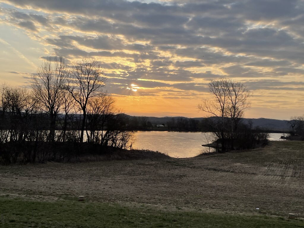
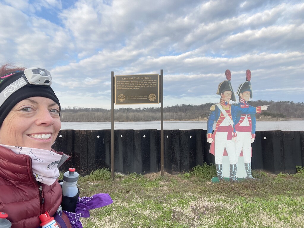
In my last drop, at the end of Godwin, I grabbed some Fireball and a Payday. I took a shot of Fireball and prepared for the last 11.1 miles – a soul-sucking 11.1 miles of exposed gravel. Walking on top of the levee near the Big Muddy was so cold. It was 4:04am. To finish in under 72 hours, I needed to cover this 11.1 miles in 4 hours and 20 minutes. As tired as I was, and as much as my legs hurt, this was a big ask. I put one foot in front of the other. That’s all I could do. I had carried my Shokz headphones with me from the beginning, saving them for when things got dire. I was at that point. The first song that played was “The Motto” by Tiesto & Ava Max. It had a great background beat, and I drove forward with my poles, digging them into the gravel to the rhythm and hoping my legs would follow. It was basically a Motto March on the Muddy Levee through the early hours of the morning. I started to lose feeling in my right hand, not sure whether it was from the weight of the pack or using the poles so aggressively. I started to weave back and forth, so I sat down, took another swig of Fireball, and ate some calories. I looked at some of the messages on my phone – so encouraging. They helped tremendously. I got up and resumed my trek, thankfully with a little less swagger. About 6:30, as the sun began it’s ascent into the sky, it brought me joy. It was a gorgeous sunrise, and I took it in to its fullest, watching every moment from my levee march. Suddenly, my left foot started to scream like my right had done in Giant City – a big blister that needed to be popped. I wasn’t stopping again, so I moved my foot around in my shoe and stomped the ground as hard as I could; pain shot through my leg, and the blister popped. The sharp pain ceased. I kept going. About 7:00, I couldn’t see Grand Tower up ahead. Why couldn’t I see it? I had to be getting close. I had a mini-pity party and minor breakdown. I was so damn cold. The cold seemed to be stealing every last ounce of energy I had. Was I going to be able to make it? It seemed almost impossible. I opened my phone and read a few more messages. I am so grateful for good friends. I listened intently to The Motto beat, which was on repeat. I tried to refocus on the sunrise – its brilliant yellows and oranges bathing the bottomlands near the river. It was amazing. I squinted hard in front of me, and I thought I could make out several buildings in the distance. I hoped with all of my being it was Grand Tower. I continued to walk – left, right, left, right, left, right…keep moving forward. It was! At 7:45am, I was in Grand Tower. I was so close to the end, but still had about ¾ of a mile left. I knew the road curved around a park and then entered it. I wasn’t done yet. One foot in front of the other. Keep moving forward. I felt my mouth turn upwards into a smile. I was going to do it! AND I was going to finish in just under 72 hours. I rounded the turn and the large Grand Tower River to River sign came into view. I smiled ear to ear. I stopped at the sign and laid my head against it. Thanks for another great journey, River to River. You have pushed me to my limits. I hobbled down to the Mississippi, whose bank is a maze of boulders and rebar. I sat down on a rock and dipped my toe in the river! I had done it – Ohio to the Mississippi again, this time completely solo! Except I never felt completely solo – thanks to everyone who sent encouragement! I couldn’t have done it without you. Day 3: 52.1 miles – 28.3 trail, 23.8 road. Total self-supported time for the FKT: 2 days, 23 hours, and 47 minutes (71 hours & 47 minutes). I am grateful to be able to begin such a journey and ecstatic to be able to complete it. Southern Illinois is indeed a wondrous place full of amazing people. Thank you John O’Dell for having the vision and ambition to see such an amazing trail become a reality – may you rest in peace. What a journey this was. Whatever journey you are on, I wish you well. Keep moving forward, and remember, be in this moment.