"Discovering the most beautiful parts of this country on foot is so much more than simply a sporting achievement. It can put everyday problems in perspective, help you to organise your thoughts or simply to switch off completely." Long-Distance Hikes in Switzerland (Kümmerly + Frey)
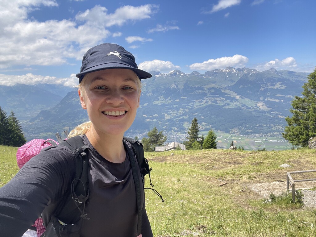
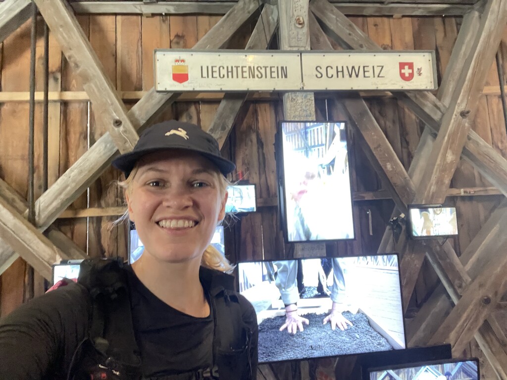
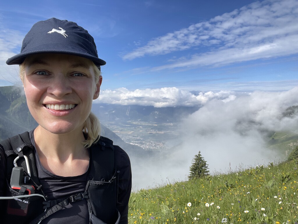
Visiting Switzerland has been at the top of my list for a while now. My family roots on both sides can be traced back to the Emmental region, and I’ve been captivated by images of narrow green ridge lines and the idea of hiking from inn to inn and enjoying hot meals and a warm bed every night, like a European holiday style of backpacking. Earlier this spring, I booked flights to and from Zürich before knowing what I was even going to do there. Then I learned about the Swiss Via Alpina: a classic long-distance hike in Switzerland encompassing 14 Alpine passes over about 242 miles. I saw that Tina van Heerden had established a women's FKT in 2020 (8 days, 5 hrs, 26 min) - her trip report is inspiring and a great read. Based on my flight schedule, I calculated that if I immediately zipped over to the starting point in Vaduz, Lichtenstein after landing, I would have nearly 8 full days to reach Montreux and complete the trail before hightailing it back to Zürich and flying home. It seemed like sort of a wild idea, which made the decision to try a no-brainer!
A ton of planning and research went into this trip, and I'm planning to share some useful links, info, and tips at mercuryontherun.com/swiss-via-alpina. I am also happy to answer any questions from anyone considering hiking or going for an FKT on this incredible route! Feel free to reach out at mercuryontherun at gmail dot com or @pinkfeathers on Instagram.
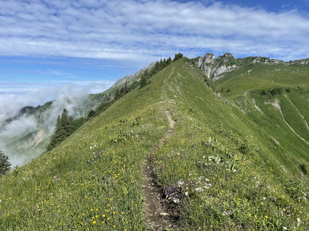
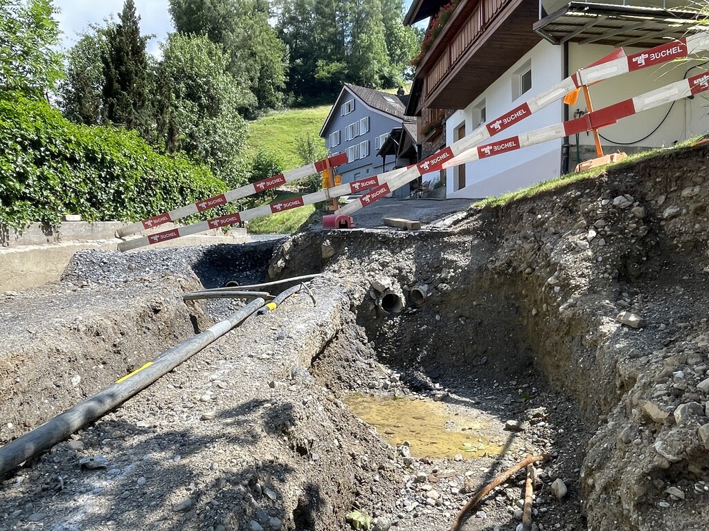
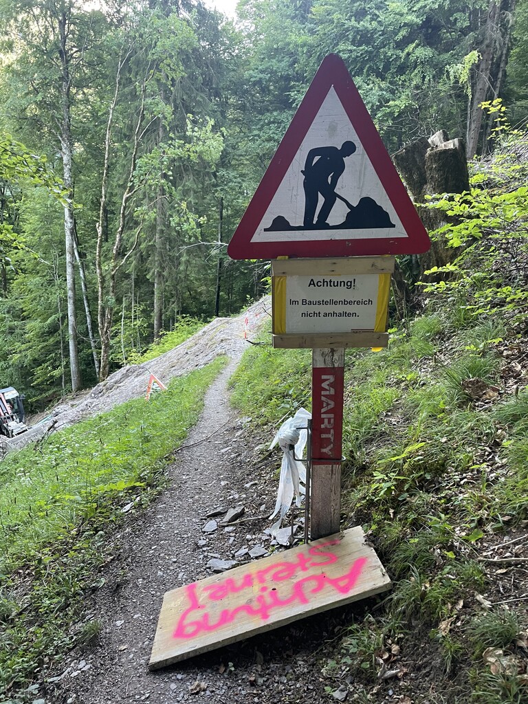
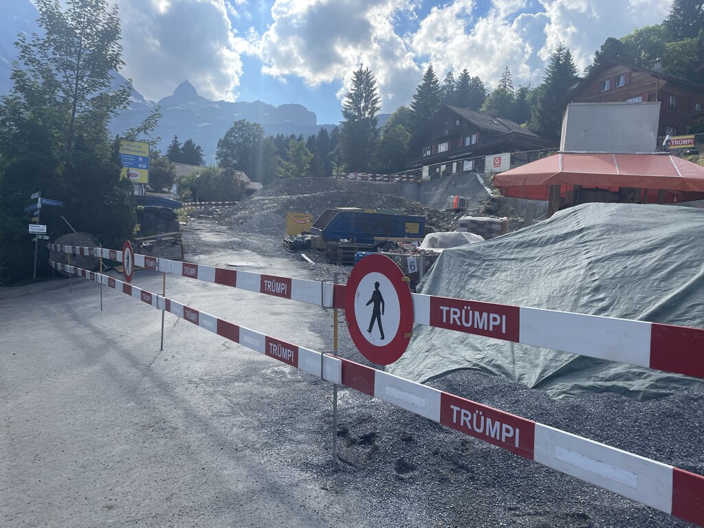
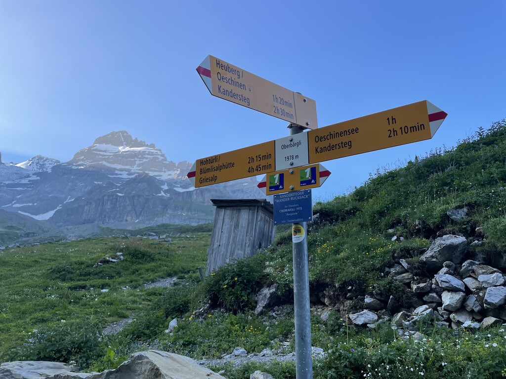
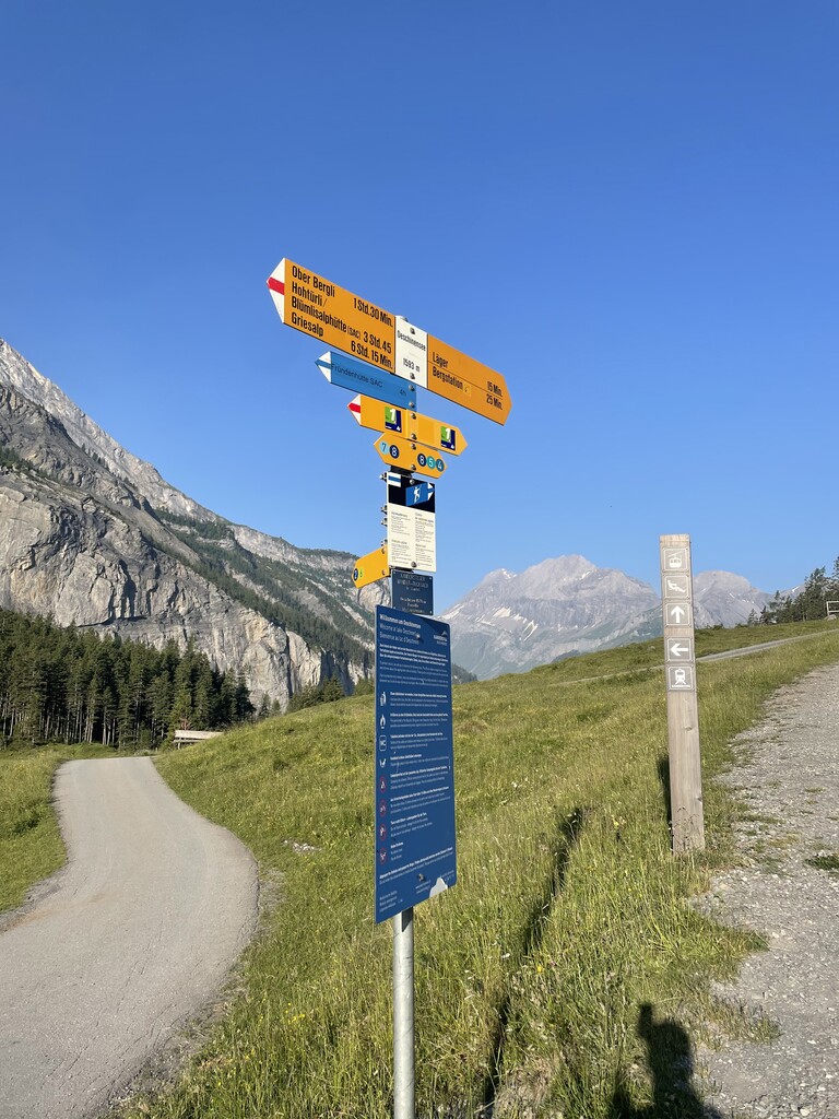
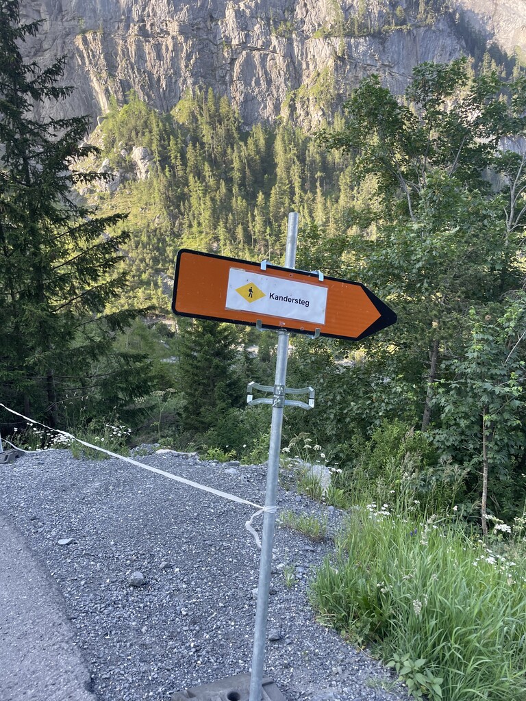
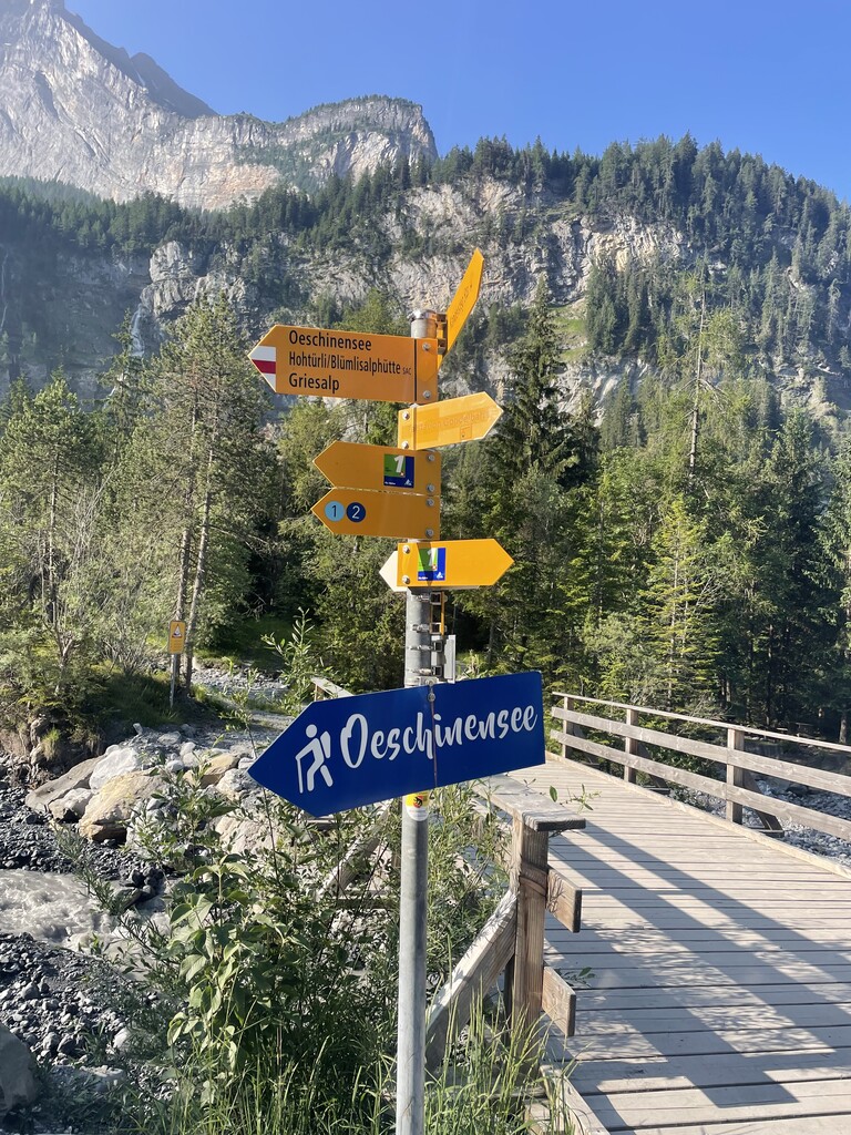
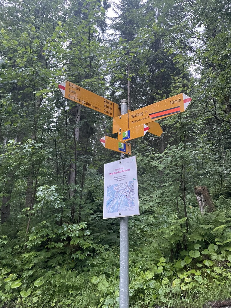
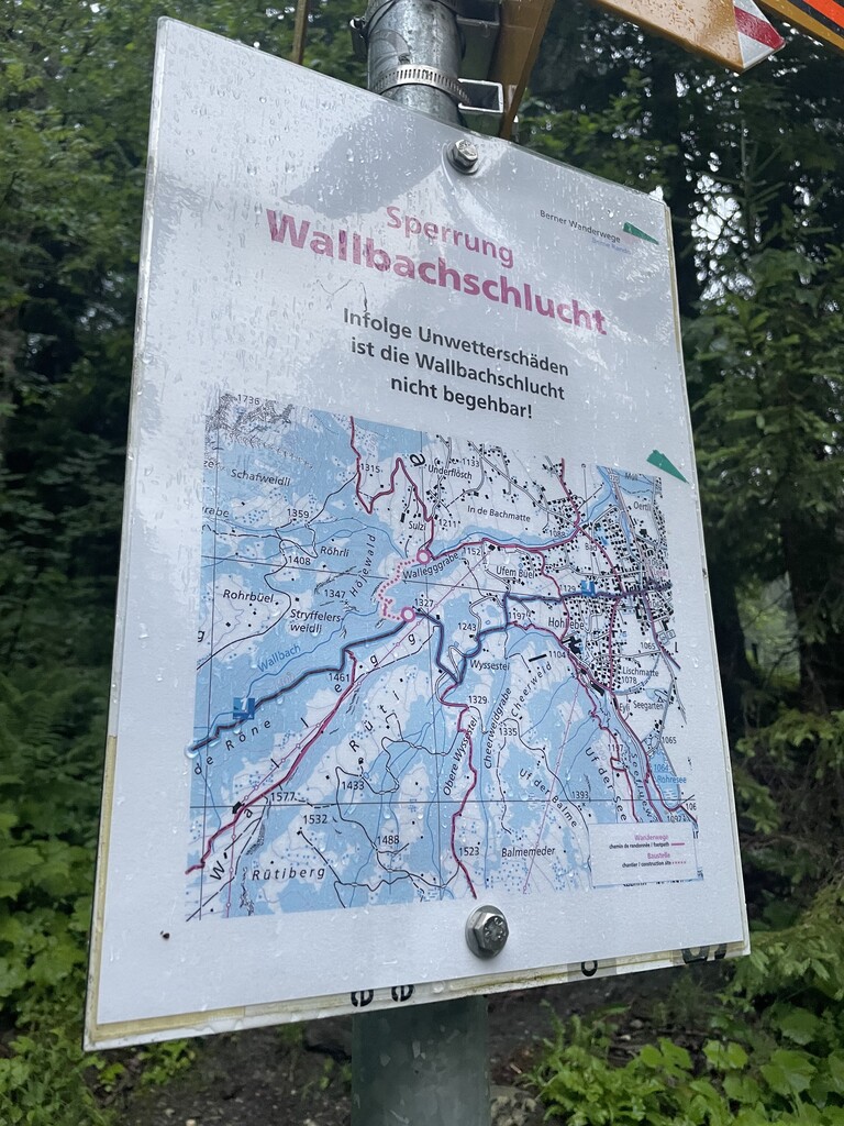
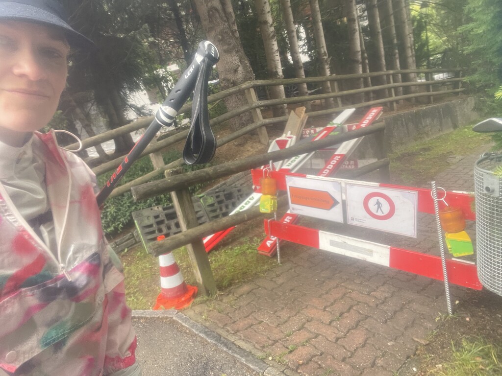
For navigation, I relied on good old fashioned signs and trail blazes as well as the SwitzerlandMobility app. There were quite a few occasions that the trail was rerouted, usually in town sections due to construction, or the trail passing through farmland that had been rerouted a different way. There were times that the trail signs conflicted with the SwitzerlandMobility app, so I'd opt to follow the physical signs. I included photos of signs that I followed that were in conflict with the GPS route, as well as construction areas and reroute signs. Additionally, if you look through my Strava/gpx files you'll see that I missed turns every day, in which case I'd retrace my steps until returning to the point where I got off route. I uploaded Wauter's GPX files to my Coros watch as a navigation backup, which ended up saving me quite a few times as my watch would beep at me if I got off course (which I would confirm with the SwitzerlandMobility app and physical signs, then turn around and get back on track). Though the Via Alpina is well marked, it's very easy to miss turns on the winding roads in and out of towns, as the route often sneakily switches between road and trail. You can't stop paying attention for a second!
Below is a brief daily recap with details and notes as they pertain to the FKT, and I'll share a reflection once I've had more time to process the experience at mercuryontherun.com/swiss-via-alpina.
Saturday, 6/24 Day 1 - Vaduz (Gaflei) to Weisstannen, 26.0 miles, 3,734ft gain/5,627ft loss, 12:52pm start, 7 hrs 3 min
After an overnight flight from Boston, I landed in Zürich a bit around 7:20am, then made my way to Gaflei via train, bus, and taxi. I was dropped off at the starting point used by Wauter and Tina. However, there was a sign for Via Alpina 1 pointing uphill from there, so I hiked uphill following the direction pointed by the Via Alpina 1 sign until I reached the next trail junction. This matched up with the start marked on the SwitzerlandMobility app. It was only about a quarter mile add-on (and I passed right by Tina and Wauter's start point a few minutes into my run), but I figured I'd start from the most "official" spot in case it matters for comparing with future attempts.
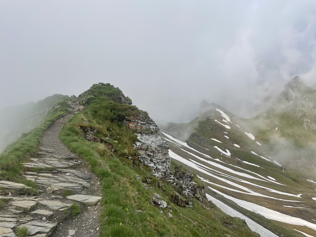
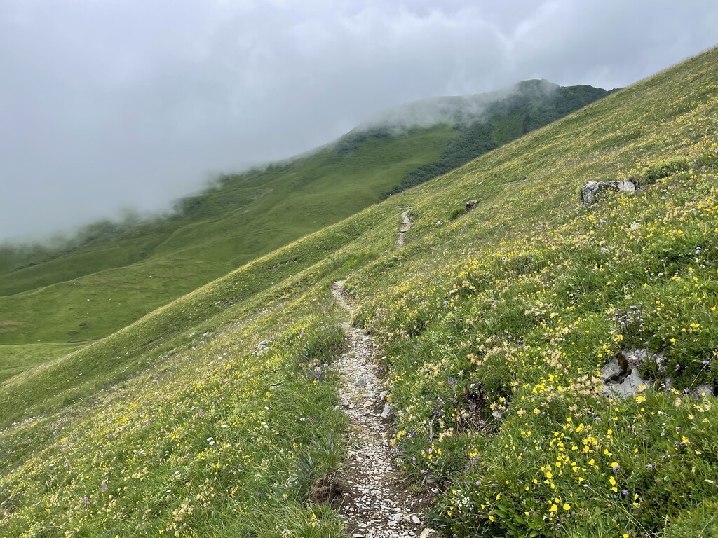
Overall this was a fun and deceptive way to start the Via Alpina. Deceptive as in, it was a very tame route compared with the remaining stages. It began with basically a 3,600ft freefall over 5.5 miles from Gaflei into Vaduz. I ran most of the way, knowing my quads would pay for it later (and they did). The rest of the day was pretty chill and flat, with only one big climb up toward Vermol at the end of the day. "Wow, that climb was straight up!" I thought. If only I knew how tame that was in comparison with the 14 passes to get up and over in the days ahead!
I stayed at Hotel Gemse, whose kitchen had closed just as I arrived for check in, but they took pity on me and cooked me up some schnitzel and french fries accompanied by an ice cold Weissbier. Ahh! After a red eye flight, train, bus, taxi, and 26 miles on foot, it was incredibly gratifying that my wild plan for day one had worked out logistically.
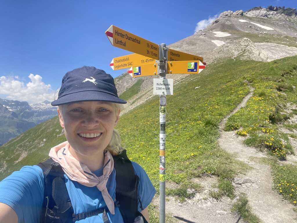
Sunday 6/25 Day 2 - Weisstannen to Klausenpass, 47.5 miles, 14,948ft gain/12,280ft loss, 4:21 am start, 17 hrs 49 min
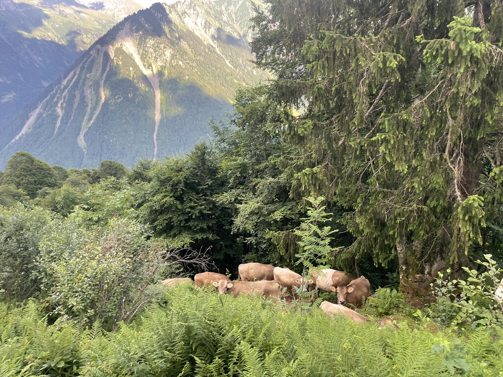
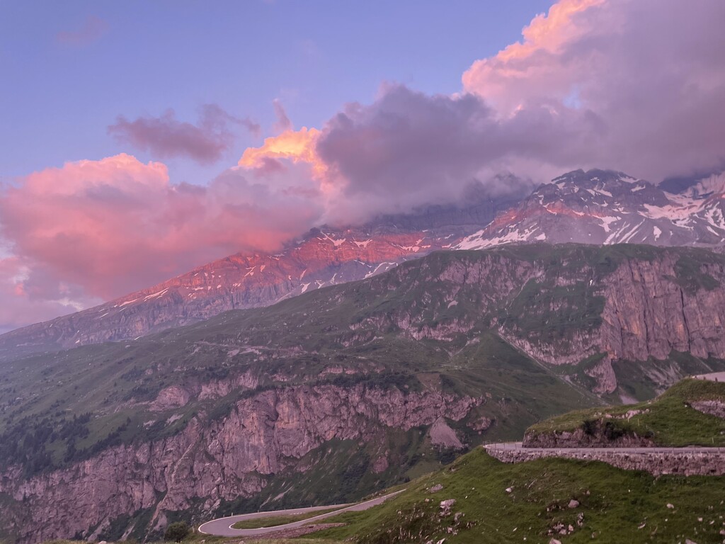
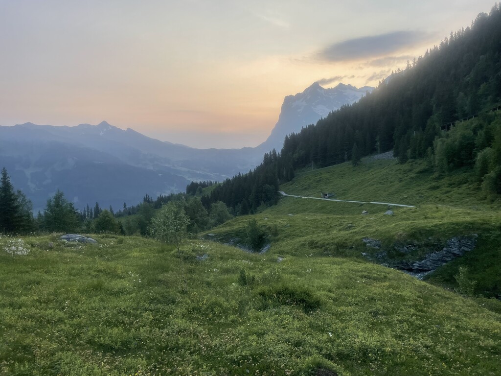
I felt pretty stressed and anxious about this ambitious day, tackling the first three passes of the trail: Foo Pass, Richetli Pass, and Klausenpass, plus covering nearly fifty miles. My quads were wrecked from the previous day's drop from Gaflei as expected, and it is always an adjustment for the body to suddenly be hiking all day and eating a bunch of food. Not to mention being all thrown off from jet lag! The climb up Foo Pass was a doozy on a very steep, dry, rocky trail. I was all proud of myself for reaching the top, except it turned out it was just the beginning of the pass and the actual crest was still another 1,000ft or so up. Hahaha, joke's on me! The climb up Richetli Pass was also quite challenging, but of course beautiful and rewarding. The best comparison I can think of is this trail is like the Appalachian Trail on steroids. The AT has a lot of steep ups and downs, but usually just a couple thousand feet at a time. The climbs of the Swiss Via Alpina seem to be steeper and about twice as long. They require a lot of patient and steady work to get to the top. Oh one funny thing happened, the trail goes through quite a few farms and cow pastures. At one point the entire single track trail was held up in a traffic jam by cows. They wouldn't move for me so I had to bushwhack my way around all the cows. It was quite a funny sight. I started to feel pretty tired and ragged toward the end of the day, and yet I still had Klausenpass ahead of me. Thankfully, the climb up Klausenpass was much more chill and I could keep up a pretty steady tempo with the more gradual grade. I was treated to an incredible pink and peach sunset light show on the mountains behind me. I took a side trail up to Hotel Klausenpass, where a staff member graciously waited up for me (I had communicated my late arrival time ahead of time, they said it would be okay). The kitchen was closed, but they had set aside breakfast and lunch for me in the refrigerator. I went ahead and ate my breakfast for dinner (cold cuts, cheese, bread, fruit), and then took my lunch (ham and cheese sandwich) on the trail with me the next morning for breakfast. I wasn't sure if I'd be able to accomplish this big day and was proud of myself for doing so!
Monday 6/26 Day 3 - Klausenpass to Engelberg, 32.7 miles, 7,333ft gain, 9,902ft loss, 4:53am start, 12 hrs 40 min
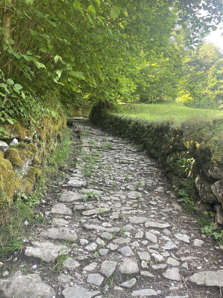
The morning started with mindblowingly beautiful scenery at sunrise along Urnerboden, Switzerland's largest alp. I hiked along and looking down into a deep valley and then eventually plunged the 4,000ft downhill into it. It was a fun, zippy way to start the morning, but my already-tired quads took quite a beating right from the start of the day. By the time I reached the town of Altdorf, it was quite hot and sunny out. The ascent out of town was very steep following an old cobblestone road, and I was sweaty, getting attacked my bugs, and exposed in the sun. From the valley to the pass it was a 6,000ft steady climb, and much of it very steep. Near the top I encountered my first snowfield, which made me quite nervous as part of it went over a raging stream. It was clear that the snow was quite thick and deep going over the stream and not in danger of breaking, but I still scurried across as quickly as I could, feeling unnerved. I worked very hard to get over the last steep bit of snow to the top (Surenenpass), and once I arrived I had to stop, gasp, and crouch over and rest my head on the top of my hiking pole. Another solo woman hiker was at the top having a rest and we were both excited to find each other- another woman hiking the Via Alpina! I thanked her for giving me footsteps to follow in the snow on the way up. The next descent would lead to Engelberg, and from there I had one more pass to climb and about 8 miles to get to Engstlenalp. However, it had been a big day to that point and my legs and body (and mind) were toast. Ending my day early in Engelberg would mean forfeiting my room and payment for lodging in Engstlenalp, it would throw off my plans and lodging reservations for the rest of the hike, and it would put me behind in my FKT attempt, but I really felt like I needed to stop. I stumbled into an inn at Engelberg a little after 5pm and asked if they had any rooms available, and they did. I treated myself to a hot meal of chicken curry and rice for dinner then basically collapsed into bed.
Tuesday 6/27 Day 4 - Engelberg to Grindelwald, 38.7 miles, 10,912ft gain, 10,656ft loss, 3:57am start, 14 hrs 45 min
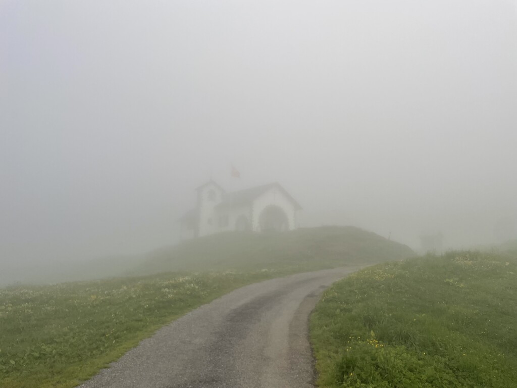
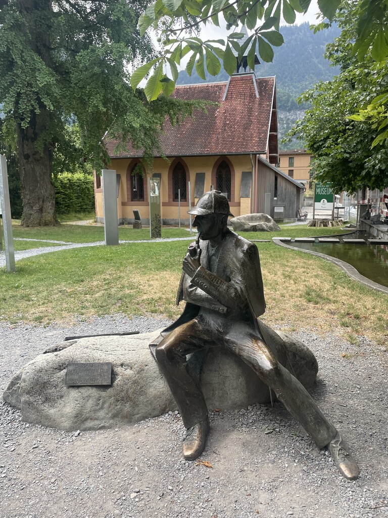
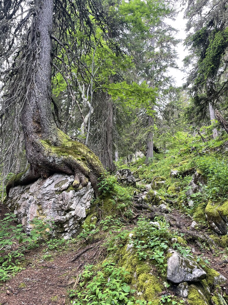
It was a surreal hike from Engelberg to Engstlenap with fog swirling about and passing through an eery, empty ski resort by a glacial lake with no one else awake or around. I walked green ridges with steep drop-offs on either side and snow streaking the mountains around me, and I had the trail all to myself. It was such a neat morning. The terrain wasn't as extreme in terms of steep ups and downs, and I made very good time this day. So much, that I allowed myself to stop at a cafe at the top of a ski lift and sit down for a breakfast of fig pie with fresh cream, coffee, and a Fanta. I was glad that the terrain eased up (relatively speaking) as I felt wrecked from yesterday. I said hello to Sherlock Holmes in statue form in Meiringen before starting the climb up Grosse Scheidegg. I think I was scarred from the difficulty of yesterday's climb, because I kept expecting every other climb to be just as hard. But this one was pretty easygoing- relative term! The mountains seemingly began to rise dramatically around me as I entered a new landscape, getting closer to the town of Grindelwald in the shadow of the north face of the Eiger. I took the luxury of stopping again for a hot carrot soup and grilled sausage hut at a lodge on the way up. Being a Tuesday night I didn't think I'd have trouble finding lodging in Grindelwald, but I underestimated its popularity. A few miles out from town, I ended up dialing up nine different inns before finding one that had availability. They told me I was lucky that they had something, and that it was only a basic room in the back with a separate entrance (my guess was that it was more of an employee room), but I told them thank you and I'd gladly take it. Upon arrival, the hosts asked where I had hiked from that day and their eyes widened when I told them Engelberg, then they started asking more questions and I told them what I was up to, and they seemed excited and wanted to help. They were fully booked for dinner, but managed to squeeze me in. They told me to take my time and go shower/clean up, they showed me where I could do my laundry, and then when I told them how early I planned to leave in the morning, they asked the chefs in the kitchen to make me a takeaway breakfast for the next morning (ham and cheese on the most delicious fresh homemade wheat bread). And they didn't even charge me much for the room since it didn't have all the bells and whistles of their regular rooms. I felt so taken care of!
Wednesday 6/28 Day 5 - Grindelwald to Hohtürli Pass (Blüemlisalphütte), 35.3 miles, 14,816ft gain, 10,459ft loss, 4:04am start, 15 hrs 54 min
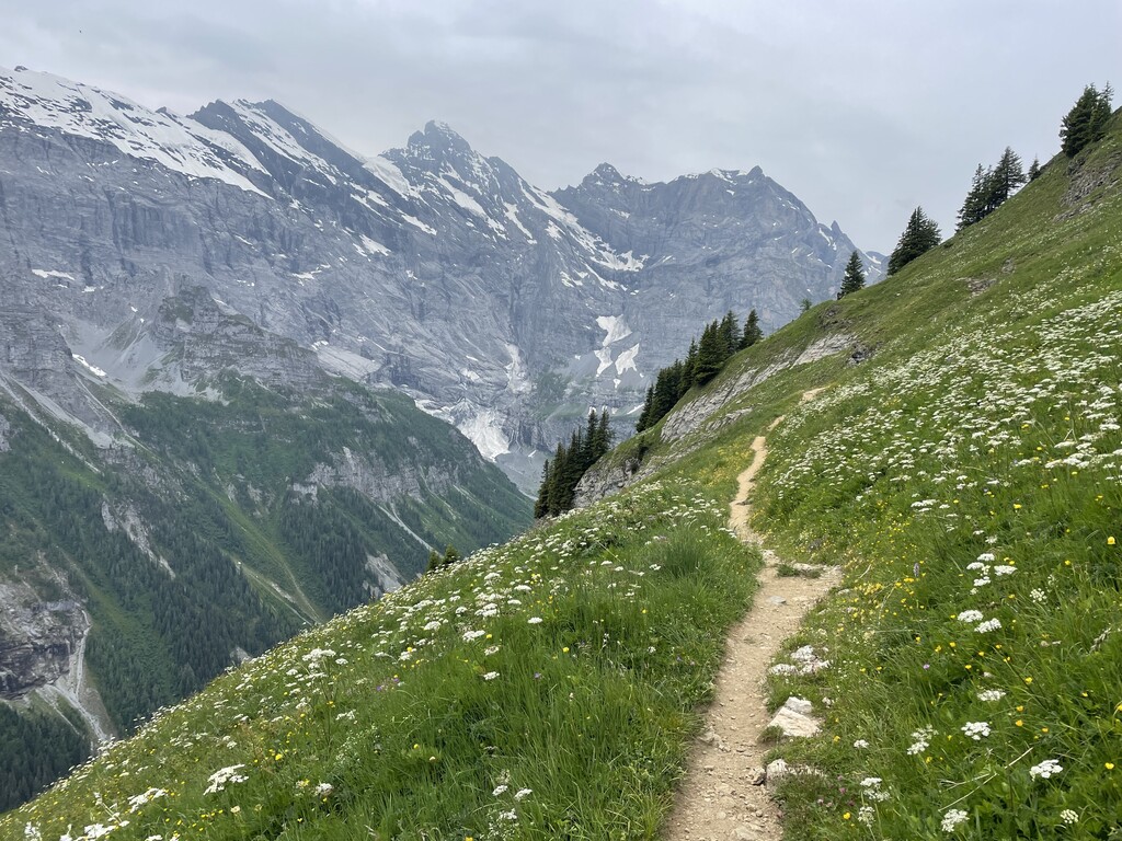
I thought I'd feel amazing today after such a wonderful evening in Grindelwald, but I think the fatigue of the first half of the week was getting to me. I trudged through the morning in a pretty low mood, though I was accompanied by a fantastic view of the north face of the Eiger at sunrise as I climbed out of Grindelwald and up and over Kleine Scheidegg, my first pass of the day. On the way down I stopped at a grocery store in Wengen treated myself to a couple pastries and orange juice and tried to snap myself out of the low I was in. The next section was pretty easy walking along a gravel path next to a train route to the touristy town of Mürren. I was still crashing and dragging, and about to tackle the next steep climb up to Sefinenfurgge. I also felt nervous as this would be my first pass over 8,000ft and I'd heard there would be some snowfields to navigate through on not only this pass, but the next one up Hohtürli at 9,114ft. On paper I thought I ought to get to Adelboden (the next town past Hohtürli pass) that evening, but feeling nervous about the difficult climbs, I emailed the Blüemlisalp Hut, situated at the top of the pass, to see if they had space for a hiker that night. Thankfully, they did! So I had my destination set for the day, but still felt nervous about the conditions getting there.
I stopped at a trendy little café in Mürren for a double espresso and a quick rest before continuing up to Sefinenfurgge. The espresso worked some magic, then as I continued on past the town and up the steep, winding trails with magnificent views of the mountains all around, I found myself in some kind of hiker ecstasy. The wildflowers, the dramatic drop offs, the unfathomable scale of the mountains around me.. my fatigue seemed to just melt away! I found myself chatting it up with day hikers from all over the world, who seemed to be equally entranced by the scenery. I asked two hikers going the opposite direction about the passes ahead and if one could get through the snow okay without special equipment. They said they got through fine and that I would be just fine with what I had. They asked my destination, and similar to the hosts at my inn last night, their eyes widened when I told them that not only was I going to Griesalp (the next town over), but continuing on up to Blüemlisalphütte. They cautioned that maybe I should settle for Griesalp, and that the way would be tough. I believed them about the difficulty, but they didn't know me, and I've gotten sort of used to being told by well-meaning men on hikes what I can or cannot do, and at this point I just nod politely and say thanks and continue on with my plan.
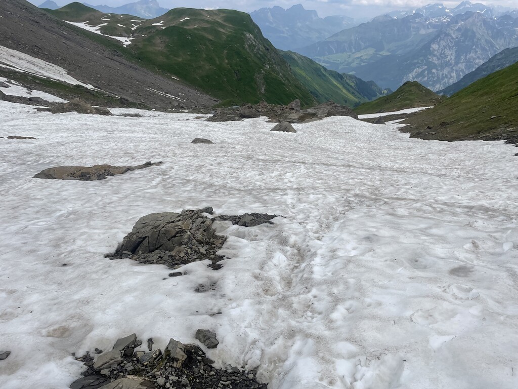
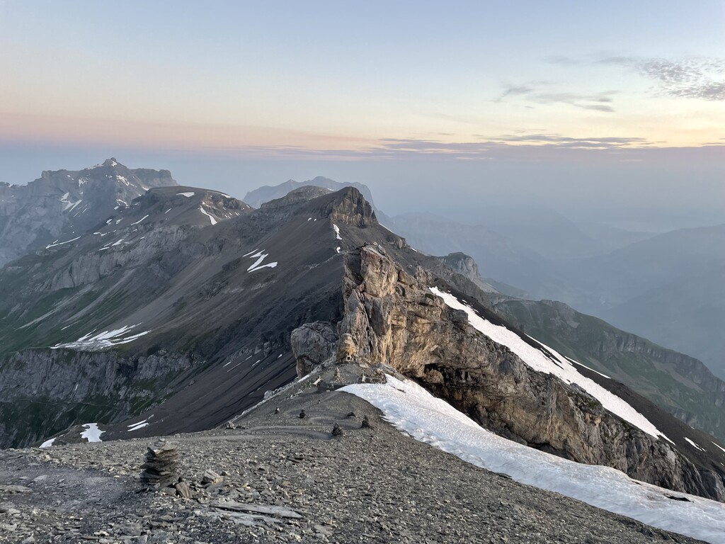
As the hikers said, the snow fields up and over Sefinenfurgge were not bad and I breathed a sigh of relief. I made it to Griesalp in good time, and now in the latter part of the day it was time to tackle the big daddy of Swiss alpine passes and the highest point of the Swiss Via Alpina Trail: Hohtürli! I spent the next few hours doing a solo hike up one of the gnarliest, sketchiest mountain trails I've been on (which isn't necessarily saying much as I'm not exactly a mountain climber to begin with). The trail went seemingly straight up, doing short little zig-zags up the spine of a foothill. I was glad I was going up this thing and not down, as much of it consisted of loose scree and being sure to lean forward at all times, as losing balance and falling backwards could be catastrophic. As I climbed higher I began taking enormous breaths as the air got thinner and the trail seemed to just get steeper. It was a slow climb, and I did hit a few small snow fields as I got closer to the top. Thankfully there were footprints stamped into the snow, and I took care to take big heavy stomps in the snow myself as to feel secure from sliding down. The trail then wound around below a very steep, almost cave-like ledge. I felt as if I were on a volcano in Iceland with hardly any vegetation to be found but for the occasional wildflower peaking out of the scree. The grand finale was a series of built in steps with rungs and ropes built in to hold onto. It was just before 8pm when I reached the pass. I had climbed over 3,000ft in the span of 2.4 miles. Unreal! It took a long time for my breathing to calm down. I felt so tired and proud of myself.
It was another hundred or so feet up to the hut. The caretakers knew I was coming, and they gave me a high five for making it, though I detected that they were a bit cross with me for my arriving after dinner time (sorry). They told me to go get settled in and clean up (there was no hot water or showers, and the lodging is bunk style, similar to the huts in the White Mountains... which were actually modeled after huts in the Alps!), then I made my way back up to the mess hall where they fed me a hearty dinner of soup, some kind of spam-looking meatloaf and grains, and bread. There were some other late arrivals so I had a bit of company and was glad I wasn't the only one shamefully late! I was so tired and out of it, and kept feeling like I was nodding off as I ate. I thanked the hut caretakers and stumbled my way back into the bunkroom to sleep, where we were lined up in bunks like sardines with a person directly on either side of me (though there was a divider on one side of me at least). The heat was cranked up, and with at least ten people in the room, it was a very toasty evening. I had a bit of a headache from the altitude, and was sweating all night in the heat.
Thursday 6/29 Day 6 - Hohtürli (Blüemlisalphütte) to Lenk, 28.2 miles, 6,802ft gain, 12,343ft loss(!), 5:30am start, 12 hrs 4 min
Though I like to start my days earlier around 4am, I felt nervous about descending the mountain in the dark as I wasn't sure of the snow conditions. There were two breakfast time options: 3:00am or 7:00am. 7:00am seemed too late, so I woke up for the early breakfast, as did a group of rock climbers, and I spent the next couple hours cradling several cups of coffee refills and charging all my electronics, since the few outlets available were taken by other hikers the night before.
Sleeping at over 9,000ft in elevation in the heat didn't do wonders for my recovery following a tough day with the two biggest climbs of the trip. It was plenty light out by the time I got started; I think I let my fear of going down the mountain get the best of me. I wasn't completely out of line in my fear though. I made a terrible mistake very early into the day. I followed some built-in wooden steps down a steep part of the mountain, but somehow missed a blaze indicating to turn left at the bottom of the steps. It appeared as if the trail continued to go down, so I followed the "trail" on down the mountain. The terrain consisted of loose scree and became increasingly steep. I felt perplexed as the trail had been relatively user-friendly to this point, and this seemed to be quite a technical descent. Then it dawned on me that I might no longer be on the trail. I planted my feet, looked up behind me, consulted my map, and sure enough I had gone off trail in a dangerous fashion. My heart started to pound, my body started shaking, and I tried not to panic. I now had to scramble back up very loose scree back to the steps to safety. I looped my one hiking pole around my wrist and plunged my hands into the scree, staying on all fours and leaning forward as to not have a catastrophic fall. In the thin air, and climbing upward, and likely from nerves as well, my breathing became labored. In just a couple minutes I was back on the stairs, shaking, upset, and feeling very stupid. My hands and legs were covered in charcoal-colored dirt. I had plenty of water so took some time to pour water on my arms and hands and clean myself up a bit. From there, I followed a much more (relatively) nicely graded trail down the mountain. There were some more snowfields and scrambly bits, but those seemed like no big deal after what I'd just experienced. It was a harrowing way to start the day.
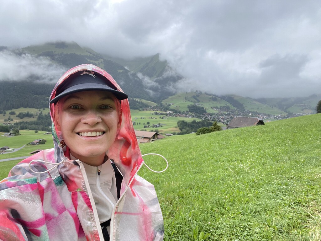
After getting through the steepest and most technical part of the descent, I had a nice long gradual descent to the next town of Kandersteg with a pretty view of a big glacial lake. I'd taken care to eat well that morning, knowing how fatigued I was. However, I think the altitude and heat of the bunkroom did a number on my body and I was not feeling well. Upon leaving Kandersteg, my stomach lurched and after funny-walking for a bit I quickly ducked into the woods and pulled down my shorts just in time to avoid having a nasty accident (sorry TMI!!). My body was not handling well what it had been through. It made me a bit nervous of how the rest of the day would go. Somehow though, I think "getting it out of my system" was exactly what I needed to feel better. I ate cautiously after that, and thankfully my body handled food okay for the rest of the day. After that I made very good time up and over the next pass to Adelboden. There were quite a few people out (not normal- most of the time I had the mountains to myself!) and I had some nice chats with other hikers throughout the day. Their destination was Adelboden, but I hoped to make it over one more pass beyond that to Lenk. There were storms forecasted for that afternoon, so I was motivated to hustle- the last thing I wanted was to be caught in a storm above treeline.
I hit a construction reroute in Adelboden and ended up having to backtrack and take a different way out of town. Aware of the impending storms, this made me nervous, and I hustled uphill as quickly as I could, essentially paralleling a ski lift line to the top of the pass. The skies had become overcast and some dark clouds were looming, but I made it up and over. On the descent to Lenk, thunder began to rumble and the skies opened up just as I was getting back down to treeline. Lightning flashed and the storm quickly rolled in and before I knew it, it was right above me! Thunder boomed, lightning crackled, rain poured, and I hightailed it down a ridge of powerlines, with the town of Lenk below me in the distance. It was completely exhilarating, and I was so glad I was well below the mountain pass. I made it to Lenk just after 5:30pm and was grateful for an early evening. I had not planned to go further, knowing the stormy forecast into the evening. Lenk is not a big town and I saw the grocery store was closing soon at 6:30pm. I took a quick shower, hightailed it to the store to pick up my breakfast, lunch, and snacks for the next day, then visited the only pub open for a locally sourced cheeseburger with fries and a weissbier. Yes, this was all quite a luxurious way to go about a self-supported FKT attempt!
Friday 6/30 Day 7 - Lenk to Château-d'Œx, 30.5 miles, 7,733ft gain, 8,071ft loss, 5:37am start, 11 hrs 40 minutes
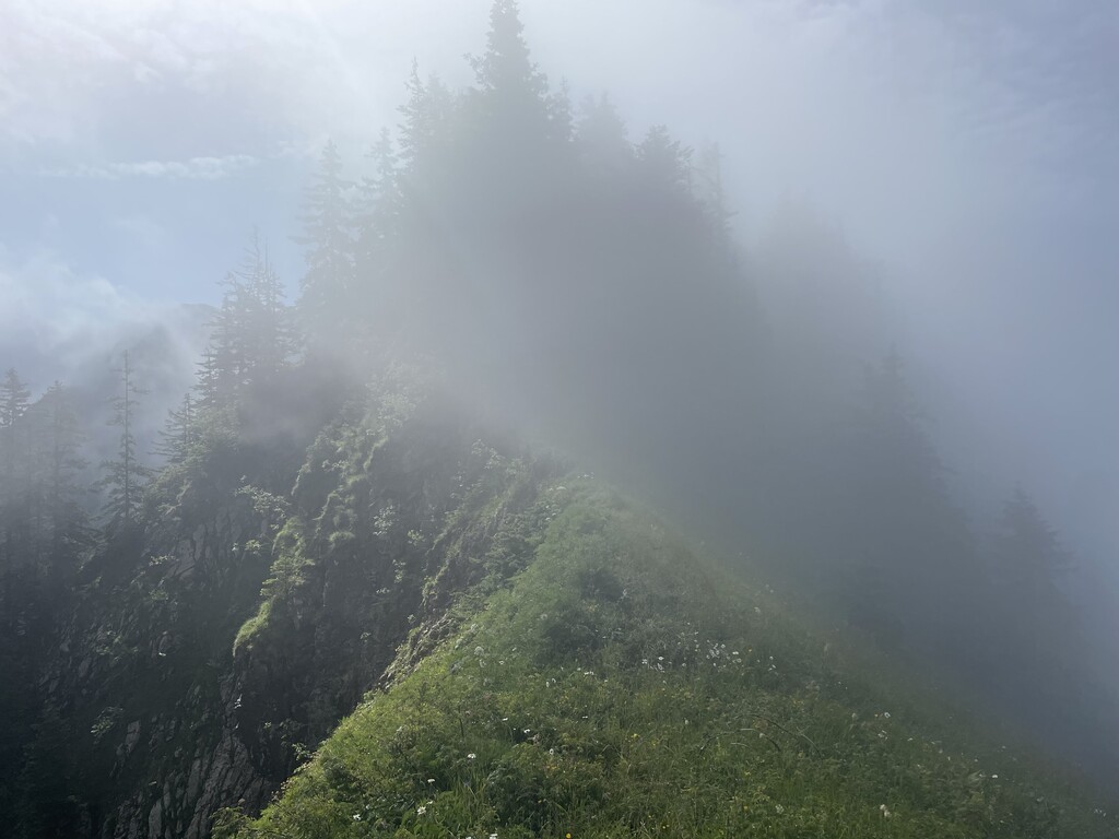
I had been dreading this day all week, as 100% chance of heavy rain had been predicted. I thought about even making it a "zero" day as I imagined how miserable it might be. I figured any miles I could get in today would put me in a great position for my last day tomorrow (Saturday), as only 57 total miles remained between me and Montreux. I could do no miles today and still finish by Saturday evening. I started luxuriously late past 5:30am after a full night of sleep. It was the first morning in a bit that I truly felt nicely recovered. To my surprise and delight, it was foggy and not raining. In fact, most of the day ended up being foggy and overcast with barely a sprinkle of rain. The weather in the mountains can be truly unpredictable, and in this case that held true to my advantage. I couldn't believe my good luck. And it just goes to show that it can be a waste of energy to worry about things in the future you have no control over. I had been dreading this day all week due to the forecast, as I said. Then it ended up being quite pleasant and beautiful. The terrain was easygoing compared to previous days. Over the pass from Lenk to Gstaad I felt as if I had been transported back in time by hundreds of years, as any sign of modern technology or architecture disappeared with only old farms and huts dotting the landscape. I got over both passes of the day without issue, and only on the mostly flat five mile river walk at the end of the day did it start to rain. However, it was a warm rain and I had plenty of layers, and it was really quite relaxing and pleasant. Who would have thought the day would go so well? I took a shortcut into Château-d'Œx as the most direct way to get to the inn I had booked a stay at. What I dumbly didn't realize was that if I had kept following the actual Via Alpina trail, it would actually literally go right by the inn. This would have been easy to see, but I didn't want to get my phone out while it was raining to check. So basically I had set myself up for an extra mile of walking the next morning to retrace my steps back to the trail, only to walk by the exact place I had stayed at the night before. It was so silly. And of course being an FKT and maintaining the integrity of hiking the entire trail, I did indeed backtrack the extra mile back to the point where I'd left the trail the next morning.
Saturday 7/1 Day 8 - Château-d'Œx to Montreux, 26.6 miles, 6,575ft gain, 8,415ft loss, 4:14am start, 8 hrs 10 minutes
Despite being "crunch time" and my last day on the trail, I felt pretty relaxed this entire day! I had plenty of time to cover the 26 miles to Montreux. Tina's record stood at 8 days, 5 hours, and 26 minutes. I had started last Saturday 6/24 at 12:52pm. If I finished by 6:18pm this evening, I would lower the women's FKT by a full day. I thought if I wanted to get really wild, I could get up early and hustle to get to Montreux before 12:52pm, breaking the seven day barrier. However, I wasn't feeling that hardcore about it and preferred getting a decent amount of sleep and just being happy with finishing Saturday evening.
As the morning got started though, there was an uncanny amount of road walking and downhill, making it quite easy to run. I hadn't really planned to run, but why not? I felt good and it was my last day. So I shuffled along all morning, the miles clicking by, and made great progress. The climb up toward the very last pass of the trail, Rochers de Naye, was mostly forested, but it was quite wet from the rain and had some very steep drop offs. I took care on these parts, going more slowly than I probably needed to, but I didn't want to take any chances of slipping, or taking a wrong step on eroding dirt and plummeting down off the side.
Once above treeline, I followed farm trails and roads up toward Rochers de Naye, and then was treated to the most beautiful, lush, green ridgewalk with wildflowers, views of Montreux and Lake Geneva down below, and mountains all around. It was the scenery I had daydreamed about that had enticed me to do this hike at all. I felt like I was in a fantasy world, like some beautiful fictional universe engineered by a video game designer.
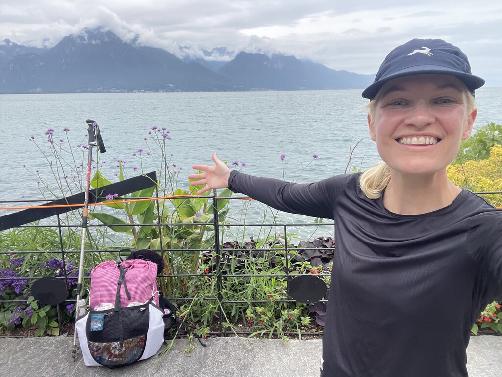
From the top at Rochers de Naye, it was around 10:30am and I had about 15 kilometers to go. Keeping a keen eye on the time, I thought "if this trail is runnable I could finish before 12:52pm and break seven days!" The trail, in fact, was a wide, user-friendly path most of the way down. Feeling excited and motivated to complete the Swiss Via Alpina in under a week, I took off and started running. It was a long, long way down with over 5,000ft of elevation loss. Not friendly on the feet, knees, or quads! I was so full of adrenaline though that nothing hurt. From the more mountainous part, the trail then dipped into a little gorge and rainforest with a beautiful waterfall, then popped out into the narrow cobblestone roads and pastel painted homes lining the streets of Montreux. The closer I got to the lake, the more crowded and touristy the route became. The route even dipped in and out of the train station to go under the tracks, before spitting me out on the other side just down a couple more blocks to the lake. It was chaotic with tourists everywhere, street musicians blaring, and vendor tents set up everywhere. It was like a sensory overload! I passed by the very last sign with a green square for "Via Alpina 1", touched the fence by Lake Geneva, and stopped my watch at 12:24pm. Only 28 minutes to spare before my "week" was up! I did it! Feeling completely delighted, I snapped a few photos and took a video, then sat down and enjoyed the satisfaction of being finished having one last afternoon in Switzerland... before taking a four hour train to Zürich and flying home the next morning. I wouldn't have it any other way!
Totals by my watch (including reroutes, wrong turns, etc.):
265.5 miles
72,853ft elevation gain
77,753ft elevation loss