This is a fun loop and an excellent introduction to the Sawtooth Wilderness.
There hadn't been a women's time posted, although I saw a Strava time of 5:27. It's unclear to me what style she ran, while I was going unsupported, but I figured I should aim to beat that time just to keep things clean.
Funny timing, a woman named Ainsley posted a comment about running the trail two days before my attempt, but without style/time info so I didn't have anything to go by.
Regardless of FKT outcome, this looked like a perfect place to explore. And it surely is beautiful! Such variety in only 20 miles, plus the accomplishment of circling a mountain.
John and I drove up from Twin Falls, with a brief delay for EV charging (another story) that got us to the trailhead a bit later than planned. No matter, there was plenty of parking and the weather was fine throughout the day. He took off on his own adventure while I started my FKT quest.
For sure, I carried way too much weight in my pack. We're fresh from a Yellowstone adventure, so the bear spray seemed logical, but really not needed. A rain jacket seemed prudent for a backcountry adventure (just in case), but I didn't realize how many people would be wandering around the middle portion of the loop.
And there is a lot of water flowing - I should have carried a filter bottle instead of all the water in my Camelbak. Perhaps the situation changes later in the summer when there isn't all this snow melt.
Anyway - good training!
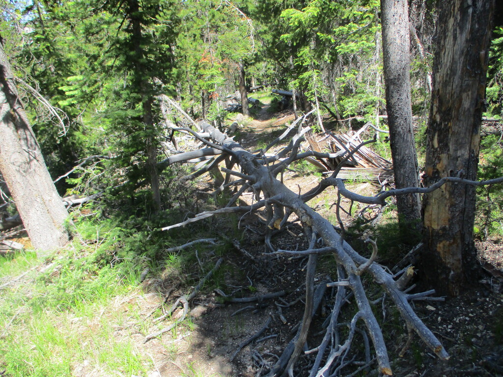
With my time goal in mind, I moved with purpose and hustled past people along the easy boardwalk. I made a note of my time at the split onto the Alpine Way trail (just under 16 minutes), which came in handy later. Immediately the downed tree challenge began. The whole Alpine Way was littered with them - nothing too big or completely blocking the trail, just extra work stepping over trunks or walking around.
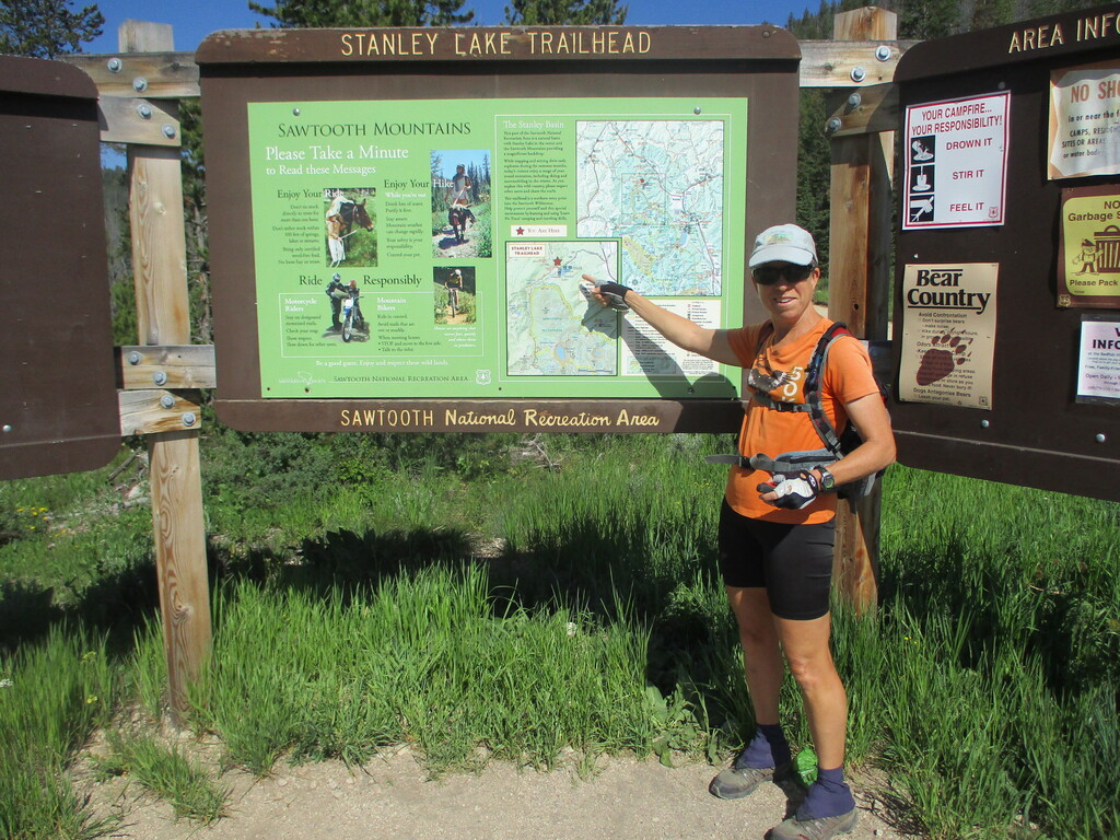
I found the permit box and quickly wrote out my deets. Having one of these ready in advance would be a benefit to scouting this route!
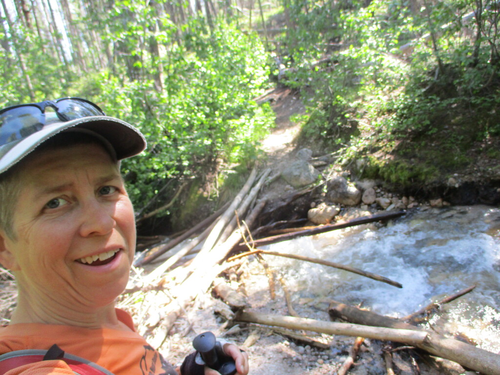
Then there was a creek in front of me. Hmm, there was also a little trail heading along it, maybe to a bridge? No, only some logs across it. I pulled out my phone and verified that the trail goes directly across (back where I first hit the creek edge). Creek crossings, got it! I had not read anything about getting my feet wet, apparently Idaho folks don't think anything of it. So I wasted a couple minutes there.
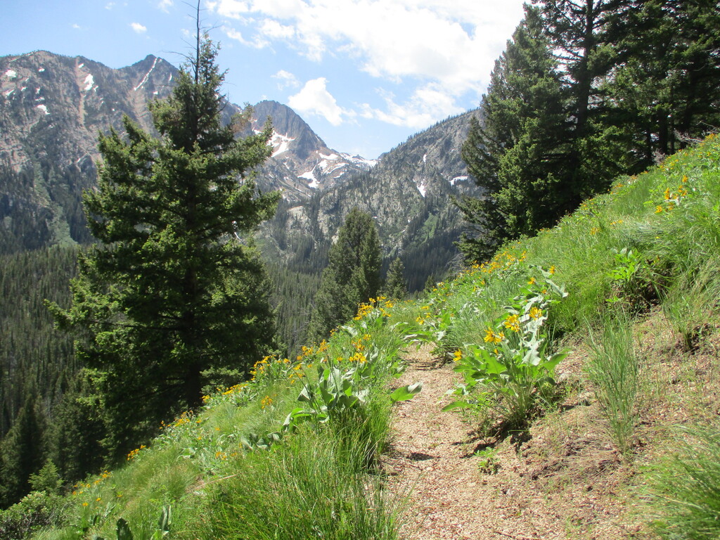
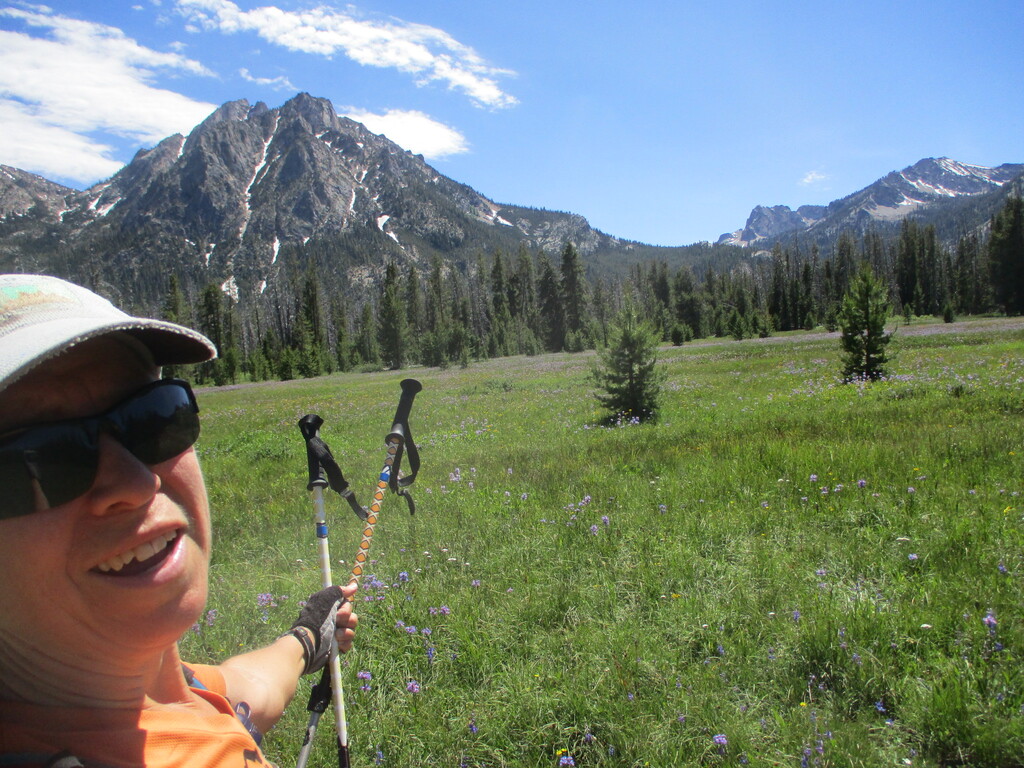
Time to climb, heading up along a traverse toward a saddle. Lovely trees and shade and an occasional view of the mountain. It was fun seeing McGown Peak and Mystery Mountain from all different sides.
More tree hopping. Down the other side of the saddle to find more creek crossings. Sometimes I found logs or rocks but mostly I waded through. I was happy to have poles to make everything easier.
At one creek with an extra tight trail through bushes, I called out "go bear go!" (just in case), splashed across, and found a group of guys having lunch on the other side. Good morning, just ignore the crazy woman passing through :)
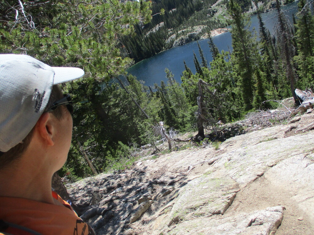
I hoofed it over another small saddle, along a narrow traverse, and down to an intersection where the crowds started. I had not realized that Alpine and Sawtooth Lakes would garner that much attention, and as I got up to them I could see why. So pretty!
I checked the track on my phone a couple times to make sure I was on it. After crossing the Sawtooth Lake outlet, there were a couple little snowfields over the trail. I kicked steps across the first one and detoured around the larger one. Happily the traverse above the lake was clear, no issue reaching the saddle higher up.
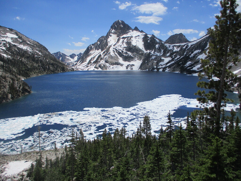
Oh, and how much snow did they get here last winter?? It amazed me to see so much still remaining on a south slope with full sun. There was even some ice left on the lake. Gorgeous.
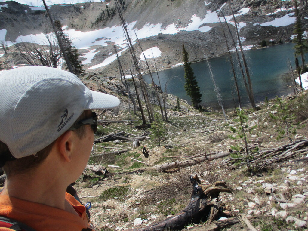
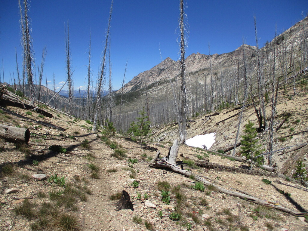
Over the top and through the burn area. Snow patches and the return of the downed trees slowed me a bit. Both at the same time caused me to lose the trail briefly. More water crossings (so much water!). And that trail, winding all over the place and up and down for no apparent reason. It sure could be frustrating for anyone in a hurry.
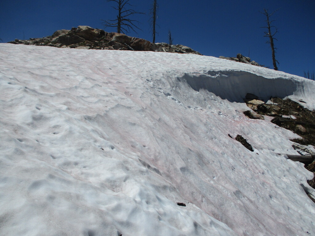
Up a hill - ? - I verified on the phone that yes, this is the right way. There was a small cornice at the top, easily avoided. And finally, downhill for real. My legs were feeling a little tired, perhaps not completely recovered yet from Bighorn.
I suspect a crew of mountain bikers built this next piece of trail, with the long gentle switchbacks that could have taken a more direct downhill path. Well, gotta get those miles in one way or another.
After the intersection with Observation Peak trail (at right about 4 hours in), it was a straight shot in the right direction. Except for stepping over trees, dealing with a rocky trail, and dropping through multiple tiny drainages. Gotta go, gotta go. I had no idea exactly how many miles I had left and whether I had a chance to beat my time goal - my bad for not calculating this in advance.
Finally the trail crossed the creek and turned into something much more runnable, as I had hoped. Nothing to do but run. I caught a glimpse of Bridal Veil Falls to the left, very pretty (tried to take a picture but got only trees). Making progress, but how far to go? Still no people on the trail, why no people? There had been plenty of people coming up from the trailhead when I started.
Ah ha, there's a wide creek crossing - that's why no people. I speed-walked up the little hill to finally find a family playing just off the trail. Still no idea how far I had to go, just hoping to get to the Alpine Way junction with at least 15 minutes to finish it up.
Down the next hill, a hiker asks "Is there an overview up there?" Ummmm, I shrugged and kept running.
From the hills around me and the flatter trail, I thought I was getting close. I realized I hadn't seen a Wilderness Boundary sign or a permit box in this direction, so I started hoping for one of those. Then there was a sign - it was the Alpine Way, at 5:07. Sweet! Finally an idea that my goal was possible.
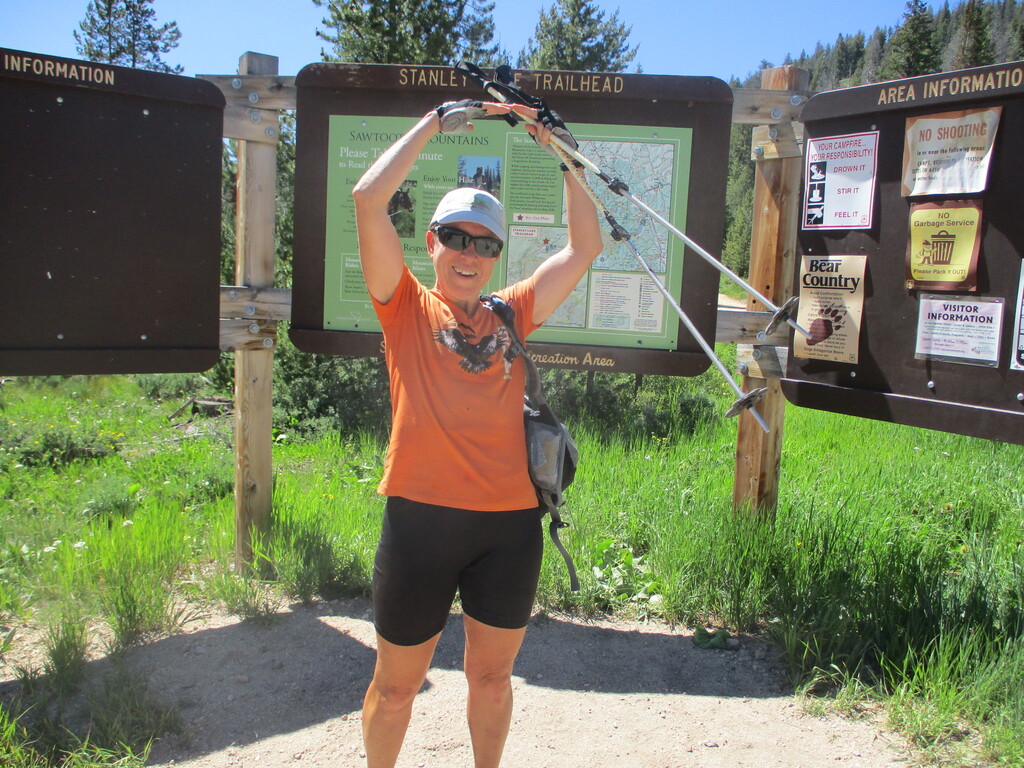
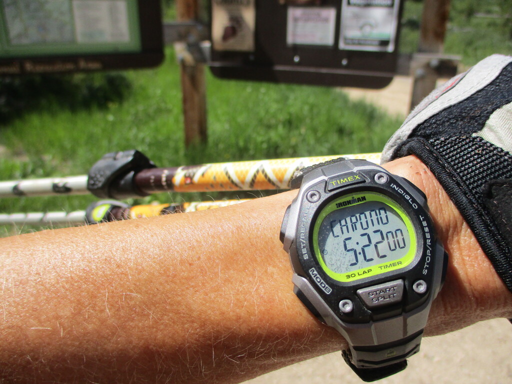
I kept running, with some speed-hiking thrown in up the final little climbs. Turned onto the road and came in at exactly 5:22. John had just arrived back from his walkabout, so we took a couple quick photos and then jumped in the truck to escape the mosquitoes.
That was super enjoyable, a wonderful tour of the mountains, lots of different terrain, and such amazing scenery. Thank you to Benjamin for putting it together.
One other thought - I propose a name change to "Arown McGown" :)