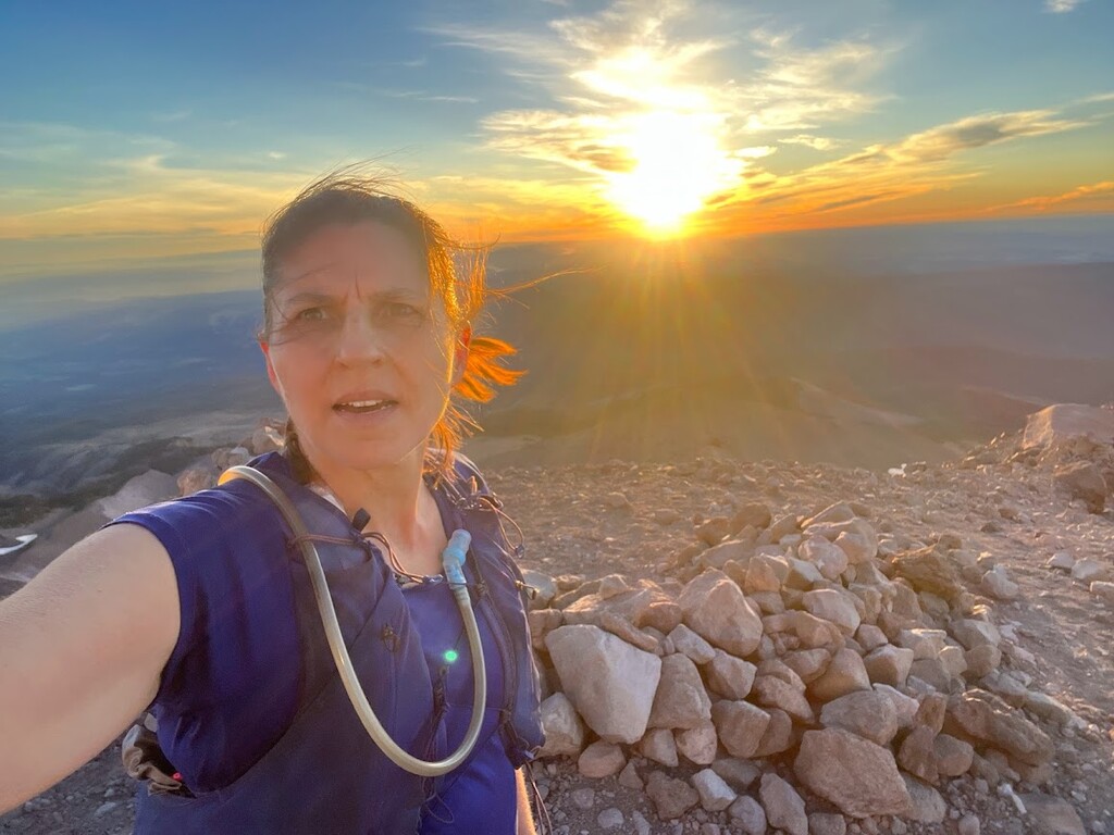
I had quite a day on the 4 Point Traverse. I slept at the trailhead in my car near Cooper Spur Ski Area so I could get an early start. On this day, I started up the trail at 3:38 AM. Cooper Spur was pretty straightforward and I topped out at Cooper Spur, my first point, right at dawn. Got my photo and headed back down to Timberline Trail.
Things continued smoothly until I got to where the Barrett Spur trail was supposed to be. I have been here before, but not for several years and I didn’t see where the trail took off. You can see from my GPS track where I ran back and forth looking for it. After 20 minutes of looking, I decided more looking was not the best use of my time and I would take the more westerly trail for both ascent and descent. When I got up higher, I saw where the 2 trails join, so clearly the more easterly trail still exists. Ah well, next time I’ll know better. The Barrett Spur scramble was the most technically difficult of the 4 points and I was very glad to be headed back to Timberline.
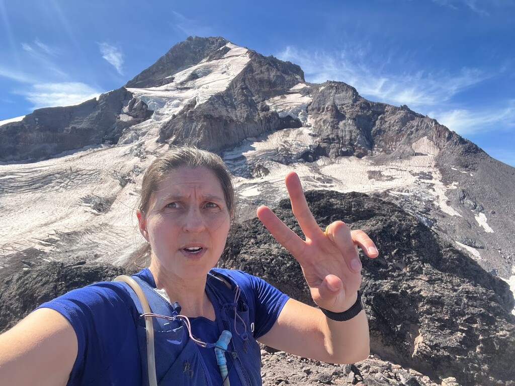
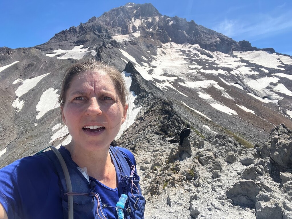
No problems getting to McNeil point, though that was the busiest section. Lots of company from day hikers. In the photo you can see the bold raven hanging out just behind me on the ridgeline.
After McNeil point there is a choice of routes. The shortest option is to stay on Timberline all the way to the Yocum Ridge turn off. However, in 2021 there was a big blowdown between Muddy Fork and Yocum that has not been completely cleaned up. Officially, the trail is open, but everyone I talked to who had been through said it was likely quicker to take the slightly longer alternate route down Top Spur to the PCT, which was what I chose to do. The male FKT holder, Steven "Aria Zoner" Thompson, also took the Top Spur alternate when he did it in 2021. This alternate was some of the easiest running I had all day!
Heading up the PCT toward the Ramona Falls Trail, my watch beeped that it was low on batteries. No problem, I expected this and switched to my phone GPS. I’ve successfully used this combo in the past FKTs lasting up to 20 hrs. Notably however, this time I did not have my phone in battery saver mode all day. (Cue the ominous music.)
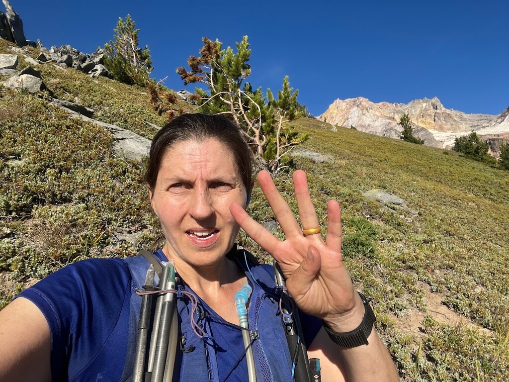
Yocum is an absolutely gorgeous ridgeline, but I was starting to feel a bit gassed and didn’t get the enjoyment out of the views that I usually do. Also, I had not calculated my food properly and was running low on calories, which did not help things.
I continued up to the end of trail for Yocum Ridge- a sort of level spot at about 6800’ where a hiker was setting up a campsite. Beyond this there wasn’t any cohesive path continuing up the ridge. However, the FKT route description said the ‘end of trail’ was at 7000’. Reality on the ground was not matching up with the described route. For the first 3 points the end of the trail was super clear with a ridge that dropped down notably after the ‘point.’ Yocum Ridge doesn’t seem to have the same kind of ‘point.’ So it’s a bit difficult to tell what counts as “the end.” There are 3 possible ways to interpret the route description:
- “Turn around at end of the Yocum Ridge Trail” - The trail petered to nothing at approximately 45.37843, -121.73299 decimal degrees and 6800’ elevation. There was no track, not even a faint one, to follow up any further. The end of the trail is a thing that you can find on the ground when you're there and know when you're at it.
- “Turn around at 7000’ elevation” - You can keep scrambling up the ridge past the end of the trail. The only previously accepted FKT on this route was from Steven “Aria Zoner” Thompson who seems to have done this. It looks like he turned around at an unremarkable spot in the middle of the ridgeline. It seemed a bit difficult to make the case that this is a ‘notable feature’ as required for all FKT routes. That said, it does match the elevation listed in the route description.
- “Turn around at a knob above 7000’ elevation” - Between the maps and what I saw on the ground, there may be a rocky knob at about 7200’ elevation. That said, from below it looked like a slightly larger rock pile, which again, doesn't really seem like a notable feature.
After scrambling a little past the end of the trail to about 6900’, I looked up to where Mr Thompson seems to have turned around. As I noted above, it was well beyond the end of the trail and didn’t seem to stand out much from the rest of the ridgeline. It felt fairly pointless to scramble up the rocks to some different random spot on the ridge. Additionally, elevations in the FKT route description had been consistently listed as higher than what my GPS was showing. (Cooper Spur elevation FKT route description 8899’ vs my GPS at 8780’. Barrett Spur elevation in FKT route description 7800’ vs my GPS at 7720’. McNeil Point elevation in FKT route description 6900’ vs my GPS at 6830’.) If elevations from my watch were running a little on the low side at the other ‘points’ it stood to reason that the end of the trail at Yocum would similarly be a little lower than the 7000’ suggested in the route description. The ‘end of trail’ feels like a more reliable guide than the elevation, which not all GPS devices measure the same. There was nothing resembling a trail that existed on the ground past about 6800’. Given this, I felt like there was a strong argument that definition #1 is the most reliable and repeatable standard to follow. As I had clearly reached that standard, I took a photo to document point 4 and headed down to finish the run.
With my 4 ‘points’ completed I just needed to head back down to the Ramona Falls parking lot. Even though it was all downhill, it was getting to the end of a very long day and I was tired. As I headed down I started getting beeps from my phone that it was running low on batteries. I realized I should have had my phone battery saver mode all day but too late to fix that now. I was so very close to the end that I just crossed my fingers and hoped that it would last long enough. It did not. Near the junction of the Ramona Falls Trail and the PCT it totally gave up the ghost and shut down. I still thought that I was going to have solid verification for the whole run because I was carrying a spot tracker, which should get me enough info to verify the finish. Also, my husband was meeting me at the end for my shuttle, so I could have him take a time stamped photo on his phone. Finally, my watch still had a tiny bit of juice when I turned it off. Maybe the watch could last the last 2 miles? No such luck. The watch didn’t even last a ½ mile. Nothing for it but to use the Spot tracker info. I still had a bit of twilight to help find the crossing at the Sandy River. From there I cruised down, eager to see my husband and eat all the food. I was pretty excited about how the day had gone and was ready to share all the ups and downs.
I got to the parking lot and… no one was there. There were some cars, of course, all locked with no one inside. Ok, no time stamped photo to mark the end. I pulled off my pack to grab my Spot Tracker. My spot tracker had also run out of batteries. There was a kiosk where you could purchase a NW Forest Parking Pass and I had a credit card, so maybe I could buy a time stamped parking pass to verify my finish? But no, the kiosk was out of order. This is where I nearly lost it. I had no food, I had no ride, I was so very tired, it was dark, and I was entirely alone. I pulled myself together and walked down the road in hopes of maybe finding campers who were awake??? Very fortunately, I found some campers still up and moving about a ¼ mile from the parking lot. The campers very kindly shared some of their leftover dinner with me and said it was about 9:15. Not long after, my husband drove up- he had checked for me at a different trailhead because, after getting messages about the spot tracker being low on batteries, he worried that I hadn’t completed the route and had bailed.
A friend pointed out that it must be a good adventure if you run 3 devices out of batteries! However, not all excellent adventures are FKTs. If it is an FKT, it needs verification. You can see from my 3 strava tracks that I did have a GPS track for all but the 1.5 miles of a nearly 50 mile route. By the time all my devices conked out near the jct of the PCT and Sandy River Trail, the only reasonable place for me to finish would be the FKT finish at Ramona Falls TH. My last bit of watch recorded 0.4 mi at a 15:14 min/mile pace (8:29 PM to 8:35 PM.) The last 2 miles are wide, well-traveled and not very technical, so it is reasonable that I would hold a consistent pace though there. Assuming I held exactly that pace, the last 1.6 miles would have taken me 24:22. 8:35 PM + 25 min = finish at 9 PM or 17 hrs, 22 min. (I was super excited to get back to food, so I was likely faster, but there’s no way to prove that.) Since I can’t absolutely verify my finish time, I think it is appropriate to err on the side of caution and assume I was slower than what the math says. Therefore, I’m claiming 9:15 PM as my finish time, or 17 hrs, 37 min. This is the time reported to me by the campers - after I’d wandered around the parking lot, messed with all my gear, and had a small cry - and affords generous time for slowing in the last 2 miles.
I carried all the food with me that I ate and filtered water from creeks.