
Landmannalagur to Skogafoss; The Laugavegur and Fimmvorduhals Trails (Iceland)
“The Laugavegur Route is a mind-blowing, multi-day overland route in the highlands of Iceland. On this
point-to-point hut adventure you'll follow singletrack through a multitude of landscapes including
geysers, multicolored rhyolite mountains, bubbling mud, endless lava fields and glaciated mountain
vistas.” – Trail Run Project
This trip was a spur-of-the-moment decision to celebrate Rosalinda’s (my wife) birthday abroad.
Obviously I immediately looked for cool places to run. I found this route and thought of running the
southernmost portion while we were staying nearby. Because Rosalinda is amazing and always supports
my crazy adventures, she was like why not do the whole thing?
I originally planned the run at the beginning of our trip. We would land on Aug 6th, I would run on the
7th, and we would start our drive around the island on the 8th. Following bad weather and a 24hr flight
delay in Minneapolis, we finally landed on the morning of the 7th. It looked like my adventure was
canceled, but like I said, Rosalinda is amazing. With last-minute rescheduling, including an additional 5.5
hour drive to the trail head, the run was back on!
I will break down this route into sections based on the huts / camp sites along the way.
10:40
Landmannalagur to Hrafntinnusker – Miles 0-7
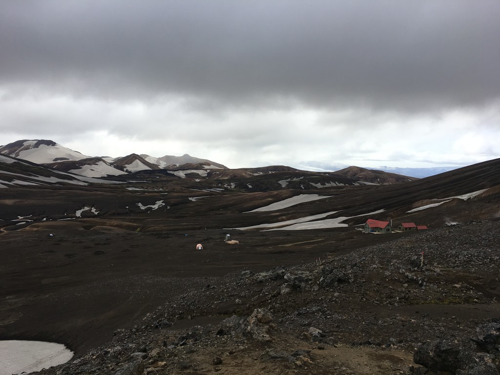
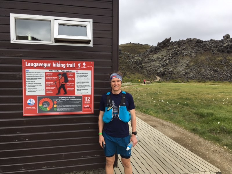
After a winding drive through lava fields and river crossings, we arrived at Landmannalagur.
Landmannalagur is both the Laugavegur trail head and a basecamp for hikes in this region. I quickly
changed and made sure all of my gear was in place. Since I was attemping the route unsupported, I had
about 8.5 pounds of food, gear, and water at the start.
At Landmannalagur, it was 40 degrees and windy. This section starts around 2000’ and is highlighted by
volcanic activity, multicolored mountains, and the smell of sulfur. After a short steep climb around mile 1,
the trail slowly works it’s way up to the high point around 3500’ at mile 6.5. This section was steadily
getting colder and windier, but I was in such awe of everything around me, I didn’t give it much thought.
This was the most populated part of the trail. I got strange looks since I was the only person not wearing
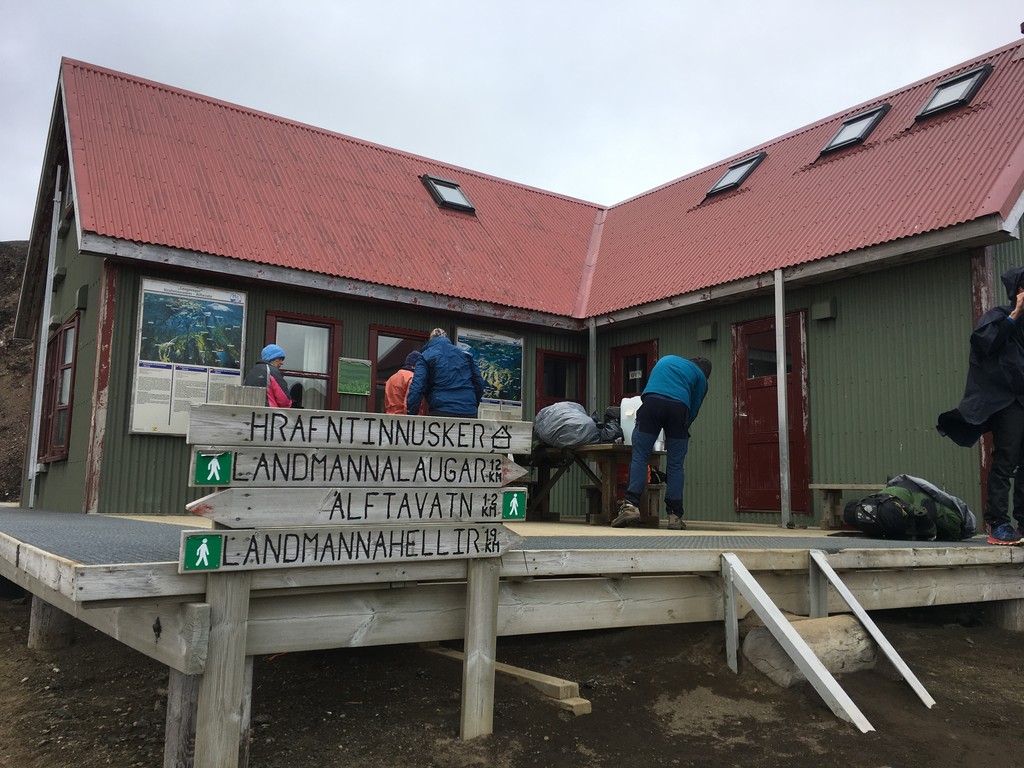
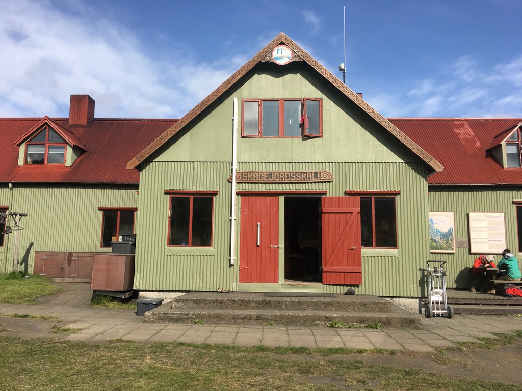
long pants and a parka. Shortly after the summit, the first hut (Hrafntinnusker) came into sight.
11:55
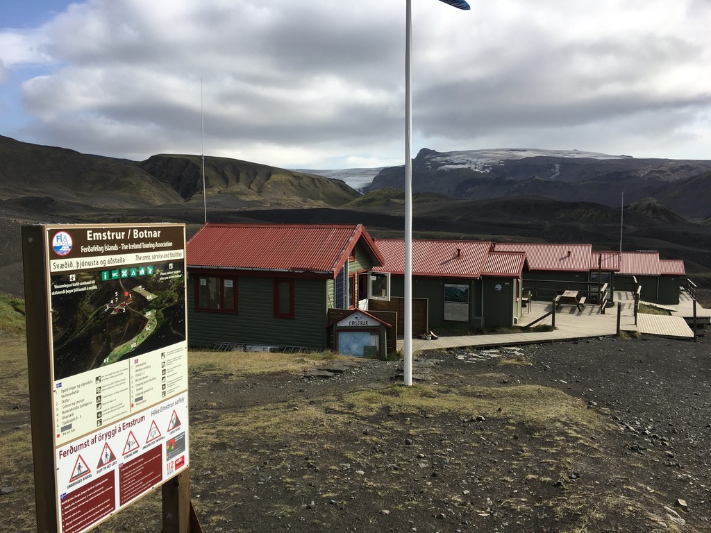
Hrafntinnusker to Alfavatn – Miles 7-13.5
For the next 2 miles, the trail crossed high rolling lava fields carved out by glacial melt. The frequent
small ravines made it hard to keep a rhythm, but the trickling streams fed vibrant green moss that
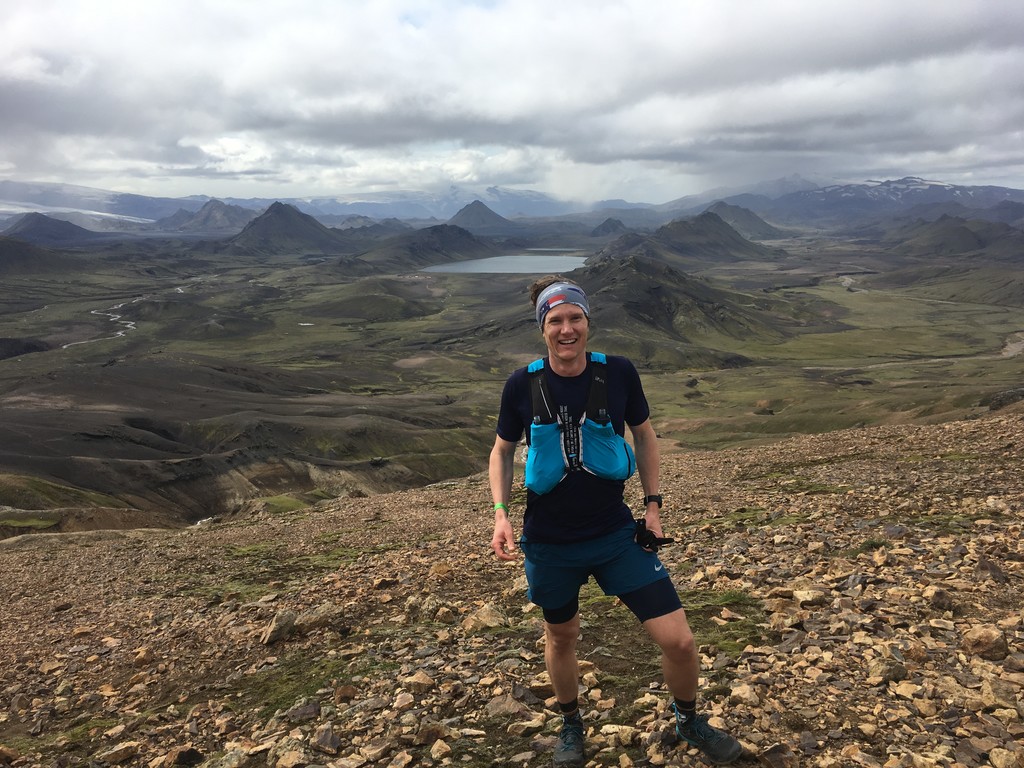
contrasted the dark landscape. There was a short climb before the steep 1200’ descent into the lowlands
where Alfavatn sat by a beautiful glacial lake. This descent, covered in loose gravel and rock, was more
of a controlled freefall than a run. The hikers on this section cheered me on as I managed to slip and slide
my way down without landing on my face. I did manage to stop long enough for kind folks take my
picture with the incredible backdrop of the valley below.
At the bottom, I managed to cross a small river without getting my feet wet. Then had a relatively flat and
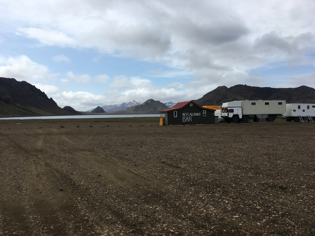
smooth 1.5 miles where I tried to make up some time. Once at Alfavatn, I was a little bit confused
because multiple trails led out and I could no longer find the red and white blazes I had followed to this
point. I found the hut’s warden who told me to follow the blue blazes from here. I refilled my bottles and
texted Rosalinda before moving on to Emstrur.
13:10
Alfavatn to Emstrur – Miles 13.5-24
After a short climb out of Alfavatn, I met “Trail Dog” who joined me for my first true river crossing of
the day and kept me company for the next 16 miles! Together we ran up and down small hills for 2.5
miles, and crossed another river (holy forking shirtballs these rivers were cold) before entering a basalt
desert.
The basalt desert was vast and flat with stunning views in all directions. Over the next 7ish miles it was
easy to keep a rhythm as long as I could stop myself from taking pictures every couple of minutes. Easier
said than done. Over the course of the day I limited myself to 174 pictures and 2 videos. Beyond the
desert was a short descent into Emstrur around mile 24.
14:53
Emstrur to Thorsmark – Miles 24-34
Not far beyond Emstrur was a steep descent and climb to cross a valley carved out by the Emstrur River. I
am happy to say that there was a foot bridge spanning the raging water. This was followed by 3.5ish miles
of easy running on my way down to the last 2 river crossings of the day. Before reaching the first of these
two rivers around mile 31, Trail Dog and I came across a few sheep. Being a border collie, his instincts
kicked in and he began herding them to me. Watching him work was one of my favorite parts of the day.
He ended up cornering the sheep, was intensely focused on not letting them go, and this is where we
parted ways. I crossed the first river and then the valley of the Pronga River, before making my way down
to Thorsmark at mile 34.
16:45
Thorsmark to Fimmvorduhals Huts – Miles 34-42/43
Thorsmark is the southern trailhead for the Laugavegur route. From here, you follow the Krossa River 1.5
miles east to Basar where the Fimmvorduhals trailhead is located. This trail takes you over the
Fimmvorduhals Pass located between the Eyjafjallajokull and Myrdalsjokull glaciers I had ran towards all
day. I was looking forward to this climb but was a little nervous about the weather.
The climb started on single track in the wooded river valley. The trees gave way to green hillsides leading
up to a plateau covered in lava rocks. The wind was drastically picking up and the temperature was
dropping. I kept thinking once I got to the top, I would start going downhill and get out of the wind. I
reached the top and realized there was at least one more long climb ahead. Then I met two hikers
traveling the opposite direction and asked them if this was the last climb. They laughed and said no: there
was this one, then another one, then it was going to get windy and dusty, and then there was another climb
to the ridge. I decided to get my Houdini windbreaker from my pack before making my way to the top.
At the top of the next climb, it was very cold and the trail markings became confusing. I had followed
blue blazes for the last 20 miles. I came to the top of a ridge and there were no more markers in sight. I
could see a hut two ridges to my left. I thought this must be where I wanted to go but wasn’t sure. I took
out my phone to check the map and found the battery at 1%. I got a quick look at the map and decided to
backtrack to another trail that had split off in the direction of the hut.
Over the next ridge, I found the wind and dust I had been warned about. The trail markings quickly
became hard to locate. My progress slowed until I was eventually stopping at each marker looking
through the blowing ash for my next point. I was starting to worry that I wasn’t going in the right
direction, but the trail started heading upwards. I reached the top of the ridge and could finally see the hut.
I had to lean into the crosswind as I ran and it felt like being sandblasted. As I approached the hut ,I could
see a man inside staring at me. I was so happy to reach shelter and get directions for the easiest way off
this mountain.
I opened the door and was greeted by a very friendly warden. His spoke little English but we managed to
communicate. This is what he told me: I was crazy to be in shorts since it was 1 degree Celsius and
insanely windy outside. He did not have a map. He did not have water because it had not rained in a
month. The path I wanted to take was no good because the ice bridge had broken. I could not take the
other trail because it was too steep and dangerous when you couldn’t see anything through the ash. I
should stay and wait out the storm. And lastly, there was another hut 1-2 km away in “this” direction, on
the other side of the ridge, it might have water, and I could maybe stay there.
I was not going to stay in this hut, so I left to find the next one, hoping to get better directions. He had
more or less given me a bearing. I decided to stick to it and only deviate if I absolutely had to. This was
not as bad as I thought it would to be. I arrived at the next hut 15 min later and I found it packed with
hikers who did not want to brave the storm. This warden was far more positive and confindently gave me
directions to Skogar.
19:25
Lower Fimmvorduhals Hut to Skogar – Miles 43-51
Her directions were simple: follow the road down to the river, cross the bridge, take the trail to the right,
and follow the river to the finish. I was so happy to know that I was not only going to make it down but I
was going to do it somewhat on schedule. With the wind at my back, I took off down the mountain. For
the first few miles I could hardly see the road in front of me. By the time I reached the river, the ash had
cleared and I could once again see amazing views. I was finally able to relax and take it all in.
20:48
Skogar – Total time 10 hours 8 minutes and 13 seconds