4th of July Solo Unsupported FKT of the Row River Trail
This was my first FKT attempt. I’m 40 years old and about a year ago I started running again after an 19 year hiatus.
This inspiration for this attempt came because I had a plan to drive 5 hours north of our home area, Southern Oregon, to purchase a canopy for pickup truck on July 3 in Vancouver, WA. Looking at the FKT map, I saw the start of the Row River FKT route Cottage Grove was the closest to I-5. And no one had attempted the unsupported out-n-back yet. So all I had to do was finish. I also thought I could beat Jason’s self-supported time of 4:55.
Things didn't quite go as planned, of course. Got almost zero sleep on Thursday night. Our 16 year old dogs' condition continued to deteriorate very quickly (late stage lung cancer). She could no longer hold down any food or water, and required 24 hour care. I checked in with our vet and managed to get an appointment for late Friday morning before she went out of town for the holiday. We took Java out for one final short family walk and the girls said their final goodbyes. My son and I held Java until her last breath and heartbeat. Very emotional and exhausting, but at the same time a relief that she was no longer in pain.
Made a quick stop at REI to get a 0.6L Katadyn soft flask for quicker filtering, as I had read in other FKT attempts that the .6L was the ideal size for running. But my REI store was only had the 1.0L, so I grabbed that (1.0L turned out to be a blessing as I will explain later). I didn't start driving north on I-5 until about 2pm and got the canopy installed around 7:00pm. Grabbed dinner around 7:30pm and and then heading back down to Cottage Grove. Pulled into the rest stop just south of Portland around 10pm and there was a food truck. Hot food! Wow, that was probably the best tasting giro I’ve ever had in my life.
I landed at about 12:30am at the rest stop just north of Cottage Grove. Tried to catch some winks but 30 minutes later a car pulled in next to me and they were loud and smoking crack. The air was terrible as the smell started creeping into my truck, along with the exhaust of the idling semi-trucks. As I prepared to leave, the crack car peeled out with the base maxed out. But one of the passengers had gotten out of the vehicle and was in the bathroom when they peeled out. He didn’t mind that they had left him and said that they were scared he’d out them for having beat him up for talking to a girl. He didn’t seem dangerous, but definitely under the influence. He asked if I had any food. I gave him one of the those oatmeal-fruit baby food squeeze tubes I had planned to eat for breakfast because it was a quick way to end the conversation and get his unmasked face away from my breathing space. I immediately started up the truck and left the rest stop, exiting at Cottage Grove and heading up Row River Rd.
Finding a legal place to pull over and spend the night was tricky because I didn’t know the area. All the campgrounds were full. I finally found a pullout on a BLM/Weyerhaeuser just past Culp Creek. It’s now 2am but at least the air was clean and I've go the sound of a creek. Around 6am I woke up again to the sound of trucks heading up this road. Decided to head down to town and try to find an unlocked bathroom. No stores were open yet and the park bathrooms were locked. So I slept another hour and then went for coffee and a restroom. And yes, I felt pretty bad. Frankly, I couldn't wait to start the run and get the endorphins to start kicking in just to start feeling the fresh air and some find some tranquility.
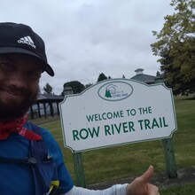
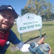
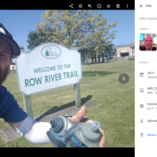
Finally, pulled into the dog park (closest place to park for the start/end of the trail). Shot gunned a can of Sierra Mist and walked to the start of the Row River trail around 10:40am. Realized I forgot my watch in the truck. But given how quickly the temperature was heating up, I decided to just rely on my phone's Strava and the Garmin InReach for GPS tracking. In hindsight, I should have walked back to the truck and grabbed the watch. It would have helped with pacing and is harder to mess up.
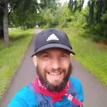
The beginning miles went by quickly. After about 4 miles I started to feel a rhythm and occasionally stopped to take photos. There are a lot of early morning joggers and bikers to go around, so out of abundance of caution I pulled up my handkerchief numerous times (coronavirus has been spreading quickly in Oregon and face coverings now mandatory in our indoor public spaces). Mentally I started to focus on the scenery and the challenge of trying to figure out where and how I was going to filter for water. The uphill climb to Dorena Lake was gradual. I made mental notes of potential watersources near the trail should I need them on the way back. I had assumed being so close to Row River would provide ample filtering opportunities, but it didn’t turn out that way.
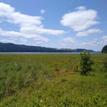
Near the 6.5 mile marker, there are a couple of dirt paths you can make a mad dash down to the lake. Not knowing what water source opportunities were ahead and noting how quickly I was depleting my two handhelds, I decided to make an early pit stop and managed to find the least steep path to the edge of the lake and not fall in. It was not the cleanest or coldest looking water, but I’ve filtered much worse. The water didn’t look aerobic or brackish. However, it took a while to get the full liter into the flask. I immediately capped the flask and power hiked back up to the paved trail. Here, I was able to walk and refill my handhelds from the flask. The 1.0L turned out to be a blessing. You can get enough water into it to almost fill up two 16-18oz handhelds, and taking off the drinking cap makes it easy and quick to filter straight into the handhelds while still moving.
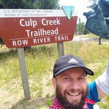
I cruised the remaining section to Culp Creek almost effortlessly, but had already ran out of water around 14.5 miles. Wow, that water went fast. The heat was really starting to kick in. I snapped a photo at the turn around, and headed back. I started to really panic and took a few little off-trail detours that thought might have a small creek, but no luck. I remembered a small creek I had passed in front of some private property at roughly 13 miles in (Sailee Creek). I had to get back there without any nutrition. It was hard to decide whether I should just maintain speed, pick it up, or slow down. Getting back to Sailee Creek was a welcome relief. I picked my way down through a few blackberry bushes down a moderately steep bank, and managed to keep my feet from getting wet somehow. This turned out to be the quickest filtering stop of the route, and I was back up on the paved path in a few minutes. This time, I was actually able to refill my handhelds and a slow jog, and even had a few ounces left over. I put the drinking cap back on and sucked those drops down. I immediately pounded an Gu packet and picked up the pace again.
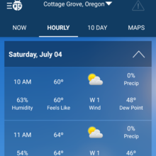
At roughly 23 miles in the heat and humidity really started to be apparent. There are a couple of sections without much shade. I drank as much water as I could hold down, and also sprayed my bandana and arm sleeves to help cool down. At 25 miles things started to get really rough and the leg muscles cramped with the temps in the upper 70s. Believe it or not, I was almost out of water again. I looked for the same path to the lake spot I’d filtered on the way up at 6.5 (now 25.5) but chose the wrong fork down to the lake. Confused, I almost fell off a very steep spot and could not figure out how to get to the water without falling in.
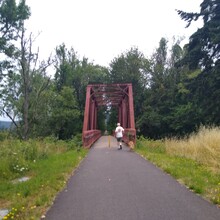
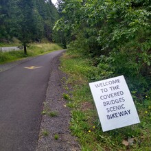
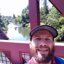
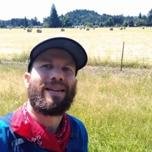
Rather than wasting time backtracking (the lake water wasn’t very good tasting anyway), I decided to take the risk of going a mile further down to the creek I had seen on the way up at roughly 5.5 (now at 26.5; Hamblen Creek). It is rather steep bank and I wasn’t sure if there were thorny bushes or not. It took me a few minutes just to decide which approach to take. I went to the west side and took a sidehill approach. That worked. The water was flowing relatively well. After filling the flask 2/3rds of the way, I capped the flask and scrambled straight back up to the trail. I then walked and refilled the handhelds. This was the best tasting water of the three sources. Believe it or not, I used all this water before I reached the end. Yup. Less than 5 miles. It was that hot. And the muscle cramping was just getting worse. My arms were cramping from carrying the two handhelds for that long, and I struggled to maintain a 10min/mile pace even on the flat downhill to town. It was going to be a struggle to get to the finish and I stopped caring or thinking about the clock. I stopped to snap a photo of one of the covered bridges over the Row River, and then again for a nice hay field. I just jogged the remaining miles to the finish thinking how great it would be to wrap this up and down one of the cold beverages in my cooler.
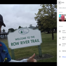
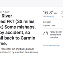
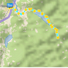
At the finish, I fumbled with my phone trying to remember what to do. I opened up Strava app and realized the route had went into pause when I got to the turnaround at Culp Creek. I panicked a bit. I went back to the camera app to snap a finish photo, thinking at least there would be a timestamp on that. A few minutes later, I remembered the Garmin InReach tracking was still running, and finally stopped that tracking. At this point, I was too tired to do the math and didn’t have any idea if I had bested Jason’s self-supported time. The InReach plan I have only sends a weigh point every 10 minutes. Because of that, it only measures 28 of the 32 miles. However, the time reported is close. I started and tested the Garmin tracking a few minutes before I took the start photo, which is corroborated by the timestamp of the start photo and the Strava gps track data.
After sipping some cold beverage on my tailgate, I got around to looked at the timestamps on the start and finish photos. At that moment, the reality of having just missed Jason’s time hit me. I laughed silently. I could have just picked up the last half mile and easily gotten it if I had known or cared. A family that was parked next to me had passed me on the trail earlier on their bicycles and were runners themselves. We reveled in the accomplishment of having done the entire route unsupported.
I’m absolutely certain my solo unsupported time will be crushed someone else soon. I wonder if running the downhill section first would actually be faster for me or if there would be any advantage in terms of water sources. If I lived near this trail, I’m reasonably certain I could project it down to sub-4 hours. That said, I was glad to have this brief opportunity as a non-elite runner to set an FKT of this nature. I honestly doubted myself several times and wondered it was even safe to start the 32 miles on this day, given the lack of sleep and late start.
But I’m glad I did it. It was a run I needed personally. And a run for freedom and celebration of our better nature. And a run thinking about the struggles of others. On my drive back home, I saw a old guy holding a sign at the Riddle exit. The message on the sign equivocated our governor's actions to try and save people from coronavirus with the KKK. It served as a reminder at just how unhealthy our mindsets could get, and that like an FKT, we should open ourselves up to being vulnerable, to listening, to learning, to changing, and taking risks and actions in the pursuit of a better way of living for ourselves and our communities. I hope my FKT is bested many times by many people of different backgrounds and circumstances. I hope my trip report inspires more people to come out and enjoy this trail and tap into the running DNA that we all share.
In memory of our sweet Java (2004 - July 3, 2020). May you rest in peace.
Time Chronology
Garmin InReach tracking - start: 10:42AM
Start photo timestamp - start: 10:43AM
Strava tracking - start (official): 17:45AM
<trkpt lat="43.7972490" lon="-123.0577100">
<ele>198.2</ele>
<time>2020-07-04T17:45:18Z</time>
</trkpt>
Half-way photo timestamp: 1:01PM (02h16m)
Strava tracking - halfway:
<trkpt lat="43.7048790" lon="-122.8490930">
<ele>295.5</ele>
<time>2020-07-04T20:01:45Z</time>
</trkpt>
Finish photo timestamp - finish (official): 3:39PM
Garmin InReach tracking - end: 3:42PM
Official Time: 4:56:00
Kit
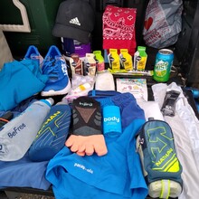
- Hoka One One Carbon X
- Patagonia Men’s Stride Pro 5” Shorts
- Patagonia Men’s Capilene Cool Lightweight t-shirt
- VaporZack 2.5 Liter Men’s Race Vest
- Nathan 18oz handheld
- Nathan ExoDraw 2.0 insulated handheld 18 oz
- Nathan SpeedDraw Plus insulated handheld 18 oz
- REI Sunsleeves
- Adidas Superlite Hat
- Katadyn BeFree Water Filtration System 1.0L
- Garmin InReach Mini
- 6 Gu gels
- 1 Gu chews
- 1 100g Maurten Gel
- Injinji women’s run lightweight no-show socks
- Personal first-aid kit (misc)
- clear plastic emergency rain jacket
- bandana
How To Beat My Time
- Get two nights of good sleep in before the attempt
- Know where you are going to sleep comfortably if you are going to camp in Cottage Grove area the night before
- If you want a fast time, try and plan for a weather window where you get 48-53 degrees

Comments
HEY! Mica! Congratulations on this!
Ridiculous how close our times ended up.
Saw your comment on Steens Traverse. Stoked to see you finding inspiration through FKTs.
with stoke,
Jason