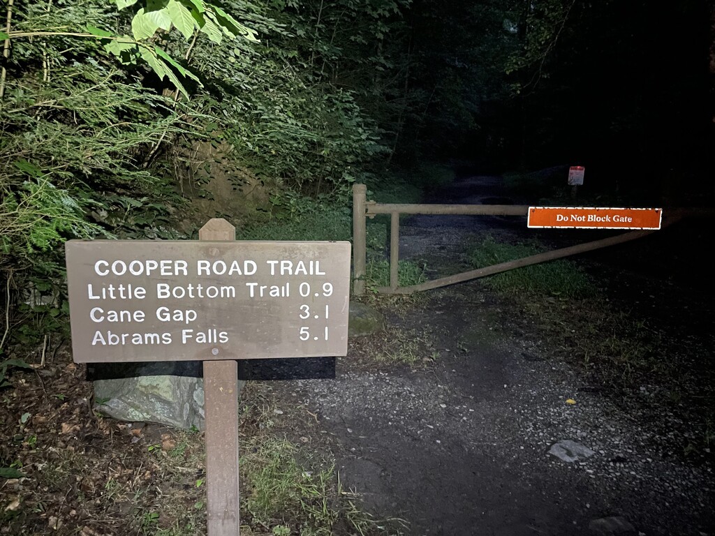
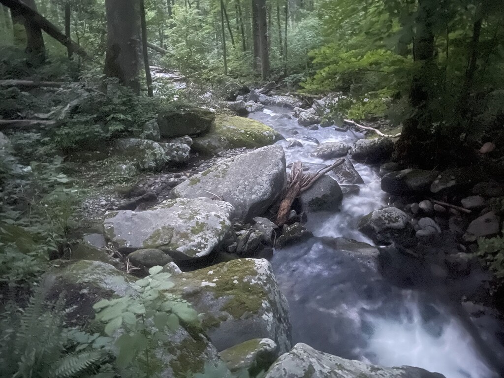
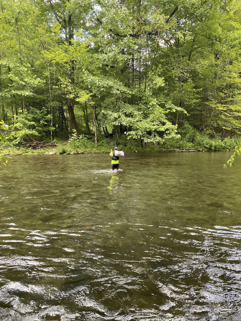
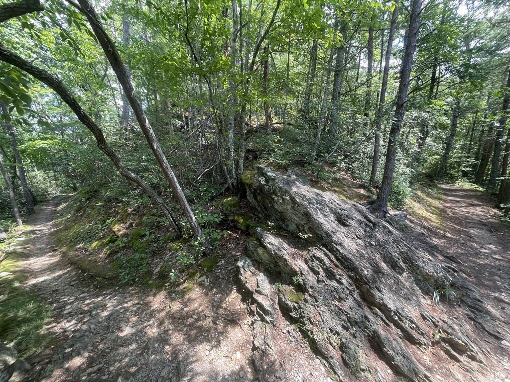
I started at first light (6:15am) at the Cooper Road trailhead in the abrams creek campground. My wife dropped me off here and headed to rich mountain rd (ace gap trailhead) crew location. Three days prior to my run, the smokies got a torrential amount of rain, and after checking out the local tubing outfitters website for the water flow, I had told my wife that I’d be taking the high water route. As I started down Cooper road, it runs parallel to abrams creek. Abrams creek receives all of the runoff from cades cove and it’s surrounding mountains, so it’s a good indicator of water levels in the area. I was a little surprised to see that abrams was running clear and not very high. At that point I took a mental note to ask my wife at the first crew location to check the river crossing at the y. The convenience of the crew locations is that your crew will have to drive right past the y after the first stop. Cooper road was smooth and peaceful, as early miles should be. Beard cane should be known for many creek crossings, and I expected as much, as well as lots of overgrowth on the trail. It was green, itchy, and wet. The saving grace of this backwoods trail is once you get near the end, there is one last knee deep crossing where you can rinse off all the itchy stuff and continue on. I saw the first person of the day at this place as he was leaving his campsite. Once I climbed up the ride to ace gap I turned my phone on and sent out a quick message to my crew that I was all good on time and moving well. Ace gap was smooth and excellent running, as expected. It’s one of my favorite trails in the park. I arrived at the trailhead at rich mountain rd and took a nice crew break to change into dry shoes and refresh my calories and liquids. I recommend getting dry feet here as the next 55 miles are possible to run with dry feet, but after that, it’s guaranteed you will have wet feet again. This was crucial for me, as by the time I finished my feet weren’t in good shape, even after drying off and going all those middle miles dry. Rich mountain trail is a real climb, and the first legit mountain of the day, but it was nice to simply hike it and enjoy it. Once I got to the top of the trail, and turned left, it wasn’t much further when the climbing ceased and the wonderful ridge running of Indian grave gap and crooked arm ridge began! This is another of my favorite places to run, especially when the leaves are down. Crooked arm ridge does go down steeply to cades cove, so I ran as best as I could a balance of not burning the quads with too much brakes and not too much downhill pressure on my toes and feet. Here I passed three hikers, and they would be the last people I saw on trail until Cosby at mile 90! This is one of the beautiful things about this route, the running is mostly amazing, and the trails are all less popular than most smokies trails. I got to cades cove earlier than planned and tapped on the window of my car to notify my wife, “I’m here!”. I got myself quickly fed and refreshed on supplies and we set off together for a quick jog to crib gap. She ran to crib gap with me and left me in good spirits to run down to turkeypen ridge. While we went she showed me pics she had taken of the water crossing at the y and confirmed for me that the water levels were good! I was excited to know that I could take the normal route and do the fun river crossing! As I continued on turkey pen ridge, another favorite of mine that is very fun to run, I don’t remember struggling much, but as I got the the trailhead on schoolhouse gap, I do remember stopping and putting my hands on my knees for the first time, and thinking to myself it’ll be a long climb to the crest of Chestnut top. After the short mile climb up to chestnut top trail I sat down on a log for the first time. Things were starting to get real, and it was starting to get hot. Chestnut top is yet another of my favorite trails, and I climbed the familiar last hills over the top, and started the almost 3 miles down to my next crew spot. I knew I had one of my favorite ultra foods, ramen and coke, waiting for me. When I got there, I was getting really hot, and really looking forward to dipping in the river during the crossing. Nevertheless I was on time and feeling fine. I really had no issues. To keep my feet and shoes dry, I removed them and bagged them up for the creek crossing. Once I crossed I stopped to lace up and carry on! Round top is a good trail for running either direction, but in the past I’ve remembered it being very green during summer months. Surprisingly it was wonderfully clear and I much enjoyed it! It does have one short and steep pitch on it which I knew about but still had to take a minute sitting down to recover from. After that it’s fun running down to the next crew location. When I got to the crossing, I was still hot and quite ready for something different. I asked for my first beer of the day, Coors light, and the mountains were BLUE! The beer was refreshing but I wasn’t feeling too optimistic at this point. I had no reason to, but I was feeling down and out mentally. My wife got me restocked and ready for the longest and highest climb of the day, little greenbrier and laurel falls to the top of cove mountain! Even though the long climb can be daunting, I usually welcome them, as they are a chance to relax somewhat while I hike relentlessly to the top. It was an uneventful, not terrible climb to the top, but somehow it really took a toll on me mentally. I sat on a log at the top of little greenbrier and again at the top of cove mountain. I suspect I didn’t take in enough calories. Whatever it was, I was not in a good way. I sat down and texted my crew to tell me something good, and some other very negative thoughts. I told them it would take me too long to get to sugar lands and I had calculated it would take me at least 30 hours to finish, and that I just wouldn’t do it. I headed down cove mountain to sugarlands, actually running very well, but still convinced I was about to convince the crew I was done. Sugarlands was where my wife would hand over crew duty to the overnight crew, so I figured I’d only have to apologize to them, not bother my overnight pacer, who wasn’t starting until mile 68, and call it a day. All of my crew was ready to convince me otherwise…
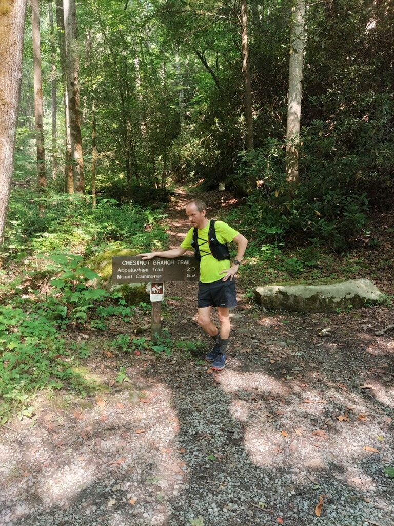
At sugarlands, we began to dutifully rejuvenate me with calories and encouraging words. Calories are almost always the answer… I knew that if I left here, my singular goal was to go 15 miles to get my pacer. I knew if I could get to him, he would get me to the final crew stop at 90, which then would be impossible to quit at. Go into the dark… get my pacer. Once there, I could rely on him to do the mental work, which to me, is harder than the physical work.
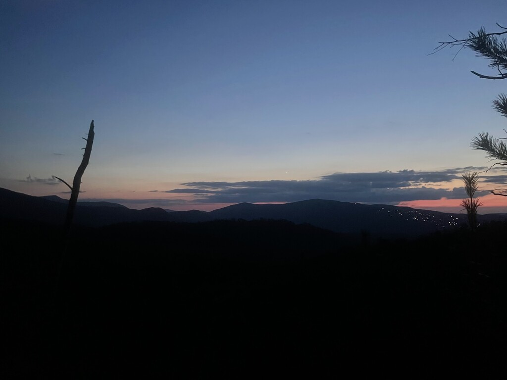
I got plenty of calories down at sugarlands and even more to go with me. As I left I wasn’t feeling anymore of the doubt, I had my single focus. I knew if I got to 68, I’d get to 100. I broke it down. First off the old sugar lands trail, starting with some mile or so of very easy running. It was going dark, and as I started the climb to the rainbow falls trailhead, I saw the last of the sunlight. I turned my headlamp on at the beginning of trillium gap trail at the rainbow falls trailhead. As it went dark, I heard some whippoorwill’s singing back and forth. I felt so much peace, in the dark, in my happy place, just moving along. I knew my wife was praying for me. This was happening! I crossed the road onto baskins creek trail, and got a beautiful shot of the last orange in the sky over gatlinburg and all of its glitzy lights. This is the only way I prefer gatlinburg. Baskins creek trail was pretty wet and I started to get a little bit of wet toes here and there, but I was hoping to stay dry until the 22 mile section from greenbrier to Cosby. As I crossed the road one last time at the Alex cole cabin, and onto the grapeyard ridge trail, I was expecting a decent climb followed by some great downhill running to greenbrier… at least, that’s how I remembered it from a few years before… well… it was significantly overgrown the whole way. Whatever hope I had of moving well and running was mostly gone, as most of the growth was waist high or higher. The downhills were not easily runnable because of this, so I just plowed along. I kept my singular focus of getting to greenbrier and getting my pacer. Once I did make it to greenbrier, my feet were soaked, not from creeks, but from water running off of the overgrowth and down my legs. But I made it to greenbrier and to my pacer and my crew! I was so thrilled! I didn’t have to work so hard mentally anymore. We resupplied carefully and thoroughly before heading out, as this was a 22 mile stretch, with incessant climbs and descents, and untold numbers of creek crossings. I started out at a good running pace on the old settlers trail, to get some good miles in before the climbs as well as to set my pace for my pacer to take over later. I prefer my pacer to pull me along, just slightly better than I’d do for myself. After a while he took over and we ran well down all hills, and he hiked strongly up all the climbs. Always just more than I’d do if I were alone, and relentlessly. I told him relentless forward progress gets us closer to the finish, and I don’t like sitting around unless I’ve got good reason. The old settlers trail follows a pattern of up a creek side, across a shoulder of the mountain and then down to the next creek. Repeat. This goes on for 15 miles. It’s an incredibly long and monotonous trail overnight. There are a couple of crossings where the trail is not obvious to pick up. There are many locations where old trails split off, some with signs, some without. All this adds up to needing to be smart and aware. All mental toil. Having a pacer to do this work for me was priceless. I can see how I’d really have some lows if I had to do this late in the run and in the dark. We had a true celebration once we hit the gabes mountain trail. This was the last climb and descent into Cosby, and both my pacer and i were familiar with it. As we started down the last few miles into Cosby the sun rose, and we really cruised, except for one issue. I had started dealing with some real pain. All of the hours of wet feet had caught up to me, and the soles of my feet had blistered and broke open. Basically this feels like fire or possibly an acid bath on the bottom of your feet, every step. Yeah… despite that, I knew we were close to our crew and the last stop. I knew that I would get it done, and a little pain wasn’t gonna stop that! We rolled into Cosby on a mission. My crew was ready for a full pit stop, but my pacer and I decided we’d stay for 10 minutes at the most, and just get moving. Relentless forward progress would get us closer than sitting and recovering. I had one more mountain to climb, lower mount cammerer trail, and it is a very very easy grade. Even with miles in the 90s I was able to run a lot of this climb. We slowly and methodically made the climb to the AT, and one more real celebration, as we knew it was all downhill. I had three miles downhill to go, but it was steep. My quads were fine, but my feet were not. This hurt. But it wasn’t getting any worse, and it wouldn’t get better till I was done, so… we got it done. The chestnut branch trail downhill is a very steep one for the first mile, then it’s a nice cruise to the road, and the roaring waters of big creek. I went straight to the creek, removed my pack and shoes and climbed in. I ordered a beer from my crew, and I sat there and cracked the cold one I had been thinking about as the heat of the day kicked in… and the mountains were blue!