https://www.strava.com/routes/2774379450403199746
103 miles, 20,000 feet of elevation gain! 100% single track dirt trails. 100% Great Smoky Mountains National Park.
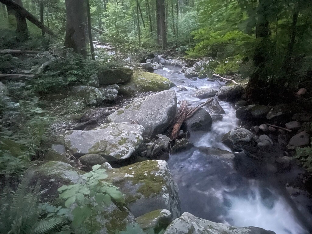
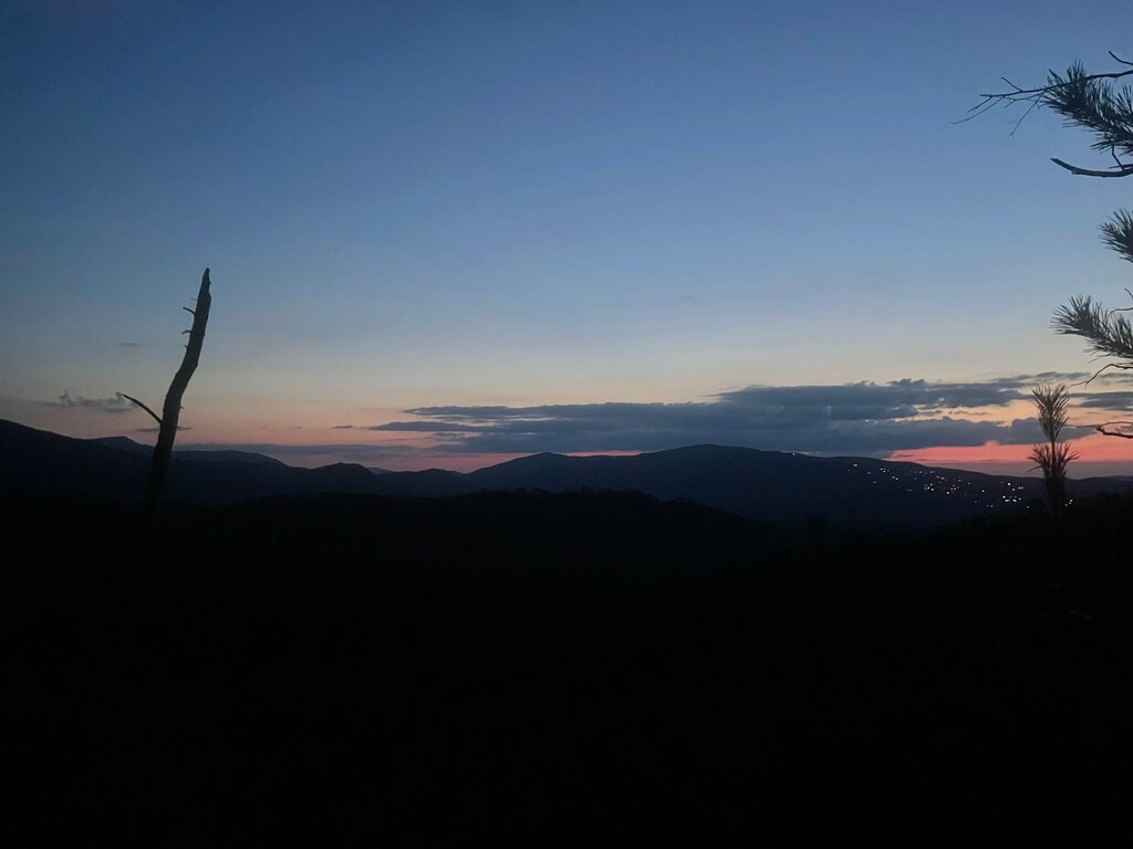
Chief Abrams Big Walk goes from Abrams Creek to Big Creek in the Great Smoky Mountains National Park. Abrams Creek is named after the Chilhowee Cherokee chief Old Abraham ("Abram”). The general idea of the route is to follow the boundary trails along the Tennessee side. While most Smokies routes feature the high places along the AT, this route stays true to much of the hidden beauty, history, and hard times of the park. The highest peaks along this route are under 4,000 feet, but this is still the Smokies, so you will climb over 20,000 vertical feet over the course. You will still have amazing views of the whole Smokies crest at times along the whole route. Along this route, you will follow historical trails used by natives long before the park existed and old roads for communities long lost. There is so much history here, I highly recommend you read the “Brown Book” (Hiking Trails of the Smokies) for each trail along the way. You will cross many dozens of creeks and a few rivers. Your feet will definitely be wet on Beard Cane, the Y crossing and Old Settlers. One river crossing in particular at the Y mile 32 you must carefully consider water levels before starting. Be sure to read the notes below about the high water route, which is identical in distance and vertical gain, and should be considered a normal completion of the full route, if chosen. The route is very easy to support / crew with 12 crew locations easily accessible with any car.
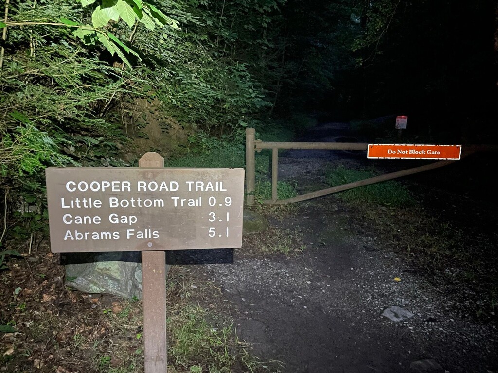
Start @Abrams Creek Campground / Cooper Road Trailhead
L on Beard Cane
R on Ace Gap
CREW: 14.5 Rich Mountain Rd (Ace Gap Trailhead)
https://goo.gl/maps/Z4WP7GuTvirCNQV1A
R on Rich Mountain Rd
L on Rich Mountain Trail
L on Indian Grave Gap
R on Crooked Arm Ridge
L on Rich Mt Loop
CREW: 21.0 Cades Cove (Rich Mountain Loop Trail Trailhead - large gravel lot across street)
https://goo.gl/maps/TwAKF98Qi3SGk5xP6
L on Cades Cove Loop Rd
R on Cades Cove Picnic Area Rd
stay R on Cades Cove Picnic Area Rd
R on Anthony Creek Trail
L on Crib Gap
CREW: 22.6 Laurel Creek rd @ Crib Gap
https://goo.gl/maps/j5FzCyvz96zABuVq6
23.4 Turkeypen Ridge TH (High Water Route Turnoff ***WARNING, there is a river crossing at the Y at 32.0. You must make this decision BEFORE you start or you will not complete the route. The High Water Route instructions are at the bottom. Distance and Vert are almost exactly the same, so either route is just as difficult.***)
L on Turkeypen Ridge
L on Schoolhouse Gap
R on Chestnut Top
R on Townsend Entrance Rd
CREW: 32.0 The Y ***WARNING, there is a river crossing at this location. Specifically, the crossing is at Mile Post 12.479 Parking https://goo.gl/maps/kWFtHhcmJKfBsWFD8. If the water is higher than waist deep, it is recommended to take the High Water Route from Turkeypen Ridge TH at 23.4 to Wear Cove Gap at 39.7. You must make this decision BEFORE you start or you will not complete the route. The High Water Route instructions are at the bottom. Distance and Vert are almost exactly the same, so either route is just as difficult.***
https://goo.gl/maps/ZD2bPXcDTnUyyZDs7
Cross River to Roundtop Trail (crossing is at Mile Post 12.479 Parking https://goo.gl/maps/kWFtHhcmJKfBsWFD8)
L on Wear Cove Gap Rd
CREW: 40.0 Wear Cove Gap
https://goo.gl/maps/d13xtn8tQGgedijG7
R on Little Greenbrier Trail
L on Laurel Falls Trail
R on Cove Mountain Trail
CREW: 53.8 Sugarlands (Cove Mountain TH)
https://goo.gl/maps/eh8yGXqJkBaAXgiKA
L on Sugarlands Residence Rd
R on Park Headquarters Rd
L on US 441
R on Old Sugarlands Trail
CREW: 57.3 Rainbow Falls TH
https://goo.gl/maps/MsBM7rbcbn4qUMxv5
straight on Trillium Gap Trail
L on Baskins Creek Trail
cross Roaring Fork Rd
CREW: 58.6 Baskins Creek Trail Trailhead
https://goo.gl/maps/9g5FJhnzTZnawVLk6
continue on Baskins Creek Trail
cross Roaring Fork Rd
*find the cabin and barn across the street, Grapeyard Ridge Trail starts behind the barn*
CREW: 61.2 Alex Cole Cabin
https://maps.app.goo.gl/J4XZmHaSccteNQVKA?g_st=ic
continue on Grapeyard Ridge Trail
CREW: 69.0 Greenbrier Picnic
https://goo.gl/maps/pBCqD7aE5cYZSBDb8
straight on Ramsey Prong Rd
L on Old Settlers Trail *This trail has a few places where old trails diverge. Pay attention to the signs which show the right trail.
CREW: 85.2 maddron bald crossing (emergency use only, requires 1.2 mile hike)
https://goo.gl/maps/D3ukZMt9nqapt5dD6
continue on Gabes Mountain Trail
R on Cosby Entrance Rd
L on Cosby Picnic Area Parking
CREW: 91.4 Cosby Campground picnic
https://goo.gl/maps/7oq1MeSgzi6K4Wp26
continue on Low Gap Trail out of parking lot (stay right as it splits)
L on Lower Mount Cammerer Trail
L on Appalachian Trail
R on Chestnut Branch Trail
FINISH: 103.1 chestnut branch TH
https://goo.gl/maps/ECJCB4rhkjuViJH8A
***High water route from Turkeypen Ridge TH (R on Finley Cane/ L on Bote/ R on West Prong/ cross road and parking lot to Lumber Ridge/ Straight on Meigs Mt/ L on Curry Mtn / L on Little River Gorge Rd / R on Little Greenbrier Rd)
CREW(high water route): 32.0 (West Prong Trail Trailhead) https://maps.app.goo.gl/z7vz86QUBSR16DqN9?g_st=ic
https://www.strava.com/routes/3026912218835132066