

This route took a little bit of everything for me, and a finish which I believe narrowly eeks out a new fastest time by 20 minutes. I felt I had more aerobically, but my legs really quit on me after the first 6 hours or so - where I was on pace for a 12-13 hour finish. And after that point I found running downhill very painful, uphill only slightly less so, with weakness and tightness in my right hip flexor preventing proper knee drive and which made recovering from even small missteps very challenging. Still, this marks my longest day out in the mountains to date, one which leaves many opportunities for improving my efficiency of movement through better layering, hydration strategy and mental fortitude. My first time visiting both Barret spur and McNiel point with fall colors popping and dusting of fresh snow on the upper mountain, I could have hardly asked for a better day, save the wind at the start. Thanks to my parents for shuttling my car from TJ to Ramona, and meeting me with cupcakes and smiles at the end!
Cooper Spur:
Starting at 4:39am on September 29 I completed the 4 points route in 15:34 from Tilly Jane sno-park to Ramona falls TH. I encountered extremely windy conditions after exiting treeline going up Cooper spur with sustained 40mph westerlies, gusting higher and blowing a lot of sand out of the Elliot moraine, and into my eyes. I was very glad to have grabbed my wool tights at the last moment or the windchill may have turned cut my day short. I reached tie-in rock, with the plaque and sheltered from the wind to eat a jelly donut before heading down.
In my rush to get off the ridgeline and out of the wind I dropped off the skiers left on a social trail rather than the ascent route on the skiers right. I tried to beeline to the nearest visible section of trail and intersected the intended route quickly - hardly saved time given the loose terrain.
Barret Spur:
The rest of the descent was uneventful and and I took the timberline to the Barret spur trail without issue, refilling water in a stream before cloud cap CG. I missed the unmarked connector heading up Barret spur but navigated back to it via Caltopo, adding a quarter mile or so. The climb was straightforward enough although the braided trail was never clear for long above treeline. I tagged the top and started descending. I had seen the previous FKT went skiers left to descent a different way, cutting off some timberline Mileage with the same idea in mind, I also dropped left but seeing the ridge it looked quite brushy - covered in small trees. Since my map had no marked trail here I took a more pleasant looking descent route, mostly on tundra to intersect the timberline somewhat west of the previous FKT route.
* This section has one minor deviation from the previous FKT route - it is unclear to me whether a different trail exists on that ridge (skiers left of barret spur) or not. *
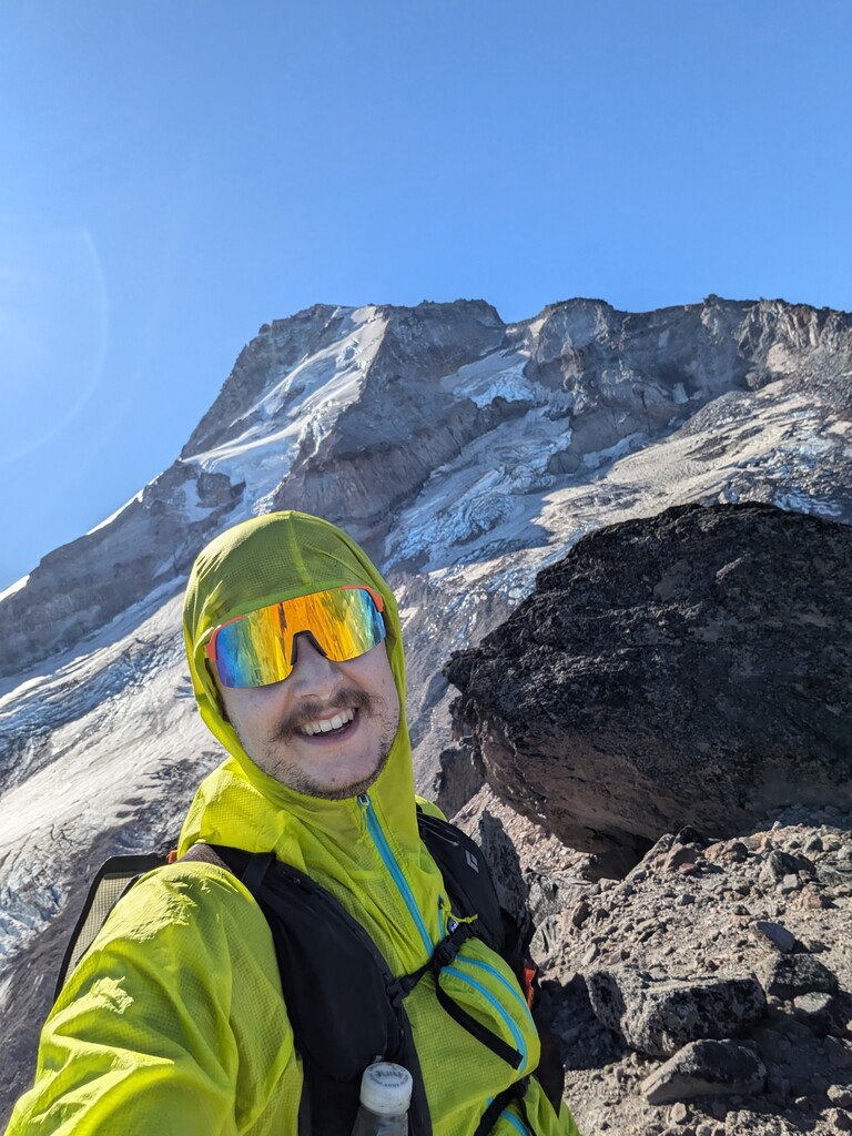
McNiel Point:
This was the shortest both in distance and vertical to any point from the previous. But I slowed down considerably in this section. The trail was steep and dusty and the descent route was unexpectedly steeper yet - a challenge on tired legs! Until reaching the top of this I hadn't fully realized the vast mileage remaining to attain Yocum.
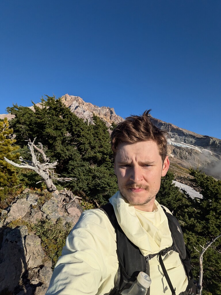
Yocum Ridge:
After descending McNiel my legs were hurting quite a bit. They didn't feel up to running downhill and I tried and failed to keep 4mi/hr on the smooth, gradual downhill on the timberline through the Muddy washout section (rebuilt trail is great, though narrow and muddy! at times on the north side of the valley). I filtered some water in this section as well.
*I also missed the cutoff trail, adding around a mile here compared to the previous FKT *
Once reaching the yocum/timberline intersection I steeled myself to push through the climb if I were still to have an attempt at the record. In this I found some success, even running portions of the uphill. I reached the end of the trail at 6800 and continued to ~7000ft up some talus in which there seemed a clear social trail that could have been followed for some ways.
Descending Yocum took everything I had to maintain 4mi/hr. I would estimate 30 blowdowns blocked the trail, all of which, in my state required coming to a stop in order to gingerly step over. Upon reaching the timberline/yocum intersection again, it was dark and I limped/jogged the final 3.5 miles passed Ramona falls and back to the parking lot.
0:00 - Slept in my car at TJ and started my watch by 3:49
0:50 - TJ Cabin
2:30 - Top of Cooper Spur
6:15 - Top of barret Sprur
8:05 - Top of McNeil point
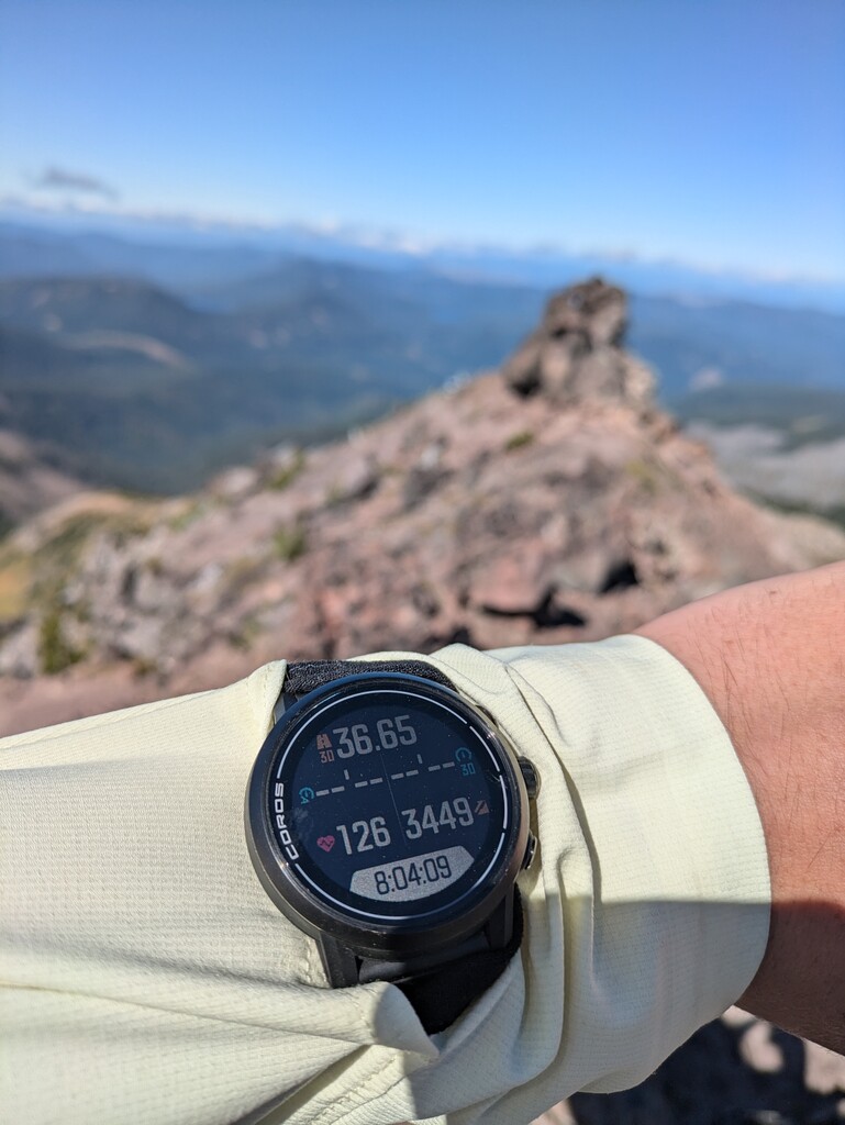
13:02 - Top of Yocum
15:34 - Ramona Falls TH
Gear:
Base weight: 2kg includes running vest, belt, houdini, extra pair socks, minimal medkit, inreach,
Food - 1.5kg planning 300-400kcal per hour. 1600kcal tailwind, 400kcal peanut m&m, 200kcal sour gummies, 1 jelly donut, 1 king size kit kat, 1 king pb cup, 4x electrolyte packets, 6x GU, 3x Sis Isotonic, 5x nutrigrain
Water Capacity - 1L smartwater bottle, 650ml softflask for concentrated tailwind (400kcal), 500ml chest bottle, 600ml softflask with Katadin BeFree. Clearly more capacity than needed and I never carried more than 2liters save the first section leaving my car.