

Foolish ideas and why we do them...
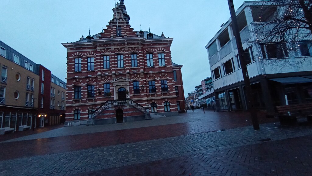
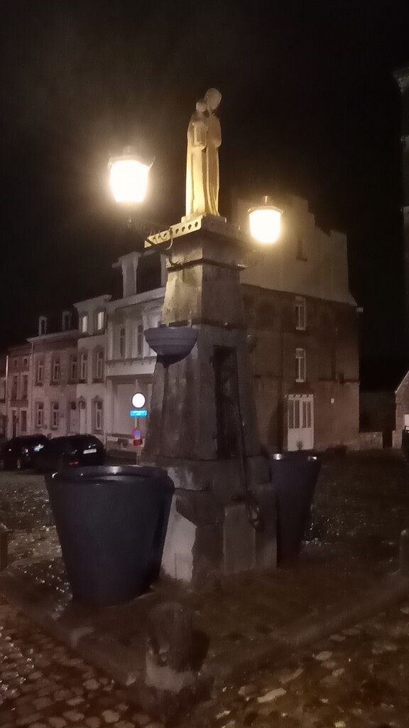
After a day of meetings I decided, while getting my kit together, that instead of sleeping for a few hours and getting up at 3AM to drive to the start of the Hertog Limburg Pad in Limbourg that I wouldn't bother going to bed, just have dinner and head off. At 00:18 on a Friday night / Saturday morning standing in the middle of the Place Saint-Georges looking up at the Fountain of the Virgin.
The run started easy, the weather was okay, and the trails good underfoot. A large part of the route is made up of farm trails, roads, and gravel paths, so nothing technical to really test you. Passing through Eupen the town was quiet, with just one or two people heading home from their night out as I am heading off into my long night. Also a good reminder that this is now Ostbelgien, and most of the people are German speaking when saying hello.
At around the 24 km point was the first of the places where the GPS file (provided by the Limburg tourist information...) was inaccurate. The route sends you straight down a steep bank through some trees where there is no path, either on the maps or on the ground. I went around and back-tracked to where the path was supposed to bring me out, but no sign of any way through.
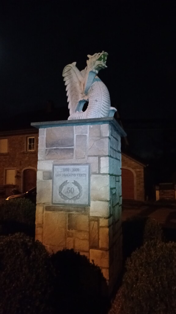
Coming under the Viaduct of Moresnet (aka Geul Valley Bridge), an impressive 1200 m long 50 m high railway bridge, and through the small village of Moresnet I had to stop and take a photo of the statue in the village centre. More places need statues of dragons. This is also the start of the longest climb on the route, up to the drielandenpunt (three counties point), the place where Belgium, the Netherlands and Germany meet, also the highest point in the Netherlands. At the top of the climb I took the time to sit, have a drink and some a bit of cake, before starting the descent down into the town of Vaals.
The next 15km were pretty uneventful, just working around the outside of Aachen, except for about 1 km before the A4 highway where the GPS route suddenly turned and went over a small river and through some fields. There was a clear track on the other side of the river, just no bridge over it. With some careful checking of depth with my poles I waded across, only thigh high at the deepest luckily!
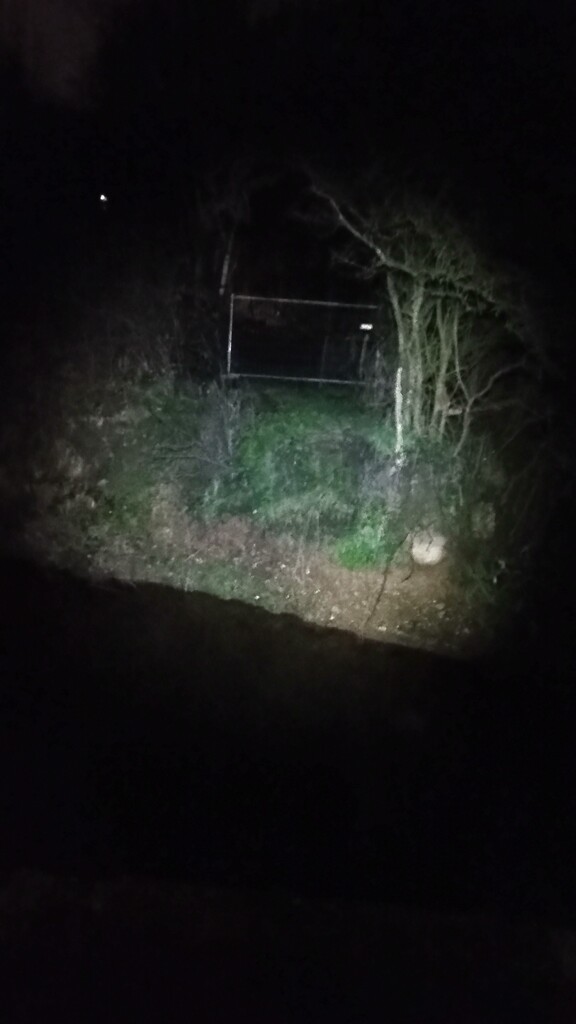
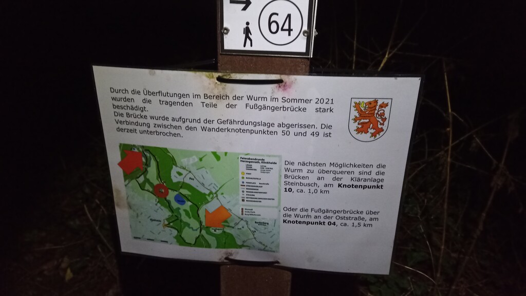
More forest paths and open fields, passing the Burg Wilhelmstein, and out onto a surprisingly busy road considering the time of the morning and the lack of any footpaths. The GPS route again had me crossing the road and following the river, but with no sign of a path (on the maps or on the ground), fallen trees, and a fast flowing river I decided to head up the hill along the road and loop around, rejoining the route 1/2 km further along only to find that after a short while there was yet another missing bridge! This time there was a sign, explaining a route around, and the fact that the bridge was destroyed back in summer 2021 (assuming my schoolboy German read it right...). At least this time there was a clear, obvious, sign posted detour.
I knew at this point that with good luck I would reach the Jumbo Supermarket just off-course in Kerkrade as they opening at 8 AM, so this was a good motivation to keep moving. It seems as the closer I got to daylight the worse the weather got, starting to rain and the wind picking up. At least at the supermarket I was able to get a (not very good but free) cup of coffee, some more water to refill my bottles, and a protein shake. I knew this would be the only place I stopped to refuel for quite a while, so best to make use of it while I could.
Leaving Kerkrade is a route I know well as it is also part of the Dutch Mountain Trail. Apart from the GPS taking you through a hedge and the private gardens of Wasserburg Haus Heyden (which I ignored and went around), and into the courtyard of Hoeve Overhuizen, which at that time of the morning was closed, the route was easy to follow, and while not marked as a route it follows many other well-marked paths, so no navigation skills required, just keep moving forward.
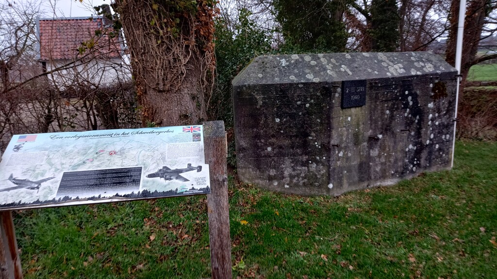
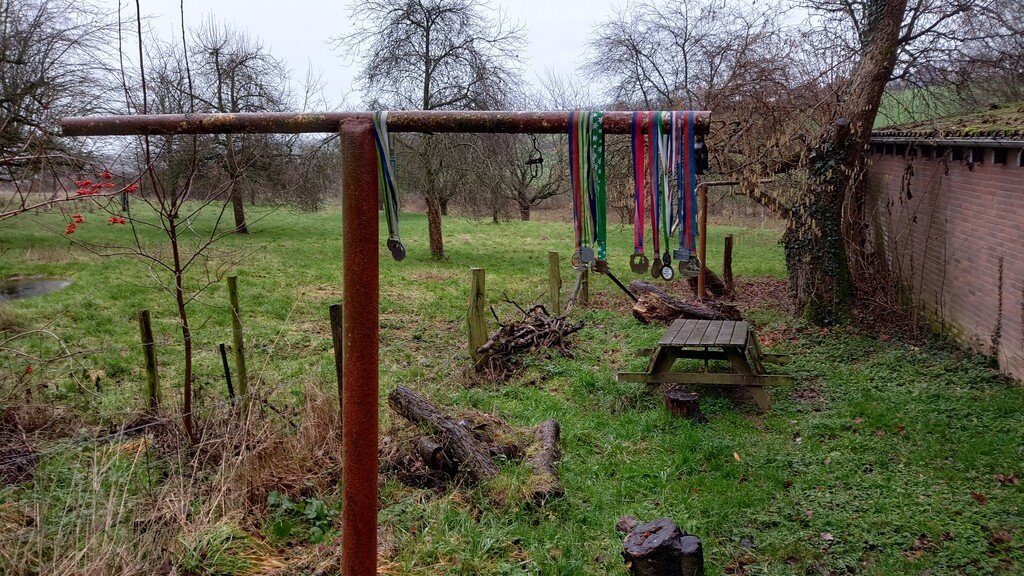
Passing through the edge of Mechelen there is one of the many signs of WW2 that still mark the area, in this case a Dutch pillbox and memorial to 2 downed aircraft, an American Thunderbolt (P47 42-26465) and a British Halifax (DT694). In Bissen there is what I can only assume is a memorial, with a collection of running medals hanging on what was once a washing line poll. I have passed them many times, and would love to know why they are there! In Epen at about 90km I made use of the "Super Epen" shop and grabbed a bottle of coke and a red bull, in dire need to feed my caffeine addiction...
This was the point that I felt I was really tuning into the wind, and the weather was getting worse. Looking back at the data from the Maastricht Airport weather station, 20km or so to the north, they showed that in the afternoon it was a fairly constant south-westerly 40km/h winds, gusting up to 70km/h, and it certainly felt it! Running into it felt impossible at times, quicker to walk than try to run, and when it was to the side it was easy to be blown off the trail if you were unlucky with a gust at the wrong time.
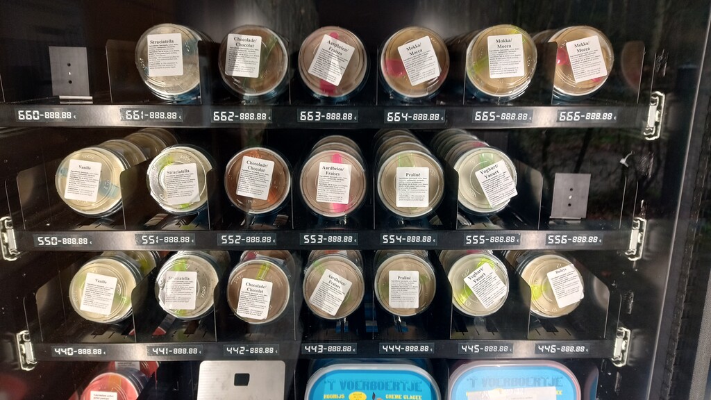
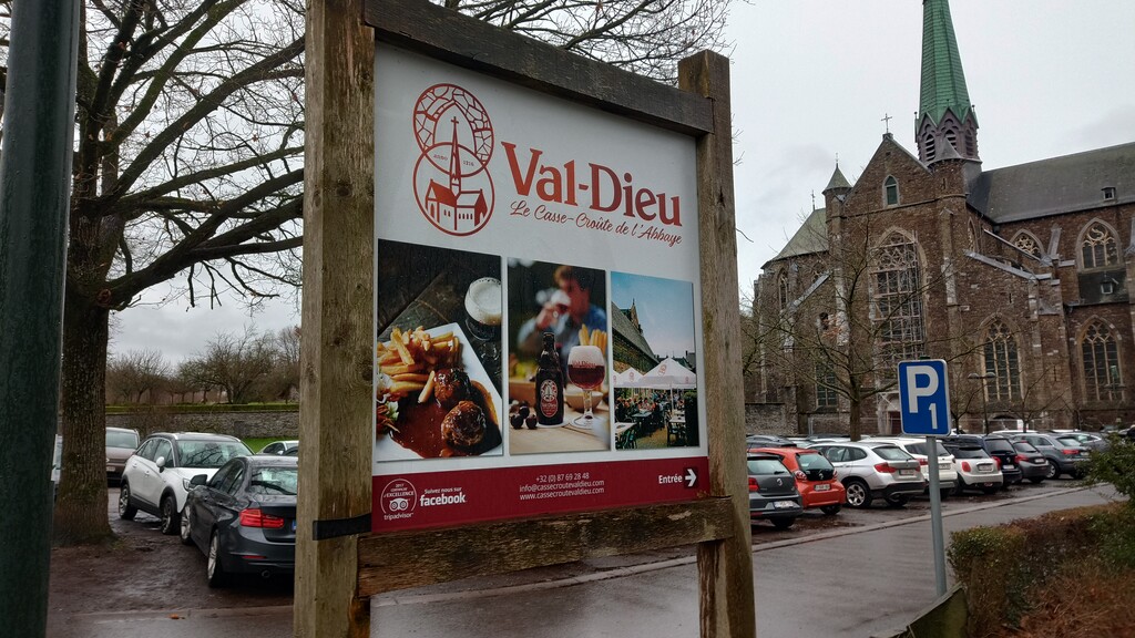
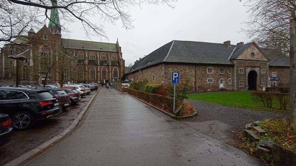
Crossing back into Belgium, and passing what in the summer is one of my favourite things, an ice cream vending machine, it was a good 12km of running straight into the wind to reach the monastery of Val Dieu. Now, they make some really nice beers, and the temptation to stop was high, but I feared that If I did I would never get moving again, and with 30+ km to go, and nobody around to come pick me up, the only option was to keep moving.
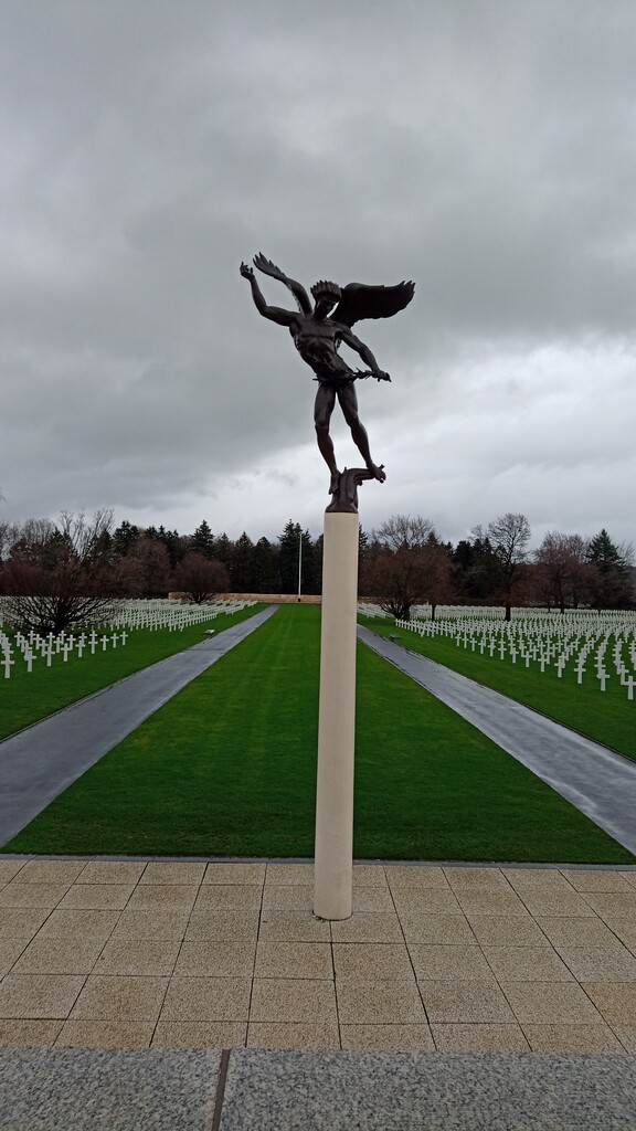
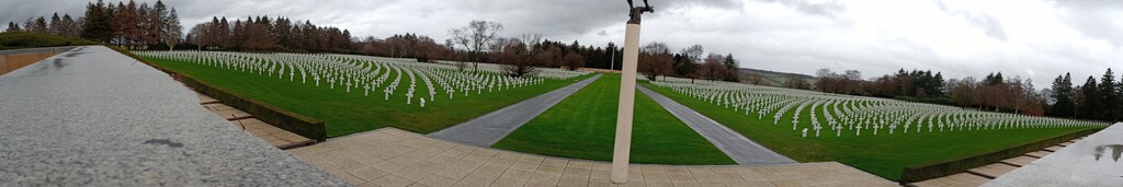
Yet another diversion before the town of Aubel where the route has been changed to go around a farm rather than through the middle of the farm yard as the GPS says (good signs to guide you at least), and another at about 115km where the route appears to go through someone's garden. Back on course, and at around th 116km point, I took a minute to rest at the Henri-Chappele American War Cemetary. Doesn't matter how often I visit places like that, the row upon row of identical graves, in this case over 7000 of them, will always make an impression. But, only 25 km to go, can't sit hiding from the weather for too long...
Passing through the village of Henri-Chapelle I had a slight sense of humour failure when I couldn't find the route on the GPS yet again. The GPS route appears to go through a newly built house, and around the side of a field that was fenced off and full of horses, so instead I followed the path that was visible on the ground around the edge and joined up again a bit further along. I was definitely in the "just want to be done" mindset, the feet were hurting, the wind weather was miserable, and it was dark again. At least I knew from Henri-Chappelle it was pretty much all down hill until the very end, so that was something...
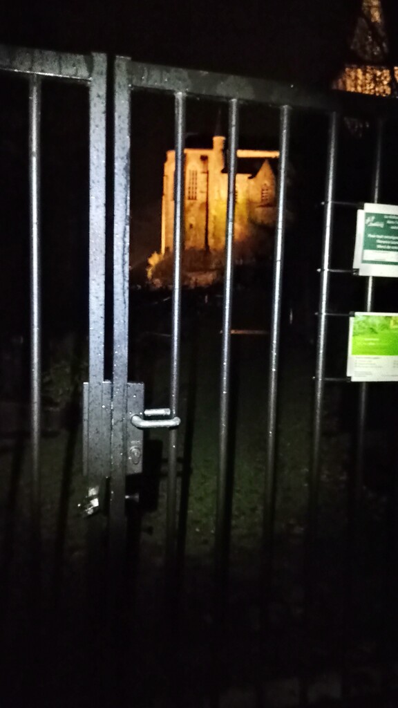
Other than very nearly getting hit my a car coming through Welkenraedt (I was on a zebra crossing, car came round the corner far to fast driver with phone in hand...) the last few km were uneventful. Unfortunately the gates to the Cimetière Saint-Georges were locked, so couldn't make the little loop through, and aching feet don't mix well with cobble stones, but after 19 hours and 17 minutes I was back looking at the Virgin Mary once more...