
This was a fantastic adventure day!
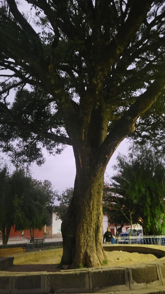
Sarah Hodges had picked the trail, but together we plotted where to start, choosing the tree in the center of Mollepata. This added about two miles from the start of the official, full Salkantay trail. We decided to finish in Aguas Calientes, in another town square, this one by a statue of Pachacutec, "The Best Inca".
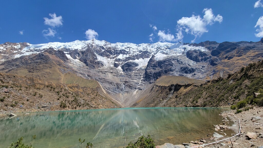
We also knew we wanted to skip a mile off trail to see the stunning Lake Humantay. This would make our route about 50 miles, that's all we knew at the start!
The day before we started we arrived in Mollepata by bus and had a delicious meal in a local restaurant. After a bit of recon on the very start of our trek, we headed back to our hostel to cook some pasta and crash early.
Our alarms went off at 4:30am and we were out the door a bit before 5, hoping to reach Aguas Calientes later that night.
The first several miles were a mix of dirt road and single track. Fog had settled in, limiting our views, but we heard waterfalls and passed a few small farms. Once we finished the first big climb we were back on a road and moving well, though got passed by the first of many teams of mules we would see on our journey. We reached Soray with the sun breaking through the clouds and saw the gorgeous Mount Humantay and "Nevado Salkantay" peeking out.
We confirmed that we wanted to add the 2 mile out and back to the lake and set off up the hill. Except...it's a really tough "hill!" The altitude and steepness after 10 miles of climbing got to us and it added over an hour to our day. Still 100% worth it! We filled up on water from a glacial stream on our way back down, our first water fill up of the day.
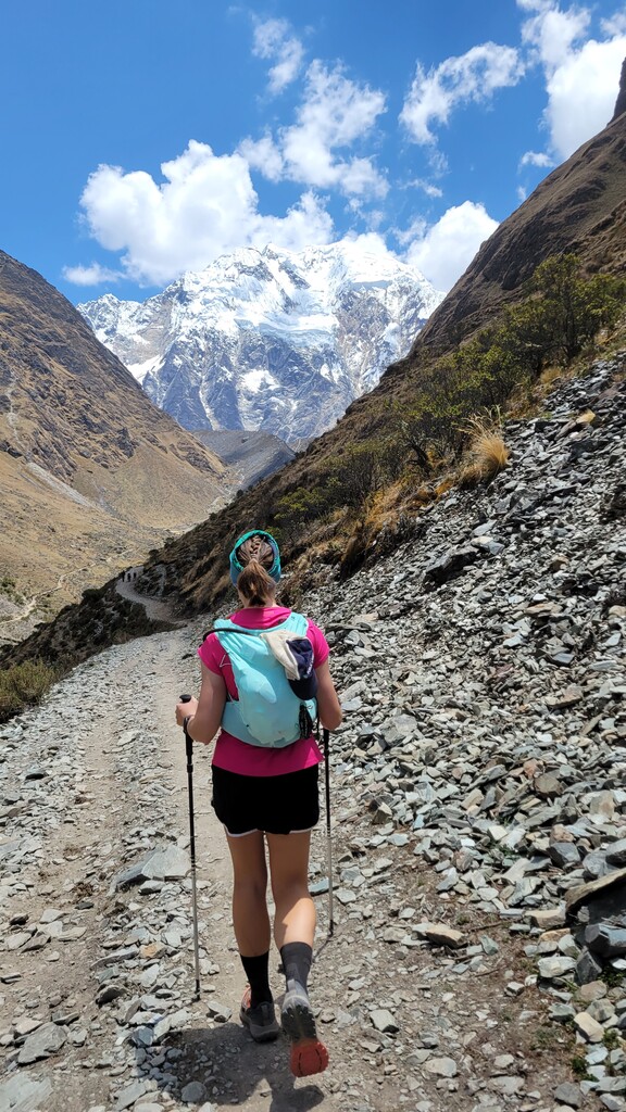
Then it was onwards: up and over the big Abra Salkantay. Surprisingly, the altitude didn't bother us as much on this section. Perhaps it was the sheep and horses we passed that kept as grinning at the beauty of the place. We hit the pass and stopped to take photos and a few moments of quiet reflection. The world holds such wonders, but not everyone is lucky enough to see them. Here, at the highpoint of our trek, Sarah scattered the ashes of her good friend, and true mountain spirit, Jace Becker.
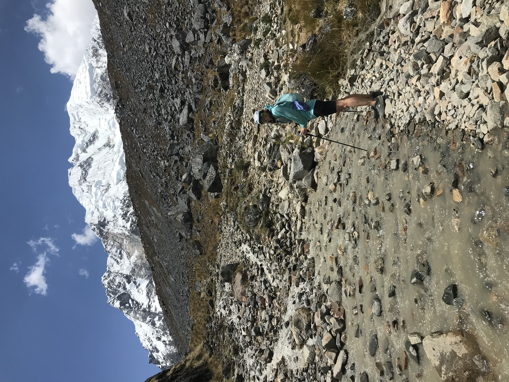
After our break, we headed down the other side, listening to glaciers crack and perhaps an avalanche (though we never saw one). The backside of Salkantay led us into a cloud forest, giving us completely new scenery to enjoy. The descent was rocky and a little steep so we alternated between finally being able to open and run, to taking careful steps so as to not break our legs.
We stopped again for water, this time filtered through moss (and our filtration system!) and got moving again. The trail turns into a road and passed through a few villages before veering off onto single track again. Sadly, our maps warned of us a mudslide, so we stayed on the road and got in 10+ miles of good running. We did see the trail over the river and were following the same trajectory. A few areas did look washed out and would have taken some serious scrambling to traverse. The road was the right choice!
The sun, altitude, and lake addition put us behind our intended goal, but we were enjoying the trip and just kept moving forward. We did, however, start to ask those in towns we passed through if we would be safe to continue into darkness as the trail would be heading back into more remote areas before our finish. We were assured we would be fine.
Without question most of the local we met were kind and hugely supportive. One our last big climb we even had an offer to stay the night so we wouldn't have to keep hiking all night! We declined, having only about 9 more miles to go.
Heading down towards the Hidroelectrica was full of tight switchbacks and quite steep. We had an adorable gray kitten follow us for two miles, bringing some cheer back to our effort.
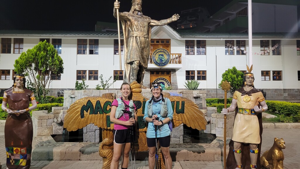
Once at the bottom and along the river we were able to click away some steady miles. Knowing we were so close to the finish made us push so we could get in a soft bed! Although it was dark and we missed some of the views, we were able to see the lights of Aguas Calientes as we got closer. Sharing a cheer we pushed up the last mile or so and into the town square. Once again, the locals were incredibly warm and welcoming. Even though it was nearly 11:30pm, we had two strangers cheer for our efforts and offer to take photos for us at the Pachacutec statue.
We were able to make the full 51 mile trek in under 19 hours. This route could be done faster if the lake is skipped. Water was easy to come by and filter. Our main advice to others attempting is to be aware that lots of dogs will be about on the back half of the route and they can be protective of their space. We sometimes slowed to a walk to not agitate them further and seem less threatening.
From stunning alpine vistas, cloud forests, train tracks, and ancient ruins, this is an exciting trail to explore should you get the chance!