Athletes
Route
Route variation
Katahdin Cirque
Gender category
Male
Style
Unsupported
Finish date
Total time
5h
45m
24s
GPS track(s)
Katahdin Cirque Livingston.gpx950.1 KB
Report
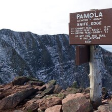
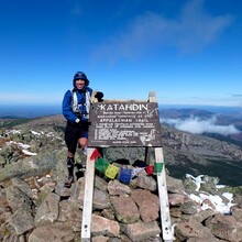
I did a counter-clockwise version of the Katahdin Cirque. It was approximately 10.4 miles with 4,500 feet of elevation gain and loss. The route was: Chimney Pond Trail to North Basin Cut-Off to North Basin Trail to Hamlin Ridge Trail to Northwest Basin Trail to Saddle Trail to The Knife Edge Trail to Helon Taylor Trail and back to Roaring Brook.
https://scottlivingston.wordpress.com/2012/10/13/katahdin/

