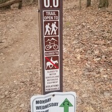
We ran the route in the clockwise direction (the posted direction for runners on Tuesdays) which began with the flatter/smoother green loop and then finished with the rockier/hillier blue loop. We carried hydration packs for water/fueling, which was probably overkill. It was fairly cold to start. At the trail intersection approximately half way, we stopped to stash layers in our packs and eat a Hammer gel. We started and ended at the mile 0.0 sign, a short walk in from the parking lot. The trail is well-marked, but we did study the map in advance, as the few intersections each have many trails coming in and out.
Notes on distance: the FKT page lists the distance as 10.4 miles--though the original poster says that this number was from Strava, and her Garmin registered 9.07. The second number is more accurate. DTE lists it as 9.95, but after running the loop multiple times, their mileage markers seem to be off. We registered 8.73 (Sierra) and 9.11 (Upton). I'd put this route at 9.1 miles, 530 ft of gain.

