The 3M Canyon Loop is a common and classic link up of three significant but easier technical slot canyons in the San Rafael Swell area, (however this is not a casual trail run, you should be experienced in canyon travel, have proper gear, and do adequate research ahead of time):
Music Canyon - 3A-B III (0-3+ rappels to 8 m ( 27 ft.))
Muddy Creek - River Hiking/Class II float (on foot/swim or packraft)
Mud Canyon - 2A III (semi-technical walk, routefinding)
The route for all three creates a loop, using a run along Hidden Splendor Road to close the loop.
Descriptions of each Canyon:
Music Canyon - 3A-B III (0-3+ rappels to 8 m ( 27 ft.))
See Video
From the trailhead, start the long walk down Music. It is easy going in the open wash. After a couple of hours, the canyon makes a sharp left hand turn. The interesting part of the canyon starts just beyond it.
As you head down canyon, Music throws quite a few short obstacles at you. A skilled team can downclimb all of these. Teamwork and partner assists are key here. Rappel any that are out of your comfort zone. Many groups do up to 3 rappels in this section.
All too soon you will begin hearing the roar, or hushed whisper depending on the time of year, of Muddy Creek. Once at Muddy Creek, the technical section is over, coil your rope and take off harnesses.
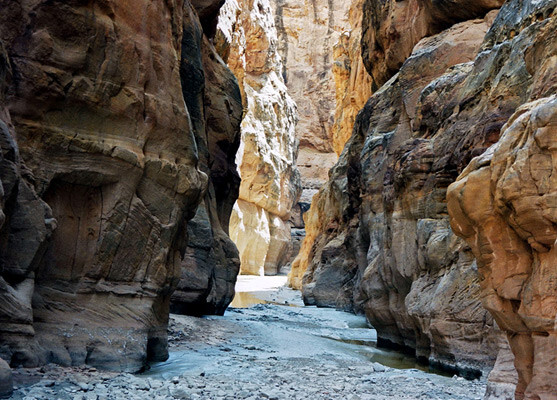
Muddy Creek - River Hiking/Class II float
See Video
"For hiking, I would recommend flows of < 100 cfs. Between 100 and 200 cfs, it is still very hike-able, but bring an inner tube to float the deeper and narrower sections of the Chute. Above 200 it could become difficult crossing some of the rocky rapids.
For floating/swimming or packraft, the river has been done as low as 100 cfs with MUCH dragging. Above 150 cfs is likely the minimum acceptable in an inflatable with some dragging. 200 cfs and higher would be recommended in an inflatable or hardshell kayak. Canoes can be run over 200 cfs, but be prepared to walk rapids, or be highly skilled. Many of the rapids are rocky chutes that are very difficult in a canoe. They can be portaged, however. (Source: Road Trip Ryan)
I think it is acceptable style to do this as a multi-sport with a packraft or entirely on foot, though the attempter should be clear and honest in their write up about methods used. The faster time will likely come from for "the swift of foot" during dry conditions - Check Flow Rates HERE
Mud Canyon - 2A III (semi-technical walk, routefinding)
This canyon offers some fun little splitters containing some narrow sections. Start form the top and work down, or explore from bottom up. If you’ve never done this canyon before it is easiest to explore form bottom up as you can easily get lost form the top down. Luckily, for the FKT route...you are going from the bottom up.
Getting there:
Take exit 131 from I-70 (about 30 miles west of Green River). Go south off the freeway, the road parallels the freeway for 1.8 miles before turning south. Road directions are as follows:
- 3.8 Junction stay left
- 4.9 Junction, stay left again.
- 10.1 Signed Junction (Reds Canyon / Tan Seep). Go right.
- 13.9 Signed junction go right again.
- 14.8 This is the Red Canyon / McKay Flat junction. Go left, toward McKay Flat.
Reset Odometer
- 8.4 Signed Hidden Splendor Junction, go left, to Hidden Splendor. (right goes to Tomsich Butte)
Reset Odometer
- 4.0 miles, trailhead. Music Canyon is on the right, with a small pullout just down from it also on the right. The canyon is easy to identify, it has a sandstone cliff on the right side, and runs almost perfectly straight away from the road.
Resources:
Muddy Creek Flow Rates HERE
Road Trip Ryan
Blue Gnome
Submitted by Jason Hardrath (IG)