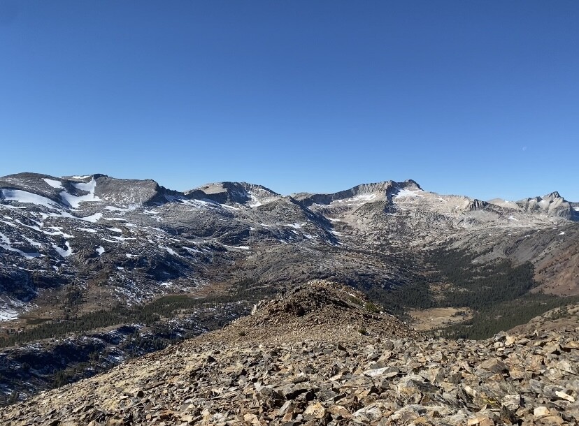
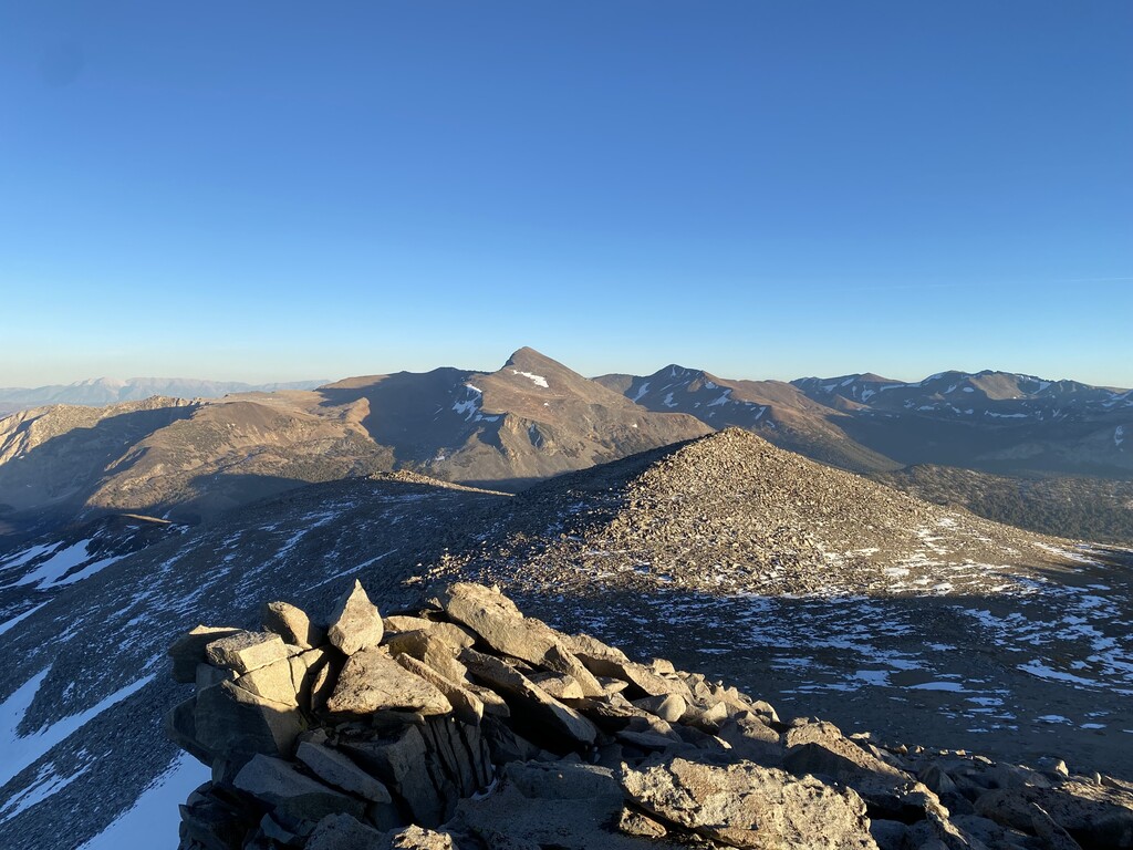
I’ve been working on a variation of this high route for a while. I think that I came up with a friendly runner/scrambler way to go. I like this route because of its altitude, never going below 9,477 ft and to a high point of 13,053 ft in 20 miles. It has about 9,900 ft of ascent and 9,900 of descent. I also like the start and stop point being the east entrance to Yosemite National Park at 9,943 ft completing a full loop and that half the route is in the park. It involves all kinds of terrain, hiking trails, climbers trails, off trail running, rock scrambling, snow, gravel and talus. It’s about 8 miles off trail and 12 miles on trail. Of that, 8 miles is single track, 2 1/2 miles is on rock climbers trail and 1 1/2 miles is on gravel roads. There’s about 100 yards of pavement to run on route 120. It does have some exposure in spots. It’s about the same that you would find on the Mountaineers Route on Mt Whitney in California. There’s no climbing gear needed but katoolas, poles, gaiters and ice axe could help depending on the time of year and how comfortable you are in this terrain. The difficulties are 3rd or 4th class rock with steep snow like you would find on Mt Shasta’s Avalanche Gulch in California. Mostly small patches of snow around Dana, Ellery Bowl and Conness. More or less on these and in other spots depending how big of a winter they had. I would say that a mid July to mid October attempt would be good for a wet winter and a beginning of June to mid October would be a good attempt for a dry winter. With all high mountain environments there are a lot of delicate plants. These are avoidable by paying attention and staying on the sand, gravel and boulders. It makes it more difficult but it’s better for the environment. Plus it’s fun hopping from rock to rock:) There’s water in a lot of spots on this route but I did carry a bladder of water for stretches where there wasn’t any
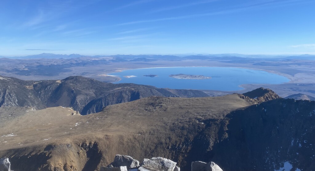
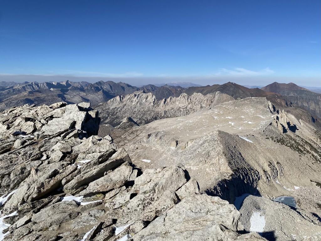
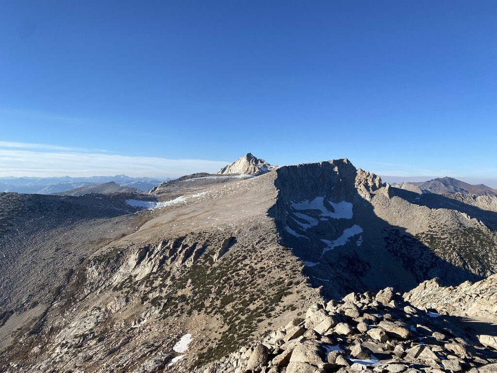
I started by touching the gate post on the east side of the entrance and finished by touching the gate post on the west side of the entrance. I do the loop counter clockwise running up Mt Dana first. The Mt Dana trail is a good hiking trail with cairns above tree line to guide you. There can be snow patches up high on the way up. Once on the summit you can look to the east and see the top of the Dana Couloir and the ridge that will take you to the Dana Plateau. Descend down towards the couloir, there will be snow here and then contour over to the ridge. Alternate right, left, right until you reach the plateau. There’s a spring fed meadow on the plateau that’s very delicate. To go around it head to the right side avoiding the grasses. After this go towards Ellery Bowl on the north end of the plateau on sand and gravel. Go down a steep gully on the right side and then go left when it cliffs out. Find the easiest path to Ellery Lake on snow, sand, gravel and boulders. Finding the Speed of Life climb approach trail can help. Once at the lake go 100 yards west on 120 until you see an old miners road on the right that looks like a ramp. Start up that and then go around the pond on the left side. Ascend steep talus and loose gravel staying more to the right until you gain the ridge. Stay just to the left of the ridge until you can see Tioga Peak and then go over to it. Once on the peak there’s a hiking trail that descends the west ridge and eventually meets up with the Gardisky Lake trail that you can take down to Saddlebag Road. Go up the road until you get to the Sawmill Campground. Take the main gravel road through the campground and it will eventually turn into a single track. At just under your 12th mile you’ll go right on a climbers trail that takes you to Mt Conness, this area can have snow on it. All climbers trail info can be found on the supertopo website. Once you drop back down from the summit go south to the right side of the ridge where there’s a hiking trail that takes you to the col between Conness and White. From here I angled right and headed straight towards the summit of White. I skipped the main ridge on the left because it’s a little convoluted. At the summit I went southeasterly to a big sandy bowl and descended going towards the granite slabs left of Skelton Lake. Instead of heading straight to the summit of False White, I went up more solid ground above the slabs to get on the ridge. Once on the ridge stay on the left side until you reach the summit. From there you’ll see two little sub peaks to the east. Go around these to the right on mostly sand staying above the cliff band on the right. After the cliff band pass by two gullies until you reach the third one. Head down this staying left on a faint rock ramp, eventually you’ll contour around and be on top of a low angle chute. This goes straight down to upper Gaylor Lake where you’ll hit the Gaylor Lakes trail. Go south on the trail to middle Gaylor Lake and then head up and over the pass back to the trailhead. At the parking lot go east on 120 for about 20 yards and then touch the gate post on the west side of the entrance. Now you’re done!!