A continuous, human-powered traverse linking the eight most prominent summits of the Entlebuch region.
Each summit is reachable on marked hiking trails, and all must be climbed in a single, continuous push on foot.
This is a 100% running, peak-bagging FKT.
The line shown in the GPX represents one possible connection — athletes may choose their own route between summits, as long as all eight summits are reached, the effort is continuous, and it is completed entirely on foot.
Rules
- Climb all 8 major summits (highest peak of each mountain range) within the district of Entlebuch.
- The entire route must be completed on foot, self-powered and in a single push.
- The route between the peaks and the order of summits can be freely chosen.
What is not allowed
- Any motorized or wheeled transport between summits.
- Starting or finishing anywhere other than a designated summit.
Start & Finish Points
The official elapsed time begins and ends on top of one of the eight summits —
athletes may choose any summit as their start and finish point.
The attempt is valid as long as all eight summits are reached in a single, continuous, human-powered effort.
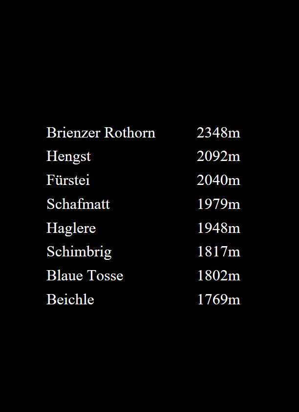
List of the 8 Summits:
- Beichle - 1769m
- Blaue Tosse - 1802m
- Schimbrig - 1817m
- Haglere - 1948m
- Schafmatt - 1979m
- Fürstei - 2040m
- Hengst (Schrattenfluh) - 2092m
- Brienzer Rothorn - 2348m
Safety Note
This route includes alpine and steep terrain. Difficulty level accoring to SAC Switzerland: T1 - T4.
It should only be attempted in safe and stable weather conditions.
Heavy rain, storms, or snow significantly increase the risk of injury and make certain sections dangerous or impassable.
I do not recommend attempting this route during snow or heavy rain.