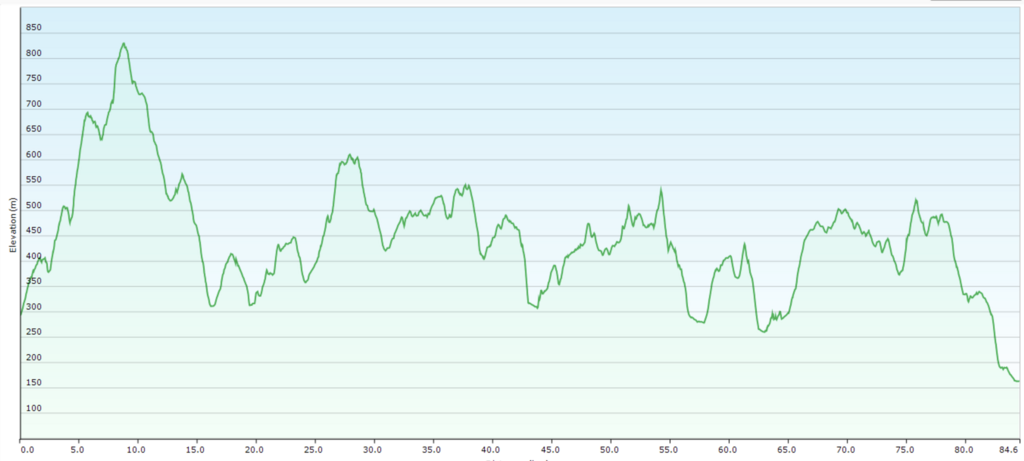
Route: Adventureday Wienerwald

Submitted by trailrunningvienna on Sat, 03/15/2025 - 01:36am
Location
Austria
Distance
84.6 km
Vertical Gain
3,100 m
Description

Trailrun around the City of Vienna.

Surface:

46% Trail
33% Forestry Road
21% Asphalt

3000m Uphill, 3000m Downhill
 

Public transportation available for startpoint, endpoint and 3-4 times on the way (emergency exits via public transportation).

Shops and drinking-water directly on the track (shops every 20 km + water in between).

Can be done as a daylight run if you are a early bird.

We plan a community event (not a race) on this track at the 10. of May 2025. (https://trailrunningvienna.at/stories/adventuredayww2025).

All-Seasons track, be carefull during the hot summer days!
 

GPS Track
Images