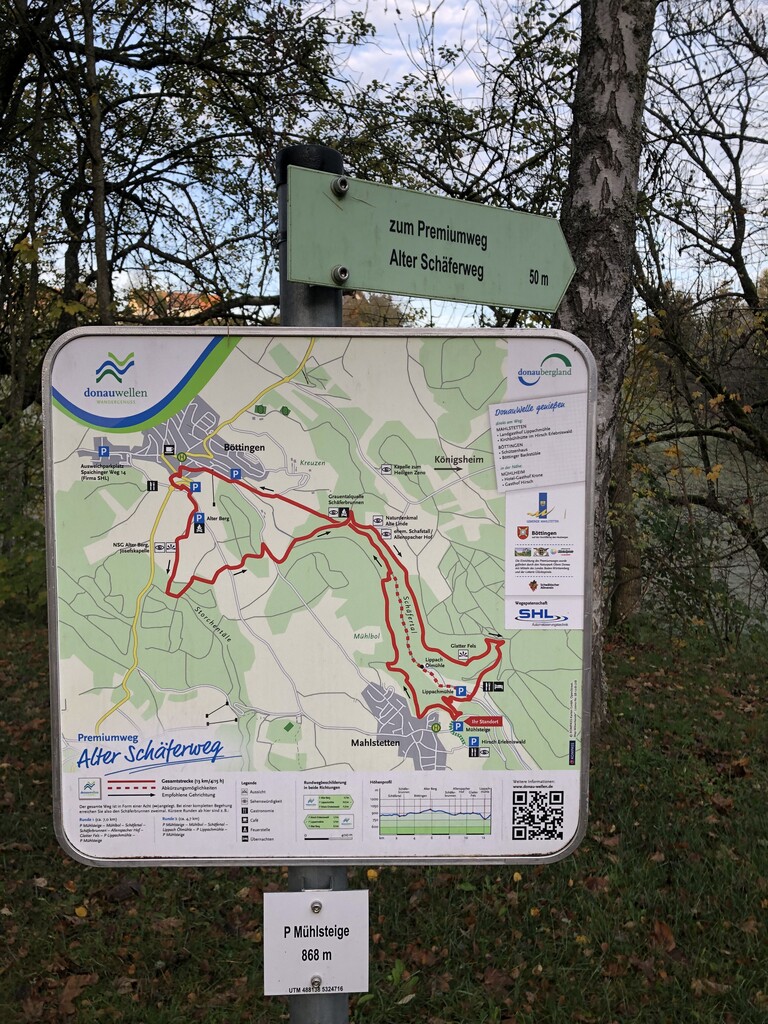
Start and end point of the famous hiking way Alter Schäferweg is the parking lot near the town sign of Mahlstetten (48°04'34.1"N 8°50'29.5"E).
From the parking lot, the first section leads through the forest below Mahlstetten and above the former ski slope. Then you pass a large clearing in the forest and after a few meters on a forest path, a steep path leads down into the valley. From there it goes straight down to the parking area of the restaurant Lippachmühle. On a steep trail it goes up to the viewpoint Glatter Fels. Following the trail on the rim through the forest until reaching the Allenspacher Hof and heading into a short downhill to the Schäferbrunnen. Then it goes up to the right in the direction of Böttingen. Passing the village and reaching after that the highest point of the route (Alter Berg, 980m). It follows a longer downhill into the Schäfertal; passing the crossing point further into the valley until the sign marks that it goes steep right up to the rim. Following the forest road further left to meadow. After that heading on the trail along the rim of the Schäfertal back to the starting point.
The route is about ~13km with ~470 HM and the path is consistently signposted with green signposts and marked with the Donauwellen sign (green-blue waves; see attached pictures).
https://www.donaubergland.de/erlebnis/donauwelle-alter-schaeferweg/