Notes:
- The gpx file reads 86km. This is a desktop plotted route and does not fully account for the complexity of the terrain; the route is 100-105km.
- You must have legitimate access to the trail (permits).
- You must follow the pre-determined route and not cut sections which may be simplified by roads.
- Take a photo of each Checkpoint with your watch indicating the time of day.
- Carry a candle/crayon/wax and 1m of string to re-seal the FKT journal at the finish after breaking the previous finisher's seal to enter your name into the journal.
Permits:
A permit is required, and available at https://amatolatrails.co.za/wp/booking/. As the non-stop effort of this trail is not the standard, you will need to communicate the intent in the ‘Optional Message’ section. They will then amend the quotation accordingly to a two-day permit.
Route Description:
Maden Dam to CP1 - Gwiligwili Hut
Distance: Approximately 12,5 km / +750m
The trail begins at Maden Dam, near King Williams Town. Expect a challenging ascent as
you make your way toward Gwiligwili Hut. The surrounding landscape features lush
vegetation, indigenous forests, and glimpses of wildlife. Keep an eye out for waterfalls along
the way.
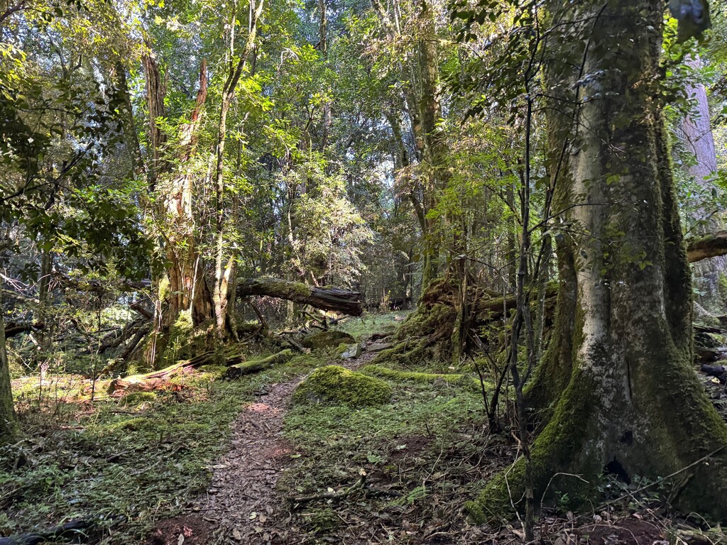
Gwiligwili Hut to CP2 - Dontsa Hut
Distance: Approximately 21,5 km / +630m
Dense, ancient indigenous rainforest dominates this section. Prepare for steep ascents and
descents. The trail winds through enchanting, forested areas, with the sound of birds and
rustling leaves.
Dontsa Hut to CP3 - Cata Hut
Distance: Approximately 24 km / +1024m
You’ll transition from forested paths to open macchia grassland. The landscape then
changes dramatically, offering relentless steep and technical climbs, river crossings and
descents through dense forest.
Cata Hut to CP4 - Mnyameni Hut
Distance: Approximately 15 km / +634m -1000m
Scenery: Enjoy panoramic views as you traverse the rugged terrain up exposed
switchbacks. The trail takes you over ridges and down steep off chamber descents.
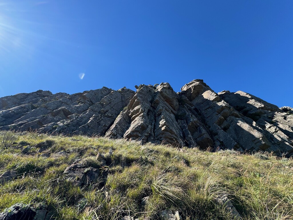
Mnyameni Hut to CP5 - Zingcuka Hut
Distance: Approximately 21,5 km / +1000m
This section involves steep ascents and descents but becomes more runnable. The trail
leads through diverse landscapes, including grassy slopes and rocky outcrops. Take in the
breathtaking views of the Amathole Mountains.
Zingcuka Hut to CP6 - Tyumie River
Distance: Approximately 16 km / +900m
This leg of the trail takes you up and over 'The Hog' then downhill toward the Tyumie River.
Following a gradual descent the trail turns back into the forest down a steep and technical
descent which leads to the end of the official Amathole hiking trail.
Tyumie River to CP7 - Madonna & Child Falls to CP 8 – The Big Tree to CP9 – Finish:
The Green Dragon Café
Distance: 5 km
This section is a popular hiking trail along boardwalks and cut trail down to the valley and
then a final 150m climb up to the finish at the doorway of Away with the Fairies’ bar.
The FKT Journal: When you finish, break the previous finisher's seal to enter your name into the journal. Then use the candle/crayon/wax and string you carried to re-seal the FKT journal after adding your story to the history.
Record your journey in the trail journal, submit your FKT at fastestknowntime.com, and complete the form at https://www.fktrun.co.za/amathole-fkt to be captured in the FKT history.
Further information at: https://www.fktrun.co.za/amathole-fkt