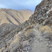
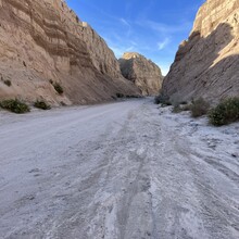
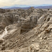
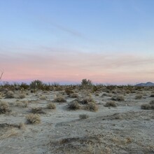
This point-to-point, open-course route takes you from the southernmost point of Anza-Borrego Desert State Park to its northernmost point, along the park’s longest “axis”. This approximately 90-mile, full length crossing of Anza-Borrego is done south to north as opposed to east to west, as the distance from the southern terminus to the northern terminus is greater than the distance from the eastern terminus to the western terminus, making this the most comprehensive possible crossing of the park.
This route is significant because it requires an individual to traverse the entirety of California’s largest state park. Anza-Borrego is also America’s third largest state park (out of 6792).
All rules of Anza-Borrego Desert State Park must be followed. It is fair game to use natural elements found in the park (as long as authorized by the park). Use of road/trail is allowed. Any time of the year is allowed.
The Northern Terminus of the park is found when you are exiting the park while northbound on the Pacific Crest Trail (PCT), and your GPS reads 33.544 N (or more north). This is at approximately 33.544070, -116.579168.
The Southern Terminus of the park is located at Lat: 32.6235507 (or more south) Lon: -116.207143 (or more east).
There does not seem to be any clear marker on the actual land indicating where Anza-Borrego Desert State Park’s boundary is, so it is acceptable to get within ±0.0003 of each number in the DD coordinate, or ± 1 second of each number in the DMS coordinate of the Southern and Northern Termini coordinates listed above.
In general, it is not required to go any one route, and you are encouraged to make your own, as only the start and end points matter. It is acceptable to attempt either from South to North, or from North to South. Additionally, you must stay within the outermost boundary of Anza-Borrego Desert State Park from start to finish.
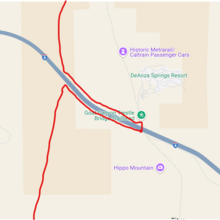
Note: Any illegal actions will disqualify an FKT. To ensure legal movement on this route, the individual must legally cross Interstate 8 via a pedestrian-legal underpass/overpass. Because it is not possible to do this within park boundaries, it is allowed to leave park boundaries only in order to legally cross Interstate 8. The suggested route, seen in the attached pictures below, is detouring to Carrizo Gorge Road. The individual must immediately re-enter park boundaries after crossing the interstate. Specifically, if the individual is traversing south to north, first the individual must reach the Interstate 8 boundary, then go to the underpass at Carrizo Gorge Road, cross under the interstate, and then go directly north of where they were before, but on the other side of the interstate, before continuing the traverse, or vice versa if north to south.
The GPS tracks, trip report and trip video below are provided as informational resources, but should not be followed as exact guides because they describe a route that does an illegal crossing over Interstate 8. So, exactly following this trip report/track would disqualify an FKT.
Supported traverses allow caching/resupplying water and food, purchasing supplies along the way, staying at motels, and finding, requesting, or being offered food or water. You must still be entirely self-powered.
For an unsupported traverse, the adventurer must carry all their food, water and all other supplies/equipment from the start to finish and will leave "no trace" (carry out all the trash as well until the end). It is not allowed to receive support from anyone else (navigation, spectating, weather, carrying equipment, filming or photography, etc.). Water should only be from natural sources, or the water that you packed. No taps allowed. No pre-placed food or water caches allowed. Using public restrooms is allowed, as long as it is not being used as an extended shelter, or for drinking water. The use of a satellite phone, distress beacon or GPS does not constitute support.
Links to Sam Kottoor's trip report and trip video:
https://docs.google.com/document/d/1W6wNMNHuHtkfOyyuSwx5pL8zyE7Hp48xVK9oyFjg-OA/edit?tab=t.0
Note: The listed mileage and vertical gain are approximates on the route description because this is an open-course route. Additionally, elevation gain going north to south would be less than south to north.
Anza-Borrego Desert State Park is within the Colorado Desert, the Colorado Desert being a part of the larger Sonoran Desert. The proposed route goes through four ranges of mountains: the Jacumba Mountains, the Vallecito Mountains, the Pinyon Mountains, and the Santa Rosa Mountains. Part of the proposed route includes a part of Juan Bautista de Anza’s historic trail, and includes a part of the Pacific Crest Trail as well. The southern terminus is just barely north of the US-Mexico Border. The proposed route also passes by the metal art sculptures found in Galleta Meadows. Additionally, Anza-Borrego Desert State Park was designated as an International Dark Sky Park by the International Dark-Sky Association.
As there are little potable water sources available in the park, the challenge becomes even more interesting if the individual attempts to do an unsupported crossing, carrying all their needed supplies from start to finish. Finally, some of the route encourages an individual to find their own way through the wilderness, while other parts of the route make more sense on trail/road.

