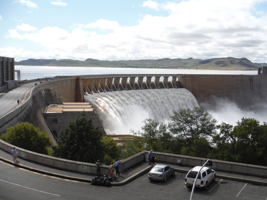
The Gariep Dam, situated in the Orange River, is the largest dam in South Africa. The dam wall crosses between the Free State and Eastern Cape provinces. At the time that construction of the dam began in 1965 the towns Norvalspont, Venterstad and Bethulie were in existence, but the town Gariep Dam, and Oviston, were built specifically to house construction personnel. The landscape is Karoo, a semi-arid area that covers a large portion of South Africa, characterised by small hardy shrubs and flat-topped hills. The dam is situated in the centre of South Africa, far from most big cities and light pollution.
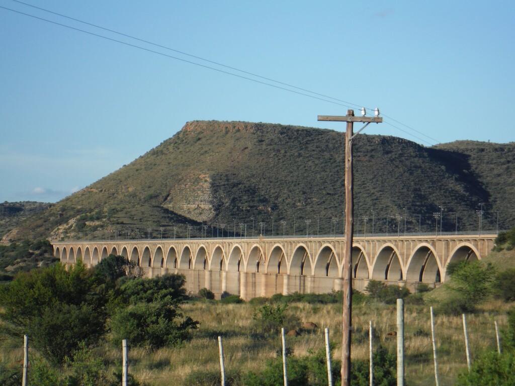
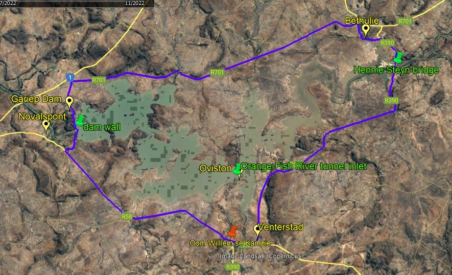
The route follows the tar road that goes around the dam. The starting point is on the R58 road, at the entrance to Oom Willem se Kampie road stall, situated near the fourway crossing where the roads to Venterstad, Colesberg/Gariep Dam, Steynsburg and Oviston intersect. The direction is clockwise. From Oom Willem se Kampie, follow the R58 towards Colesberg/Gariep Dam. At 31km, turn right on the R33 to Gariep Dam, cross the dam wall from Eastern Cape to Free State, and run through the town Gariep Dam, passing the shopping centre at about 40km. Just outside of the town Gariep Dam, turn right on the R701 that leads to the N1 highway, but before reaching the highway, at about 45km turn right towards the town Bethulie, still on the R701. At 92km, where the R715 joins the R701 from the left, turn right along Olien Street into Bethulie. Olien Street becomes Joubert Street, then Scott Street, and meets the R390 at 98km. Turn right here. At 103km, cross back from Free State to Eastern Cape over the 1km-long Hennie Steyn road/rail combination bridge. At 111km, turn 90 degrees right direction Venterstad, still on the R390. At 144km, enter Venterstad. Continue through the town, exit on the R58 and finish at Oom Willem se Kampie at 149km.