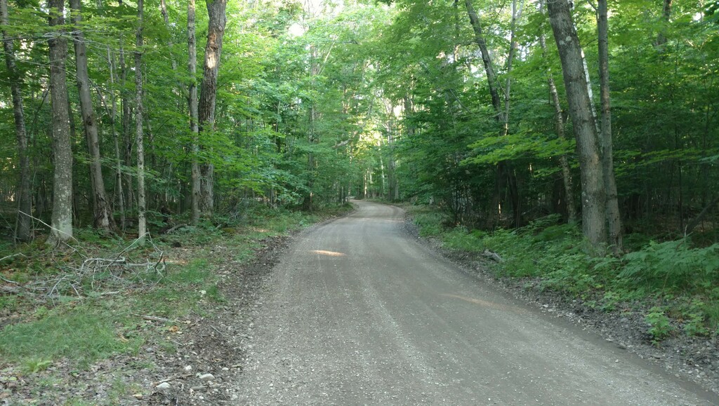
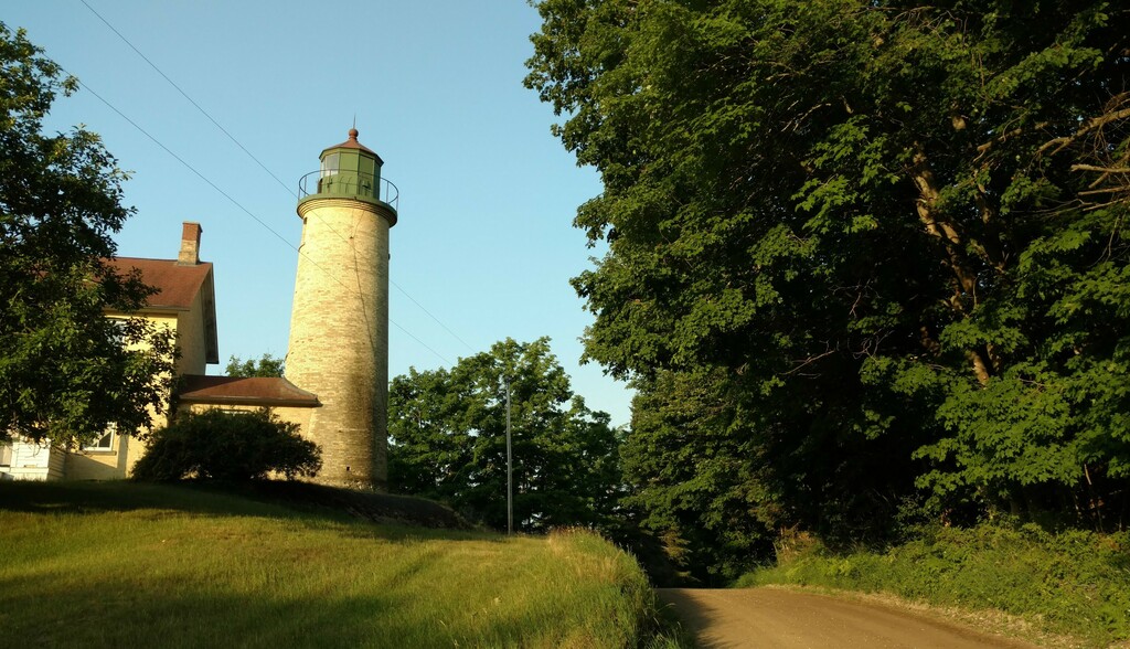
This route travels along the main public perimeter/outer-most roads of the Island. It also include the length of Kuebler Trail on the west side of the Island. Since there are several options for roads on the north side of the Island, the main Donegal Bay Road will be used as the "perimeter" for the northern boundary and the route does not go around the harbor in town. This is a fairly obvious loop when you look at a map of the island. It also takes you to all parts of Beaver Island, from the meadows and beaches on the east side, to the bluffs and lighthouse on the south, through the shaded tree tunnels and past inland lakes on the west side. There is only about 1.25 miles of pavement and the rest is gravel, dirt, and trail. It goes through the very edge of town and this makes a perfect start/stop place so you can replenish calories after a hard effort. The suggested route goes clockwise, to make use of the shade during the second half of the run along the west side.
The route:
The official start/stop is the corner of Donegal Bay Road and King's Highway (Daddy Frank's). Looking at the route in a clockwise manner, the route starts by heading out of town south on King's Highway. At Four Corners, take a left (east) on East Side Drive and follow all the way to the south end of the Island, where it turns into South End Road past the south arm of Lake Geneserath.
Continue on South End Road past the lighthouse and along Iron Ore Bay. NOTE: The route does NOT turn inland at Betsy Smith Trail!!! This road is technically private (although used by the public, private is against official FKT rules) and is a short-cut from the perimeter along the south end (thus against the spirit of this route). Stay on the South End Road at Iron Ore Bay. After the road turns north at the end of the Bay, it turns into West Side Drive.
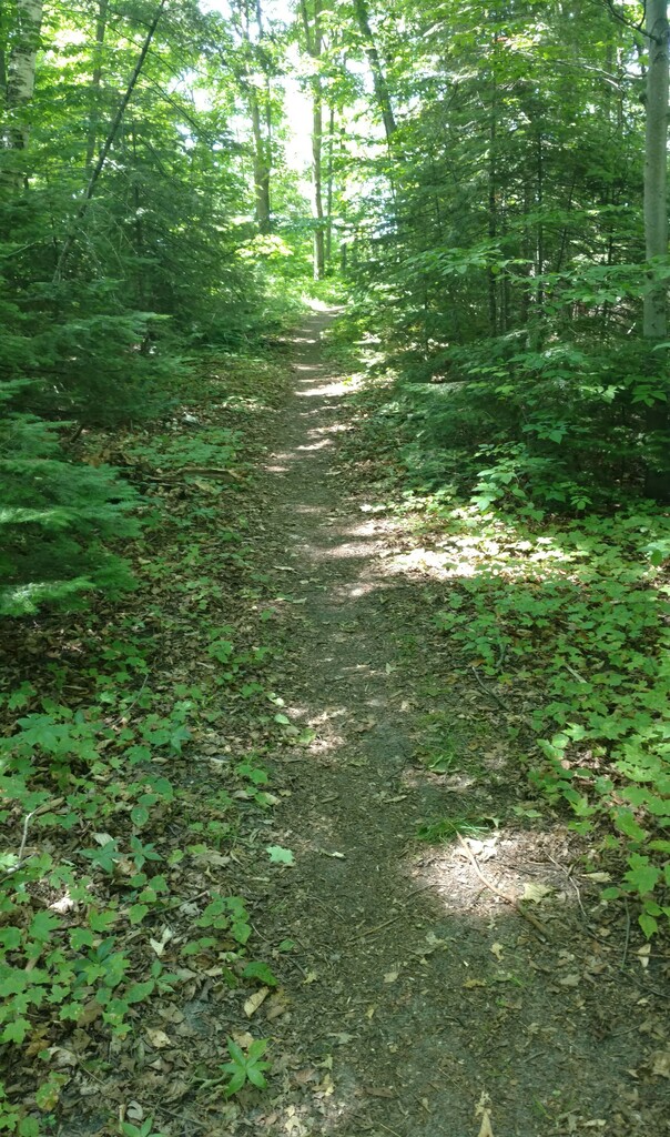
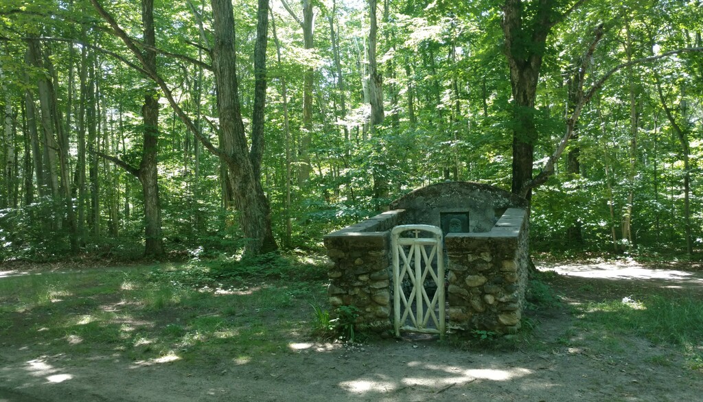
Continue north on West Side Drive, making sure you stay on the main road and do not take a wrong turn (S/N French Bay Road and Greene's Bay/Lake Roads are pretty established-looking). Be sure to stay left (north) on West Side Drive where it intersects with Fox Lake Road and Camp #3 Trail, as this is a (relatively) larger intersection. Keep right (east) on the last bit of West Side Drive where it intersects with Mrs. Redding Trail and then take a left (north) at the intersection by the public airport, on Donnell Mor's Lane. When you hit the "T" intersection with Sloptown Road, head left (west) to the next intersection, where you turn right (north) toward's Protar's tomb and catch the Kuebler Trail. Take Kuebler trail all the way to its northern terminus at Allen's Lakeview Road. Follow Allen's Lakeview Road to the intersection with Donegal Bay Road and turn right (east) on Donegal Bay Road back to the start.
Comments
Is there a current time for this one right now?
Tomorrow I'll attempt this route unsupported. Following the guidelines for loop trails (https://fastestknowntime.com/guidelines) I'll be starting /ending from a different location and traveling in a different direction than is indicated on the gpx. I will begin and end at the south side of the Kuebler tunnel (I can't believe that trail has a tunnel) and travel counter-clockwise. I will try for the unsupported record (with one water refill at the publicly available source in the Bill Wagner campground). I'll record on my Garmin Enduro 2 watch and photo-document.