Chilliwack, BC. Starts and finishes at Cultus Lake and goes to Chilliwack Lake and back, via the easiest route there and the hardest route back (or reverse).
The first 30 miles has 3700ft of climbing, the final 78.5 miles has 29,666ft of climbing and crosses four major mountain passes. The entire route only doubles back on itself (runs the same terrain twice) for about two miles, so it's approximately 106 miles of unique terrain.
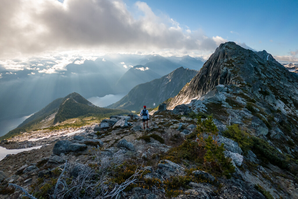
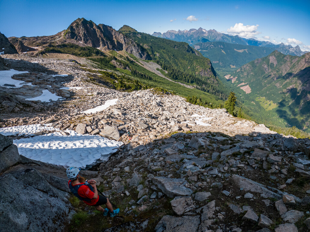
Much of this route is off trail and on rocky talus slopes with some exposure. Experience with mountain travel and off trail navigation is a must, but at no point does the route involve actual scrambling.
A helmet is recommended for the second mountain pass, from Slesse to MacFarlane via Crossover Pass.
It is highly recommended to cover the crux of the route, the first two mountain passes, in daylight, and as such I began my run at 11pm at night, to reach the first mountain pass for just after sunrise the next morning.
Gary Robbins' Big Chill film: https://www.youtube.com/watch?v=7zS62bsWsMU
A website with more specific details is in the works.
Detailed route description:
Start and finish at Entrance Bay, Cultus Lake, on the main dock in the water. Proceed to Chilliwack Lake via the Trans Canada Trail as best can be followed (some sections of the trail are overgrown and difficult to locate). As you approach Chilliwack Lake detour off of the TCT and onto the main road at Riverside Campground. This prevents the route from having an out and back section. Follow the main road to Chilliwack Lake and then step back onto the TCT until it splits off towards Radium Lake and Mt. Webb.
At the Mt. Webb saddle turn towards MacDonald Peak and Mt. Lindeman, taking the path of least resistance through the alpine. You can choose to summit MacDonald if you choose as it's only a minor add on at this point. Once you navigate the pass below Lindeman you follow the rudimentary trail out of the alpine and back down into the forest below where a more established trail presents. Descend this all the way down to the Centre Creek FSR. Expect some bushwhacking as you begin along the FSR proper. The bushwhacking continually improves until you reach the still serviced portion of the FSR.
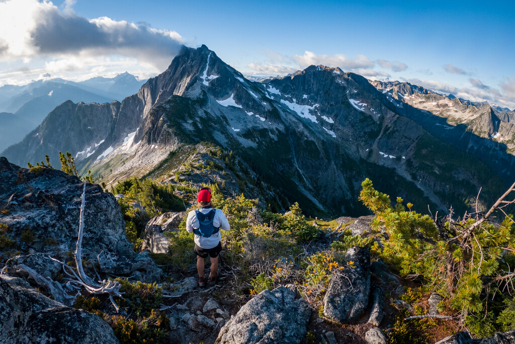
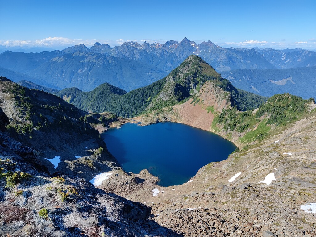
Follow Centre Creek FSR to Nesakwatch Creek FSR and then up to the trailhead towards the Slesse Memorial Site. As you climb towards the Memorial Site, take the slightly obscure but marked route to Crossover Pass. You will then climb steep loose forested terrain that is mostly devoid of switchbacks. Follow the main trail (it eventually splits and the left fork goes to a climbing area, you want to stay right) until it peters out to boulder fields in the alpine. Contoura along the 1700 meter band as you leave the trail and locate the small downclimb route into the pass below Crossover Peak. Please reference the Chilliwack East map for exact location.
All of the crossing from the alpine area below Slesee, across to MacFarlane is off trail, alpine terrain, technical and not without consequence. A helmet and previous knowledge (at least one scouting day) of the route is highly recommended.
You may select the path of least resistance across to the true peak of Mt. MacFarlane.
Take the main route off of MacFarlane, down past Upper and Lower Pierce Lakes.
Once you descend the 2000m down to the parking area you are once again following the main paved Chilliwack Lake Road for a brief stretch. If you have followed the correct TCT route over the first 50 kms of this route, while going to Chilliwack Lake, you'll now only be running over the exact same terrain as you had previously for a few hundred meters. Turn left and away from Chilliwack Lake as you hug the shoulder of the road. Your next target is Mount McGuire and you can choose your preference between the Old and New Borden Creek FSR. For my run I took the old Borden Creek. I am uncertain as to which route is faster or shorter, but the New route is better maintained and accessible to a 4x4 vehicle, whereas the Old route is not.
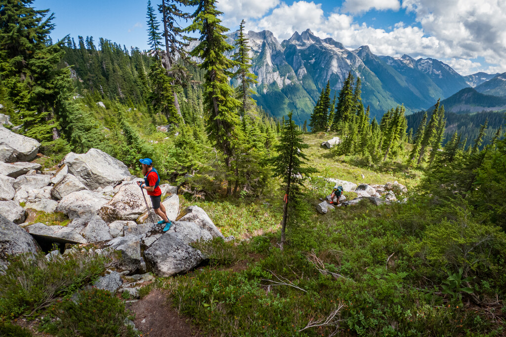
You must gain the true summit of Mount McGuire. It is up to you at this point how you descend McGuire to then target the Church Mountain area. For my running I took the ridge trail below the summit leading down to the Chilliwack - Tamihi Creek FSR. There is an alternate route via the Spencer Peak area. Having since scouted the Spencer Peak region I can confirm as of 2021 that it is overgrown and potentially slower than the route I took, but annual maintenance may alter that in the coming years. As long as you top out on McGuire and then head over towards Church, you are in line with the scope of this route. Both alpine routes mentioned here are outlined on the Chilliwack East trail map.
Take the Tamihi Creek FSR towards Canadian Border Peak and then leave the road for the ascent trail called Perish Hill. This trail can be identified via the "Trailforks" app, under the "dirtbike" setting. Follow Perish Hill to Buffalo Jump, contouring just below the Church summit. At the end of Buffalo Jump go left onto the Windy Knob FSR. To descend the mountain from here you can use either the FSR or the newly constructed mountain bike trails. The trails are much steeper and hence shorter. Your quads may prefer the service road.
At the bottom of Windy Knob FSR turn left onto the Liumchen West FSR. Follow this route back up, to gain the shoulder below the Mount Amadis trail, along the International Ridge Connector Trail. Follow this back down to Columbia Valley Road via the "Horse Trail Loop". Stay to the right along the descent until you pop back out onto pavement with less than 1km to go. Retrace these final few steps to your starting point at the main dock at Entrance Bay on Cultus Lake.
FKTs