Route submitted by: Mohit Oberoi, Nakul Butta, Sannat Sachdev
INTRODUCTION
Bir, a small village located in the Kangra District in the state of Himachal Pradesh, approximately 50 kms from Dharamshala. Bir is known for paragliding and adventure activities, though it has grown to be a popular tourist destination. The area has an atypical topography with gentler slopes suddenly rising in elevation, typical of Dhauladhar range of the Himalayas.
SUMMARY
This FKT route is a looped trail course reaching a local top called “Hunumangarh” (~ 3,050 m / 10,015 ft), the highest point in the local (Barot) valley.
ROUTE DESCRIPTION
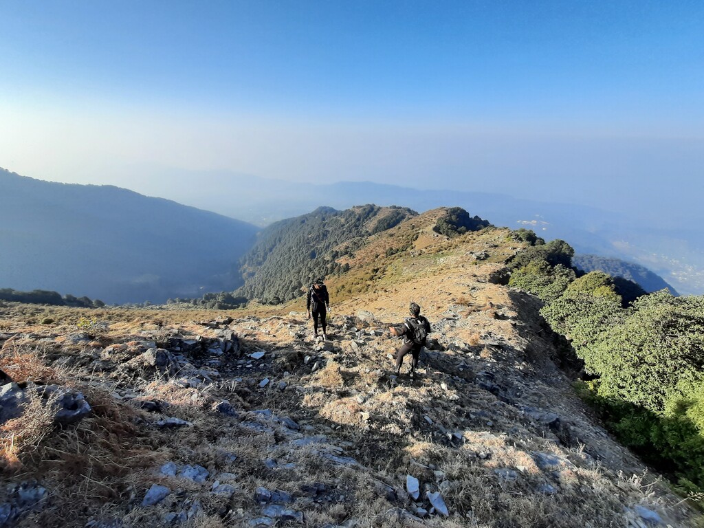
The start and end is a trail head marked by a large cemented open gate of a local temple. From there, climb into the forest and follow the ridgeline all the way to the top called Hanumangarh. The climb is steep and technical in sections, typical of this side of the Himalayas.
From Hanumangarh, take the south ridgeline down to “Chaina pass” that connects the two valleys of the region. Along the route to Chaina pass, cross a local temple.
From Chaina pass, follow a dirt road that leads to Rajgundha village. (The original route gpx file has some extra distance recorded, so avoid that section)
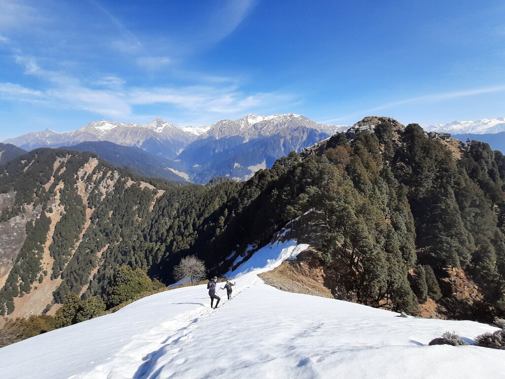
From Rajgundha, it’s a steep climb over shepherd trails to another pass, which is close to Hanumangarh top. Cross the pass and head down through beautiful old growth forests. Once lower into the valley, cross several Himalayan villages, heading towards Mandehr. From Mandehr, follow the road / dirt track back to the starting point. Don’t miss taking some trail shortcuts along the way or you’ll have to cover some extra distance to the finish.
NOTES
- Excellent view of the Himalayan range on a clear day from Hanumangarh top
- Bear risk through the forest, so travel in a group and make some noise
- Snow to be expected in patches in winter
- Limited water source till reaching Rajgundha
BACKGROUND:
This FKT route was created as part of a collaborative project between Mr. Mohit Oberoi, veteran rock climber, triathlete and adventurer, and Mr. Nakul Butta, trail runner and outdoors enthusiast. Several local partners, from runners to local friends, have supported this initiative and helped with creating these routes.
While India has thousands of kilometres of pristine trails, very few are documented digitally. Our aim is to develop routes that allow individuals to test their abilities by moving fast & light, while enjoying some iconic parts of the country, specifically in the Indian Himalayas.
We hope this will help create a FKT culture in the country for years to come.