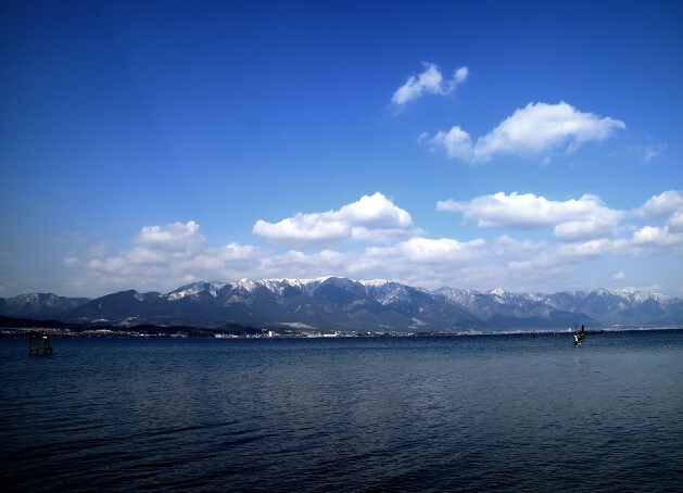
On the western shore of Lake Biwa, a series of mountains can be seen from south to north. Mt. Hiei, a World Heritage Site, to the South, and the Hira Mountains to the North, including the main peak of Buna-gatake.
Hiei-zan has been a path of mountain worship since the Nara period (710-794), and was designated by Saicho as a place for Buddhist ascetic practices. The temple area, registered as a World Heritage Site, is 20 km square in circumference, and the path leading through the cedar groves is also the path taken by the "thousand-day Kaimpo Gyoja" as a way to undergo severe ascetic training. The mountains of Hira, stretching from Mount Hiei to the North, have 15 peaks over 1,000 m, including the highest peak, Mt Buna-gadake, with a spectacular view of Lake Biwa below.
(source: https://longtrail.jp/trail.html#hira)
琵琶湖の西岸に、南から北へ山々が連なって見える。南は世界遺産の比叡山、北へ主峰の武奈ケ岳など比良山地が続く、絶景の道。
奈良時代から山岳信仰の道であった比叡山を、最澄は仏教修行の場と定め修行を積み重ねて 天台宗を開創した。世界文化遺産に登録された寺域は周囲20キロ四方に及び、杉木立の中に つづく道は、過酷な修行の道として「千日回峰行者」が歩く道でもあり、修験者たちの頂上を 目指すだけでない山の歩き方は、全国に広がる「トレイル」と意味を同じくしている。比叡山 から北へ続く比良の山々は、最高峰の武奈ケ岳など1000mを超える峰が15座、眼下に琵琶湖 の絶景を眺めながら歩きます。