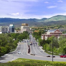
This route traverses the most iconic mountains and features of Boise including Lucky Peak, Boise Peak, Doe Point, Shafer’s Butte, and Stack Rock. It’s more than likely the most difficult and complete traverse with the most elevation you could do while still being in Boise.
*The route starts when you touch or pass by the Weat Valley Highland Trailhead, and ends when you touch or pass by the Collister Trailhead.
*You have to climb to the top of Stack Rock for it to count.
Some basic directions
Starting from West Valley Highland trailhead you climb to the top of Lucky Peak. From there you drop down to Adalpe Pass. Then following Boise Ridge Rd you continue to climb until you arrive at the base of Boise Peak. Leaving the road you climb up a small path and end up bushwhacking quite a bit to get to the top. Dropping down from Boise Peak involves a lot more bushwhacking until you meet back up with the road. Following Boise Ridge Rd you continue until you reach the Deer Point chairlift. From there you take a series of roads, trails, and even a short scramble if you feel like it to the top of Shafer’s Butte. Descending Shafer’s Butte using a handful of road and trail connections and run down Bogus Basin Rd for around a mile and a half. Turn onto Pats and then Eastside trail. Follow Eastside until you reach Stack Rock Trail. Go up that trail until you reach Stack Rock. From there you turn around and run down the same trail until you meet up with a trail that follows the ridge down towards Boise side note this trail is pretty hard to follow sometimes as it’s pretty washed out. Eventually you’ll meet up with Sweet Connie trail and from there you’ll follow it until you meet up with Peggy’s trail. Follow Peggy’s trail and cross Cartwright Rd into Polecat Reserve. Then take Quick Draw until you finish at the Collister Trailhead.


Comments
Jared, thank you for posting this route. Id like to try it this summer starting at Polecat and ending at the highland valley trailhead. Would that be kosher to do it in the opposite direction you did? Or would you only accept the FKT in the same direction?