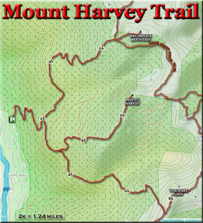
Route: Brunswick Mountain (BC, Canada)

Location
British Columbia, CA
Distance
13 km
Vertical Gain
1,560 m
Description

Brunswick Mountain is the highest of all the North Shore peaks, and as such has incredible views in all directions. Howe Sound and its islands, Brunswick Lake, Sky Pilot Mountain, The Lions, Mount Harvey, and Grouse Mountain are all prominently on display. The narrow summit has a 360 degree panoramic view that is truly one of the best around.

However, the hike to the summit is not for the faint of heart (or for the inexperienced hiker, for that matter). The final 200 m are very steep and exposed, and require some scrambling. Weather can set in quickly, and if there’s snow or ice you must take extreme caution. The ridge approaching the summit is very narrow and a slip at the wrong moment could easily spell disaster.

But, if you can handle the vertigo, Brunswick Mountain is the perfect hike for anyone looking for something challenging, with lots of vertical climbing and jaw-dropping views.

The round trip hike is 14 km with 1543m of elevation gain.

GPS Track
Images