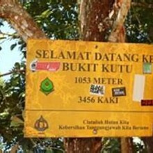
Bukit Kutu or Treacher Hill (1053m) is a former hill station and now a ghost town in Selangor, Malaysia, This hill station was established in 1893 and consisted of two bungalows, which served as a lodge for visitors and included a 15.3 kilometres (9.5 mi) bridle path that connected it with the town of Kuala Kubu.
TRAIL
Starting from the carpark which has an elevation of 250 meters, the 6km hiking trail to Bukit Kutu summit (1053 meters tall) takes approximately 3-4 hours, climbing up an elevation of 800 meters.
The trail can be split into two parts. The first part (1.5km)– walking to the foot of Bukit Kutu and the second part (4.5km)– the actual climbing of Bukit Kutu.
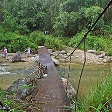
The first part – walking to the foot of Bukit Kutu, is approximately 1.5km long and takes about 30 to 45 minutes to complete. Always take the trail on your right if you come into a diversion. There will be three river crossing along the way. After crossing the third river, you will see a yellow sign7 board with the words “Hutan Simpanan Kekal” which means reserved forest. The hike to Bukit Kutu begins.
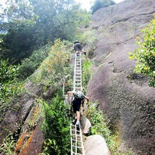
The second part – actual climbing of Bukit Kutu begins after the yellow signboard and is approximately 4.5km long to the summit. you will need to cross a small stream8. After the stream, the actual ascends begins. There are 9 checkpoint along the way, C1 to C9.
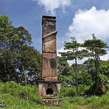
Once you reach the chimney, you are almost at the summit. The right path of the chimney leads to the summit boulder and the path behind the chimney leads towards the old ruins. The chimney is said to be a leftover from one of the buildings back in the times.
Hiking down the track will take you another 2 hours but please take it slow and refrain yourself from jumping down the ledges. Once you reach the river at the bottom, it’s time to enjoy yourself with some swimming in the cool freshwater river.
Enjoy the trail!


