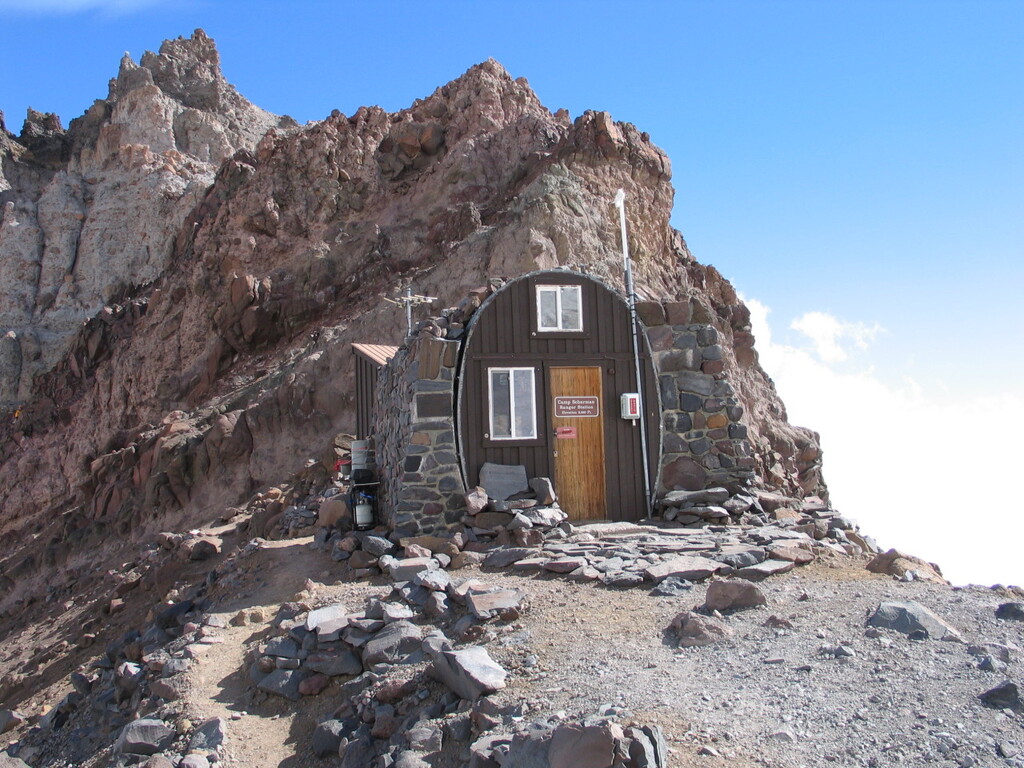
This route takes place on Iconic Mount Rainier northside Base Camp Called "Camp Schurman"
Start and Finish of this route is at White River Campground at the Glacier Basin Trailhead. The route continues towards the Inter Glacier then it is a straight up on the Inter Glacier towards Camp Curtis. Right Above Camp Curtis there is a technical scramble decent down to Emmons Glacier and from there it's a pretty short uphill travel to the Camp Schurman. The same path follows down Emmons Glacier with a Scramble back up to Camp Curtis, down Inter Glacier and back to Glacier Basin Trail to White River Campground.
This route is unique due to very fast and easy dirt glacier basin trail that switches to steep glacier travel crossing two Glaciers (Inter and Emmons Glacier) with in between rock scramble to connect these glaciers. It's a a trail that has Fast easy dirt running, Glacier/Snow Climbing and Technical Rock Scrambling. Using of proper glacier safety gear is mandatory on this route.
Section one: from the Trail Head at White Rive Campground to Inter Glacier (same applies for the trip down)
- 6.25 KM of single track trail. Trail is in very good shape and gets little bit rockier once you get closer to the Inter glacier. No special gear required here.
Section two: Inter Glacier to Camp Curtis right above the Moraine Scramble (same applies for the trip down)
- 2.18 KM. This is mainly snowfield with few rocky spots and graduate incline. Crampons are recommended but no rope is necessary. No fall danger here.
Section three: Crossing the Moraine from Camp Curtis to Emmons Glacier (same applies for the trip down except you will be climbing up the moraine and is easier than going down)
- 0.15KM. This is the crux of this route and potential fall hazard. 36 meter scramble decent on the glacier tilt rock. The slope grade is not too terrible about 24%. The rock is very loose so I do not recommend going underneath someone or above someone. Take your time until the path is clear so rocks don’t fall on people. There is also nowhere to anchor to so if you are on a team of two or three some people choose to do hip belay but it is not that common and can be scrambled carefully and slowly paying attention to your footing. There is also no cliff below so you would not fall too far. The gear required here would be a helmet and proper shoes either trail runners or hiking boots. I would suggest using your hands 100% rather than poles or Ice Axe. Attached are couple of pictures of showing the moraine.
Section four: Bottom of the Moraine/ Emmons Glacier to Camp Schurman (same applies for the trip down)
- 0.65 KM. This is a full-on Glacier travel with Open Crevasses and potential fall hazard. The boot pack is typically pretty well established mid to late summer. It is short but requires to have Helmet, Harness, Crampons, Rope, Ice Axe and Crevasses Rescue Skills. Team of 2 or more are recommended to rope up. If you travel solo proceed with caution but ware all gear as mentioned above. Climbing Permit is not required if you are not traveling about 10,000.00 Feet. The elevation of Camp Schurman is 9,460 Feet. I would also suggest to bring Emergency GPS beacon along for this .