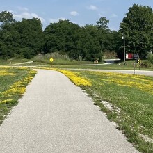
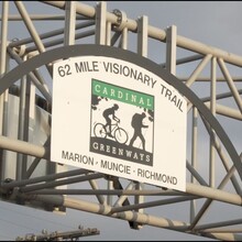
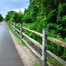
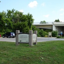
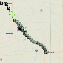
The Cardinal Greenway is a scenic, multi-use recreational trail spanning approximately 77 miles, including dedicated trail segments and a road portion. The route stretches from Sweetser to Richmond in eastern Indiana, following the path of the former Chesapeake and Ohio Railway for much of its length. This diverse trail offers a mix of urban, rural, and natural environments.
The trail consists primarily of paved surfaces suitable for running, cycling, walking, and inline skating. However, there is a significant road portion between Jonesboro and Gaston. This description follows the Wheeling Pike route, though athletes may select their own route between Jonesboro and Gaston. The route may be completed in either direction.
Highlights
- Wysor Street Depot: Located in Muncie, this historic depot serves as a central hub, offering restrooms, water, and information.
- White River: The trail crosses the White River in Muncie, providing scenic river views and opportunities for wildlife observation.
- Natural Scenery: The route features a variety of natural landscapes, including forests, farmland, and rivers, providing a serene backdrop for trail users.
- Historic Towns: The trail passes through several historic towns, each offering unique local charm and amenities.
Challenges
- At-Grade Road Crossings: Several at-grade crossings intersect with busy roads. Caution is advised, particularly during peak traffic times. Example: Crossing State Road 32 in Muncie.
- Road Portion: The 11-mile road segment from Jonesboro to Gaston involves navigating regular roads with vehicular traffic. This section requires heightened awareness and adherence to road safety practices.
Specific Descriptions of End Points
- Northern Terminus: The northern end of the Cardinal Greenway is located at the Cardinal Greenway sign beside the parking lot at the Elm Street Trailhead in Sweetser. This trailhead offers parking and serves as a welcoming starting point for the journey southward.
- Southern Terminus: The southern end is marked by the Cardinal Greenway sign at the Richmond trailhead, located at 301 South 1st Street, Richmond, IN. This endpoint provides parking and access to nearby amenities in Richmond.
Route Breakdown
- Sweetser to Jonesboro: Approximately 12.5 miles of dedicated trail.
- Jonesboro to Gaston (Road Portion): Approximately 11 miles. The GPX on this page follows Wheeling Pike, but athletes may choose their own route between Jonesboro and Gaston. If the trail is connected in the future, the route will follow the official trail connection.
- Gaston to Richmond: Approximately 53.5 miles of continuous dedicated trail with trailheads and amenities.
Waypoints for Cardinal Greenway Trail
- Sweetser (Elm Street Trailhead): 40.5681, -85.7655
- Jonesboro: 40.4792, -85.6278
- Jonesboro to Gaston Road Segment Start: 40.4792, -85.6278
- Intersection at Wheeling Pike and County Road 950 S: 40.4642, -85.5476
- Intersection at Wheeling Pike and South 300 E: 40.4081, -85.5279
- Intersection at Wheeling Pike and South 900 W: 40.3395, -85.5129
- Gaston Road Segment End: 40.3131, -85.5070
- Gaston (Trailhead): 40.3131, -85.5070
- Muncie (Wysor Street Depot): 40.1934, -85.3880
- Losantville (Trailhead): 40.0036, -85.1772
- Economy (Trailhead): 39.9750, -85.0919
- Richmond (South 1st Street): 39.8290, -84.8917
Trailheads and Access Points
- Multiple access points along the route allow for flexible entry and exit, including key locations such as Gaston, Losantville, and Economy.
Amenities
- Restrooms, benches, and picnic areas are available at various points along the trail.

