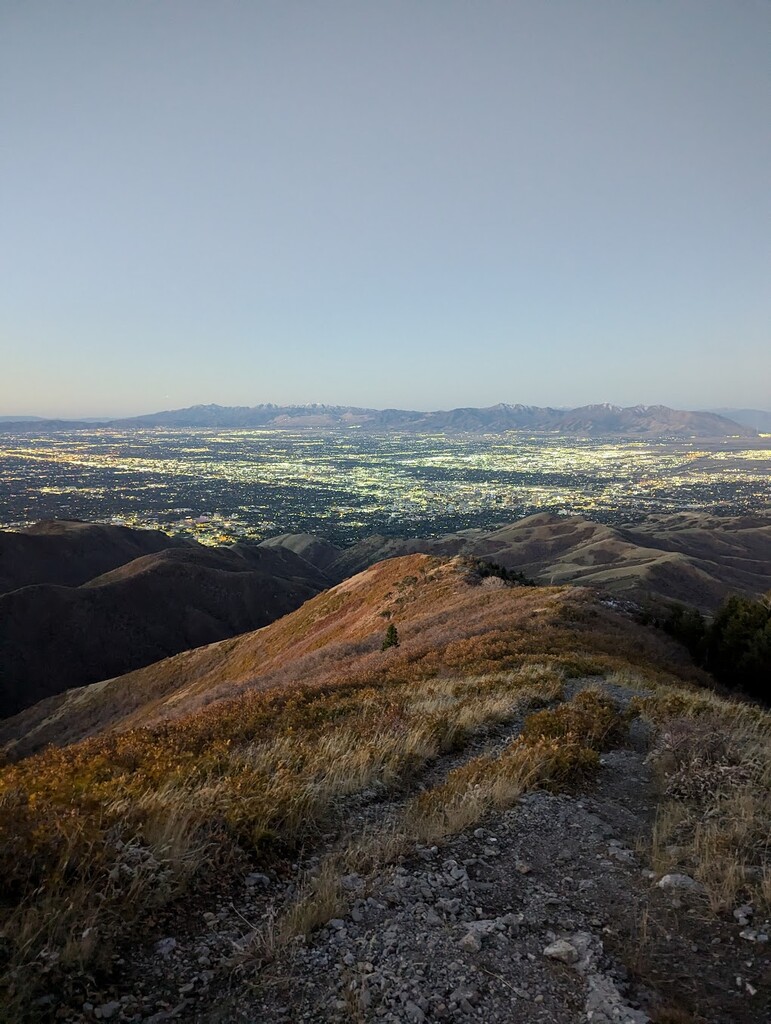
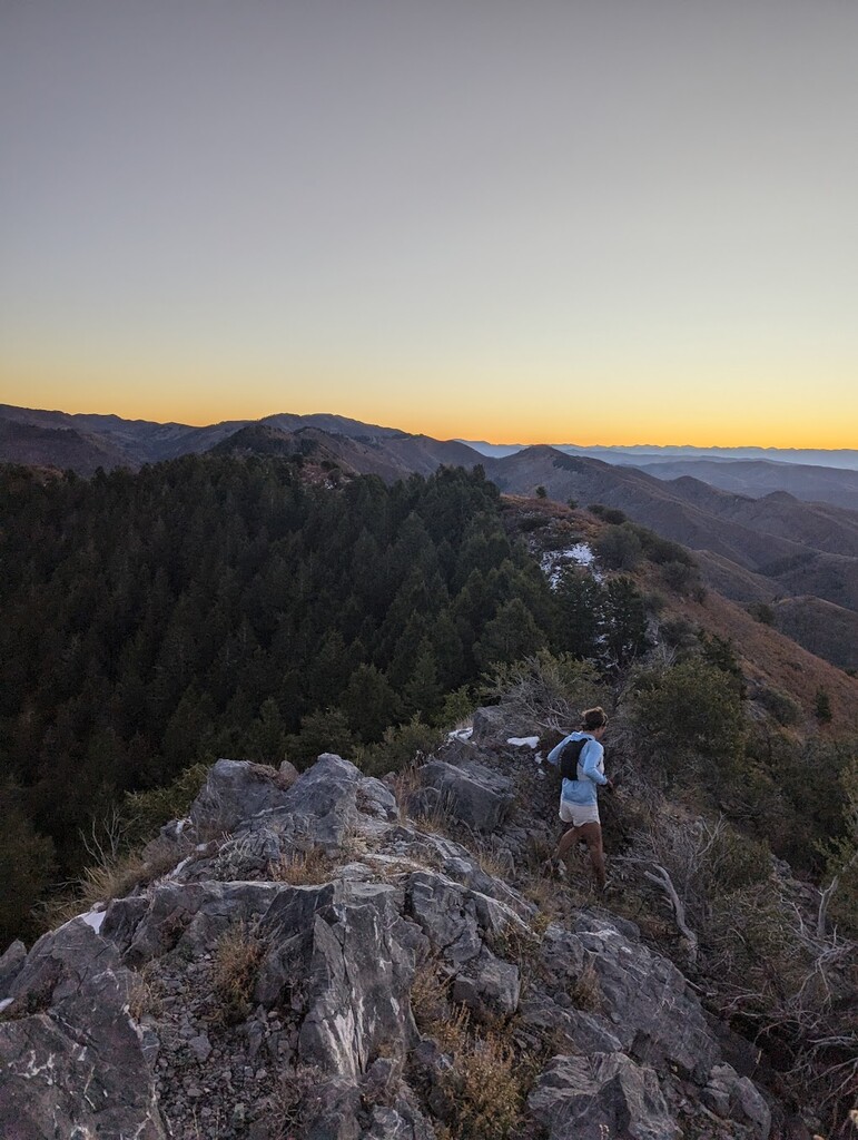
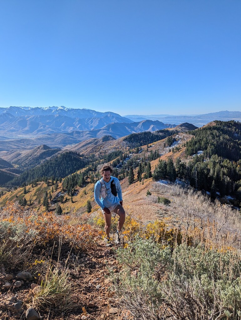
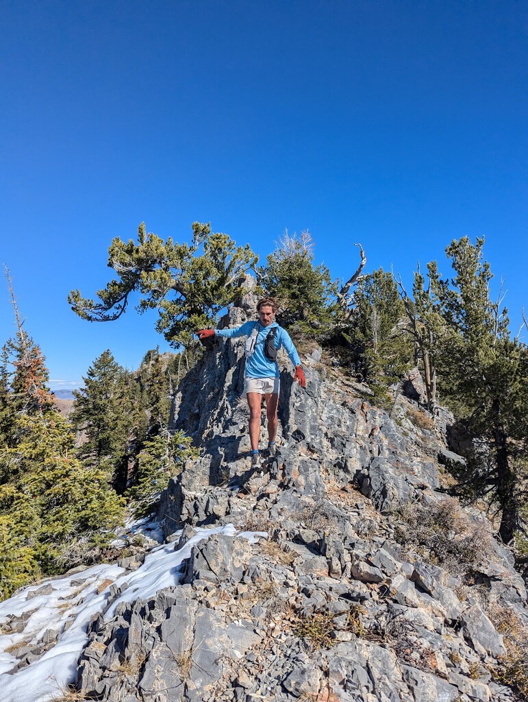
The CCURL or City Creek Ultimate Ridge Linkup is similar in idea of the WURL (Wasatch Ultimate Ridge Linkup) but circumnavigates City Creek, a popular canyon residing just to the north of the Utah State capital. A normal attempt at this route could start at the 11th and B area of the SLC avenues area but with my friend Luke lives just a few blocks, so we started from the door. Either way, you start by going up the Bonneville Shoreline trail until you get to the meadows at the 18th Ave (~2.2 miles). Then instead of continuing up the normal BST trail, break off to the north and climb up to Morris Mountain on the direct and steep unnamed trail (called Stupid Hill on Strava, .37 miles and 577ft. vert) to take the ridge. Follow the ridge over the peak and back down and connect to the Avenues Ridge Trail. You will stay on the ridge as the trails change from the Avenues Ridge Trail to the Twin Peaks Trail and then the Black Mountain trail which will be your last trail turn off for a while as you take it all the way up to the Black Mountain ridge. By the time you take this ridge you’re about 6.5 miles and 3kft vertical in. For the next 6 miles you will follow the loose trail through some scrambly sections and PLENTY of bush as you head over Little Black Mountain and Black Mountain on your way to Lookout Peak. This whole section while slow moving and treacherous at times is intuitive and self-explanatory as you’re following the only ridge. Only when you're about 10ish miles in will you want to follow a ridge to the south/southeast rather than the north/northeast as both look like they go to Lookout but only one does (south option). Bushwhack along that ridge and up to Lookout. From there, rather than dropping well off Lookout to the south, you’ll get yourself back in the bush for about .25 mile heading north/northeast to create a direct linkup to The Brink Trail. Follow this for ~2 miles until you take a sharp left towards the north (~13.8 miles in) onto the Great Western Trail. Follow this, a mostly good trail (or best you’ve had in many miles) as you climb back up and have Grandview in your sights. Another 2ish miles later (~15.7 miles in) and you take a sharp left onto the Grandview Peak Trail. Climb the peak and take in the sights from the most desolate peak in the Wasatch. Youve approached Grandview now from the east side so as you descend the peak you pick up the ridge and Grandview Peak Trail heading west and back towards the city, but this time on the northern side of the CCURL. The north side much easier to navigate than the south side as you remain on the Grandview Peak trail all the way back to Rudy's Flat and then Dude Benchmark and then finally to the cell towers. Then do a series of down and overs to Twin Sisters and follow that to the sharp ridge descent down to Ensign Vista Dr. Follow Capitol Blvd. downhill until you can connect the trail that goes down into Memory Grove and then back out and up into the avenues to connect the loop.