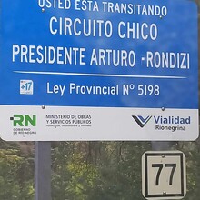
Circuito Chico meanders through pine-covered slopes speckled with unique cabins and rustic hotels on a loop of 24.8 kilometers. The trees often part to provide stunning views of the surrounding lakes and the Andes, which have snow on their peaks for most of the year in this area. The road is paved, with one lane in each direction, but there is a path wide enough for running on either side of the pavement. There is also plenty of free parking around the loop but remember not to leave anything of value in an unattended vehicle. With that in mind, this is an easy route to access and a beautiful one to explore.
The recommended direction of travel on Circuito Chico is counterclockwise, facing traffic on the inside of the loop. From the roundabout near the southeast corner of the circuit, it is 7 kilometers to the luxurious Llao Llao Resort. Parque Municipal Llao Llao, named for the peninsula that it occupies, starts one kilometer later. Side trails enter the woods throughout the park, making this area popular with hikers who drive Circuito Chico in order to explore its adjacent slopes. Near kilometer 14, the trail crosses the first of two bridges before it skirts the bottom of Cerro Lopez. At 16.5 kilometers, keep left to avoid the road that leads to Colonia Suiza. The view from Punto Panoramica, at 20.5 kilometers, is perhaps the most impressive of the entire route. The next turn to Colonia Suiza is at 21.7 kilometers, so keep left again and descend to the second bridge. Crossing the bridge marks 22.5 kilometers, and from there the traffic circle and the end of the loop is just over 2 more kilometers.
English: https://barilocheturismo.gob.ar/en/short-circuit
Spanish: https://barilocheturismo.gob.ar/es/circuito-chico
Portuguese: https://barilocheturismo.gob.ar/br/circuito-chico


